Palmdale, California

Last updated

Palmdale, California
Palmdale and Mountains.jpg
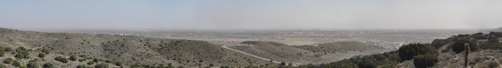
Palmdale, looking southeast toward the Antelope Valley Freeway and the San Gabriel Mountains
Flag of Palmdale, California.gif
Seal of Palmdale, California.png
Motto: 
"A Place to Call Home"
LA County Incorporated Areas Palmdale highlighted.svg
Location of Palmdale in Los Angeles County, California
U.S. - Los Angeles Metropolitan Area location map.svg
Red pog.svg
Palmdale
Location within the Los Angeles Metropolitan Area
Relief map of California.png
Red pog.svg
Palmdale
Location within the State of California
Usa edcp relief location map.png
Red pog.svg
Palmdale
Location within the contiguous United States
Coordinates: 34°34′52″N118°6′2″W / 34.58111°N 118.10056°W / 34.58111; -118.10056
Country Flag of the United States.svg  United States
State Flag of California.svg  California
County Los Angeles
Established1886
Incorporated August 24, 1962 [1]
Named for An anglicization of "Palmenthal", in turn named for Joshua trees, at the time referred to as "yucca palms"
Government
  Type Council–manager [2]
  Body City council:
  • Austin Bishop (mayor) [2]
  • Austin Bishop, Dist-1
  • Richard J. Loa, Dist-2 [3]
  • Laura Bettencourt, Dist-3
  • Eric Ohlsen, Dist-4
  • Andrea Alarcón, Dist-5
Area
[4]
   City 106.32 sq mi (275.37 km2)
  Land106.08 sq mi (274.74 km2)
  Water0.24 sq mi (0.63 km2)  0.24%
Elevation
[5]
2,657 ft (810 m)
Population
 (2020) [6]
   City 169,450
  Rank 6th in Los Angeles County
32nd in California
  Density1,600/sq mi (620/km2)
   Urban
359,559 (US: 115th) [7]
  Urban density4,240.9/sq mi (1,637.4/km2)
   Metro
[8]
13,200,998
Demonym Palmdalite
Time zone UTC−8 (Pacific Time Zone)
  Summer (DST) UTC−7 (PDT)
ZIP Codes [9]
93550–93552, 93590–93591, 93599
Area code 661
FIPS code 06-55156
GNIS feature IDs 1652769, 2411359
Website www.cityofpalmdaleca.gov

Palmdale is a city in northern Los Angeles County in the U.S. state of California. The city lies in the Antelope Valley of Southern California. The San Gabriel Mountains separate Palmdale from the Los Angeles Basin to the south.

Contents

On August 24, 1962, Palmdale became the first city in Antelope Valley. Forty-seven years later, in November 2009, voters approved making it a charter city. Palmdale's population was 169,450 at the 2020 census, up from 152,750 at the 2010 census. Palmdale is the 32nd most populous city in California. Together with its immediate northern neighbor, the city of Lancaster, the Palmdale–Lancaster urban area had a population of 359,559 in 2020. [7]

History

Explorer Juan Bautista de Anza led his expedition through the area in 1774. Portrait of Juan Bautista de Anza (Painted by Fray Orci; 1774, Mexico City).jpg
Explorer Juan Bautista de Anza led his expedition through the area in 1774.

Palmdale was first inhabited by various Native Americans. [10] Populated by different cultures for an estimated 11,000 years, the Antelope Valley was a trade route for Native Americans traveling from Arizona and New Mexico to California's coast. [11] Before the arrival of white Europeans, the Palmdale area was occupied by the Kitanemuk. [12]

Spanish soldier Captain Pedro Fages explored the Antelope Valley in 1772. The opening of California to overland travel through the forbearing desert was due to Captain Juan Bautista de Anza and Father Francisco Garces, a Spanish padre. They led a colonizing expedition including 136 settlers across the Mojave Desert from Mexico to Monterey in 1773.

Later in 1776 while exploring the Valley, Garces with several Indian guides from the San Gabriel Mission recorded viewing the vast expanse of what was the El Tejon Rancheria (the Badger Ranch) of the Cuabajoy Indians. After the Shoshone Indians left the valley, immigrants from Spain and Mexico established large cattle ranches there. Then, in the late 1880s, the ranches were broken up into smaller homesteads by farmers from Germany, France and the state of Nebraska. [13]

Palmenthal, 1886–1913

"Palmenthal", the first European settlement within the limits of Palmdale, was established as a village on April 20, 1886, by westward Lutheran travelers from the American Midwest, mostly of German and Swiss descent. According to area folklore, the travelers had been told they would know they were close to the ocean when they saw palm trees. They took the local Joshua trees for palms and named their settlement after them. (Palmenthal is German for Palm Valley.) [14] [15] According to David L. Durham, Joshua trees were sometimes called yucca palms at the time, which was the reason for the name. [14] The village was officially established upon the arrival of a post office on June 17, 1888.

By the 1890s (soon after the last of the indigenous antelopes, which the valley was named after, had been hunted to extinction by Europeans), farming families continued to migrate to Palmenthal and nearby Harold to grow grain and fruit. However, most of these settlers were unfamiliar with farming in a desert climate, so when the drought years occurred, most abandoned their settlement.

By 1899, only one family was left in the original village. The rest of the settlers, including the post office, moved closer to the Southern Pacific railroad tracks. This new community was renamed Palmdale and was located where the present day civic center is. A railroad station was built along the tracks there. This railroad was operated by Southern Pacific and traveled between Los Angeles and San Francisco. The Wells Fargo stagecoach line that ran between San Francisco and New Orleans stopped there as well. [16]

The only remaining pieces of evidence of the original settlements of Palmenthal and Harold are the old Palmdale Pioneer cemetery located on the northeast corner of Avenue S and 20th Street East, recently acquired and restored by the city as part of a future historical park, and the old schoolhouse now relocated to McAdam Park.

First two decades of the Town of Palmdale, 1913–1933

As the population of Palmdale began to increase after relocation, water became scarce, until November 5, 1913 when the California – Los Angeles Aqueduct system was completed by William Mulholland, bringing water from the Owens Valley into Los Angeles County. During this period, crops of apples, pears and alfalfa became plentiful. [17] [18]

In 1915, Palmdale's first newspaper, the Palmdale Post, was published. Today it is called the Antelope Valley Press. [19]

In 1921, the first major motor vehicle link between Palmdale and Los Angeles was completed, Mint Canyon/Lancaster Road, later designated U.S. Route 6. Completion of this road caused the local agricultural industry to flourish and was the first major step towards defining the metropolis that exists today. Presently this road is known as Sierra Highway. [20]

In 1924, the Little Rock Dam and the Harold Reservoir, present day Lake Palmdale, were constructed to assist the agricultural industry and have enough water to serve the growing communities. [20]

Picture of Lake Palmdale with the California Aqueduct in the foreground. Lake Palmdale-kmf.JPG
Picture of Lake Palmdale with the California Aqueduct in the foreground.

Next three decades of the Town of Palmdale, 1933–1962

Agriculture continued to be the foremost industry for Palmdale and its northern neighbor Lancaster until the outbreak of World War II. In 1933, the United States government established Muroc Air Base (from an original founder's name, Effie Corum, spelled backwards) six miles (10 km) north of Lancaster in Kern County, now known as Edwards Air Force Base. [21]

They also bought Palmdale Airport in 1952 and established an aerospace development and testing facility called United States Air Force Plant 42. One year later, in 1953, Lockheed established a facility at the airport. After this point in time, the aerospace industry took over as the primary local source of employment. [21] The city has been referred to as the "Aerospace Capital of America" because of its rich heritage in being the home of many of the aircraft used in the United States military. [16]

In August 1956, an unpiloted out-of-control Navy drone flew over Palmdale while Air Force Interceptor aircraft tried to shoot it down with unguided rockets. Many rockets landed in and around the city, starting fires and damaging property. [22]

In 1957, Palmdale's first high school, Palmdale High School, was established, making it easier for youths to not have to travel to Antelope Valley High School in nearby Lancaster. [23]

Incorporation, 1962–1980

In August 1962, the township of Palmdale officially became the city of Palmdale with the incorporation of 2 square miles (5 km2) of land around the present day civic center. [16]

In 1964, the Antelope Valley Freeway, or State Highway 14, was completed as a link between Palmdale and Los Angeles. The freeway at this time ran all the way to present-day Technology Drive. It was at this time that talk about the future Palmdale Intercontinental Airport was seen as the way of the future. By 1965, the new city had annexed an additional 20 square miles (52 km2) of land and industry was thriving. Talk of the future commercial airport had many investors buying up large quantities of land. [20]

Antelope Valley Freeway looking southbound near downtown Palmdale on a day with sparse traffic. Palmdale Freeway.jpg
Antelope Valley Freeway looking southbound near downtown Palmdale on a day with sparse traffic.

In 1970, the city of Los Angeles went forward with buying 17,750 acres (71.8 km2) of land east of the city for its proposed intercontinental commercial airport. However, the United States Air Force desired to put construction of this new facility on hold until the existing airport reached its commercial capacity. So, under a joint use agreement with the military, the Los Angeles Department of Airports, now called Los Angeles World Airports, built a 9,000 square foot (800 m2) terminal on leased land that opened in 1971, creating present day LA/Palmdale Regional Airport which the City of Palmdale has taken control of in an effort to establish reliable air service in the region. [24]

By 1974, the Antelope Valley Freeway construction ended at the southern border of Mojave in Kern County. In 1977, Palmdale built its first municipal building, the Palmdale City Library. This was the same year that its northern neighbor Lancaster incorporated as a city. Since the 1920s, Lancaster had been the much larger and principal community of the Antelope Valley, as well as the rest of California's Mojave Desert. [25]

First housing market growth and recession, 1980–1990

Central Palmdale looking north along 10th Street West toward Rancho Vista Boulevard Central Palmdale.jpg
Central Palmdale looking north along 10th Street West toward Rancho Vista Boulevard

The 1980s and 1990s were the decades that really started to define the two Antelope Valley cities. Affordable housing in the area caused a dramatic spike in the population. The city, like its northern neighbor Lancaster, became a bedroom community for those employed in Los Angeles. In 1980, Palmdale's population was 12,227. [20]

Geography

Satellite image showing the Antelope Valley area in relation to Los Angeles with the San Gabriel Mountains separating them. Palmdale CA and Antelope Valley and Environs Landsat7.jpg
Satellite image showing the Antelope Valley area in relation to Los Angeles with the San Gabriel Mountains separating them.

Palmdale is located in Los Angeles County, and the urbanized centers of Palmdale and Los Angeles are separated by the San Gabriel mountain range, which is about 40 miles (64 km) wide. This range forms the southern edge of the Antelope Valley portion of the Mojave Desert. Palmdale is the second-most populous city in the Antelope Valley, and fifth overall in the Mojave Desert, after Las Vegas, Henderson, North Las Vegas, Nevada; and Lancaster. Palmdale is part of a twin-city complex with its northern neighbor Lancaster and together they are the principal cities within the Antelope Valley region and California's High Desert.

Downtown Palmdale is located at 34°34′46″N118°07′00″W / 34.57944°N 118.11667°W / 34.57944; -118.11667 , [26] at an elevation of 2,655 feet (809 m) above sea level.

According to the United States Census Bureau the city has a total area of 106.2 square miles (275 km2), of which, 106.0 square miles (275 km2) of it is land and 0.3 square miles (0.78 km2) of it is water (including man-made Lake Palmdale, the most visible and scenic part of the municipal water supply system). The total area is 0.24% water.

The city lies in proximity to the San Andreas Fault, making it prone to severe earthquakes. This fault cuts across the Antelope Valley Freeway just north of the Avenue S off-ramp; running westward along the old Butterfield Stage Line (now Elizabeth Lake Road) into Leona Valley.

Looking south from the hills near Tierra Subida Avenue, January snow can be seen at the higher elevations. Palmdale snow w.jpg
Looking south from the hills near Tierra Subida Avenue, January snow can be seen at the higher elevations.

Climate

Typical of the High Desert, Palmdale has an arid climate (Köppen climate classification BWk), and it is part of USDA Plant Hardiness Zone 8b. [27] Winters are cool to mild, with daily normal minimum temperatures at or just below freezing from late November until late January, and the coolest month, December, having a normal mean temperature of 44.4 °F (6.9 °C). [28] Summers are hot and nearly rainless, with July and August, tied for the hottest month, having a normal mean temperature of 81.2 °F (27.3 °C). [28] On average, annually there are 52 mornings with a minimum at or below freezing, and 35 afternoons with a maximum at or above 100 °F (37.8 °C). [28] The normal annual rainfall is 5.90 inches (150 mm), [28] occurring on an average of only 27 days. [29]

Record temperatures range from 3 °F (−16.1 °C) on January 13, 1963 to 118 °F (47.8 °C) on August 5, 1990. [28] The “rain year” from July 1940 to June 1941 had the highest annual precipitation on record, at 18.41 inches (467.6 mm), whilst the most precipitation in a calendar month was in December 1943 at 7.55 inches (191.8 mm), as well as the most in one calendar day on December 11, 1943, at 3.43 inches (87.1 mm); [28] conversely, the lowest annual precipitation was 1.15 inches (29.2 mm) from July 2012 to June 2013. [28]

Climate data for Palmdale Regional Airport, California (19912020 normals, [lower-alpha 1] extremes 1931present)
MonthJanFebMarAprMayJunJulAugSepOctNovDecYear
Record high °F (°C)85
(29)
85
(29)
91
(33)
98
(37)
106
(41)
113
(45)
113
(45)
118
(48)
111
(44)
105
(41)
88
(31)
85
(29)
118
(48)
Mean maximum °F (°C)72.3
(22.4)
75.1
(23.9)
81.8
(27.7)
90.3
(32.4)
97.1
(36.2)
104.2
(40.1)
107.5
(41.9)
106.4
(41.3)
102.7
(39.3)
93.0
(33.9)
81.6
(27.6)
72.3
(22.4)
109.1
(42.8)
Mean daily maximum °F (°C)58.9
(14.9)
61.8
(16.6)
67.5
(19.7)
73.4
(23.0)
82.0
(27.8)
91.0
(32.8)
97.6
(36.4)
97.7
(36.5)
91.6
(33.1)
79.7
(26.5)
67.3
(19.6)
57.7
(14.3)
77.2
(25.1)
Daily mean °F (°C)45.9
(7.7)
48.9
(9.4)
53.8
(12.1)
59.3
(15.2)
67.4
(19.7)
75.4
(24.1)
82.5
(28.1)
81.8
(27.7)
75.2
(24.0)
64.1
(17.8)
52.5
(11.4)
44.7
(7.1)
62.6
(17.0)
Mean daily minimum °F (°C)32.8
(0.4)
36.1
(2.3)
40.2
(4.6)
45.2
(7.3)
52.8
(11.6)
59.9
(15.5)
67.4
(19.7)
66.0
(18.9)
58.8
(14.9)
48.6
(9.2)
37.7
(3.2)
31.6
(−0.2)
48.1
(8.9)
Mean minimum °F (°C)23.0
(−5.0)
25.4
(−3.7)
29.4
(−1.4)
34.5
(1.4)
42.4
(5.8)
48.1
(8.9)
56.3
(13.5)
55.7
(13.2)
48.5
(9.2)
37.0
(2.8)
26.0
(−3.3)
21.3
(−5.9)
19.5
(−6.9)
Record low °F (°C)3
(−16)
11
(−12)
16
(−9)
26
(−3)
28
(−2)
30
(−1)
44
(7)
41
(5)
32
(0)
18
(−8)
4
(−16)
6
(−14)
3
(−16)
Average precipitation inches (mm)0.98
(25)
1.49
(38)
0.87
(22)
0.26
(6.6)
0.13
(3.3)
0.02
(0.51)
0.11
(2.8)
0.03
(0.76)
0.16
(4.1)
0.47
(12)
0.36
(9.1)
1.02
(26)
5.90
(150)
Average precipitation days (≥ 0.01 in)4.45.23.72.21.00.30.80.60.71.32.34.326.8
Source: NOAA [28] [30]

Notes:

  1. Mean monthly maxima and minima (i.e. the expected highest and lowest temperature readings at any point during the year or given month) calculated based on data at said location from 1991 to 2020.

Flora and fauna

Plants native to Palmdale are big berry manzanita, fremont cottonwood, California aster, White Sage, Giant wildrye, Deerbrush, California buckwheat, Black Sage, California Goldfields, Antelope Bitterbrush, Golden Yarrow, Desert Globemallow and more. [31] Animals in the area are golden mantled ground squirrel, Beechey ground squirrel, red-tailed hawk, Cooper's hawk, Stellar's jay, leopard frog and rattlesnake. Coyotes are found throughout Palmdale. [32] [33] The California condor, a rare species of bird occupies Palmdale. [34] Palmdale was a juniper berry processing area. [35] California poppies are grown near Palmdale.

Demographics

Historical population
CensusPop.Note
1960 11,522
1970 8,511−26.1%
1980 12,27744.2%
1990 68,842460.7%
2000 116,67069.5%
2010 152,75030.9%
2020 169,45010.9%
U.S. Decennial Census [36]

2020

Palmdale city, California – Racial and ethnic composition
Note: the US Census treats Hispanic/Latino as an ethnic category. This table excludes Latinos from the racial categories and assigns them to a separate category. Hispanics/Latinos may be of any race.
Race / Ethnicity (NH = Non-Hispanic)Pop 2000 [37] Pop 2010 [38] Pop 2020 [39] % 2000% 2010% 2020
White alone (NH)47,83137,39028,73941.00%24.48%16.96%
Black or African American alone (NH)16,44721,59522,00014.10%14.14%12.98%
Native American or Alaska Native alone (NH)6224774890.53%0.31%0.29%
Asian alone (NH)4,3276,2237,0073.71%4.07%4.14%
Pacific Islander alone (NH)1632112780.14%0.14%0.16%
Other race alone (NH)2653961,1120.23%0.26%0.66%
Mixed race or Multiracial (NH)3,0243,3615,0832.59%2.20%3.00%
Hispanic or Latino (any race)43,99183,097104,74237.71%54.40%61.81%
Total116,670152,750169,450100.00%100.00%100.00%

2010

The 2010 United States Census [40] reported that Palmdale had a population of 152,750. The population density was 1,438.1 inhabitants per square mile (555.3/km2). The racial makeup of Palmdale was 74,901 (49.0%) White, (24.5% Non-Hispanic White), [6] 22,677 (14.8%) African American, 1,316 (0.9%) Native American, 6,548 (4.3%) Asian (2.2% Filipino, 0.4% Indian, 0.4% Korean, 0.3% Chinese, 0.3% Vietnamese, 0.2% Japanese, 0.16% Cambodian, 0.11% Thai and 0.07% Pakistani), 335 (0.2%) Pacific Islander, 38,773 (25.4%) from other races, and 8,200 (5.4%) from two or more races. There were 83,097 Hispanic or Latino residents (54.4%). 38.1% of Palmdale residents are of Mexican ancestry; 6.2% Salvadoran; and 2.4% of Guatemalan heritage and 0.79% Honduran, 0.76% Puerto Rican, 0.69% Nicaraguan, 0.50% Cuban, 0.47% Colombian and Argentinian 0.34%. [41] Spanish is spoken by 36.4% of the population and Tagalog by 1.3%. The most common ancestries are German 5.2%, Irish 4.1%, English 2.9%, Italian 2.7%, French 1.1%, Polish 1.0%, Norwegian 0.7%, Scottish 0.6%, Dutch 0.6%, Russian 0.6%, Swedish 0.5%, Belizean 0.4%, Armenian 0.4% and Danish, Welsh and Greek 0.3%. [42]

According to the 2000 Census, Mexican and German were the most common ancestries in Palmdale. Mexico and El Salvador were the most common foreign places of birth. [43]

The Census reported that 152,551 people (99.9% of the population) lived in households, 158 (0.1%) lived in non-institutionalized group quarters, and 41 (0%) were institutionalized.

There were 42,952 households, out of which 23,345 (54.4%) had children under the age of 18 living in them, 24,199 (56.3%) were opposite-sex married couples living together, 7,821 (18.2%) had a female householder with no husband present, 3,318 (7.7%) had a male householder with no wife present. There were 2,998 (7.0%) unmarried opposite-sex partnerships, and 316 (0.7%) same-sex married couples or partnerships. 5,828 households (13.6%) were made up of individuals, and 1,880 (4.4%) had someone living alone who was 65 years of age or older. The average household size was 3.55. There were 35,338 families (82.3% of all households); the average family size was 3.87.

The age distribution of the population included 50,514 people (33.1%) under the age of 18, 17,089 people (11.2%) aged 18 to 24, 40,077 people (26.2%) aged 25 to 44, 34,963 people (22.9%) aged 45 to 64, and 10,107 people (6.6%) who were 65 years of age or older. The median age was 29.7 years. For every 100 females, there were 95.3 males. For every 100 females age 18 and over, there were 91.3 males.

There were 46,544 housing units at an average density of 438.2 per square mile (169.2/km2), of which 29,167 (67.9%) were owner-occupied, and 13,785 (32.1%) were occupied by renters. The homeowner vacancy rate was 3.2%; the rental vacancy rate was 9.4%. 102,444 people (67.1% of the population) lived in owner-occupied housing units and 50,107 people (32.8%) lived in rental housing units. According to US Census Population Estimates, July 1, 2022: 15.8% of the population was living below the federal poverty line. [44]

Religion

37.0% of people are Catholic in Palmdale. 53.4% in the city are religious. [45]

Palmdale01.JPG
Panoramic photo of Palmdale from the west, taken March 2000

Homelessness

In 2022, Los Angeles Homeless Services Authority's Greater Los Angeles Homeless Count counted 309 homeless individuals in Palmdale. [46]

Homeless population
YearPop.±%
2016 325    
2017 398+22.5%
2018 203−49.0%
2019 290+42.9%
2020 289−0.3%
2022 309+6.9%
Source: Greater Los Angeles Homeless Count
Los Angeles Homeless Services Authority

Economy

The most important industry for Palmdale is the aerospace industry. [21] Other manufacturing companies have relocated to Palmdale seeking more affordable land, proximity to Palmdale Airport, and special tax breaks.

The special tax breaks granted for companies that relocate to Palmdale is due to the city having the Antelope Valley Enterprise Zone and the Palmdale Federal Foreign Trade Zone . These are special zoning areas within the city that are given various state and federal tax breaks and municipal grant incentives to relocate their business there. These zones were put in effect to help Palmdale, as well as nearby Lancaster, draw more jobs to the area so that they would be less dependent on the Los Angeles Basin and the San Fernando Valley area for employment. This will help relieve traffic congestion and pollution and stabilize the Antelope Valley economy on several industries. The local governments of the Antelope Valley seek to diversify their economies and not just depend on the aerospace industry as it is known for having "feast or famine" seasons.

A completed Lockheed L-1011; this aircraft was built and underwent testing at Palmdale Lockheed L-1011-1 Tristar, Lockheed JP5893645.jpg
A completed Lockheed L-1011; this aircraft was built and underwent testing at Palmdale

Palmdale refers to itself with the nickname the "aerospace capital of the United States", and has been the site of research, development, final assembly, flight testing and/or servicing/modifications of the Space Shuttle, B-1 Lancer, X-15, B-2 Spirit, B-21 Raider, F-117 Nighthawk, F-22 Raptor, F-35 Lightning II, SR-71 Blackbird, Lockheed L-1011 Tristar, and many other aircraft that have been used in the United States Air Force, NASA and air forces and airlines around the world. USAF Plant 42, where the aerospace projects occurred / occur is home to major operations of the following aerospace companies: Boeing, Lockheed Martin and its famed Skunk Works, and Northrop Grumman. [47] The Los Angeles World Airports owns the former Boeing hangar (formerly North American Rockwell) at Plant 42 near LA/Palmdale Regional Airport which is one of the largest buildings in the world. The hangar was used for the set of the 2004 film The Terminal , which featured an enormous replica of a JFK International Airport terminal. NASA's SOFIA program relocated its operation to this hangar at Site 9 from Edwards Air Force Base.

A number of world class corporations and manufacturing firms have made Palmdale home, helping to diversify the local economy. Delta Scientific, a world leader in high strength vehicle barrier systems, supplying protection for many federal, state and local buildings, and a prime supplier to the military and US State Department for embassies and other installations worldwide, and US Pole, a major manufacturer of street lighting poles, are major anchor tenants in the Fairway Business Park. The Palmdale Trade and Commerce Center is home to many other major manufacturing, industrial, corporate offices and other employers, as well as home to the Palmdale Auto Mall. A number of medical and related support offices are coming on-line to meet the needs of the new Palmdale Regional Medical Center. On July 8, 2009 Quallion LLC, which manufactures lithium ion cells and battery packs, announced plans to build a battery manufacturing plant in Palmdale if it won a government grant being offered by the U.S. Department of Energy. [48]

Beginning in the 1960s, Palmdale was home to Don Babb's The Model A Ford Company, which became Classic Manufacturing and Supply, builder of exact reproduction and custom steel bodies and parts for hot rods and customs. [49]

With an $890-million contract to build 175 light-rail cars for Metropolitan Transportation Authority that was behind schedule, Kinkisharyo, the El Segundo-based U.S. arm of Kinki Sharyo Co. Ltd. of Osaka announced in December 2014 that they would retrofit an existing space in Palmdale to build the P3010 series vehicles. A major shipment was needed for the Expo Line Phase II extension to Santa Monica and Foothill Extension to Azusa which were scheduled to open in 2016. The balance of the 175 cars will be needed in the following years as the K Line and Regional Connector open. [50] Final assembly work has already occurred in hangar space the company leased in Palmdale from Los Angeles World Airports. [51] The first car was delivered to Metro in October for testing before series production begins. [52]

The Antelope Valley Mall is the retail shopping destination in the region, with a variety of dining choices on its restaurant row. [53]

Onions are the most valued crop that grows in Palmdale. [54] Some of Antelope Valley's onions were exported to Japan, Taiwan, Dubai and Australia. [54] Other crops grown in Palmdale and the Antelope Valley are alfalfa, wheat, fruit, oats and barley. [55] [56]

Largest employers

Employers include: [57]

Government

Local government

Palmdale is a Charter City governed under the council / manager form of local government. Beginning with the November 2016 election, the City Council was subjected to districting, with councilmembers were selected from each of 4 districts. The mayor is elected at-large every two years for a two-year term. Every two years, two of the four district council members are elected to serve four-year terms. Palmdale does not have term limits for council and mayor. [58]

The City Council appoints the City Manager and City Attorney. [59]

The city also has an appointed Planning Commission divided into four separate districts. The Planning Commission was organized to help with the planning, zoning, and development of various city areas in different districts and to give the residents of those particular districts a greater voice in local land use decisions. There is also an appointed Board of Library Trustees, and Youth Council. [60]

On November 3, 2009, local residents voted in favor of a measure to change Palmdale's general law city status to that of a Charter city. This allowed Palmdale to draft a city charter and constitution, enabling it to make more decisions at the local level without interference or rules from the state government. [61]

Palmdale has animal services, Palmdale Animal Care Center. [62]

Municipal services

The city provides a number of municipal services, including a Planning Department, Economic Development Department, Building and Safety Department, Public Works Department, Parks and Recreation Department, and Library Department. The city also operates the Palmdale Transportation Center which serves as the hub for public transit services including Metrolink trains, Antelope Valley Transit Authority, Amtrak Thruway, and Greyhound Lines. Palmdale was selected as a stop for the California High-Speed Rail system that will link northern and southern California. [63] City officials have formed the Palmdale Airport Authority, as they pursue regional air service from a joint use facility at USAF Plant 42.

Recreation and cultural services include the Palmdale City Library, [64] Legacy Commons, Larry Chimbole Cultural Center, Palmdale Playhouse and Art Gallery, Dry Town Water Park, Palmdale Amphitheater, Best of the West Softball Complex, Hammack Activity Center, Palmdale Oasis Park Recreation Center, Marie Kerr Park Recreation Center, Joe Davies Heritage Airpark at Palmdale Plant 42, and four swimming pools.

Public safety

The city is policed by the Los Angeles County Sheriff's Department under a formal contract with the County of Los Angeles and has its municipal judicial system intertwined with the Los Angeles County Superior Court. [65]

The Los Angeles County Sheriff's Department (LASD) operates the Palmdale Station in Palmdale. [66] Palmdale has the largest Sheriff's Station in Los Angeles County. Palmdale's innovative Partners Against Crime (PAC) Program, a cooperative effort between law enforcement, landlords and community members, has successfully focused on quality of life issues and crime suppression, reducing the crime rate annually. Recently, the Partners for a Better Palmdale program was initiated by the City Council, to further engage residents, schools, community groups and law enforcement in improving community quality of life. [67] The city pioneered the use of municipal Community Service Officers for low level incidents to free up Deputies for higher priority matters, and employ high-tech tools, such as Automated License Plate Recognition Systems on patrol cars, to increase officer productivity.

Palmdale Regional Medical Center handles the city's medical services. Palmdale Hospital.jpg
Palmdale Regional Medical Center handles the city's medical services.

The city is served by the Los Angeles County Fire Department for its fire and paramedic services through the Consolidated Fire Protection District. Palmdale downtown Station #37 is one of the busiest fire stations in the United States. Two new fire stations went into service in late 2008 on the east and west sides of Palmdale. [68]

Public utilities

Utility services within the city are provided by several public and private agencies. Water service is primarily provided by Palmdale Water District (separate public agency) and Los Angeles County Waterworks (part of the County Public Works); sewer service is provided by the County Sanitation Districts of Los Angeles County (separate public agency, with City Council members on district board); electrical service is provided by Southern California Edison; natural gas service is provided by Southern California Gas; cable television service is provided by Time Warner Cable; telephone service is provided by AT&T and Frontier; refuse pickup and disposal service is provided by Waste Management, Inc of the Antelope Valley under a franchise agreement with the city. The city successfully licensed and sold permits for a hybrid natural gas and steam turbine power facility and its operator is awaiting state approval of amendments to begin construction. [69]

County representation

The Los Angeles County Department of Health Services operates the Antelope Valley Health Center in Lancaster, serving Palmdale. [70]

In the Los Angeles County Board of Supervisors, Palmdale is in the 5th District, represented by Kathryn Barger. [71]

State and federal representation

In the California State Legislature, Palmdale is in the 21st Senate District , represented by Republican Scott Wilk, and in the 36th Assembly District , represented by Democrat Eduardo Garcia. [72]

In the United States House of Representatives, Palmdale is in California's 27th congressional district , represented by Republican Mike Garcia. [73]

Education

Kindergarten – grade 12 schools

Palmdale has three separate elementary school districts and one high school district:

Colleges and universities

Media

Newspapers

Online newszine

Antelope Valley New Press [78]

www.thepalmdalejournal.com

Radio stations

AM

  • KAVL 610 AM Sports
  • KTPI 1340 AM Adult Standards
  • KOSS 1380 AM News/Talk
  • KUTY 1470 AM Spanish Oldies

FM

  • KCRY 88.1 FM NPR (KCRW Santa Monica)
  • KTLW 88.9 FM Religious/Christian
  • KLXP 89.7 FM Religious/Christian (simulcast of Hollister KHRI 90.7)
  • K211EY 90.1 FM Religious/Christian (simulcast of Victorville KHMS 88.5)
  • K216FA 91.1 FM Religious/Christian (simulcast of Twin Falls KAWZ 89.9)
  • KWTD 91.9 FM Religious/Christian (simulcast of Bishop KWTW 88.5)
  • KQAV 93.5 FM Classic Rock
  • KTPI-FM 97.7 FM Country
  • KKZQ 100.1 FM Modern Rock
  • KRAJ 100.9 FM Hip Hop
  • KSRY 103.1 FM Modern Rock (simulcast of Los Angeles KYSR 98.7)
  • KGBB 103.9 FM Adult Hits
  • KEPD 104.9 FM Country
  • KVVS 105.5 FM Top 40 (simulcast of Los Angeles KIIS 102.7)
  • KGMX 106.3 FM Adult Contemporary
  • KMVE 106.9 FM Regional Spanish

Internet radio

Television stations

Transportation

According to the latest U.S. Census report released in September 2009, Palmdale has the longest average commute time in the United States at 41.5 minutes. This commute time exceeds that of even New York City. this is due to the majority of citizens commuting to nearby Santa Clarita and farther south to Los Angeles. [79]

Airport

The LA/Palmdale Regional Airport/Air Force Plant 42 (PMD) has two runways, each over 2.25 miles (3.62 km) in length, although there is currently no commercial airline service at the airport. PMD's commercial terminal is owned and operated by Los Angeles World Airports (LAWA), a municipal department of the City of Los Angeles, on leased land from the U.S. Air Force. Airline service has been sporadic since commercial flights were first offered in 1971. Most recently, United Express/SkyWest Airlines flew between PMD and San Francisco from June 7, 2007, to December 6, 2008. The city of Palmdale formed the Palmdale Airport Authority to move forward to control the facilities and the lease with the USAF, to better develop regional air service in the High Desert.

LA/Palmdale Regional Airport Terminal Palmdale Airport Terminal.jpg
LA/Palmdale Regional Airport Terminal

LAWA also owns 17,500 acres (71 km2) of land adjacent to the existing airport. The land was acquired between 1970 and 1983 to be developed into "Palmdale Intercontinental Airport", intended to surpass the air traffic of LAX. The land remains undeveloped. LAWA is currently developing a Master Plan for Palmdale that will guide airport land use and development decisions through 2030.

The FAA's Los Angeles Air Route Traffic Control Center is located adjacent to the airport. [80]

NASA has consolidated its research, environmental and training aircraft, support services and facilities at the Dryden Aircraft Operations Facility in Palmdale. From the oversized runway and the massive hangar located at Air Force Plant 42 Site 9, NASA conducts worldwide environmental research with its ER-2 (a U-2 variant) and cutting edge deep space imaging with the 747-based SOFIA infrared telescope.

Highways

The Antelope Valley Freeway (SR 14) is the major north–south highway connecting Palmdale to Los Angeles and Mojave.

State Route 138 (SR 138) is the major east–west highway connecting Palmdale to the Inland Empire and Frazier Park.

State Route 18 (SR 18) heads eastward out of the Antelope Valley connecting it to Victorville and via I-15 the Barstow area. This road is commonly used as a route to Las Vegas, Nevada.

Street system

The street system in the Antelope Valley is set out in a grid. Unless otherwise named or curved around due to terrain, east–west roads are called avenues and north–south roads are called streets. The city is essentially on a perfect grid, and the traffic signals are coordinated by a central processing facility at the Civic Center.

East–west avenues are lettered mile-by-mile from north to south, starting with Avenue A on the Los Angeles-Kern County line. One mile south of Avenue A is Avenue B, and so on. Smaller roads between major avenues carry suffixes "-1" (nearest to the lettered avenue) through "-15" (nearest to the next lettered avenue). Some "-8" avenues can be major thoroughfares, for example, Avenue R-8 is halfway between Avenue R and Avenue S.

North–south streets are numbered with an "east" or "west" suffix with respect to their distances from Division Street. The number increases by 10 for each mile, so a mile east and west of Division Street lie "10th Street East" and "10th Street West" respectively. Some streets like 5th or 15th can also be major thoroughfares.

House addresses on east–west "avenues" are numbered according to the "streets". For example, "2001 East Palmdale Boulevard" is just east of 20th Street East, and "6066 West Avenue M-2" is just west of 60th Street West on Avenue M-2, which is 2/16 of a mile south of Avenue M.

On north–south streets, numbers are counted from downtown Los Angeles (thus increase from south to north), and while in the Antelope Valley, the difference is 800 per mile. For example, Palmdale Boulevard (geographically "Avenue Q-8") is 38400, Avenue Q is 38800, Avenue P is 39600, and so on. "37200 25th Street East" would be at the corner of Avenue S.

In accordance with Los Angeles County standards, odd numbers are on west and north sides of the road, and even numbers are on east and south sides of the road.

Avenue M is the general border of the connected population between Palmdale and Lancaster. Avenue L is actually the longer border between the two cities, east of Challenger Way, but is not as heavily populated. Avenue M has recently been named Columbia Way out of respect for the astronauts on board the Space Shuttle Columbia that disintegrated on re-entry in 2003. 10th Street East north of Columbia Way was renamed Challenger Way in 1987, in honor of those lost in the Challenger Disaster. (All of the shuttles were built in Palmdale.)

Public transportation

The Palmdale Transportation Center serves at the regional transit hub for the Antelope Valley. Palmdale Transportation Center.jpg
The Palmdale Transportation Center serves at the regional transit hub for the Antelope Valley.

The Palmdale Transportation Center, completed in March 2005, is the central mass transit center for the Antelope Valley. It serves as the transit hub for the Antelope Valley Transit Authority, the city's public bus system, as well as an Amtrak, Greyhound Bus, and commuter rail Metrolink station. The station is also designated a stop on the proposed California High-Speed Rail system and the proposed Orange Line Maglev rail from Irvine.

Sites of interest

ZIP Codes

The Palmdale vicinity currently has a total of ten ZIP Codes:

Books

Movies and TV

Music

Sister cities

Palmdale has one sister city:

See also

Related Research Articles

<span class="mw-page-title-main">Los Angeles County, California</span> Most populous county in the United States and in California

Los Angeles County, officially the County of Los Angeles, and sometimes abbreviated as L.A. County, is the most populous county in the United States, with 9,861,224 residents estimated in 2022. Its population is greater than that of 40 individual U.S. states. Comprising 88 incorporated cities and many unincorporated areas within a total area of 4,083 square miles (10,570 km2), it is home to more than a quarter of Californians and is one of the most ethnically diverse U.S. counties. The county's seat, Los Angeles, is the second most populous city in the United States and the most populous city in California, with 3,822,238 residents estimated in 2022. It is also known for being the home of the American film and television industry, a distinction it has held since the early 20th century which has given the county global prominence.

<span class="mw-page-title-main">Rosamond, California</span> Unincorporated community in Kern County, California

Rosamond is an unincorporated community in Kern County, California, US, near the Los Angeles county line. Rosamond is part of Greater Los Angeles and is located in the Mojave Desert just north of Lancaster and Palmdale, two of the largest cities in Antelope Valley. As of the 2010 Census, Rosamond's population was 18,150. For statistical purposes, the United States Census Bureau has defined Rosamond as a census-designated place (CDP).

<span class="mw-page-title-main">Acton, California</span> Census designated place in Los Angeles County, California

Acton is an unincorporated census-designated place in Los Angeles County, California, near the Antelope Valley. According to the 2010 census, Acton had a population of 7,596.

<span class="mw-page-title-main">Lancaster, California</span> City in California, United States

Lancaster is a charter city in northern Los Angeles County, in the Antelope Valley of the western Mojave Desert in Southern California. As of the 2020 census, the population was 173,516, making Lancaster the 153rd largest city in the United States and the 30th largest in California. Lancaster is a twin city with its southern neighbor Palmdale; together, they are the principal cities within the Antelope Valley region.

<span class="mw-page-title-main">Littlerock, California</span> Census-designated place in California, United States

Littlerock is a census-designated place in California United States. The population was 1,377 at the 2010 census, down from 1,402 at the 2000 census. The Littlerock, and Sun Village community, which is typically referred to as Littlerock, has a population around 15,000. According to the Greater Antelope Valley Economic Alliance report of 2009, the Palmdale / Lancaster urban area has a population of 483,998, which Littlerock is a part of.

<span class="mw-page-title-main">Quartz Hill, California</span> Census-designated place in California, United States

Quartz Hill is a census-designated place (CDP) in Los Angeles County, California, United States. The population was 10,912 at the 2010 census, up from 9,890 at the 2000 census. The name is also shared with the neighboring district areas of its border cities, Palmdale, and Lancaster. Quartz Hill was once home to the Quartz Hill Airport. According to the Greater Antelope Valley Economic Alliance report of 2009, the Palmdale / Lancaster urban area of which Quartz Hill is a part, has a population of 483,998.

<span class="mw-page-title-main">Lake Los Angeles, California</span> Census-designated place in California, United States

Lake Los Angeles is a census-designated place (CDP) in Los Angeles County, California, United States. The population was 12,328 at the 2010 census, up from 11,523 at the 2000 census. It is located 17 miles (27 km) east of Palmdale's Civic Center. According to the Greater Antelope Valley Economic Alliance report of 2009, the Palmdale / Lancaster urban area has a population of 483,998, of which Lake Los Angeles is a part.

<span class="mw-page-title-main">Antelope Valley</span> Valley in Southern California, United States

The Antelope Valley is located in northern Los Angeles County, California, United States, and the southeast portion of California's Kern County, and constitutes the western tip of the Mojave Desert. It is situated between the Tehachapi, Sierra Pelona, and the San Gabriel Mountains. The valley was named for the pronghorns that roamed there until they were all eliminated in the 1880s, mostly by hunting, or resettled in other areas. The principal cities in the Antelope Valley are Palmdale and Lancaster.

<span class="mw-page-title-main">California State Route 14</span> State highway in Los Angeles and Kern counties in California, United States

State Route 14 (SR 14) is a north–south state highway in the U.S. state of California that connects Los Angeles to the northern Mojave Desert. The southern portion of the highway is signed as the Antelope Valley Freeway. Its southern terminus is at Interstate 5 in the Los Angeles neighborhoods of Granada Hills and Sylmar just immediately to the south of the border of the city of Santa Clarita. SR 14's northern terminus is at U.S. Route 395 (US 395) near Inyokern. Legislatively, the route extends south of I-5 to SR 1 in the Pacific Palisades area of Los Angeles; however, the portion south of the junction with I-5 has not been constructed. The southern part of the constructed route is a busy commuter freeway serving and connecting the cities of Santa Clarita, Palmdale, and Lancaster to the rest of the Greater Los Angeles area. The northern portion, from Vincent to US 395, is legislatively named the Aerospace Highway, as the highway serves Edwards Air Force Base, once one of the primary landing strips for NASA's Space Shuttle, as well as the Naval Air Weapons Station China Lake that supports military aerospace research, development and testing. This section is rural, following the line between the hot Mojave desert and the forming Sierra Nevada mountain range. Most of SR 14 is loosely paralleled by a rail line originally built by the Southern Pacific Railroad, and was once the primary rail link between Los Angeles and Northern California. While no longer a primary rail line, the southern half of this line is now used for the Antelope Valley Line of the Metrolink commuter rail system.

<span class="mw-page-title-main">California State Route 138</span> Highway in California

State Route 138 is an east–west state highway in the U.S. state of California that generally follows the northern foothills of the San Gabriel Mountains and the western Mojave Desert. The scenic highway begins in the west at its junction with Interstate 5 located south of Gorman in the Sierra Pelona Mountains, continues eastward through the Antelope Valley and Cajon Pass, to its junction with State Route 18 in the east, located in the San Bernardino Mountains south of Crestline.

<span class="mw-page-title-main">Palmdale Regional Airport</span> Joint public-military airport in Palmdale, California

Palmdale Regional Airport is an airport in Palmdale, California, United States. The city of Palmdale took over the airport at the end of 2013, managing it via the Palmdale Airport Authority. The airport currently does not have any scheduled passenger airline service.

The Antelope Valley Press, colloquially referred to as the Valley Press or AV Press by its staff and Antelope Valley residents, is the largest-circulation daily newspaper in Palmdale, California, United States. It had been a family-owned business since beginning as a weekly newspaper in 1915, until June 30, 2017, when it was assimilated into Canadian publisher Steven Malkowich's consortium of holdings.

Sun Village is an unincorporated community and census-designated place (CDP) in Los Angeles County, California, United States. It is in the eastern Antelope Valley at an elevation of 2,723 feet (830 m). The center of Sun Village may be considered to be Palmdale Boulevard and 87th Street East as noted at the Los Angeles County Assessors office. As of the 2010 census the population of Sun Village was 11,565, up from 9,375 at the 2000 census.

<span class="mw-page-title-main">Antelope Valley College</span> Community college in Lancaster, California

Antelope Valley College (AVC) is a public community college in Lancaster, California. It is part of the California Community College system. It is operated by the Antelope Valley Community College District, with a primary service area of 1,945 square miles (5,040 km2) covering portions of Los Angeles and Kern counties. Instruction is offered at several sites, including Palmdale and Lancaster, and through online and instructional television courses.

<span class="mw-page-title-main">Antelope Valley Line</span> Metrolink commuter rail line linking Downtown Los Angeles to Northern Los Angeles County

The Antelope Valley Line is a commuter rail line that serves the Northern Los Angeles County area as part of the Metrolink system. The northern segment of the line is rural in character because it travels through the sparsely populated Soledad Canyon between Santa Clarita and Palmdale, serving the small community of Acton along the way. Other portions of its route parallel the former US Route 6, now San Fernando Road and Sierra Highway. This is the only Metrolink line contained entirely within Los Angeles County.

The Antelope Valley Union High School District (A.V.U.H.S.D.) is located in the Antelope Valley area of California, in northern Los Angeles County.

<span class="mw-page-title-main">Antelope Valley Transit Authority</span> Public transit agency serving the Antelope Valley of California

Antelope Valley Transit Authority is the transit agency serving the cities of Palmdale, Lancaster and Northern Los Angeles County. Antelope Valley Transit Authority is operated under contract by MV Transportation, and is affiliated with and offers connecting services with Metro and Metrolink. In 2023, the system had a ridership of 1,523,700, or about 5,900 per weekday as of the fourth quarter of 2023.

<span class="mw-page-title-main">High Desert (California)</span> Geographic area of southern California

High Desert is a vernacular region with non-discrete boundaries covering areas of the western Mojave Desert in Southern California. The region encompasses various terrain with elevations generally between 2,000 and 4,000 ft above sea level, and is located just north of the San Gabriel, San Bernardino, and Little San Bernardino Mountains.

<span class="mw-page-title-main">California county routes in zone N</span>

There are 9 routes assigned to the "N" zone of the California Route Marker Program, which designates county routes in California. The "N" zone includes county highways lying in Los Angeles and Orange counties.

<span class="mw-page-title-main">United States Air Force Plant 42</span> United States Air Force-owned aircraft manufacturing facility in Palmdale, California

United States Air Force Plant 42 is a classified aircraft manufacturing plant owned by the United States Air Force in the Antelope Valley, about 60 miles from downtown Los Angeles. It is also used by the National Aeronautics and Space Administration (NASA).

References

  1. "California Cities by Incorporation Date". California Association of Local Agency Formation Commissions. Archived from the original (Word) on November 3, 2014. Retrieved August 25, 2014.
  2. 1 2
    James Purtee (City Manager) "City Council". City of Palmdale. Archived from the original on December 26, 2018. Retrieved January 28, 2015.
  3. City of Palmdale official web page http://www.cityofpalmdale.org/Your-City-Hall/City-Council Archived December 26, 2018, at the Wayback Machine
  4. "2019 U.S. Gazetteer Files". United States Census Bureau. Retrieved July 1, 2020.
  5. "Palmdale". Geographic Names Information System . United States Geological Survey, United States Department of the Interior . Retrieved October 13, 2014.
  6. 1 2 "Palmdale (city) QuickFacts". United States Census Bureau . Retrieved February 12, 2022.
  7. 1 2 United States Census Bureau (December 29, 2022). "2020 Census Qualifying Urban Areas and Final Criteria Clarifications". Federal Register.
  8. "2020 Population and Housing State Data". United States Census Bureau. Retrieved August 22, 2021.
  9. "ZIP Code(tm) Lookup". United States Postal Service . Retrieved November 30, 2014.
  10. O'Rourke, Judy (May 22, 2005). "Tataviam Culture – DNA Links Ancient, Modern Indians". scvhistory.com.
  11. "LA County Library". LA County Library. Retrieved September 11, 2019.
  12. "Early Palmdale". City of Palmdale. Retrieved August 6, 2023.
  13. "AV History – Los Angeles County – Waste Management". www.wm.com.
  14. 1 2 Durham, David L. (1998). California's Geographic Names – A Gazetteer of Historic and Modern Names of the State. Quill Driver Books. p. 1320. ISBN   978-1-884995-14-9.
  15. "Palmdalelibrary.org". December 9, 2014. Archived from the original on December 9, 2014. Retrieved November 6, 2017.
  16. 1 2 3 "Antelope Valley: Frequently Asked Questions – County of Los Angeles Public Library". Colapublib.org. Archived from the original on November 7, 2017. Retrieved November 6, 2017.
  17. "Antelope Valley: Frequently Asked Questions – County of Los Angeles Public Library". Colapublib.org. Archived from the original on November 7, 2017. Retrieved November 6, 2017.
  18. "Antelope Valley: Frequently Asked Questions – County of Los Angeles Public Library". Colapublib.org. Archived from the original on November 7, 2017. Retrieved November 6, 2017.
  19. "Antelope Valley Press sold to new owner". Los Angeles Daily News . July 3, 2017.
  20. 1 2 3 4 Palmdale: How It All Began. City of Palmdale. 1998.
  21. 1 2 3 SIMMONS, ANN M. (May 29, 2012). "For Antelope Valley African Americans, a lower life expectancy". Los Angeles Times . Retrieved September 11, 2019.
  22. Stilwell, Blake (September 21, 2023). "The Battle of Palmdale: That Time the Air Force Accidentally Bombed Southern California". Military.com. Retrieved September 27, 2023.
  23. "Palmdale High School". Phsfalcons.org. Archived from the original on April 15, 2008. Retrieved November 6, 2017.
  24. "New LAWA Home Page". Lawa.org. Retrieved November 6, 2017.
  25. "Antelope Valley: Frequently Asked Questions – County of Los Angeles Public Library". Colapublib.org. Archived from the original on November 7, 2017. Retrieved November 6, 2017.
  26. "US Gazetteer files: 2010, 2000, and 1990". United States Census Bureau. February 12, 2011. Retrieved April 23, 2011.
  27. "USDA Plant Hardiness Zone Map". Agricultural Research Center, PRISM Climate Group Oregon State University. Archived from the original on February 27, 2014. Retrieved February 24, 2014.
  28. 1 2 3 4 5 6 7 8 "NOWData – NOAA Online Weather Data". NOAA. Retrieved August 8, 2020. Select "Palmdale Area" for all fields
  29. "Station Name: CA PALMDALE". NOAA. Retrieved August 8, 2020.
  30. "Summary of Monthly Normals 1991–2020". NOAA. Retrieved August 20, 2022.
  31. "Home > All plants for Palmdale,CA".
  32. "Trails - Department of Parks and Recreation". trails.lacounty.gov. Retrieved September 11, 2019.
  33. "Antelope Valley Wildlife Area". www.wildlife.ca.gov. Retrieved September 11, 2019.
  34. "Palmdale International Airport, New Airport: Environmental Impact Statement". 1982.
  35. "SCVHistory.com | Tataviam Culture | DNA Links Ancient, Modern Indians". www.scvhistory.com. Retrieved September 11, 2019.
  36. "Census of Population and Housing". Census.gov. Retrieved June 4, 2015.
  37. "P004: Hispanic or Latino, and Not Hispanic or Latino by Race – 2000: DEC Summary File 1 – Palmdale city, California". United States Census Bureau. Retrieved January 26, 2024.
  38. "P2: Hispanic or Latino, and Not Hispanic or Latino by Race – 2010: DEC Redistricting Data (PL 94-171) – Palmdale city, California". United States Census Bureau. Retrieved January 26, 2024.
  39. "P2: Hispanic or Latino, and Not Hispanic or Latino by Race – 2020: DEC Redistricting Data (PL 94-171) – Palmdale city, California". United States Census Bureau. Retrieved January 26, 2024.
  40. "2010 Census Interactive Population Search: CA – Palmdale city". U.S. Census Bureau. Archived from the original on July 15, 2014. Retrieved July 12, 2014.
  41. "Ancestry in Palmdale, California". statisticalatlas.com. Retrieved September 11, 2019.
  42. "Palmdale, CA Demographics and Population Statistics". Neighborhood Scout. Retrieved February 6, 2019.
  43. Palmdale Profile - Mapping L.A. - Los Angeles Times
  44. "U.S. Census Bureau QuickFacts: Palmdale city, California".
  45. "Palmdale, California Religion". bestplaces.net. Retrieved January 9, 2020.
  46. "Homeless Count by City/Community". LAHSA. Retrieved April 14, 2023.
  47. Petersen, Melody (February 7, 2015) "New stealth bomber contract likely to be boon for Antelope Valley" Los Angeles Times
  48. Shepard, Jeff (July 8, 2009). "Quallion Selects California For New Lithium Ion Battery Manufacturing Facility - News". EE Power. Retrieved August 31, 2020.
  49. Street Rodder, 7/94, pp.132–40.
  50. Nelson, Laura J. (November 26, 2014) "Japanese firm plans to build light-rail cars in L.A. area after all" Los Angeles Times
  51. Madler, Mark (October 20, 2014) "Update: Kinkisharyo Delivers Rail Car Amid Dispute" San Fernando Valley Business Journal
  52. "Los Angeles takes delivery of P3010 light rail vehicle". Railway Gazette. October 20, 2014. Retrieved November 26, 2014.
  53. "Great Read: Desert cities Lancaster and Palmdale are a prickly pair". Los Angeles Times. September 30, 2013.
  54. 1 2 CHANDLER, JOHN (August 21, 1993). "Measuring Onion Economics : Agriculture: The Antelope Valley harvest has become the county's most highly valued vegetable crop, and to farm workers the yield represents a way to eke out a living". Los Angeles Times . Retrieved February 6, 2019.
  55. "CDFA - Error 404 - Page not found" (PDF). www.cdfa.ca.gov.{{cite web}}: Cite uses generic title (help)
  56. "CROP & LIVESTOCK REPORT, ANTELOPE VALLEY: AGRICULTURAL VISTAS" (PDF). Los Angeles County. 2012.
  57. "Greater Antelope Valley Economic Alliance". January 8, 2009. Archived from the original on January 8, 2009. Retrieved November 6, 2017.
  58. City Charter | Palmdale, CA
  59. City Council | Palmdale, CA
  60. Planning Commission | Palmdale, CA
  61. Merl, Jean (July 12, 2014) "Palmdale continues lonely fight against Voting Rights Act" Los Angeles Times
  62. "Los Angeles County Animal Care & Control". LA County Animal Care & Control.
  63. Vartabedian, Ralph (June 30, 2014) "Burbank-Palmdale segment added to bullet train timetable" Los Angeles Times
  64. "Palmdale City Library". City of Palmdale. Archived from the original on September 19, 2010. Retrieved September 5, 2008.
  65. Law Enforcement | Palmdale, CA
  66. "Los Angeles County Sheriff's Dept. - Palmdale Station". Archived from the original on March 31, 2010. Retrieved March 21, 2010.
  67. Miller, Leila (February 25, 2021). "Sheriff's Department reform in Antelope Valley has lagged for years, court monitors say". Los Angeles Times. Retrieved February 26, 2021.
  68. Los Angeles County Fire Department (LAFD)
  69. Commission, California Energy. "Palmdale Energy Project (Formerly Palmdale Hybrid Power Project), Licensing Case – Docket # 2008-AFC-09". Energy.ca.gov. Retrieved November 6, 2017.
  70. "Antelope Valley Health Center." Los Angeles County Department of Health Services. Retrieved on March 18, 2010.
  71. "Supervisor Kathryn Barger | The 5th District".
  72. "Statewide Database". UC Regents. Archived from the original on February 1, 2015. Retrieved October 16, 2014.
  73. "California's 25th Congressional District - Representatives & District Map". Civic Impulse, LLC.
  74. "The Palmdale Aerospace Academy / Overview". Palmsdalesd.org. January 5, 2013. Archived from the original on January 5, 2013. Retrieved November 6, 2017.
  75. "Daily News – Antelope Valley". Dailynews.com. Archived from the original on June 17, 2008. Retrieved November 6, 2017.
  76. "The Antelope Valley Times – Your community. Your issues. Your news". Theavtimes.com. Retrieved November 6, 2017.
  77. "AV Political Observer". www.tavpo.com. Archived from the original on February 23, 2009.
  78. "AV New Press". Avnewpress.com. Archived from the original on May 23, 2019. Retrieved November 6, 2017.
  79. "Census: Recession had sweeping impact on US life - Yahoo! News". Archived from the original on September 26, 2009. Retrieved January 15, 2017.
  80. Los Angeles Air Route Traffic Control Center (ARTCC)
  81. "Best Of The West Softball Complex". City of Palmdale. Archived from the original on May 4, 2008.
  82. "Barrel Springs Trail & Arena and Joshua Ranch Trail". City of Palmdale. Archived from the original on June 18, 2008.
  83. "Palmdale Amphitheater - City of Palmdale, CA Official Web Site". Archived from the original on April 18, 2008. Retrieved April 17, 2008.
  84. "City of Palmdale > Visitors > Joe Davies Heritage Airpark". Cityofpalmdale.org. Archived from the original on October 29, 2017. Retrieved November 6, 2017.
  85. "Palmdale Playhouse and Art Gallery". Cityofpalmdale.org. Archived from the original on April 17, 2008. Retrieved November 6, 2017.
  86. Parks (PDF) (Map). June 28, 2014. Archived from the original (PDF) on June 28, 2014. Retrieved May 18, 2018.
  87. "Palmdale Schoolhouse". Palmdalesd.org. Archived from the original on July 27, 2011. Retrieved November 6, 2017.
  88. "Rancho Vista Golf Course". April 12, 2001. Archived from the original on April 12, 2001. Retrieved July 16, 2018.
  89. "Thursday Night on the Square". Cityofpalmdale.com. Archived from the original on May 17, 2008. Retrieved November 6, 2017.
  90. "Antelope Valley Mall ::: Directory".
  91. "Keeping Up with Kylie Jenner! Our May 2015 Cover Star Talks Body Pressure, Her Famous Family, and Whom She Stalks On Instagram". Teen Vogue. Condé Nast. April 16, 2015. Retrieved February 6, 2019.
  92. Cooper, Leonie (November 24, 2013). "Britney Spears sparks gun controversy on video set". NME. Retrieved February 6, 2019.
  93. "One Direction's video release spotlights Shadow Hills". Desert Sun. Retrieved February 6, 2019.
  94. "Lea Michele Suffers a Nip Slip—See the Pic!". E! Online. April 21, 2014. Retrieved February 6, 2019.
  95. Corner, Lewis (November 4, 2016). "X Factor's Louisa causes havoc in 'So Good' music video". Digital Spy. Retrieved February 6, 2019.
  96. "Winnie Cooper as You've Never Seen Her Before".
  97. Staff (September 25, 2014). "Palmdale welcomes delegates from sister city". The Antelope Valley Times. Retrieved July 31, 2018.

Further reading