
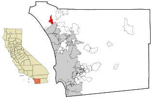
Diablo is a census-designated place (CDP) in Contra Costa County, California, United States. The population was 1,158 at the 2010 census. It is located 2.5 miles (4.0 km) east-northeast of Danville.

Calwa is an unincorporated community and census-designated place (CDP) in Fresno County, California, United States. The population was 2,052 at the 2010 census, up from 762 in 2000. Calwa is located 4 miles (6.4 km) south-southeast of downtown Fresno, at an elevation of 292 feet. The name was taken from the acronym for "California Wine Association" (CalWA).
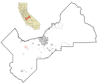
Tranquillity is a census-designated place (CDP) in Fresno County, California, United States. It is located 10 miles (16 km) southeast of Mendota, at an elevation of 164 feet (50 m). The population was 799 at the 2010 census, down from 813 at the 2000 census. Tranquillity High School is the only high school in Tranquillity.

East Whittier is an unincorporated community in Los Angeles County, California, United States. The population was 9,757 at the 2010 census, up from 9,538 at the 2000 census. For statistical purposes, the United States Census Bureau has defined this community as a census-designated place (CDP). The name was changed from East La Mirada in 2012, likely due to its precise location in relation to the city of Whittier.
East Pasadena is an unincorporated community and census designated place (CDP) in Los Angeles County, California, United States. The population was 6,021 at the 2020 census, down from 6,144 at the 2010 census. For statistical purposes, the United States Census Bureau has defined East Pasadena as a census-designated place (CDP).
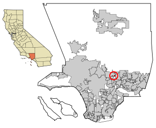
Mayflower Village is a census-designated place (CDP) in the San Gabriel Valley, in Los Angeles County, California, United States. The population was 5,515 at the 2010 census, up from 5,081 at the 2000 census. The ZIP Codes serving the community are 91006, which is served by Arcadia and 91016, which is served by Monrovia.

West Rancho Dominguez, formerly known as West Compton and also known as East Gardena, is an unincorporated census-designated place (CDP) located in southern Los Angeles County, California. Per the 2020 census, the population was 24,347. The community lies to the west of the city of Compton. The ZIP Codes encompassing the CDP area are 90220 & 90248.

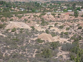
Bootjack is an unincorporated community and census-designated place in Mariposa County, California, United States. The population was 661 at the 2020 census, down from 960 in 2010 and 1,588 in 2000, largely due to reductions in the area of the CDP.
Laytonville is a census-designated place (CDP) in Mendocino County, California, United States. It is located 23 miles (37 km) north-northwest of Willits, at an elevation of 1,670 feet (510 m). The population was 1,152 at the 2020 census, down from 1,227 at the 2010 census.

Storrie is an unincorporated community and former census-designated place (CDP) in Plumas County, California and about 20 miles northeast of Lake Oroville. As of the 2010 Census, the CDP had a population of four.

Homeland is a census-designated place (CDP) in Riverside County, California, United States. The population was 5,969 at the 2010 census, up from 3,710 at the 2000 census.
Camp Pendleton Mainside is a census-designated place (CDP) in San Diego County, California, located at the southeast corner of Marine Corps Base Camp Pendleton. Per the 2020 census, the population was 9,683. It was formerly known as Camp Pendleton North, but its name was changed for the 2020 Census. Along with Camp Pendleton South, it is one of two CDPs located on the base.

Empire is a census-designated place (CDP) in Stanislaus County, California, United States. The population was 4,189 at the 2010 census, up from 3,903 at the 2000 census. It is part of the Modesto Metropolitan Statistical Area. Influenced by the Mexican culture, Empire is agriculturally active, and is home to the new Empire Community Park.
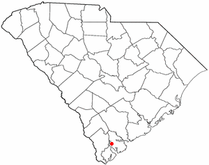
Burton is a census-designated place (CDP) on Port Royal Island in Beaufort County, South Carolina, United States. The population was 6,976 at the 2010 census. As defined by the U.S. Census Bureau, Burton is included within the Hilton Head Island-Bluffton-Beaufort, SC Metropolitan Statistical Area.
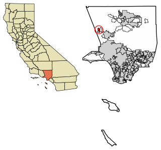
Agua Dulce is an unincorporated community and census-designated place (CDP) in Los Angeles County, California, United States. It lies at an elevation of 2,526 feet (770 m), northeast of Santa Clarita. The community had a population of 3,342 at the 2010 census and covers a geographic area of about 23 square miles (59 km2). Agua Dulce is on the Pacific Crest Trail. The ZIP code is 91390, and the area code is 661.
Malaga is a census-designated place in Fresno County, California. It is located 6 miles (9.7 km) south-southeast of downtown Fresno, at an elevation of 295 feet. As of the 2020 census, Malaga had a population of 884.

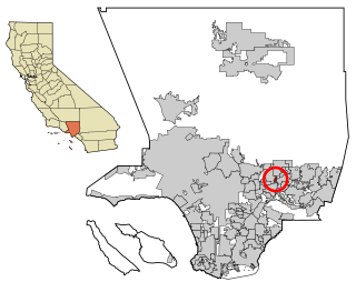
San Pasqual is an unincorporated community and census-designated place (CDP) in Los Angeles County, California. It lies between San Marino and Pasadena. The major streets in San Pasqual are San Pasqual Street, South Sierra Madre Blvd., and Oakdale Street. San Pasqual is served by the Pasadena post office responsible for ZIP code 91107, and thus locations there are properly addressed with the final line reading "Pasadena, CA 91107". The population was 2,041 at the 2010 census.
Hasley Canyon is a census-designated place in the Sierra Pelona mountains of Los Angeles County, California. Hasley Canyon sits at an elevation of 1,765 feet (538 m). The 2010 United States census reported Hasley Canyon's population was 1,137.

Rose Hills is a census-designated place in Los Angeles County, California. Rose Hills sits at an elevation of 518 feet (158 m) above sea level. The 2010 United States census reported Rose Hills's population was 2,803.

Lemon Hill is a census-designated place in an unincorporated area of Sacramento County, California, south of the city of Sacramento. Lemon Hill sits at an elevation of 30 feet (9.1 m). The 2010 United States census reported Lemon Hill's population was 13,729.


