San Juan Capistrano, California

Last updated

San Juan Capistrano, California
2019 Mission Basilica San Juan Capistrano 2.jpg
San Juan Capistrano station California - panoramio (cropped).jpg
Jewel of the Missions (cropped).jpg
2019 Provincial Building, San Juan Capistrano (cropped).jpg
Historic Old Town San Juan Capistrano, California (25394541403).jpg
Top: San Juan Mission Basilica (left), San Juan Capistrano station (right); middle: Mission San Juan Capistrano; bottom: Downtown San Juan Capistrano
San Juan Capistrano Flag, Calfiornia.png
Seal of the City of San Juan Capistrano, California.png
Motto: 
"Preserving The Past To Enhance The Future"
Orange County California Incorporated and Unincorporated areas San Juan Capistrano Highlighted.svg
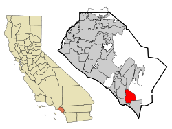
Location of San Juan Capistrano within Orange County, California.
Usa edcp relief location map.png
Red pog.svg
San Juan Capistrano, California
Location in the United States
Coordinates: 33°29′58″N117°39′42″W / 33.49944°N 117.66167°W / 33.49944; -117.66167
Country United States
State California
County Orange
Incorporated April 19, 1961
Named for John of Capistrano
Government
  Type Council-Manager
   Mayor [1] Sergio Farias
   Mayor Pro Tem Howard Hart
   City Council Troy A. Bourne
John Taylor
   City manager [2] Benjamin Siegel
Area
[3]
  Total14.43 sq mi (37.37 km2)
  Land14.43 sq mi (37.37 km2)
  Water0.00 sq mi (0.00 km2)
Elevation
[4]
121 ft (37 m)
Population
 (2020)
  Total35,196
  Density2,439.09/sq mi (941.82/km2)
Time zone UTC-8 (Pacific)
  Summer (DST) UTC-7 (PDT)
ZIP Code
92675
Area code 949
FIPS code 06-68028
GNIS feature IDs 1661383, 2411793
Website sanjuancapistrano.org

San Juan Capistrano (also known colloquially as San Juan or SJC) is a city in southern Orange County, California, United States. The population was 35,253 at the 2020 Census.

Contents

Named for Saint John of Capistrano, San Juan Capistrano was founded by the Spanish in 1776, when Father Junípero Serra established Mission San Juan Capistrano. Extensive damage caused by an earthquake in 1812 caused the community to decline. Following the Mexican secularization act of 1833, the mission village officially became a town and was briefly renamed as San Juan de Argüello. After the American conquest of California, San Juan remained a small, rural town until the 20th century; the restoration of the mission in the 1910s–20s transformed the town into a tourist destination and a backdrop for Hollywood films.

History

The Spanish founded San Juan Capistrano in 1776, when Saint Junipero Serra established Mission San Juan Capistrano. San Juan Capistrano, California (c. 1806).jpg
The Spanish founded San Juan Capistrano in 1776, when Saint Junípero Serra established Mission San Juan Capistrano.

Indigenous

The region was populated by the Acjachemen, referred to by the Spanish as Juaneños, an Indigenous Californian nation. They lived in the area for approximately 10,000 years, with some of their oldest villages being confirmed as over 9,600 years old. [5] [6] The mother village of Putuidem was located in what is now San Juan Capistrano, as well as the village of Acjacheme. [7]

Spanish era

The settlement that today is San Juan Capistrano began in 1776 when the Spanish Franciscan missionary Junípero Serra founded Mission San Juan Capistrano, the seventh of the Spanish missions in California. The mission was built less than 60 yards from the native village of Acjacheme, which was exploited as a source of labor for the mission. [8] The mission was named after Saint John of Capistrano, a 14th-15th century Franciscan saint. The 1812 San Juan Capistrano earthquake resulted in the deaths of thirty-nine Acjachemen people, thirty-one of whom were women, when the stone church at the Mission collapsed. [9]

Mexican era

Ruins of the Great Stone Church at Mission San Juan Capistrano, 1876 Ruins of San Juan Capistrano (1876).jpg
Ruins of the Great Stone Church at Mission San Juan Capistrano, 1876

The Mexican Congress of the Union enacted the secularization of the Californian missions in 1833. In the mission period, 4,317 natives had been baptized at the mission (1,689 adults and 2,628 children). In that same period, 3,158 of those baptized had died. Some of the native people who survived the mission period continued to live at the mission for a short period after the secularization act, while others settled in the surrounding areas. [10]

Each mission was appointed an administrator to oversee the transfer of the missions and their lands from the Franciscan Order to the Mexican authorities. Santiago Argüello, a member of a prominent family of Californios, was appointed administrator of Mission San Juan Capistrano. During his tenure, the community was briefly renamed "San Juan de Argüello", similar to what happened to San Juan Bautista in Northern California, which was briefly renamed "San Juan de Castro" after its administrator José Castro.

In 1844, Don Juan Forster and James McKinley purchased the former Mission San Juan Capistrano at public auction. Forster made his home there until 1864, when the mission was returned to the Catholic Church by President Abraham Lincoln.

American era

San Juan Capistrano station, 1895 San Juan Capistrano railway station c.1895.jpg
San Juan Capistrano station, 1895
San Juan Capistrano in the 1940s Hotel Capistrano, San Juan Capistrano (3042364270).jpg
San Juan Capistrano in the 1940s

Following the American Conquest of California, San Juan remained a relatively small and rural community until the end of the 19th century.

Padre O'Sullivan arrived in San Juan Capistrano in 1910 to recuperate from a recent stroke. He became fascinated by Mission San Juan Capistrano and soon set to work on rebuilding it a section at a time. O'Sullivan repaired the roof of the Serra Chapel using California sycamore logs to match those that were used in the original work. He brought in architect Arthur B. Benton of Los Angeles to strengthen the chapel walls through the addition of heavy masonry buttresses. The centerpiece of the chapel restoration was its retablo , imported from Barcelona in 1806 and donated by the Bishop of Los Angeles.

The restoration of the mission resulted in the town's emergence as a tourist destination, owing to its historic architectural style and proximity to the sea. The mission was used often in Hollywood productions, such as D. W. Griffith's 1910 western film The Two Brothers , the first film ever shot in Orange County. San Juan was incorporated as a city on April 19, 1961. [11]

From 2009 to 2017, the cliff swallows did not make their famous annual springtime return to Mission San Juan Capistrano, instead migrating to the Chino Hills, north of San Juan. [12] The swallows changed their route because the Mission is no longer the tallest building in the area due to urban sprawl, and thus stopped attracting the swallows for nesting. [13] Mission San Juan Capistrano embarked on a program to facilitate the return of the swallows, first by using swallow calls to attract the birds and then by building artificial swallow nests for the birds to use. [14] As of 2017, the swallows have returned home to Mission San Juan Capistrano and are still celebrated each year at the town's annual Swallows Day Parade and Mercado Street Fair. In 2018, the town celebrated its 80th annual Swallows Day Parade and Fiesta de las Golondrinas (Spanish : Festival of the Swallows). [15] The event holds the title of being the longest-running and largest non-motorized parade west of the Mississippi.[ citation needed ]

Geography

The Santa Ana Mountains separate San Juan Capistrano from Lake Elsinore in Riverside County. Ortega Highway Between San Juan Capistrano and Lake Elsinore, California (5974112125).jpg
The Santa Ana Mountains separate San Juan Capistrano from Lake Elsinore in Riverside County.

San Juan Capistrano is located in south Orange County and is bisected by Interstate 5.

According to the United States Census Bureau, the city has a total area of 14.3 square miles (37 km2). 14.1 square miles (37 km2) of it is land and 0.1 square miles (0.26 km2) of it (1.26%) is water.

Climate

Climate data for San Juan Capistrano, California
MonthJanFebMarAprMayJunJulAugSepOctNovDecYear
Record high °F (°C)93
(34)
94
(34)
96
(36)
101
(38)
101
(38)
107
(42)
110
(43)
104
(40)
116
(47)
108
(42)
99
(37)
93
(34)
116
(47)
Mean daily maximum °F (°C)65
(18)
66
(19)
66
(19)
68
(20)
70
(21)
73
(23)
76
(24)
78
(26)
77
(25)
74
(23)
69
(21)
65
(18)
71
(22)
Mean daily minimum °F (°C)50
(10)
50
(10)
52
(11)
54
(12)
57
(14)
60
(16)
63
(17)
63
(17)
62
(17)
59
(15)
53
(12)
49
(9)
56
(13)
Record low °F (°C)25
(−4)
30
(−1)
32
(0)
33
(1)
39
(4)
44
(7)
48
(9)
47
(8)
45
(7)
38
(3)
35
(2)
28
(−2)
25
(−4)
Average precipitation inches (mm)3.05
(77)
3.31
(84)
1.83
(46)
0.83
(21)
0.37
(9.4)
0.12
(3.0)
0.12
(3.0)
0.12
(3.0)
0.24
(6.1)
0.61
(15)
0.83
(21)
2.20
(56)
13.63
(344.5)
Source: [16] [17]

Demographics

Historical population
CensusPop.Note
1880 376
1960 1,120
1970 3,781237.6%
1980 18,959401.4%
1990 26,18338.1%
2000 33,82629.2%
2010 34,5932.3%
2020 35,2531.9%
U.S. Decennial Census [18]

2020

The 2020 U.S. Census reported a population of 35,253. The racial makeup was 70.6% White (52.8% Non-Hispanic white), 0.7% African American, 3.6% Asian, and 37.3% Hispanic or Latino of any race. [19]

San Juan Capistrano city, California – Racial and Ethnic Composition
(NH = Non-Hispanic)
Note: the US Census treats Hispanic/Latino as an ethnic category. This table excludes Latinos from the racial categories and assigns them to a separate category. Hispanics/Latinos may be of any race.
Race / EthnicityPop 2000 [20] Pop 2010 [21] Pop 2020 [22] % 2000% 2010% 2020
White alone (NH)21,08419,31218,59162.33%55.83%52.82%
Black or African American alone (NH)1511461390.45%0.42%0.39%
Native American or Alaska Native alone (NH)1691561060.50%0.45%0.30%
Asian alone (NH)6349521,1941.87%2.75%3.39%
Pacific Islander alone (NH)3530220.10%0.09%0.06%
Some Other Race alone (NH)27431470.08%0.12%0.42%
Mixed Race/Multi-Racial (NH)5205661,2931.54%1.64%3.67%
Hispanic or Latino (any race)11,20613,38813,70433.13%38.70%38.94%
Total33,82634,95335,196100.00%100.00%100.00%

2010

The historic Casa Manuel Garcia. El Casa de Garcias (25376088153).jpg
The historic Casa Manuel García.
The historic Juan Avila Adobe. Don Juan Avila Adobe (25376592103).jpg
The historic Juan Ávila Adobe.

At the 2010 Census San Juan Capistrano had a population of 34,593. The population density was 2,419.9 inhabitants per square mile (934.3/km2). The racial makeup of San Juan Capistrano was 26,664 (77.1%) White (55.8% Non-Hispanic White), [23] 193 (0.6%) African American, 286 (0.8%) Native American, 975 (2.8%) Asian, 33 (0.1%) Pacific Islander, 5,234 (15.1%) from other races, and 1,208 (3.5%) from two or more races. Hispanic or Latino of any race were 13,388 persons (38.7%). [24]

The census reported that 34,506 people (99.7% of the population) lived in households, and 87 (0.3%) lived in non-institutionalized group quarters.

There were 11,394 households, 4,030 (35.4%) had children under the age of 18 living in them, 6,706 (58.9%) were opposite-sex married couples living together, 1,089 (9.6%) had a female householder with no husband present, 526 (4.6%) had a male householder with no wife present. There were 456 (4.0%) unmarried opposite-sex partnerships, and 87 (0.8%) same-sex married couples or partnerships. 2,381 households (20.9%) were one person and 1,407 (12.3%) had someone living alone who was 65 or older. The average household size was 3.03. There were 8,321 families (73.0% of households); the average family size was 3.44.

The age distribution was 8,518 people (24.6%) under the age of 18, 3,066 people (8.9%) aged 18 to 24, 7,804 people (22.6%) aged 25 to 44, 9,792 people (28.3%) aged 45 to 64, and 5,413 people (15.6%) who were 65 or older. The median age was 40.2 years. For every 100 females, there were 98.3 males. For every 100 females age 18 and over, there were 96.7 males.

There were 11,940 housing units at an average density of 835.2 per square mile, of the occupied units 8,462 (74.3%) were owner-occupied and 2,932 (25.7%) were rented. The homeowner vacancy rate was 1.3%; the rental vacancy rate was 4.7%. 24,052 people (69.5% of the population) lived in owner-occupied housing units and 10,454 people (30.2%) lived in rental housing units.

According to the 2010 Census, San Juan Capistrano had a median household income of $75,356, with 12.7% of the population living below the federal poverty line. [23]

2000

The 85-foot (26 m) tall Mission Basilica is the tallest building in San Juan. Pope John Paul II conferred it the rank of Basilica in 2000. San Juan Capistrano, CA, USA - panoramio (4) (cropped).jpg
The 85-foot (26 m) tall Mission Basilica is the tallest building in San Juan. Pope John Paul II conferred it the rank of Basilica in 2000.
The historic Frank A. Forster House, a Mission Revival estate built by the grandson of Don Juan Forster. Frank A. Forster House (cropped).JPG
The historic Frank A. Forster House, a Mission Revival estate built by the grandson of Don Juan Forster.

As of the 2000 Census, there were 33,826 people in 10,930 households, including 8,196 families, in the city. The population density was 2,381.2 inhabitants per square mile (919.4/km2). There were 11,320 housing units at an average density of 307.6 persons/km2 (796.9 persons/mi2). The racial makeup of the city was 78.47% White, 0.78% African American, 1.07% Native American, 1.92% Asian, 0.11% Pacific Islander, 14.21% from other races, and 3.43% from two or more races. 33.13% of the population were Hispanic or Latino of any race.

Of the 10,930 households, 39.9% had children under the age of 18 living with them, 62.7% were married couples living together, 8.5% had a female householder with no husband present, and 25.0% were non-families. 19.7% of households were one person and 10.3% were one person aged 65 or older. The average household size was 3.06 and the average family size was 3.45.

The age distribution was 28.1% under the age of 18, 7.8% from 18 to 24, 27.3% from 25 to 44, 23.7% from 45 to 64, and 13.1% 65 or older. The median age was 36 years. For every 100 females, there were 96.9 males. For every 100 females age 18 and over, there were 94.0 males.

The median household income was $62,392, and the median family income was $69,481. Males had a median income of $47,574 versus $34,821 for females. The per capita income for the city was $29,926. About 10.7% of the population and 6.6% of families were below the poverty line, including 14.8% of those under age 18 and 4.2% of those age 65 or over. [25] [26]

Economy

Shops in downtown San Juan. Quaint Town, relaxing time (25684786730).jpg
Shops in downtown San Juan.
Los Rios Historic District is a National Register Historic District. 31665 Los Rios.JPG
Los Rios Historic District is a National Register Historic District.

San Juan Capistrano is home to over 1,700 businesses. The city's unemployment rate was at 3.7% as of December 2017. [27]

Top employers

According to the city's Comprehensive Annual Financial Report from June 30, 2022, [28] the largest employers in the city are:

#Employer# of employees
1 Capistrano Unified School District 3,992
2 St. Margaret's Episcopal School 429
3 Costco 340
4Ensign Services185
5 JSerra Catholic High School 145
6Fluidmaster Inc. HQ130
7ASRV, LLC124
8Inn at the Mission San Juan Capistrano118
9Marbella Country Club106
10Capistrano Connections Academy100

Arts and culture

Cliff swallows make their home at Mission San Juan Capistrano during their yearly migration from Argentina. Mission Bell Wall.jpg
Cliff swallows make their home at Mission San Juan Capistrano during their yearly migration from Argentina.

San Juan Capistrano is also known for its cliff swallows. The protected birds return during migration, which originates in the town of Goya, Argentina, around St. Joseph's Day (March 19) each year. The day is celebrated by the city's annual Swallows' Day Parade and other festive events. [29] The swallows leave around October 23, the former feast day of St. John of Capistrano. The 1940 hit song "When the Swallows Come Back to Capistrano", written by Leon René, is a love song inspired by this annual event.

The Serra Chapel at the mission is the oldest in-use building in California. San Juan was also the site of one of the first places to produce Californian wine.

Putuidem Village, a 1.5-acre park (0.61 ha), is part of the original lands of the Acjachemen. Completed in 2021, it commemorates the history of the people called the Juaneño by the Spanish colonizers. [30]

Government

Ruins of the Great Stone Church Great Stone Church 02 (cropped).jpg
Ruins of the Great Stone Church

As of April 2022, the City Council members are: Derek Reeve (Mayor), [31] Howard Hart (Mayor Pro Team), John Taylor, Sergio Farias, and Troy Bourne. [32]

The current city manager is Benjamin Siegel. [2]

In the California State Legislature, San Juan Capistrano is in the 36th Senate District , represented by Republican Janet Nguyen, and in the 74th Assembly District , represented by Republican Laurie Davies. [33]

In the United States House of Representatives, San Juan Capistrano is in California's 49th congressional district , represented by Democrat Mike Levin. [34]

Education

San Juan Hills High School San Juan Hills High School in San Juan Capistrano, CA (cropped).jpg
San Juan Hills High School

San Juan Capistrano is served by the Capistrano Unified School District. In the 2007–08 academic year, San Juan Hills High School opened with about 600 freshman students. It is the city's only public high school, although a sizable portion of San Juan Capistrano's residents attend high schools in neighboring cities since many of those schools are also part of the Capistrano Unified School District.

San Juan has four public elementary schools (grades K–5): Del Obispo Elementary School, Harold Ambuehl Elementary School, Kinoshita Elementary School, and San Juan Elementary School. The local public middle school (grades 6–8) is Marco Forster Middle School. Capistrano Valley High School (grades 9–12) lies just outside of the city's borders, but serves many of the city's students. A public continuation high school, Junipero Serra High School, also serves the area.

View of the north wing of the mission from the central patio. Mission San Juan Capistrano - North Corridor (cropped).jpg
View of the north wing of the mission from the central patio.

San Juan also has six private, non-secular schools. Capistrano Valley Christian Schools (grades pre-K – 12), Saddleback Valley Christian School (grades pre-K – 12), St. Margaret's Episcopal School (grades pre-K – 12), and JSerra Catholic High School (grades 9–12). Mission Basilica School (grades K–8) is located on the historic Mission grounds, utilizes some of the historic buildings as classrooms, and is part of Mission Basilica San Juan Capistrano. The other is Rancho Capistrano Christian School (grades K–8), located off Interstate 5 on Saddleback Church's south campus.

San Juan also has a private, secular school, Fairmont School [35] (grade K - 12), located close to San Juan Capistrano Mission.

Media

San Juan Capistrano is served by two newspapers, the Capistrano Valley News (owned by the Orange County Register) and The Capistrano Dispatch. The Capistrano Valley News runs once weekly on Thursdays and The Dispatch runs on the second and fourth Fridays of each month.

The San Juan Capistrano Patch , an online-only news website, also serves the city.

Transportation

San Juan Capistrano station is served by Amtrak and Metrolink. Railway Station San Juan Capistrano.jpg
San Juan Capistrano station is served by Amtrak and Metrolink.

The Orange County Transportation Authority (OCTA) operates bus routes within the city, connecting it to other parts of Orange County.

Rail

The San Juan Capistrano station is served by Amtrak and Metrolink. The station is located one block away from the historic San Juan Capistrano Mission next to Los Rios Street in downtown San Juan Capistrano. Its proximity to the city's tourist attractions makes it a popular stop during the summer months.

Highways

Shops in downtown San Juan. Old Town San Juan Capistrano, California (26026195495).jpg
Shops in downtown San Juan.
The Casa de Esperanza is on the National Register of Historic Places. Casa de Esperanza (cropped).jpg
The Casa de Esperanza is on the National Register of Historic Places.

I-5 (CA).svg Interstate 5 (San Diego Freeway) has three interchanges completely located in the city (at Camino Capistrano, SR 74/Ortega Highway, and Junipero Serra Road), two interchanges partially located within the city (at SR 1/Camino las Ramblas (which is partially within Dana Point) as well as SR 73 (which is partially within Mission Viejo), and an additional northbound entrance ramp from Stonehill Drive and Camino Capistrano.

California 1.svg Pacific Coast Highway is one of the most notable state routes in California. It is often incorrectly referenced that SR 1 terminates in nearby Dana Point because the city borders the Pacific Ocean (unlike San Juan Capistrano). In reality, SR 1 terminates shortly after it junctions with Interstate 5, crossing within San Juan Capistrano city limits (although this is a few hundred feet away from the city limits of Dana Point). There is an official SR 1 terminus sign on a traffic light pole along the southbound lanes on SR 1 shortly after crossing under Interstate 5 which is within San Juan Capistrano city limits.

California 73.svg California State Route 73 (San Joaquin Hills Toll Road) has its southern terminus at I-5 in San Juan Capistrano. There are no exits along SR 73 in San Juan Capistrano other than its junction with Interstate 5.

California 74.svg California State Route 74 has its official western terminus at Interstate 5 in San Juan Capistrano. The city-maintained road that continues west as Ortega Highway originally terminated at Camino Capistrano in front of Mission San Juan Capistrano; however, interchange reconstruction that was completed in 2015 brought Ortega Highway to continue onto Del Obispo Street towards Dana Point, with a right turn required to stay on the older portion of Ortega Highway. [36]

US 101 (CA historic).svg The original route of U.S. 101 ran through downtown San Juan Capistrano on what is now Camino Capistrano. It was decommissioned when Interstate 5 was completed in the 1950s.

Sister cities

Notable people

Related Research Articles

<span class="mw-page-title-main">Mission San Juan Capistrano</span> 18th-century Spanish mission in California

Mission San Juan Capistrano is a Spanish mission in San Juan Capistrano, Orange County, California. Founded November 1, 1776 in colonial Las Californias by Spanish Catholic missionaries of the Franciscan Order, it was named for Saint John of Capistrano. The Spanish Colonial Baroque style church was located in the Alta California province of the Viceroyalty of New Spain. The Mission was founded less than 60 yards from the village of Acjacheme. The Mission was secularized by the Mexican government in 1833, and returned to the Roman Catholic Church by the United States government in 1865. The Mission was damaged over the years by a number of natural disasters, but restoration and renovation efforts date from around 1910. It functions today as a museum.

<span class="mw-page-title-main">Fermín de Lasuén</span> Basque Franciscan missionary

Fermín de Francisco Lasuén de Arasqueta was a Basque Franciscan missionary to Alta California president of the Franciscan missions there, and founder of nine of the twenty-one Spanish missions in California.

<span class="mw-page-title-main">San Luis Obispo County, California</span> County in California, United States

San Luis Obispo County, officially the County of San Luis Obispo, is a county on the Central Coast of California. As of the 2020 census, the population was 282,424. The county seat is San Luis Obispo.

<span class="mw-page-title-main">Duarte, California</span> City in California, United States

Duarte is a city in Los Angeles County, California, United States. As of the 2020 census, the city population was 21,727. It is bounded to the north by the San Gabriel Mountains, to the north and west by the cities of Bradbury and Monrovia, to the south by the city of Irwindale, and to the east by the cities of Irwindale and Azusa. Duarte is located on historic U.S. Route 66 which today follows Huntington Drive through the middle of the city. The town is named after Andrés Avelino Duarte, a California ranchero who founded the community.

<span class="mw-page-title-main">Costa Mesa, California</span> City in Orange County, California, United States

Costa Mesa is a city in Orange County, California, United States. Since its incorporation in 1953, the city has grown from a semi-rural farming community of 16,840 to an urban area including part of the South Coast Plaza–John Wayne Airport edge city, one of the region's largest commercial clusters, with an economy based on retail, commerce, and light manufacturing. The city is home to the two tallest skyscrapers in Orange County. The population was 111,918 at the 2020 census.

<span class="mw-page-title-main">Dana Point, California</span> City in California, United States

Dana Point is a city located in southern Orange County, California, United States. The population was 33,107 at the 2020 census. It has one of the few harbors along the Orange County coast, and with ready access via State Route 1, it is a popular local destination for surfing.

<span class="mw-page-title-main">Laguna Niguel, California</span> City in California, United States

Laguna Niguel is a city in Orange County, California, United States. The name Laguna Niguel is derived from the words "Laguna" and "Niguili". As of the 2020 census, the population was 64,355. Laguna Niguel is located in the San Joaquin Hills in the southeastern corner of Orange County, close to the Pacific Ocean, and borders the cities of Aliso Viejo, Dana Point, Laguna Beach, Laguna Hills, Mission Viejo, and San Juan Capistrano.

<span class="mw-page-title-main">Mission Viejo, California</span> City in the United States

Mission Viejo is a commuter city in the Saddleback Valley in Orange County, California, United States. Mission Viejo is considered one of the largest master-planned communities ever built under a single project in the United States and is rivaled only by Highlands Ranch in size. Its population as of 2020 was 93,653.

<span class="mw-page-title-main">San Clemente, California</span> City in California, United States

San Clemente is a city in Orange County, California, United States. Located in the Orange Coast region of the South Coast of California, San Clemente's population was 64,293 in at the 2020 census. Situated roughly midway between Los Angeles and San Diego, San Clemente is a popular tourist destination in Southern California, known for its beaches, Spanish Colonial Revival architecture, and hospitality industry. San Clemente's city slogan is "Spanish Village by the Sea".

<span class="mw-page-title-main">Oceanside, California</span> City in California, United States

Oceanside is a city on the South Coast of California, located in San Diego County. The city had a population of 174,068 at the 2020 United States census, up from 167,086 at the 2010 census. The city is a popular tourist destination, owing to its historic landmarks, beaches, and architecture.

<span class="mw-page-title-main">Millbrae, California</span> City in California, United States

Millbrae is a city located in northern San Mateo County, California, United States. To the northeast is San Francisco International Airport; San Bruno is to the northwest, and Burlingame is to the southeast. It is bordered by San Andreas Lake to the southwest. The population was 23,216 at the 2020 census.

<span class="mw-page-title-main">Santa Clara, California</span> City in California, United States

Santa Clara is a city in the county of the same name. The city's population was 127,647 at the 2020 census, making it the eighth-most populous city in the Bay Area. Located in the southern Bay Area, the city was founded by the Spanish in 1777 with the establishment of Mission Santa Clara de Asís under the leadership of Junípero Serra.

<span class="mw-page-title-main">Mission Basilica San Juan Capistrano</span> Catholic parish in San Juan Capistrano, California

Mission Basilica San Juan Capistrano is a Catholic parish in the Diocese of Orange. The parish church is located just northwest of Mission San Juan Capistrano in the city of San Juan Capistrano, California, United States. Completed in 1986, it was designated a minor basilica in 2000 and a national shrine in 2003.

Putuidem, alternative spelling Putiidhem or Putuidhem, was a large native village of the Acjachemen people, also known as Juaneño since their relocation to Mission San Juan Capistrano. Putuidem was a mother village, a community that spawned other villages of the tribe.

<span class="mw-page-title-main">Ladera Ranch, California</span> Place in California, United States

Ladera Ranch is a master-planned community and census-designated place located in south Orange County, California, just outside the city limits of Mission Viejo.

Rancho Mission Viejo is an active 23,000 acres (9,300 ha) ranch and farm, habitat reserve, residential community, and census-designated place in South Orange County, California. Rancho Mission Viejo originated as a series of land grants to John Forster in 1845. The remaining part of Rancho Mission Viejo consists of a nearly 17,000-acre (6,900 ha) nature reserve and multiple residential communities slated to open in phases between 2010 and 2030. As of the 2020 census, it had a population of 10,378.

JSerra Catholic High School is a private coeducational Catholic high school located in San Juan Capistrano, California. Named after Saint Junípero Serra, the school was founded by parents in 2003 and is an independent school sanctioned by the Diocese of Orange. Total enrollment as of 2015 was 1,225.

<span class="mw-page-title-main">Santa Margarita, California</span> Census-designated place in California, United States

Santa Margarita is a town and census-designated place located in San Luis Obispo County, California. It was founded in 1889 near Cuesta Peak and San Luis Obispo along State Route 58. The town's name comes from the Mexican Alta California land grant of Rancho Santa Margarita. It is home to the Santa Margarita de Cortona Asistencia site. The population was 1,259 at the 2010 census.

<span class="mw-page-title-main">Junipero Serra Boulevard</span> Street in California

Junipero Serra Boulevard is a major boulevard in and south of San Francisco named after Franciscan friar Junipero Serra. Within the city, it forms part of the route of State Route 1, the shortest connection between Interstate 280 and the Golden Gate Bridge. The remainder, in San Mateo County, was bypassed or replaced by I-280, the Junipero Serra Freeway. The boulevard was one of several new roads built along the San Francisco Peninsula before the age of freeways, and became a state highway known as Route 237 in 1956, receiving the State Route 117 designation in the 1964 renumbering, only to be deleted from the state highway system the next year. Two other regional highways—Bayshore Highway and Skyline Boulevard—were also upgraded into or bypassed by freeways.

The California mission clash of cultures occurred at the Spanish Missions in California during the Spanish Las Californias-New Spain and Mexican Alta California eras of control, with lasting consequences after American statehood. The Missions were religious outposts established by Spanish Catholic Franciscans from 1769 to 1823 for the purpose of protecting Spain's territory by settlements and converting the Californian Native Americans to the Christian religion.

References

  1. "Mayor and City Council". City of San Juan Capistrano. Retrieved April 15, 2022.
  2. 1 2 "City Manager". City of San Juan Capistrano. Retrieved January 12, 2021.
  3. "2019 U.S. Gazetteer Files". United States Census Bureau. Retrieved July 1, 2020.
  4. "San Juan Capistrano". Geographic Names Information System . United States Geological Survey, United States Department of the Interior . Retrieved October 23, 2014.
  5. Gottlieb, Alma (2012). The restless anthropologist : new fieldsites, new visions. Chicago: The University of Chicago Press. pp. 63–65. ISBN   978-0-226-30497-7. OCLC   780446639.
  6. Gilio-Whitaker, Dina (2019). As long as grass grows : the indigenous fight for environmental justice, from colonization to Standing Rock. Boston, Massachusetts. p. 132. ISBN   978-0-8070-7378-0. OCLC   1044542033.{{cite book}}: CS1 maint: location missing publisher (link)
  7. "New Church-Indian Divide". Los Angeles Times. November 27, 2002. Retrieved January 12, 2021.
  8. O'Neil, Stephen; Evans, Nancy H. (1980). "Notes on Historical Juaneno Villages and Geographical Features". UC Merced Journal of California and Great Basin Anthropology. 2 (2): 226–232.
  9. Vélez, Karin (October 2, 2017). "Stones and Bones: Catholic Responses to the 1812 Collapse of the Mission Church of Capistrano". Material Religion. 13 (4): 437–460. doi: 10.1080/17432200.2017.1379375 . ISSN   1743-2200.
  10. Handbook of American Indians north of Mexico. Volume III, N to S. Frederick Webb Hodge. Scituate, MA: Digital Scanning. 2003. pp. 445–446. ISBN   978-1-58218-755-6. OCLC   647873186.{{cite book}}: CS1 maint: others (link)
  11. "California Cities by Incorporation Date". California Association of Local Agency Formation Commissions. Archived from the original (Word) on November 3, 2014. Retrieved August 25, 2014.
  12. Esquivel, Paloma (March 25, 2009). "Another year without swallows – Festival goes on without birds at historic mission". The Boston Globe . Boston . Retrieved September 30, 2014.
  13. "Famed swallows of Capistrano nest in country club". The Associated Press (via Southern Carolina Public Radio). New York City. June 7, 2010. Retrieved September 30, 2014.
  14. "Swallows Legend - Mission San Juan Capistrano". Mission San Juan Capistrano. Retrieved May 13, 2018.
  15. "San Juan Capistrano Fiesta Association". San Juan Capistrano Fiesta Association. Retrieved May 13, 2018.
  16. "Climate and Average Weather Year Round in San Juan Capistrano California, United States". Weather Spark . Retrieved January 2, 2023.
  17. "San Juan Capistrano, CA Historical Information" . Retrieved February 26, 2021.
  18. "Census of Population and Housing". Census.gov. Retrieved June 4, 2015.
  19. "U.S. Census Bureau QuickFacts: San Juan Capistrano city, California". www.census.gov. Retrieved August 17, 2022.
  20. "P004 HISPANIC OR LATINO, AND NOT HISPANIC OR LATINO BY RACE – 2000: DEC Summary File 1 – San Juan Capistrano city, California". United States Census Bureau .
  21. "P2 HISPANIC OR LATINO, AND NOT HISPANIC OR LATINO BY RACE – 2010: DEC Redistricting Data (PL 94-171) – San Juan Capistrano city, California". United States Census Bureau .
  22. "P2 HISPANIC OR LATINO, AND NOT HISPANIC OR LATINO BY RACE - 2020: DEC Redistricting Data (PL 94-171) – San Juan Capistrano city, California". United States Census Bureau .
  23. 1 2 "San Juan Capistrano (city), California". quickfacts.census.gov. July 8, 2014. Archived from the original on March 11, 2015. Retrieved September 30, 2014.
  24. "2010 Census Interactive Population Search: CA - San Juan Capistrano city". U.S. Census Bureau. Archived from the original on July 15, 2014. Retrieved July 12, 2014.
  25. "San Juan Capistrano city, California - Fact Sheet - American FactFinder". U.S. Census Bureau. Archived from the original on February 12, 2020. Retrieved June 27, 2010.
  26. "California by Placae - GCT-PH1, Population, Housing Units, Area, and Density: 2000". U.S. Census Bureau. Archived from the original on February 12, 2020. Retrieved June 27, 2010.
  27. City of San Juan Capistrano CAFR
  28. "Comprehensive Annual Financial Report for the Fiscal Year Ended June 30, 2022". City of San Juan Capistrano. Retrieved August 24, 2023.
  29. "Swallows Parade". Archived from the original on October 15, 2007. Retrieved November 2, 2007.
  30. Brazil, Ben (December 13, 2021). "After delays, the first people of Orange County have preserved a piece of their ancestral village". Los Angeles Times. Retrieved December 13, 2021.
  31. "Derek Reeve Becomes New Mayor". The Capistrano Dispatch. December 10, 2021. Retrieved April 16, 2022.
  32. "Mayor and City Council". City of San Juan Capistrano. Retrieved January 12, 2021.
  33. "California Districts". UC Regents. Retrieved January 5, 2023.
  34. "California's 49th Congressional District - Representatives & District Map". Civic Impulse, LLC.
  35. "Private School In San Juan Capistrano, CA - Pre-K-12th | Fairmont Schools" . Retrieved April 2, 2021.
  36. "Ortega Highway Construction Nearing End". August 19, 2015.
  37. 1 2 "Sister Cities | San Juan Capistrano, CA".