Emerald Bay | |
---|---|
Coordinates: 33°33′09″N117°49′04″W / 33.5524711°N 117.8178812°W | |
Country | United States |
State | California |
County | Orange County |
Elevation | 79 ft (24 m) |
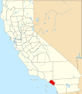
Emerald Bay is an unincorporated community in Orange County, California. [1] It borders the city of Laguna Beach to the northwest and southeast, Crystal Cove State Park to the northeast, and the Pacific Ocean to the south.
Emerald Bay is a gated community bisected by California State Route 1. There are approximately 538 homes in the community. Emerald Bay beach purports to be a private beach accessible only to residents of the gated community. The only entrance to Emerald Bay is on the north side of State Route 1; access to the southern portion is provided by a tunnel which runs under the highway. The community has its own fire station. [2]
The only portion of Laguna Beach located west of Emerald Bay is Irvine Cove, which is another gated community with a "private" beach. Unlike Emerald Bay, however, Irvine Cove is within the city limits of Laguna Beach.
Emerald Bay is one of two unincorporated areas on the coast of Orange County, the other being a portion of Crystal Cove State Park located between Newport Beach and Laguna Beach. It is the only unincorporated populated place on the county's coastline.
Orange County is a county located in the Los Angeles metropolitan area in Southern California, United States. As of the 2020 census, the population was 3,186,989, making it the third-most-populous county in California, the sixth-most-populous in the United States, and more populous than 19 American states and Washington, D.C. Although largely suburban, it is the second-most-densely-populated county in the state behind San Francisco County. The county's three most-populous cities are Anaheim, Santa Ana, and Irvine, each of which has a population exceeding 300,000. Santa Ana is also the county seat. Six cities in Orange County are on the Pacific coast: Seal Beach, Huntington Beach, Newport Beach, Laguna Beach, Dana Point, and San Clemente.
Greater Los Angeles is the most populous metropolitan area in the U.S. state of California, encompassing five counties in Southern California extending from Ventura County in the west to San Bernardino County and Riverside County in the east, with Los Angeles County in the center, and Orange County to the southeast. The Los Angeles–Anaheim–Riverside combined statistical area (CSA) covers 33,954 square miles (87,940 km2), making it the largest metropolitan region in the United States by land area. The contiguous urban area is 2,281 square miles (5,910 km2), whereas the remainder mostly consists of mountain and desert areas. With a population of 20.6 million in 2024, it is the second-largest metropolitan area in the country, behind New York, as well as one of the largest megacities in the world.
Laguna Beach is a city in Orange County, California, United States. Located in Southern California along the Pacific Ocean, this seaside resort city has a mild year-round climate, scenic coves, and environmental preservation efforts. The population in the 2020 census was 23,032.
Laguna Niguel is a city in Orange County, California, United States. The name Laguna Niguel is derived from the words "Laguna" and "Niguili". As of the 2020 census, the population was 64,355. Laguna Niguel is located in the San Joaquin Hills in the southeastern corner of Orange County, close to the Pacific Ocean, and borders the cities of Aliso Viejo, Dana Point, Laguna Beach, Laguna Hills, Mission Viejo, and San Juan Capistrano.
Newport Beach is a coastal city of about 85,000 in southern Orange County, California, United States. Located about 40 miles (64 km) southeast of downtown Los Angeles, Newport Beach is known for its sandy beaches. The city's harbor once supported maritime industries. Today it is used mostly for recreation. Balboa Island draws visitors with a waterfront path and easy access from the ferry to the shops and restaurants.
State Route 133 (SR 133) is a state highway in the U.S. state of California, serving as an urban route in Orange County. It connects SR 1 in Laguna Beach through the San Joaquin Hills with several freeways in Irvine, ending at the SR 241, a toll road in the latter city. It is built as an expressway from SR 73 to Laguna Canyon Road, and past this, SR 133 is a freeway to I-5, and a tollway to SR 241 near the Santa Ana Mountains.
The Orange Coast is the string of cities and neighborhoods fronting the Pacific Coast in Orange County, California. From northwest to southeast, these cities are Seal Beach, Huntington Beach, Newport Beach, Laguna Beach, Dana Point and San Clemente. There are also two small unincorporated areas, a portion of Crystal Cove State Park between Newport Beach and Laguna Beach and Emerald Bay, a gated community located between two neighborhoods of Laguna Beach.
Crystal Cove State Park is a state park of California, United States, encompassing 3.2 miles (5.1 km) of Pacific coastline, inland chaparral canyons, and the Crystal Cove Historic District of beach houses. The park is located partially in Newport Beach and partially in an unincorporated area of Orange County, and is part of the larger South Coast Wilderness area. Crystal Cove is a stretch of coastal cliffs and a beachfront cove situated between the Pacific Coast Highway and the Pacific Ocean, southeast of Newport Beach and northwest of Laguna Beach. The 3,936-acre (1,593 ha) park was established in 1979. The entire park hosts a total of three miles (4.8 km) of beaches and tide pools, a 1,400-acre marine Conservation Area (570 ha) as well as underwater park, 400 acres (160 ha) of bluffs, and 2,400 acres (970 ha) of canyons.
State Route 73 (SR 73) is an approximately 17.76-mile (28.58 km) state highway in Orange County, California. The southernmost 12 miles (19.31 km) of the highway is a toll road operated by the San Joaquin Hills Transportation Corridor Agency named the San Joaquin Hills Transportation Corridor, which opened in November 1996. The northernmost 5.76 miles (9.27 km) of the highway, which opened in 1978, is part of the Corona del Mar Freeway. SR 73's southern terminus is at Interstate 5 (I-5) near the San Juan Capistrano–Mission Viejo–Laguna Niguel tripoint. Its northern terminus is at Interstate 405 (I-405) in Costa Mesa. The highway's alignment through the San Joaquin Hills follows an approximately parallel path between the Pacific Coast Highway and I-405. Currently, there are no HOV lanes for the three-mile freeway segment, but the medians have been designed with sufficient clearance for their construction should the need arise in the future.
Saddleback Valley refers to the flat and foothill areas west-southwest of the Saddleback double peak of the Santa Ana Mountains and east-northeast of the hilly Crystal Cove State Park in southern Orange County, California. The region primarily encompasses the cities of Mission Viejo, Lake Forest, and Rancho Santa Margarita, as well as the communities of Coto de Caza and Ladera Ranch. The cities of Aliso Viejo, Laguna Woods, Laguna Hills, and Laguna Niguel, as well as some of Orange County's eastern canyon communities, partially reside within the valley. The southeastern portion of Irvine also encroaches upon the area, but the two are not typically associated with each other.
The San Joaquin Hills are a low mountain range of the Peninsular Ranges System, located in coastal Orange County, California.
The Orange County Fire Authority (OCFA) is the agency that provides fire protection and emergency medical services for unincorporated areas of Orange County, California as well as 25 cities within the county that contract OCFA's services. There are 7 divisions and 11 battalions.
The Crystal Cove Historic District is a part of the Crystal Cove State Park located in Newport Beach, California. It is listed on the National Register of Historic Places encompassing 12.3 acres (50,000 m2) along the Southern California coast. It was listed on the National Register not only because of its significance but also because of the 46 cottages located there which were built in the 1920s and 1930s. These cottages are perfect examples of Southern California coastal development in the early 20th century and were preserved by the Crystal Cove Conservancy Alliance. Since the restoration, the cottages have been open to the public for overnight stays.
Laguna Canyon, also called Cañada de las Lagunas, is a gorge that cuts through the San Joaquin Hills in southern Orange County, California, in the United States, directly south of the city of Irvine. The canyon runs from northeast to southwest, and is drained on the north side by tributaries of San Diego Creek and on the south by Laguna Canyon Creek. It is deeper and more rugged on the southwestern end near Laguna Beach.
Laguna Coast Wilderness Park is a 7,000-acre (2,800 ha) wilderness area in the San Joaquin Hills surrounding Laguna Beach, California. This park features coastal canyons, ridgeline views and the only natural lakes in Orange County, California. Trails are maintained for hiking and mountain biking with a wide range of difficulty, from beginner to expert. Most trails gain in height, reaching a maximum of 1,000 feet (300 m) in elevation. Several trails lead to downtown Laguna Beach.
Dana Point State Marine Conservation Area
Laguna Beach State Marine Reserve (SMR) and Laguna Beach State Marine Conservation Area (SMCA) are two adjoining marine protected areas that extend offshore of Laguna Beach in Orange County on California’s south coast. The SMR covers 6.27 square miles, and the SMCA covers an additional 3.44 square miles. These two MPAs are part of a four-MPA complex on the coast of southern Orange County. Each protects marine life by prohibiting or limiting the removal of marine wildlife from within its borders.
Upper Newport Bay State Marine Conservation Area (SMCA) is a marine protected area in Newport Bay in Orange County and the South Coast region of Southern California. It extends inland/northeast from the Pacific Coast Highway crossing of the bay, within the city of Newport Beach.
The Irvine Ranch Natural Landmarks are a collection of protected areas in Orange County, California in and around Irvine. They encompass almost 50,000 acres (20,000 ha) of land which was once a part of the Irvine Ranch owned by the Irvine Company. Almost 40,000 acres (16,000 ha) of the landmarks were designated a National Natural Landmark in 2006 and a California Natural Landmark in 2008.
The Municipal Water District of Orange County, commonly known by the acronym MWDOC, is a wholesale water provider, water resource development and planning agency., water-centric information, education, emergency planning, and conservation resource hub for nearly 3.2 millionOrange County, California residents, and businesses. Local water supply sources meet only about half of the region's total water needs. To fulfill the remaining demand, MWDOC buys imported water from the California State Water Project in northern California and the Colorado River through the Metropolitan Water District of Southern California (Metropolitan). MWDOC delivers water to its 27 member agencies - made up of both water districts and city water departments - who then, in turn, provide retail water service to the public.