Santa Susana Mountains

Last updated
Santa Susana Mountains
Woodland Hills vista.jpg
View of the range from Woodland Hills
Highest point
Peak Oat Mountain
Elevation 3,747 ft (1,142 m)
Geography
Wpdms shdrlfi020l santa susana mountains.jpg
CountryUnited States
StateCalifornia
Counties Los Angeles and Ventura
Range coordinates 34°19′47″N118°36′04″W / 34.3297°N 118.601°W / 34.3297; -118.601 Coordinates: 34°19′47″N118°36′04″W / 34.3297°N 118.601°W / 34.3297; -118.601
Parent range Transverse Ranges
Borders on San Gabriel Mountains and Simi Hills
California chaparral in Aliso Canyon, Santa Susana Mountains Santa Susana Mts.jpg
California chaparral in Aliso Canyon, Santa Susana Mountains

The Santa Susana Mountains are a transverse range of mountains in Southern California, north of the city of Los Angeles, in the United States. The range runs east-west, separating the San Fernando Valley and Simi Valley on its south from the Santa Clara River Valley to the north and the Santa Clarita Valley to the northeast. The Oxnard Plain is to the west of the Santa Susana Mountains.

Contents

Description

Geography

The Newhall Pass separates the Santa Susana Mountains from the San Gabriel Mountains to the east. Newhall Pass is the major north-south connection between the San Fernando Valley and the Santa Clarita Valley, and Interstate 5 and a railroad line share Newhall Pass. The Santa Susana Pass (containing SR 118) connects Simi Valley and the San Fernando Valley, and separates the Santa Susana Mountains from the Simi Hills to the south. Santa Susana Pass State Historic Park is located in the Simi Hills, just south of the Santa Susana Pass, at the northwestern edge of the San Fernando Valley.

The Santa Susana Mountains are not as steep or high as the San Gabriel Mountains.

The western half of the range lies in Ventura County, and the eastern half lies in Los Angeles County. The southeastern slopes of the Santa Susana Mountains are part of the City of Los Angeles, and housing subdivisions, including Porter Ranch, have been built on the lower slopes of the range. The city of Simi Valley lies to the southwest. North of the range is the fast-growing city of Santa Clarita, and several large subdivisions in unincorporated Los Angeles County, including Lyons Ranch and Newhall Ranch, have been approved for development. The Sunshine Canyon Landfill is at the mountains' eastern end, and several canyons in the northwest corner of the range have been proposed for more landfills. The Santa Susana Mountains are paralleled by State Route 118 to the south and State Route 126 to the north.

Climate

The mountains have a mild climate, with warm, dry summers and cool, wet winters (Mediterranean climate type). Snow falls in winter in some higher areas, such as Oat Mountain, but melts quickly. Annual precipitation totals vary between 18 and 25 inches, depending on exposure to the rain-bearing winds. Most of the rain falls between November and March. Because of the summer drought, wildfires sometimes occur in summer and fall before the rains start, especially during hot, dry "Santa Ana" wind events (mostly between late September to mid November).

Peaks

The highest peaks in the range are Oat Mountain (1,142 m; 3,747 feet), Mission Point (845 m; 2,771 feet), Rocky Peak (827 m; 2,714 feet), and Sand Rock Peak (765 m; 2,511 feet). The summit of Rocky Peak lies directly atop the line separating Ventura and Los Angeles counties and is indicated by a battered marker embedded into the sandstone boulder summit.

History

The Santa Susana Mountains are depicted in the bottom right quarter of the seal of nearby California State University, Northridge. CSUN Seal.png
The Santa Susana Mountains are depicted in the bottom right quarter of the seal of nearby California State University, Northridge.

The first discovery of oil in California was in Pico Canyon, on the north side of the mountains, The California Star Oil Works, later Chevron, succeeded with Pico Well No. 4 . It became famous not only as the first well in California, but also as the longest-producing well in the world, having been capped in September, 1990 after 114 years. Well No. 4 has the distinction of being the first site in Los Angeles County to be listed on the National Register of Historic Places, in 1966. The surrounding town, Mentryville, is maintained as the oil "ghost town" Mentryville Historical Park, within Pico Canyon Park. Many active oil and gas fields remain in the area, with some of the larger operators including Vintage Production, Freeport McMoRan, and the Southern California Gas Company. The largest of SoCalGas's four underground storage natural gas facilities is within the Aliso Canyon Oil Field north of Porter Ranch.

The mountains are within the acquisition area for the Santa Monica Mountains Conservancy, which operates several parks, including Santa Clarita Woodlands Park, Rocky Peak Park, [2] Joughin Open Space Preserve, Happy Camp Canyon Regional Park, and other Santa Susana parks in the Santa Susana Mountains through the Mountains Recreation and Conservation Authority. The City of Los Angeles maintains O'Melveny Park at the eastern end of the mountains. [3]

Note: the Santa Susana Field Laboratory, once operated by and still owned by Rocketdyne until toxics are cleaned up, is actually in the Simi Hills, which are adjacent to the south of the Santa Susana Mountains.

Plants and animals

Flora

Santa Susana Tarweed, Hemizonia minthornii, vulnerable species Hemizonia minthornii 3.jpg
Santa Susana Tarweed, Hemizonia minthornii, vulnerable species

The south-facing slopes are mostly covered in Chaparral shrubland, grasslands, and oak savanna. The north-facing slopes are home to magnificent oak woodlands and conifer (fir) woodlands, some of which have been protected in the Santa Clarita Woodlands Park and other large open space preserves. The mountains are part of the California chaparral and woodlands ecoregion. The oaks, (Quercus spp.), include the evergreen coast live oak (Quercus agrifolia), the deciduous valley oak (Quercus lobata), and the coastal scrub oak (Quercus dumosa) all can be found in the area. Spring wildflowers include the redbush monkey flower, Mariposa lily, and canyon sunflower. Poison oak is also an important member of the native plant habitat community. Various ferns are found in moister and tree-shaded areas.

Fauna

Many bird species thrive in the Santa Susana Mountains. Perhaps the most common raptors observed soaring over the brushy, boulder-strewn landscape are turkey vultures, red-tailed hawks, and American kestrels. In oak woodlands it is not uncommon to see red-shouldered hawks flying from limb to limb. Through the cover of dense, trailside chaparral you might glimpse the California towhee or the colorful spotted towhee, birds who often make their presence known by rustling up leaf litter on the ground. California quail, greater roadrunner, and common raven are also residents of the range. The eerie and enchanting call of the common poorwill can often be heard after dark while quick eyes might observe the silent flight of great horned owls and phantom-like barn owls.

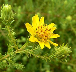
A handful of fascinating amphibians live in the area. Streams and creeks support populations of Pacific tree frog, the small amphibian whose signature chorus adds an aura of mystery and inexplicable beauty to the surrounding land. Western toads often make their appearance at nightfall, emerging from burrows in search of water and insects, while California slender salamanders are often found under the cool leaf litter and canopy of oak woodlands. Many reptiles thrive in the Santa Susana range. Lizards that are likely to be observed on any given day include the common western fence lizard and the equally abundant side-blotched lizard. Somewhat less frequently observed but still present are the southern alligator lizard, western skink, whiptail, and the seemingly rare coast horned lizard. Southern Pacific rattlesnakes and gopher snakes are perhaps the most commonly observed snakes, but a lucky hiker might also encounter other species including the striped racer, California kingsnake, and ring-necked snake.

Mammals that may be regularly observed in the mountains include smaller animals such as the California ground squirrel and brush rabbit. Small mammals that are less often seen include the dusky-footed woodrat and the agile kangaroo rat. As for larger mammals, the well-trained eye might spot California mule deer or a coyote. Larger mammals that are considerably more secretive and therefore less often encountered include the gray fox, bobcat, ring-tailed cat, American badger, and the mountain lion. [4] A population of American black bears occupy various niches in the backcountry; showing up in communities below the mountains every few years.

The mountains are part of the Southern California coastal wildlife corridor the connects Los Padres National Forest with the Santa Monica Mountains. [5] [4]

Rim of the Valley Trail

The Rim of the Valley Trail is a plan in progress for connecting the parkland and recreational areas of the San Fernando, Simi, and La Crescenta Valleys via the Santa Susana Mountains. Rocky Peak Park and O'Melveny Park have trail sections already. [6] [7] [8] [9]

See also

Nearby mountain ranges

Related Research Articles

San Fernando Valley Large populated valley in Los Angeles County, California, US

The San Fernando Valley, known locally as the Valley, is an urbanized valley in Los Angeles County, California. Located just north of the Los Angeles Basin, it contains a large portion of the City of Los Angeles, as well as unincorporated areas and the incorporated cities of Burbank, Calabasas, Glendale, Hidden Hills, and San Fernando. The valley is well known for its iconic film studios such as Warner Bros. Studio and Walt Disney Studios. In addition, it is home to the Universal Studios Hollywood theme park.

Chatsworth, Los Angeles Neighborhood in Los Angeles, California, United States

Chatsworth is a suburban neighborhood in the City of Los Angeles, California, in the San Fernando Valley.

Santa Monica Mountains Mountain range of the Transverse Ranges in California, United States

The Santa Monica Mountains is a coastal mountain range in Southern California, next to the Pacific Ocean. It is part of the Transverse Ranges. Because of its proximity to densely populated regions, it is one of the most visited natural areas in California. Santa Monica Mountains National Recreation Area is located in this mountain range.

The Santa Monica Mountains Conservancy is an agency of the state of California in the United States founded in 1980 and dedicated to the acquisition of land for preservation as open space, for wildlife and California native plants habitat Nature Preserves, and for public recreation activities.

Santa Clarita Valley Valley in Los Angeles County, California, United States

The Santa Clarita Valley (SCV) is part of the upper watershed of the Santa Clara River in Southern California. The valley was part of the 48,612-acre (19,673 ha) Rancho San Francisco Mexican land grant. Located in Los Angeles County, its main population center is the city of Santa Clarita which includes the communities of Canyon Country, Newhall, Saugus, and Valencia. Adjacent unincorporated communities include Castaic, Stevenson Ranch, Val Verde, and the unincorporated parts of Valencia.

Santa Susana Pass Mountain pass in Los Angeles County, California, United States

The Santa Susana Pass, originally Simi Pass, is a low mountain pass in the Simi Hills of Southern California, connecting the San Fernando Valley and Los Angeles neighborhood of Chatsworth, to the city of Simi Valley and eponymous valley.

Rocky Peak Mountain in southern California, United States

Rocky Peak, located in Rocky Peak Park, is the fourth-highest point in the Santa Susana Mountains, and overlooks the San Fernando Valley and Chatsworth, the Simi Hills, and the Simi Valley in Southern California. The peak, which is 2,715 feet (828 m) in elevation, sits on the Los Angeles County–Ventura County line.

Simi Hills Mountain range of the Transverse Ranges in California, United States

The Simi Hills are a low rocky mountain range of the Transverse Ranges in eastern Ventura County and western Los Angeles County, of southern California, United States.

Santa Monica Mountains National Recreation Area Protected area in Southern California, USA

The Santa Monica Mountains National Recreation Area is a United States national recreation area containing many individual parks and open space preserves, located primarily in the Santa Monica Mountains of Southern California. The SMMNRA is in the greater Los Angeles region, with two thirds of the parklands in northwest Los Angeles County, and the remaining third, including a Simi Hills extension, in southeastern Ventura County.

Santa Clarita, California City in California, United States

Santa Clarita is a city in northwestern Los Angeles County, California. With a 2020 census population of 228,673, it is the third-largest city by population in Los Angeles County, and the 17th-largest in the state of California. It is located about 30 miles (48 km) northwest of downtown Los Angeles, and occupies 70.75 square miles (183.2 km2) of land in the Santa Clarita Valley, along the Santa Clara River. It is a notable example of a U.S. edge city, satellite city, or boomburb.

Sierra Pelona Ridge Mountain range of the Transverse Ranges in California, United States

The Sierra Pelona, also known as the Sierra Pelona Ridge or the Sierra Pelona Mountains, is a mountain ridge in the Transverse Ranges in Southern California. Located in northwest Los Angeles County, the ridge is bordered on the north by the San Andreas fault and lies within and is surrounded by the Angeles National Forest.

Rancho San Francisco Mexican land grant issued to Antonio del Valle in 1839

Rancho San Francisco was a land grant in present-day northwestern Los Angeles County and eastern Ventura County, California. It was a grant of 48,612 acres (19,673 ha) by Governor Juan B. Alvarado to Antonio del Valle, a Mexican army officer, in recognition for his service to Alta California. It is not related to the city of San Francisco.

Santa Susana Pass State Historic Park State historic park in Los Angeles County, California, United States

Santa Susana Pass State Historic Park is a California State Park of approximately 680 acres (2.8 km2) located on the boundary between Ventura and Los Angeles counties, between the communities of Chatsworth and Simi Valley. Geologically, the park is located where the Simi Hills meet the Santa Susana Mountains. Here in the western part of the Transverse Ranges, the land is dominated by high, narrow ridges and deep canyons covered with an abundant variety of plant life. The park offers panoramic views of the rugged natural landscape as a striking contrast to the developed communities nearby. The park is also rich in archaeological, historical, and cultural significance.

Old Santa Susana Stage Road United States historic place

The Old Santa Susana Stage Road, or Santa Susana Wagon Road, is a route taken by early travelers between the San Fernando Valley and Simi Valley near Chatsworth, California, via the Santa Susana Pass. The main route climbs through what is now the Santa Susana Pass State Historic Park, with a branch in Chatsworth Park South.

<i>Chorizanthe parryi</i> Species of flowering plant

Chorizanthe parryi is a species of flowering plant in the buckwheat family known by the common name Parry's spineflower and San Bernardino spineflower.

Simi Valley, California City in California, United States

Simi Valley is a city in the valley of the same name in the southeast corner of Ventura County, California, United States. Simi Valley is 40 miles (65 km) from downtown Los Angeles, making it part of the Greater Los Angeles Area. The city sits next to Thousand Oaks, Moorpark, and Chatsworth. As of the 2020 U.S. Census the population was 126,356, up from 124,243 in 2010. The city of Simi Valley is surrounded by the Santa Susana Mountain range and the Simi Hills, west of the San Fernando Valley, and northeast of the Conejo Valley. It grew as a commuter bedroom community for the cities in the Los Angeles area and the San Fernando Valley when a freeway was built over the Santa Susana Pass.

The Chalk Hills are a north–south-running low 'mountain' range in the San Fernando Valley perpendicular to and adjoining the Santa Monica Mountains. They are located in the Woodland Hills District of the City of Los Angeles in Southern California. They run between DeSoto and Winnetka Avenues, from south of Ventura Boulevard to near Victory Boulevard.

Santa Susana, California Place in California, United States

Santa Susana is a former railroad town located mostly within the City of Simi Valley. A small portion of the community, outside the Simi Valley city limits to the south of the Ventura County Metrolink rail line, is an unincorporated area and census-designated place (CDP). The community is in the eastern part of the Simi Valley.

Sage Ranch Park Public park and nature preserve in Ventura County, California

Sage Ranch Park is a 625-acre park (253 ha) and wildlife corridor located at a 2,000 feet (610 m) height in the northwestern Simi Hills on the northwestern plateau of the Simi Valley, bordering Los Angeles County and its San Fernando Valley. The campground area used to be a cattle ranch and later a filmset for Western movies. Sage Ranch Park is today an intermountain wildlife corridor, which links the Simi Hills with the Santa Susana- and Santa Monica Mountains. The mountainous park is mostly known for its unique sandstone rock formations, maybe particularly on its western side where the Sandstone Ridge and Turtle Rock are situated. On its northern side, there are great panoramic rural and metropolitan views of the Simi Valley, as well as surrounding Simi Hills, Santa Susana Mountains and beyond. It is home to numerous sandstone formations, caves, outcroppings, tilted rock formations, several hiking trails, a camping ground, as well as native flora and wildlife. The area is lined with coastal sage scrub and other flora includes chaparral, bush lupine, California poppy, sunflowers, Cream Cups, bracken, sword fern, prickly pear cactus, eucalyptus trees, oak woodland of ceanothus, coffee berry, California buckwheat, sycamore, Walnut Tree, ferns, orange- and avocado trees. It is a critical cross-mountain wildlife corridor and is home to fauna such as mountain lions, bobcats, eagles, vultures, owls, rattle snakes, coyotes, hawks, grey fox, king snakes, and more. Bordering Sage Ranch to the south is the Rocketdyne Santa Susana Field Laboratory, in which the nearby Burro Flats Painted Cave is located.

Tapo Canyon

Tapo Canyon is a series of canyons and a wildlife corridor in the western Santa Susana Mountains, north of Simi Valley in Ventura County, Southern California. It's the main filming location of the well-known TV show Little House on the Prairie in the 1970s.

References

  1. California State University, Northridge. "Wordmark - CSUN Graphic Standards Manual". California State University, Northridge. Retrieved September 2, 2011.
  2. "Parks - LAMountains.com". www.lamountains.com.
  3. "Parks - LAMountains.com". www.lamountains.com.
  4. 1 2 Carlson, Cheri (July 6, 2016). "Mountain lion kittens found, tagged in Santa Susana Mountains". Ventura County Star . Retrieved 6 July 2016.
  5. McGrath, Rachel (June 21, 2014) "Park district joins effort to preserve wildlife corridor, open space between Simi Valley, Moorpark" Ventura County Star
  6. http://smmc.ca.gov/ROV%20Master%20Plan.pdf rimofthevalleytrail-master plan 6/1/2010
  7. "www.lamountains" (PDF). lamountains.com.
  8. "Rim of the Valley Trail-update 6/6/2010". modernhiker.com.
  9. Kamal, Sameea (March 4, 2015). "Three lawmakers urge Park Service action on Rim of the Valley study". Los Angeles Times.