Mission Point (California)

Last updated
Mission Point

Mission Point (California).JPG

Mission Point, from Zelzah Ave. and San Jose St.
Highest point
Elevation 2,771 ft (845 m)  NAVD 88 [1]
Prominence 184 ft (56 m) [2]
Coordinates 34°18′42″N118°32′02″W / 34.311712525°N 118.533823739°W / 34.311712525; -118.533823739 Coordinates: 34°18′42″N118°32′02″W / 34.311712525°N 118.533823739°W / 34.311712525; -118.533823739 [1]
Geography
Location Los Angeles County, California, U.S.
Parent range Santa Susana Mountains
Topo map USGS Oat Mountain
Climbing
Easiest route Trail

Mission Point, better known as "Mission Peak" to locals, is a spur of Oat Mountain. It is 2,771 ft (845 m) high. In Los Angeles County, Southern California, it is the second highest peak of the Santa Susana Mountains after Oat Mountain.

Oat Mountain is a peak of the Santa Susana Mountains overlooking the San Fernando Valley to the south and southeast. Oat Mountain is the highest peak in the Santa Susana Mountains of California. The Los Angeles district of Chatsworth is to the south of the mountain. There are many microwave relay antennas as well as Doppler weather equipment at Oat Mountain. SoCal Gas has several wells in the area as well.

Los Angeles County, California County in California, United States

Los Angeles County, officially the County of Los Angeles, in the Los Angeles metropolitan area of the U.S. state of California, is the most populous county in the United States, with more than 10 million inhabitants as of 2017. As such, it is the largest non–state level government entity in the United States. Its population is larger than that of 41 individual U.S. states. It is the third-largest metropolitan economy in the world, with a Nominal GDP of over $700 billion—larger than the GDPs of Belgium, Norway, and Taiwan. It has 88 incorporated cities and many unincorporated areas and, at 4,083 square miles (10,570 km2), it is larger than the combined areas of Delaware and Rhode Island. The county is home to more than one-quarter of California residents and is one of the most ethnically diverse counties in the U.S. Its county seat, Los Angeles, is also California's most populous city and the nation's second largest city with about 4 million people.

Southern California Place in California, United States

Southern California is a geographic and cultural region that generally comprises California's southernmost counties, and is the second most populous urban agglomeration in the United States. The region is traditionally described as eight counties, based on demographics and economic ties: Imperial, Los Angeles, Orange, Riverside, San Bernardino, San Diego, Santa Barbara, and Ventura. The more extensive 10-county definition, which includes Kern and San Luis Obispo counties, is also used and is based on historical political divisions.

Contents

Geography

Mission Point is located in the eastern edge of the Santa Susana Mountains. Newhall Pass lies to the east, separating the Santa Susana and San Gabriel mountain ranges. Mission Point is located above Aliso Canyon, north of California State Route 118 (Ronald Reagan freeway) between Porter Ranch and Granada Hills in the San Fernando Valley.

Newhall Pass

Newhall Pass is a low mountain pass in Los Angeles County, California. Historically called Fremont Pass and San Fernando Pass, with Beale's Cut, it separates the Santa Susana Mountains from the San Gabriel Mountains. Although the pass was originally discovered in August 1769 by Catalan explorer Gaspar de Portolà, it eventually was named for Henry Newhall, a significant businessman in the area during the 19th century.

San Gabriel Mountains mountain range in Los Angeles and San Bernardino Counties, California

The San Gabriel Mountains are a mountain range located in northern Los Angeles County and western San Bernardino County, California, United States. The mountain range is part of the Transverse Ranges and lies between the Los Angeles Basin and the Mojave Desert, with Interstate 5 to the west and Interstate 15 to the east. This range lies in, and is surrounded by, the Angeles National Forest, with the San Andreas Fault as the northern border of the range.

California State Route 118 highway in California

State Route 118 is a state highway in the U.S. state of California that begins running west to east through Ventura and Los Angeles counties in southern California. It travels from the eastern edge of Ventura immediately northwest of Saticoy, then through Saticoy, in Ventura County east to Lake View Terrace in Los Angeles. Route 118 crosses the Santa Susana Pass and the northern rim of the San Fernando Valley along its route.

Recreation

Mountain hiking and mountain biking are popular in this area. The view from the top of Mission Point is striking, taking in most of the San Fernando Valley. In clear weather, one can see the Pacific Ocean and Downtown Los Angeles. Once at the top, there is a monument dedicated to Mario A. Decampos M.D. (5/26/1924–2/17/1984) with the inscription:

Hiking walking as a hobby, sport, or leisure activity

Hiking is the preferred term, in Canada and the United States, for a long, vigorous walk, usually on trails (footpaths), in the countryside, while the word walking is used for shorter, particularly urban walks. On the other hand, in the United Kingdom, and the Republic of Ireland, the word "walking" is acceptable to describe all forms of walking, whether it is a walk in the park or backpacking in the Alps. The word hiking is also often used in the UK, along with rambling, hillwalking, and fell walking. The term bushwalking is endemic to Australia, having been adopted by the Sydney Bush Walkers club in 1927. In New Zealand a long, vigorous walk or hike is called tramping. It is a popular activity with numerous hiking organizations worldwide, and studies suggest that all forms of walking have health benefits.

Pacific Ocean Ocean between Asia and Australia in the west, the Americas in the east and Antarctica or the Southern Ocean in the south.

The Pacific Ocean is the largest and deepest of Earth's oceanic divisions. It extends from the Arctic Ocean in the north to the Southern Ocean in the south and is bounded by Asia and Australia in the west and the Americas in the east.

Downtown Los Angeles Neighborhood of Los Angeles in Los Angeles, California

Downtown Los Angeles (DTLA) is the central business district of Los Angeles, California, as well as a diverse residential neighborhood of some 58,000 people. A 2013 study found that the district is home to over 500,000 jobs. It is also part of Central Los Angeles.

"Share this peaceful retreat and enjoy the beauty.—Mario's Friends 5/26/1984"

There are at least two trails up to Mission Point. One begins at the end (the farthest from the entrance) of O'Melveny Park. Continue until you reach a split and take the trail going up. The other trailhead is at the end of Neon Way. Watch for a pond (with live goldfish) to the east of the trail near the beginning (bottom). From that trailhead, you will see a gas line that also goes up to Mission Point. For those eager for a challenge, it is possible to go directly up in parallel with the gas line.

Trail closure

As of October 2007, the Southern California Gas Company has gated off areas near the top of Mission Point, although it is still accessible via a newly cut trail. The area northeast of Mission Point is part of the 500-acre Michael D. Antonovich Open Space Preserve which was dedicated August 12, 2002. [3]

Southern California Gas Company

The Southern California Gas Company is the primary provider of natural gas to the region of Southern California. Its headquarters are located in the Gas Company Tower in Downtown Los Angeles.

See also

Sand Rock Peak (California) mountain in United States of America

Sand Rock Peak is a mountain that overlooks Newhall and the rest of Santa Clarita Valley to the northeast. The summit is at an elevation of 2,511 feet (765 m).

Rocky Peak mountain in California, United States of America

Rocky Peak, located in Rocky Peak Park, is the fourth-highest point in the Santa Susana Mountains, and overlooks the San Fernando Valley and Chatsworth, the Simi Hills, and the Simi Valley in Southern California. The peak, which is 2,715 feet (828 m) in elevation, sits on the Los Angeles County–Ventura County line.

Mount Wilson (California) mountain in California, USA

Mount Wilson is a peak in the San Gabriel Mountains, located within the San Gabriel Mountains National Monument and Angeles National Forest in Los Angeles County, California. With only minor topographical prominence the peak is not naturally noticeable from a distance, although it is easily identifiable due to the large number of antennas near its summit. It is a subsidiary peak of nearby San Gabriel Peak.

Related Research Articles

Geography of California

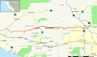
California is a U.S. state on the western coast of North America. Covering an area of 163,696 sq mi (423,970 km2), California is geographically diverse. The Sierra Nevada, the fertile farmlands of the Central Valley, and the arid Mojave Desert of the south are some of the major geographic features of this U.S. state. It is home to some of the world's most exceptional trees: the tallest, most massive, and oldest. It is also home to both the highest and lowest points in the 48 contiguous states. The state is generally divided into Northern and Southern California, although the boundary between the two is not well defined. San Francisco is decidedly a Northern California city and Los Angeles likewise a Southern California one, but areas in between do not often share their confidence in geographic identity. The US Geological Survey defines the geographic center of the state at a point near North Fork, California.

San Fernando Valley large populated valley in Los Angeles County, California, USA

The San Fernando Valley is an urbanized valley in Los Angeles County, California in the Los Angeles metropolitan area, defined by the mountains of the Transverse Ranges circling it. Home to 1.77 million people, it is north of the larger, more populous Los Angeles Basin.

Chatsworth, Los Angeles Neighborhood in Los Angeles, California, United States

Chatsworth is a neighborhood in the northwestern San Fernando Valley region of Los Angeles, California, United States.

Santa Monica Mountains mountain range in Southern California, United States

The Santa Monica Mountains is a coastal mountain range in Southern California, paralleling the Pacific Ocean. It is part of the Transverse Ranges. Because of its proximity to densely populated regions, it is one of the most visited natural areas in California. Santa Monica Mountains National Recreation Area is located in this mountain range.

Santa Susana Mountains mountain range in Southern California, United States

The Santa Susana Mountains are a transverse range of mountains in Southern California, north of the city of Los Angeles, in the United States. The range runs east-west, separating the San Fernando Valley and Simi Valley on its south from Santa Clara River Valley to the north and Santa Clarita Valley to the northeast. The Oxnard Plain is to the west of Santa Susana Mountains.

West Hills, Los Angeles Neighborhood of Los Angeles in California, United States

West Hills is a residential and commercial neighborhood in the western San Fernando Valley region of Los Angeles, California. The percentage of residents aged 35 and older is among the highest in Los Angeles County.

Santa Susana Pass

The Santa Susana Pass, originally Simi Pass, is a low mountain pass in the Simi Hills of Southern California, connecting the San Fernando Valley and town of Chatsworth, to the city of Simi Valley and eponymous valley.

El Escorpión Park

El Escorpión Park is a three-acre park located in the Simi Hills of the western San Fernando Valley, in the West Hills district of Los Angeles, California. The park contains the geographic landmark known as Escorpión Peak or Castle Peak, a 1,475-foot-tall rocky peak seen from most parts of the park and the surrounding community.

Chatsworth Peak is a peak in the Simi Hills overlooking Chatsworth and the western San Fernando Valley, in Los Angeles, Southern California. It is southwest of Santa Susana Pass and north of the Chatsworth Reservoir.

Simi Hills mountain range in Southern California, United States

The Simi Hills are a low rocky mountain range of the Transverse Ranges in eastern Ventura County and western Los Angeles County, of southern California, United States.

Upper Las Virgenes Canyon Open Space Preserve

The Upper Las Virgenes Canyon Open Space Preserve is a large open space nature preserve owned and operated by the Santa Monica Mountains Conservancy spanning nearly 3,000 acres (1,200 ha) in the Simi Hills of western Los Angeles County and eastern Ventura County.

Sierra Pelona Mountains mountain range in Southern California, United States

The Sierra Pelona Mountains, or the Sierra Pelona Ridge, is a mountain range of the Transverse Ranges in Southern California. Located in northwest Los Angeles and southern Kern Counties, the range is bordered on the north by the San Andreas fault and lies within and is surrounded by the Angeles National Forest.

Bell Canyon Park is a large open-space regional park located in the Simi Hills at the western end of the San Fernando Valley in West Hills, Los Angeles and Bell Canyon, California. Bell Creek, a primary tributary to the Los Angeles River, flows through the park with riparian zone vegetation along its natural banks. The geographic landmark Escorpión Peak is high above it to the south in adjacent El Escorpión Park.

Santa Susana Pass State Historic Park

Santa Susana Pass State Historic Park is a California State Park of approximately 680 acres (2.8 km2) located on the boundary between Ventura and Los Angeles counties, between the communities of Chatsworth and Simi Valley. Geologically, the park is located where the Simi Hills meet the Santa Susana Mountains. Here in the western part of the Transverse Ranges, the land is dominated by high, narrow ridges and deep canyons covered with an abundant variety of plant life. The park offers panoramic views of the rugged natural landscape as a striking contrast to the developed communities nearby. The park is also rich in archaeological, historical and cultural significance.

Aliso Creek (Los Angeles County)

Aliso Creek is a major tributary of the Upper Los Angeles River in the Santa Susana Mountains in Los Angeles County and western San Fernando Valley in the City of Los Angeles, California.

The history of the San Fernando Valley from its exploration by the 1769 Portola expedition to the annexation of much of it by the City of Los Angeles in 1915 is a story of booms and busts, as cattle ranching, sheep ranching, large-scale wheat farming, and fruit orchards flourished and faded. Throughout its history, settlement in the San Fernando Valley was shaped by availability of reliable water supplies and by proximity to the major transportation routes through the surrounding mountains.

Browns Canyon Wash, also known as Browns Canyon Creek, is a 10.3-mile-long (16.6 km) tributary of the Los Angeles River in the Santa Susana Mountains of Los Angeles County and across the western San Fernando Valley of Los Angeles, California.

Mount McCoy (Simi Valley) mountain in California, United States of America

Mount McCoy is a 1,325-foot-high peak in Simi Valley, California known for its characteristic 12 foot white cross on the top. There are numerous trails leading to Mount McCoy, which sits in a 200 acres (81 ha) nature area operated by the Rancho Simi Recreation and Park District (RSRPD), while the cross and its immediate surroundings are owned by the Simi Valley Historical Society. By 1813, the cross on Mt. McCoy was a landmark for the Friars and others in the Simi Valley.

References

  1. 1 2 "Mission Point". NGS data sheet. U.S. National Geodetic Survey . Retrieved 2009-08-08.
  2. "Mission Point, California". Peakbagger.com. Retrieved 2010-05-23.
  3. "Michael D. Antonovich Open Space Preserve" (PDF). Santa Monica Mountains Conservancy . Retrieved 2014-03-04.
Geographic Names Information System geographical database

The Geographic Names Information System (GNIS) is a database that contains name and locative information about more than two million physical and cultural features located throughout the United States of America and its territories. It is a type of gazetteer. GNIS was developed by the United States Geological Survey in cooperation with the United States Board on Geographic Names (BGN) to promote the standardization of feature names.

United States Geological Survey Scientific agency of the United States government

The United States Geological Survey is a scientific agency of the United States government. The scientists of the USGS study the landscape of the United States, its natural resources, and the natural hazards that threaten it. The organization has four major science disciplines, concerning biology, geography, geology, and hydrology. The USGS is a fact-finding research organization with no regulatory responsibility.