Los Angeles Community College District

Last updated

Los Angeles Community College District
Los Angeles Community College District Logo.png
Location
United States
District information
TypePublic
GradesCollege
Schools9
Other information
Website www.laccd.edu

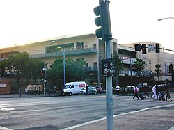
The Los Angeles Community College District (LACCD) is the community college district serving Los Angeles, California, and some of its neighboring cities and certain unincorporated areas of Los Angeles County. Its headquarters are in Downtown Los Angeles. [1] Over the course of its history, LACCD has served as educator to more than three million students. The Los Angeles Community College District is the largest community college district in the United States and is one of the largest in the world.

Contents

The LACCD consists of nine colleges and covers an area of more than 882 square miles (2,280 km2). They serve students in the Alhambra, Beverly Hills, Burbank, Culver City, Garvey, Las Virgenes, Los Angeles, Montebello, Palos Verdes and San Gabriel school districts. [2] The district covers the Los Angeles city limits, San Fernando, Calabasas, Agoura Hills, Hidden Hills, Burbank, West Hollywood, Beverly Hills, Culver City, Alhambra, Monterey Park, San Gabriel, Rosemead (southern portion), Montebello, Commerce, Vernon, Huntington Park, Bell, Cudahy, Bell Gardens, South Gate, Gardena, Carson, Lomita, Palos Verdes Estates, Rolling Hills, Rancho Palos Verdes, and numerous unincorporated communities, including East Los Angeles, Florence-Firestone, Athens, and Walnut Park.
Colleges

Los Angeles Trade-Tech College Trade Tech College.jpg
Los Angeles Trade-Tech College


CampusLocationFounded
East Los Angeles College Monterey Park 1945
Los Angeles City College East Hollywood, Los Angeles 1929
Los Angeles Harbor College Harbor City, Los Angeles 1949
Los Angeles Mission College Sylmar, Los Angeles 1975
Los Angeles Pierce College Woodland Hills, Los Angeles 1947
Los Angeles Trade-Technical College Historic South Central Los Angeles 1925
Los Angeles Valley College Valley Glen, Los Angeles 1949
Los Angeles Southwest College West Athens 1967
West Los Angeles College Culver City 1969

Board of trustees

The Los Angeles Community College District is governed by an elected Board of Trustees first established in 1969. [3]

Related Research Articles

<span class="mw-page-title-main">Greater Los Angeles</span> Metropolitan area in California, United States

Greater Los Angeles is the most populous metropolitan area in the U.S. state of California, encompassing five counties in Southern California extending from Ventura County in the west to San Bernardino County and Riverside County in the east, with the city of Los Angeles and Los Angeles County at its center, and Orange County to the southeast. The Los Angeles–Long Beach combined statistical area (CSA) covers 33,954 square miles (87,940 km2), making it the largest metropolitan region in the United States by land area. The contiguous urban area is 2,281 square miles (5,910 km2), whereas the remainder mostly consists of mountain and desert areas. With an estimated population of over 18.3 million, it is the second-largest metropolitan area in the country, behind New York, as well as one of the largest megacities in the world.

<span class="mw-page-title-main">San Gabriel Valley</span> Populated valley in Southern California, United States

The San Gabriel Valley, often referred to by its initials as SGV, is one of the principal valleys of Southern California, with the city of Los Angeles directly bordering it to the west, and occupying the vast majority of the southeastern part of Los Angeles County. Surrounding landforms and other features include the following:

The Los Angeles Westside is an urban region in western Los Angeles County, California, United States. It has no official definition, but sources like LA Weekly and the Mapping L.A. survey of the Los Angeles Times place the region on the western side of the Los Angeles Basin south of the Santa Monica Mountains.

<span class="mw-page-title-main">Area codes 213, 323, and 738</span> Area codes in the Los Angeles metropolitan area

Area codes 213, 323, and 738 are telephone area codes in the North American Numbering Plan (NANP) for the U.S. state of California. They are assigned in an overlay complex to a numbering plan area (NPA) that comprises, roughly, the area of downtown Los Angeles City, as well as several southeast Los Angeles County cities, such as Bell and Huntington Park. Area code 213 was one of the original North American area codes of 1947 and 323 was created in an area code split of 213 in 1998. This was the fifth split of 213 and left it serving only downtown Los Angeles and immediately adjoining neighborhoods. In 2017, the two NPAs were recombined in the overlay.

<span class="mw-page-title-main">University Hills, Los Angeles</span> Neighborhood of Los Angeles in California, United States

University Hills is a neighborhood on the East Side of Los Angeles, California. It consists of the residential areas surrounding California State University, Los Angeles.

Montebello Unified School District is a school district based in Montebello, California, United States.

<span class="mw-page-title-main">California's 38th congressional district</span> U.S. House district for California

California's 38th congressional district is a congressional district in the U.S. state of California based in suburban eastern Los Angeles County and Orange County, California. The district is currently represented by Democrat Linda Sánchez.

California's State Assembly districts are numbered 1st through 80th, generally in north-to-south order.

Law enforcement in Los Angeles County is conducted by a variety of law enforcement agencies.

<span class="mw-page-title-main">Los Angeles Area Council</span>

Founded in 1915, the Greater Los Angeles Area Council (GLAAC) (#033) served most of the City of Los Angeles as well as several other cities in the greater Los Angeles area. It was one of five Boy Scouts of America councils in Los Angeles County, California. Since its founding in 1915, the Los Angeles Area Council has brought its purpose and values to millions of youth. The Council served 54,567 youth in the Greater Los Angeles Area in 2008 alone.

The Southern California Association of Governments (SCAG) is the metropolitan planning organization (MPO) of six of the ten counties in Southern California, serving Imperial County, Los Angeles County, Orange County, Riverside County, San Bernardino County, and Ventura County. San Diego County's MPO is the San Diego Association of Governments, which is an unrelated agency.

Los Angeles City High School District was a school district that served high school-aged residents of western Los Angeles County, California from 1890 to 1962. At times the district included Beverly Hills, Culver City, and Torrance.

<span class="mw-page-title-main">Garfield Avenue (Los Angeles County)</span>

Garfield Avenue is a major north-south street in Los Angeles County, California, US.

<span class="mw-page-title-main">George Floyd protests in Los Angeles County, California</span> 2020 civil unrest after the murder of George Floyd

This is a list of protests that took place in Los Angeles County, California following the murder of George Floyd on May 25, 2020, in Minneapolis, Minnesota, while in police custody.

References

  1. "Home." Los Angeles Community College District. Retrieved on August 3, 2013. "770 Wilshire Boulevard Los Angeles, CA 90017"
  2. "Los Angeles Community College District Map" (PDF). Archived (PDF) from the original on October 9, 2022.
  3. "History of LACC". www.lacitycollege.edu. Retrieved January 23, 2023.

34°02′57″N118°15′28″W / 34.0491°N 118.2578°W / 34.0491; -118.2578