List of Los Angeles Metro Busway stations

Last updated

Go Metro System Map (Metro Rail & Busway) map as of June 16, 2023. Los Angeles Metro System Map.png
Go Metro System Map (Metro Rail & Busway) map as of June 16, 2023.

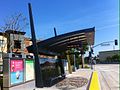
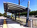
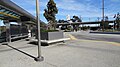
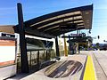
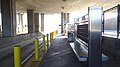
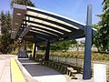
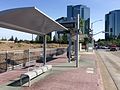
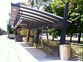
The Los Angeles Metro Busway system consists of two bus rapid transit routes in Los Angeles County, California, operated by the Los Angeles County Metropolitan Transportation Authority (Metro). The bus rapid transit lines which compose the Metro Busway network include the G Line and the J Line. The Metro Busway network operates on dedicated busways, shared-use busways, and streets.

Contents

Lines

Metro Busway lines
Line nameStationsStreet StopsTerminiRidership
(October 2012) [1]
LACMTA Square G Line.svg  G Line 17 Chatsworth (west)
North Hollywood (east)
32,069
LACMTA Square J Line.svg  J Line 1231 El Monte Station (north)
Harbor Gateway Transit Center (south)
Downtown San Pedro (south)
13,765

Stations

The following table lists all stations served by Metro Busway lines (Metro G and J Lines). The list does not include Metro J line street stops.

** Termini
Transfer stations and termini
StationImageLineLocationService beganService ended
37th Street/USC 37th St USC station platforms, September 2023.jpg LACMTA Square J Line.svg  J Line Exposition Park December 13, 2009
Balboa Balboa Metro Orange Line Station 1.JPG LACMTA Square G Line.svg  G Line Winnetka October 29, 2005
Cal State LA CSULA WB busway platform, September 2023.jpg LACMTA Square J Line.svg  J Line East Los Angeles December 13, 2009
Canoga HSY- Los Angeles Metro, Canoga, Platform 1.jpg LACMTA Square G Line.svg  G Line Canoga Park December 27, 2006
Carson LACMTA Square J Line.svg  J Line Carson December 13, 2015
Chatsworth HSY- Los Angeles Metro, Chatsworth, Platform 1.jpg LACMTA Square G Line.svg  G Line Chatsworth June 30, 2012
De Soto HSY- Los Angeles Metro, De Soto, Platform View 1.jpg LACMTA Square G Line.svg  G Line Winnetka October 29, 2005
El Monte Station El Monte Station cycle park.jpg LACMTA Square J Line.svg  J Line El Monte December 13, 2009
Harbor Freeway Harbor Freeway Metro Green & Silver Lines Station- Picture 06.JPG LACMTA Square J Line.svg  J Line South Los Angeles December 13, 2009
Harbor Gateway Transit Center Harbor Gateway Transit Center 07.JPG LACMTA Square J Line.svg  J Line Harbor Gateway December 13, 2009
LA County+USC Medical Center LAC & USC Med. Center Metro Silver Line Station- 5 (cropped).JPG LACMTA Square J Line.svg  J Line East Los Angeles December 13, 2009
Laurel Canyon/Valley Village HSY- Los Angeles Metro, Laurel Canyon, Platform 1.jpg LACMTA Square G Line.svg  G Line Valley Village October 29, 2005
Manchester Manchester Metro Silver Line Station 02.JPG LACMTA Square J Line.svg  J Line South Los Angeles December 13, 2009
Nordhoff HSY- Los Angeles Metro, Nordhoff, Platform 1.jpg LACMTA Square G Line.svg  G Line Chatsworth June 30, 2012
North Hollywood ** LA metro liner with bicycle rack.jpg LACMTA Square G Line.svg  G Line North Hollywood October 29, 2005
Pacific Coast Highway Pacific Coast Highway Line 450X freeway station.JPG LACMTA Square J Line.svg  J Line Carson December 13, 2015
Pierce College HSY- Los Angeles Metro, Pierce College, Platform View 1.jpg LACMTA Square G Line.svg  G Line Winnetka October 29, 2005
Reseda HSY- Los Angeles Metro, Reseda, Platform View 1.jpg LACMTA Square G Line.svg  G Line Winnetka October 29, 2005
Roscoe HSY- Los Angeles Metro, Roscoe, Platform 1.jpg LACMTA Square G Line.svg  G Line Canoga Park June 30, 2012
Rosecrans Rosecrans & I-110 Metro Silver Line Station- Picture 1.JPG LACMTA Square J Line.svg  J Line Harbor Gateway, Los Angeles December 13, 2009
Sepulveda HSY- Los Angeles Metro, Sepulveda, Platform 1.jpg LACMTA Square G Line.svg  G Line Van Nuys October 29, 2005
Sherman Way HSY- Los Angeles Metro, Sherman Way, Platform 1.jpg LACMTA Square G Line.svg  G Line Canoga Park June 30, 2012
Slauson Slauson & 1-110 Metro Silver Line Station- Picture 7.JPG LACMTA Square J Line.svg  J Line South Los Angeles December 13, 2009
Tampa HSY- Los Angeles Metro, Tampa, Platform View 1.jpg LACMTA Square G Line.svg  G Line Tarzana October 29, 2005
Valley College HSY- Los Angeles Metro, Valley College, Platform 1.jpg LACMTA Square G Line.svg  G Line Valley Glen October 29, 2005
Van Nuys HSY- Los Angeles Metro, Van Nuys, Platform 1.jpg LACMTA Square G Line.svg  G Line Van Nuys October 29, 2005
Warner Center ** HSY- Los Angeles Metro, Warner Center, Platform View.jpg LACMTA Square G Line.svg  G Line Woodland Hills October 29, 2005June 24, 2018
Woodman HSY- Los Angeles Metro, Woodman, Platform 1.jpg LACMTA Square G Line.svg  G Line Valley Glen October 29, 2005
Woodley HSY- Los Angeles Metro, Woodley, Platform 1.jpg LACMTA Square G Line.svg  G Line Van Nuys October 29, 2005

Related Research Articles

<span class="mw-page-title-main">Los Angeles County Metropolitan Transportation Authority</span> Public transport agency in Los Angeles County, California, United States

The Los Angeles County Metropolitan Transportation Authority (LACMTA), branded as Metro, is the county agency that plans, operates, and coordinates funding for most of the public transportation system in Los Angeles County, California, the most populated county in the United States. The agency directly operates a large transit system that includes bus, light rail, heavy rail (subway), and bus rapid transit services; and provides funding for transit it does not operate, including Metrolink commuter rail, municipal bus operators and paratransit services. Metro also provides funding and directs planning for railroad and highway projects within Los Angeles County. In 2022, the system had a total ridership of 255,250,500 and had a ridership of 881,600 per weekday as of the second quarter of 2023. It is the single largest transit agency within the county as well.

<span class="mw-page-title-main">Civic Center/Grand Park station</span> Los Angeles Metro Rail station

Civic Center/Grand Park station is an underground rapid transit station on the B Line and D Line of the Los Angeles Metro Rail system. The station also has street level stops for the J Line of the Los Angeles Metro Busway system. The station is located under Hill Street at its intersection with 1st Street. It is located in the Civic Center neighborhood of Los Angeles, after which the station is named, alongside the nearby Grand Park.

<span class="mw-page-title-main">Pershing Square station</span> Los Angeles Metro Rail station

Pershing Square station is an underground rapid transit station on the B Line and D Line of the Los Angeles Metro Rail system. The station also has street-level stops for the J Line of the Los Angeles Metro Busway system. The station is located under Hill Street between 4th and 5th Street. It is located in Downtown Los Angeles with one station entrance across the street from Pershing Square, after which the station is named, and the other is located near the historic Angels Flight funicular which provides access to the high-rise office buildings in the Bunker Hill neighborhood.

<span class="mw-page-title-main">7th Street/Metro Center station</span> Los Angeles Metro Rail station

7th Street/Metro Center station is an underground light rail and rapid transit station on the A, B, D, and E lines of the Los Angeles Metro Rail system. The station also has street level stops for the J Line of the Los Angeles Metro Busway system. The station is located under 7th Street, after which the station is named, at its intersections with Figueroa, Flower and Hope Streets.

<span class="mw-page-title-main">G Line (Los Angeles Metro)</span> Bus rapid transit line

The G Line is a bus rapid transit line in Los Angeles, California, operated by the Los Angeles County Metropolitan Transportation Authority (Metro). It operates between Chatsworth and North Hollywood stations in the San Fernando Valley. The 17.7-mile (28.5 km) G Line uses a dedicated, exclusive right-of-way for the entirety of its route with 17 stations located at approximately one-mile (1.6 km) intervals; fares are paid via TAP cards at vending machines on station platforms before boarding to improve performance. It is one of the two lines in the Los Angeles Metro Busway system.

<span class="mw-page-title-main">North Hollywood station</span> Los Angeles Metro Rail station

North Hollywood station is a combined rapid transit and bus rapid transit (BRT) station in the Los Angeles Metro Rail and Metro Busway systems. It is the northwestern terminus of the B Line subway and eastern terminus of the G Line BRT route. It is located at the intersection of Lankershim Boulevard and Chandler Boulevard in the NoHo Arts District of the North Hollywood neighborhood in the San Fernando Valley of Los Angeles.

<span class="mw-page-title-main">Harbor Transitway</span> Roadway in Interstate Highway 110 in Los Angeles County, California

The Harbor Transitway is a 10.3-mile (16.6 km) shared-use express bus corridor and high occupancy toll (HOT) lanes running in the median of Interstate 110 between Downtown Los Angeles and the Harbor Gateway Transit Center in Gardena, California. Buses also make intermediate stops at 37th Street/USC, Slauson, Manchester, Harbor Freeway, and Rosecrans stations. The facility opened for two-person carpools on June 26, 1996, for buses on August 1, 1996 and was converted to HOT lanes as part of the Metro ExpressLanes project on November 10, 2012.

<span class="mw-page-title-main">El Monte Busway</span> Los Angeles Metro Busway

The El Monte Busway is a 12-mile (19 km) shared-use express bus corridor (busway) and high occupancy toll (HOT) lanes running along Interstate 10 between Union Station in Downtown Los Angeles and Interstate 605 or El Monte Station in El Monte, California. Buses also make intermediate stops at Cal State LA station and LA County+USC Medical Center station. The busway opened in January 1973 to buses only, three-person carpools were allowed to enter in 1976, and the facility was converted to HOT lanes as part of the Metro ExpressLanes project on February 22, 2013.

<span class="mw-page-title-main">Van Nuys station (Los Angeles Metro)</span> Bus rapid transit stop in San Fernando Valley, Los Angeles, California

Van Nuys station is a station on the G Line of the Los Angeles Metro Busway system. It is named after adjacent Van Nuys Boulevard, which travels north-south and crosses the east-west busway route and is located in the Van Nuys district of Los Angeles, in the San Fernando Valley. Adjacent to the station is the G Line's bicycle path.

<span class="mw-page-title-main">Harbor Freeway station</span> Light rail and bus rapid transit station in Los Angeles, California

Harbor Freeway station is a transport hub located on the Harbor Transitway, within the Judge Harry Pregerson Interchange of Interstate 105 and Interstate 110 near Figueroa Street in the neighborhood of South Los Angeles. The station is served by the light rail C Line, the bus rapid transit J Line and other bus services. The station is owned by the California Department of Transportation (Caltrans) and operated by the Los Angeles County Metropolitan Transportation Authority (Metro).

<span class="mw-page-title-main">37th Street/USC station</span> Bus rapid transit station in Los Angeles, California

37th Street/USC station is a busway station located in Los Angeles, California. It is situated between the LATTC/Ortho Institute and Slauson stations on the J Line, a bus rapid transit route which runs between El Monte, Downtown Los Angeles and San Pedro as part of the Metro Busway system. The station consists of two side platforms in the center of Interstate 110 above 37th Street, adjacent to the University of Southern California campus. The station serves the University Park, Exposition Park and Historic South Central neighborhoods of Los Angeles.

<span class="mw-page-title-main">Slauson station (J Line)</span> Bus rapid transit station in Los Angeles, California

Slauson station is a busway station located in Los Angeles, California. It is situated between the 37th Street/USC and Manchester stations on the J Line, a bus rapid transit route which runs between El Monte, Downtown Los Angeles and San Pedro as part of the Metro Busway system. The station consists of two side platforms in the center of Interstate 110 above Slauson Avenue. The station serves the Vermont-Slauson, South Park and Florence neighborhoods of Los Angeles.

<span class="mw-page-title-main">Manchester station (Los Angeles Metro)</span> Bus rapid transit station in Los Angeles, California

Manchester station is a busway station located in Los Angeles, California. It is situated between the Slauson and Harbor Freeway stations on the J Line, a bus rapid transit route which runs between El Monte, Downtown Los Angeles and San Pedro as part of the Los Angeles Metro Busway system. The station consists of two side platforms in the center of Interstate 110 above Manchester Avenue. The station serves the Vermont Knolls, Vermont Vista, Florence, and Broadway-Manchester neighborhoods of Los Angeles.

<span class="mw-page-title-main">Rosecrans station</span> Bus rapid transit station in Los Angeles, California

Rosecrans station is a busway station located in Los Angeles, California. It is situated between the Harbor Freeway station and the Harbor Gateway Transit Center on the J Line, a bus rapid transit route which runs between El Monte, Downtown Los Angeles and San Pedro as part of the Metro Busway system. The station consists of two side platforms in the center of Interstate 110 under Rosecrans Avenue. The station serves the Harbor Gateway neighborhoods of Los Angeles.

<span class="mw-page-title-main">Harbor Gateway Transit Center</span> Public transit hub in Los Angeles, California

Harbor Gateway Transit Center, formerly Artesia Transit Center, is a large bus station at the southern end of the Harbor Transitway that serves as a transport hub for the South Bay region of Los Angeles County including the Harbor Gateway neighborhood of Los Angeles and cities of Carson, Gardena, and Torrance. The station consists of one large island platform with 12 bus bays and a 980 space park and ride parking lot located in the southwest corner of Interstate 110 and California State Route 91.

Carson station is a below grade busway station on the J Line of the Los Angeles Metro Busway system. The station is located on the shoulder of Interstate 110 at its intersection with Carson Street, after which the station is named, in Carson and West Carson, California.

<span class="mw-page-title-main">LA County+USC Medical Center station</span> Busway station in Los Angeles, California

Los Angeles County+USC Medical Center station is a busway station located in the Boyle Heights neighborhood of Los Angeles, California. It is situated between Union Station and Cal State LA station on the El Monte Busway. The station is served by two bus rapid transit routes: the J Line, operated by Metro and the Silver Streak, operated by Foothill Transit. It is also used by several Metro Express and Foothill Transit bus services, most of which only run during weekday peak periods. The station consists of an island platforms in the center of the El Monte Busway, near its then namesake, the Los Angeles County+USC Medical Center. The station was completed on November 4, 1974, and is accessed by a bridge from Pomeroy Avenue between Kingston Avenue and Brittania Street. Metro intends to change the name to "LA General Medical Center" to reflect the hospital's new name.

<span class="mw-page-title-main">Cal State LA station</span>

Cal State LA station is a commuter train and bus station located on the El Monte Busway. The station is located between Interstate 10 and its namesake, the campus of California State University, Los Angeles. It is located in the El Sereno neighborhood of the City of Los Angeles and Eastside region, in southern California. The busway portion of the station opened on February 18, 1975 and the Metrolink platform was added on October 26, 1994.

<span class="mw-page-title-main">J Line (Los Angeles Metro)</span> Bus rapid transit line

The J Line is a 38-mile (61.2 km) bus rapid transit line that runs between El Monte, Downtown Los Angeles and the Harbor Gateway, with some trips continuing to San Pedro. It is one of the two lines in the Metro Busway system operated by the Los Angeles County Metropolitan Transportation Authority (Metro).

<span class="mw-page-title-main">Los Angeles Metro Busway</span> Bus rapid transit system in Los Angeles County, California

Metro Busway is a system of bus rapid transit (BRT) routes that operate primarily along exclusive or semi-exclusive roadways known locally as a busway or transitway. There are currently two lines serving 29 stations in the system, the G Line in the San Fernando Valley, and the J Line between El Monte, Downtown Los Angeles and Gardena, with some trips continuing to San Pedro. The Los Angeles County Metropolitan Transportation Authority (Metro) operates the system.

References

  1. "Ridership Statistics". Los Angeles County Metropolitan Transportation Authority. November 14, 2012. Archived from the original on July 1, 2012. Retrieved November 15, 2012.