
North Hollywood station is a combined rapid transit and bus rapid transit (BRT) station in the Los Angeles Metro Rail and Metro Busway systems. It is the northwestern terminus of the B Line subway and eastern terminus of the G Line BRT route. It is located at the intersection of Lankershim Boulevard and Chandler Boulevard in the NoHo Arts District of the North Hollywood neighborhood in the San Fernando Valley of Los Angeles.

Grand/LATTC station is an at-grade light rail station on the A Line of the Los Angeles Metro Rail system. The station is located in the median of Washington Boulevard at its intersection with Grand Avenue, after which the station is named, along with Los Angeles Trade–Technical College (LATTC). One of the station's exits leads directly to the LATTC campus. The station also has nearby stops for the J Line of the Los Angeles Metro Busway system, southbound buses stop at the intersection of Flower Street and Washington Boulevard, one block to the west of the station, and northbound buses stop at the intersection of Figueroa Street and Washington Boulevard, two blocks to the west. In addition to the LATTC campus, the station also serves the South Los Angeles neighborhood.

Warner Center station is an intercity bus station and former bus rapid transit station in the eponymous commercial development in the Woodland Hills neighborhood of the San Fernando Valley in Los Angeles, California, United States.

Pierce College station is a station on the G Line of the Los Angeles Metro Busway system. It is named after the adjacent community college of the same name, which is located on Winnetka Avenue, immediately across Victory Boulevard from the station. The station is located in the Los Angeles neighborhood of Winnetka.

Tampa station is a station on the G Line of the Los Angeles Metro Busway system. It is named after adjacent Tampa Avenue, which travels north–south and crosses the east–west busway route. The artwork at this station is by Sandow Birk. The station is in the Tarzana neighborhood of Los Angeles.

Reseda station is a station on the G Line of the Los Angeles Metro Busway system. It is named after adjacent Reseda Boulevard, which travels north–south and crosses the east–west busway route. The station is in the Los Angeles neighborhood of Tarzana.

Balboa station is a station on the G Line of the Los Angeles Metro Busway system. It is named after adjacent Balboa Boulevard, which travels north–south and crosses the east–west transitway route. The station is in the Lake Balboa district of Los Angeles, in the central San Fernando Valley.

Woodley station is a station on the G Line of the Los Angeles Metro Busway system. It is named after adjacent Woodley Avenue, which travels north–south and crosses the east–west busway route. The station is in the Van Nuys neighborhood of Los Angeles, in the San Fernando Valley.

Sepulveda station is a station on the G Line of the Los Angeles Metro Busway system. It is named after nearby Sepulveda Boulevard, which travels north-south and crosses the east-west busway route. Unique among G Line stations, Sepulveda's platforms are not located at the cross street, but rather about a block west of it. The station is in the Van Nuys neighborhood of the City of Los Angeles, in the central San Fernando Valley.

Van Nuys station is a station on the G Line of the Los Angeles Metro Busway system. It is named after adjacent Van Nuys Boulevard, which travels north-south and crosses the east-west busway route and is located in the Van Nuys district of Los Angeles, in the San Fernando Valley. Adjacent to the station is the G Line Bikeway.

Woodman station is a station on the G Line of the Los Angeles Metro Busway system. It is named after adjacent Woodman Avenue, which travels north-south and crosses the east-west busway route. The station is in the Valley Glen district of Los Angeles, in the San Fernando Valley. The station is located next to Oxnard Street, and east of Woodman Avenue.

Valley College station is a station on the G Line of the Los Angeles Metro Busway system. It is named after the adjacent Los Angeles Valley College.

Laurel Canyon station is a station on the G Line of the Los Angeles Metro Busway system. It is named after adjacent Laurel Canyon Boulevard, and the Valley Village district of Los Angeles, in the San Fernando Valley.

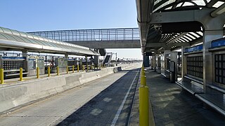
Chatsworth station is an intermodal passenger transport station in the Los Angeles neighborhood of Chatsworth, United States. It is served by Amtrak Pacific Surfliner inter-city rail service, Metrolink Ventura County Line commuter rail service, and the Metro G Line of the Los Angeles Metro Busway bus rapid transit. The station is also served by Los Angeles Metro Bus and Simi Valley Transit local buses, plus Santa Clarita Transit and LADOT Commuter Express regional express bus routes.

Canoga station is a station on the G Line of the Los Angeles Metro Busway system located on Canoga Avenue in Canoga Park, in the western San Fernando Valley. It is part of the Los Angeles Metro Busway system.
Slauson station is a busway station located in Los Angeles, California. It is situated between the 37th Street/USC and Manchester stations on the J Line, a bus rapid transit route which runs between El Monte, Downtown Los Angeles and San Pedro as part of the Metro Busway system. The station consists of two side platforms in the center of Interstate 110 above Slauson Avenue. The station serves the Vermont-Slauson, South Park and Florence neighborhoods of Los Angeles.

Roscoe station is a station on the G Line of the Los Angeles Metro Busway system located in Canoga Park in the western San Fernando Valley, it opened in June 2012. It is part of the Los Angeles Metro Busway system. The station is currently in service as part of the Metro Orange Line Chatsworth Extension. The station has bicycle lockers. A parking lot was not planned for this station.

Nordhoff station is a station on the G Line of the Los Angeles Metro Busway system located in the Chatsworth neighborhood of Los Angeles in the western San Fernando Valley. The station opened in June 2012 and was built as part of the Metro Orange Line Chatsworth Extension.

Sherman Way station is a station on the G Line of the Los Angeles Metro Busway system located at Sherman Way in downtown Canoga Park — a community of Los Angeles in the western San Fernando Valley. The station is in service on the Metro G Line Chatsworth Extension. It opened in June 2012.

Grand Avenue Arts/Bunker Hill station is an underground light rail station on the A and E lines of the Los Angeles Metro Rail system. The station also has street level stops for the J Line of the Los Angeles Metro Busway system. The station is located under the intersection of 2nd Place and Hope Street, near the Grand Avenue Arts district and in the Bunker Hill neighborhood of Downtown Los Angeles, after which the station is named. In planning documents, the station was originally referred to as 2nd Place/Hope.

