
7th Street/Metro Center station is an underground light rail and rapid transit station on the A, B, D, and E lines of the Los Angeles Metro Rail system. The station also has street level stops for the J Line of the Los Angeles Metro Busway system. The station is located under 7th Street, after which the station is named, at its intersections with Figueroa, Flower and Hope Streets.

The E Line is a 21.9-mile (35.2 km) light rail line in Los Angeles County, California. It is one of the six lines of the Los Angeles Metro Rail system, operated by the Los Angeles County Metropolitan Transportation Authority (Metro). The E Line runs east-west and serves 29 stations between East Los Angeles and Santa Monica, interlining and sharing five stations with the A Line in Downtown Los Angeles. The line operates for 19 hours per day with headways of up to 8 minutes during peak hours. It is the second-busiest light rail line in the system, carrying more than 12 million total passengers in 2023.

Pico station is an at-grade light rail station on the Los Angeles Metro Rail system located on Flower Street at the intersection of Pico Boulevard. The station also has southbound bus stops on Flower Street, across from the station and northbound bus stops on Figueroa Street, one block to the west. Pico station serves the South Park and Figueroa/Convention District neighborhoods.

Florence station is an at-grade light rail station on the A Line of the Los Angeles Metro Rail system. The station is located alongside the Union Pacific freight railroad's Wilmington Subdivision, at its intersection with Florence Avenue, after which the station is named, in the unincorporated Los Angeles County neighborhood of Florence.

Little Tokyo/Arts District station is an underground light rail station on the Los Angeles Metro Rail system. It replaced an at-grade station with the same name that was located on the east side of Alameda Street between 1st Street and Temple Street, on the edge of Little Tokyo and the Arts District in Downtown Los Angeles. The at-grade station opened in 2009 as part of the Gold Line Eastside Extension and was served by the L Line. The at-grade station closed in October 2020, and the new underground station on the south side of 1st Street between Central Avenue and Alameda Street opened on June 16, 2023.

Expo Park/USC station is an at-grade light rail station on the E Line of the Los Angeles Metro Rail system. The station is located in the center median of Exposition Boulevard near entrances to Exposition Park and the University of Southern California (USC), after which the station is named. The 37th Street/USC station for the J Line of the Los Angeles Metro Busway system is located a few blocks east of the station.

Jefferson/USC station is an at-grade light rail station on the E Line of the Los Angeles Metro Rail system. The station is located alongside Flower Street at its intersection with Jefferson Boulevard, after which the station is named, along with the nearby University of Southern California (USC). The station also has nearby stops for the J Line of the Los Angeles Metro Busway system, southbound buses stop on Flower Street, across from the station and northbound buses stop on Figueroa Street, one block to the west. Jefferson/USC station serves the North University Park in neighborhood of Los Angeles.

Expo/Vermont station is an at-grade light rail station on the E Line of the Los Angeles Metro Rail system. The station is located in the center median of Exposition Boulevard at its intersection with Vermont Avenue, after which the station is named, near the Exposition Park and West Adams neighborhoods of Los Angeles.

Expo/Western station is an at-grade light rail station on the E Line of the Los Angeles Metro Rail system. The station is located in the center median of Exposition Boulevard at its intersection with Western Avenue, after which the station is named, in the West Adams neighborhood of Los Angeles.

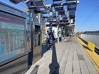
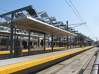
Expo/Crenshaw station is a light rail station in the Los Angeles Metro Rail system located in the Jefferson Park neighborhood of Los Angeles at the intersection of Crenshaw and Exposition Boulevards. During construction, it was known as the Crenshaw station. The station is the transfer point between the E Line, which stops at two street-level platforms alongside Exposition Boulevard, and the K Line, which has its northern terminus at a single island platform under Crenshaw Boulevard.

Farmdale station is an at-grade light rail station on the E Line of the Los Angeles Metro Rail system. The station is located in the center median of Exposition Boulevard at its intersection with Farmdale Avenue, after which the station is named, in the West Adams neighborhood of Los Angeles. It is located between Expo/La Brea station to the west and Expo/Crenshaw station to the east.

La Cienega/Jefferson station is an elevated light rail station on the E Line of the Los Angeles Metro Rail system. The station is over the intersection of La Cienega Boulevard and Jefferson Boulevard, after which the station is named, in the Baldwin Hills neighborhood of Los Angeles.
Culver City station is an elevated light rail station on the E Line of the Los Angeles Metro Rail system. The station is located on a dedicated right-of-way alongside Exposition Boulevard — between the intersection of Venice Boulevard and Robertson Boulevard on the west and the intersection of Washington Boulevard and National Boulevard on the east. The station is located in the city of Culver City, California, after which the station is named.

Palms station is an elevated light rail station on the E Line of the Los Angeles Metro Rail system. The station is located over the intersection of National Boulevard and Palms Boulevard in the Palms neighborhood of Los Angeles, after which the station is named.

Westwood/Rancho Park station is an at-grade light rail station in the Los Angeles Metro Rail system located at the intersection of Westwood Boulevard and Exposition Boulevard in the Rancho Park neighborhood of West Los Angeles, California. It serves the E Line. The station connects to the UCLA campus via the Big Blue Bus Rapid 12 and Route 8 lines.

Expo/Sepulveda station is an elevated light rail station in Los Angeles. It serves the E Line. The station connects to the UCLA campus via the Culver CityBus 6 and Rapid 6 and Metro 761 bus lines.

Expo/Bundy station is an elevated light rail station in the Los Angeles Metro Rail system. It is located at the intersection of Bundy Drive and Exposition Boulevard in West Los Angeles, California. It serves the Metro E Line.

26th Street/Bergamot station is an at-grade light rail station in the Los Angeles Metro Rail system. It is located near the intersection of 26th Street and Olympic Boulevard in Santa Monica, California and near the Bergamot Station Arts Center. The station is served by the E Line.

17th Street/SMC station is an at-grade light rail station in the Los Angeles Metro Rail system located near the intersection of 17th Street and Colorado Avenue in Santa Monica, California. It is served by the E Line.
Downtown Santa Monica station is an at-grade light rail station in the Los Angeles Metro Rail system. It is located near the intersection of 4th Street and Colorado Avenue in downtown Santa Monica, California. It is the E Line's western terminal station.

