Warner Center | |||||||||||||
|---|---|---|---|---|---|---|---|---|---|---|---|---|---|
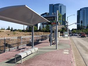 Warner Center station platform in 2015 while still part of the Orange Line | |||||||||||||
| General information | |||||||||||||
| Location | 61011⁄2 Owensmouth Avenue Los Angeles, California | ||||||||||||
| Coordinates | 34°10′49″N118°36′05″W / 34.1804°N 118.6014°W | ||||||||||||
| Owned by | Los Angeles County Metropolitan Transportation Authority | ||||||||||||
| Bus stands | 6 | ||||||||||||
| Construction | |||||||||||||
| Bicycle facilities | Racks | ||||||||||||
| Accessible | Yes | ||||||||||||
| History | |||||||||||||
| Opened | October 29, 2005 | ||||||||||||
| Closed | June 24, 2018 (Orange Line) | ||||||||||||
| |||||||||||||
| |||||||||||||

Warner Center station is an intercity bus station and former bus rapid transit station in the eponymous commercial development in the Woodland Hills neighborhood of the San Fernando Valley in Los Angeles, California, United States.
Contents
When service began on the Orange Line (now the G Line) in 2005, Warner Center was the western terminus, and the only stop not on the dedicated busway. In 2012 an extension of the Orange Line opened to Chatsworth station, leaving Warner Center on a one-stop stub served by alternate buses.
Service to Warner Center station on the Orange Line ended on June 24, 2018, replaced by a shuttle that stopped in several locations around the Warner Center area before offering passengers a transfer to the Orange Line at Canoga station, running every 10 minutes. [1] [2]
The station remains standing as a transit hub for the area and is now served by several other bus lines. [3]
