
The E Line is a 22-mile (35 km) light rail line in Los Angeles County, California. It is one of the six lines of the Los Angeles Metro Rail system, operated by the Los Angeles County Metropolitan Transportation Authority (Metro). The E Line runs east-west and serves 29 stations between East Los Angeles and Santa Monica. It interlines and shares five stations with the A Line in Downtown Los Angeles. Service operates for 21 hours per day with headways of up to 8 minutes during peak hours. The E Line, the second-busiest light rail line in the system, saw an average of 41,902 passengers on weekdays in October 2023.
The Culver Boulevard Median Bike Path is Class I rail trail bicycle path, walk route and linear park on Culver Boulevard in western Los Angeles County, California.

The Sawtelle Streetcar Depot is located on the grounds of the Sawtelle Veterans Home in Sawtelle, in the Westside area of Los Angeles, California.

Glendale–Burbank is a defunct Pacific Electric railway line that was operational from 1904 to 1955 in Southern California, running from Downtown Los Angeles to Burbank via Glendale. Short lines terminated Downtown and in North Glendale, including the popular Edendale Local.

The Upland–San Bernardino Line was an interurban line operated by the Pacific Electric Railway between Downtown Los Angeles and San Bernardino, California. This line also had shorter service that terminated before the end of the line at Baldwin Park, Covina, and San Dimas. Though service along this line in its entirety was discontinued in November 1941, it stands as the fourth-longest rapid transit line in American history, after the Sacramento Northern Railway's Chico and Colusa services, and the Pacific Electric's own Riverside–Rialto Line.

The Westgate Line was a suburban route operated by the Pacific Electric Railway from 1911 to 1940. This line was one of four lines connecting Downtown Los Angeles and Santa Monica that did not run through Hollywood. The line is notable for taking a circuitous route towards its end, along San Vicente Boulevard, mainly because it was built to encourage construction of new homes near Pacific Palisades.

The Balboa Line was the southernmost route of the Pacific Electric Railway. It ran between Downtown Los Angeles and the Balboa Peninsula in Orange County by way of North Long Beach, though the route was later cut back to the Newport Dock. It was designated as route 17.

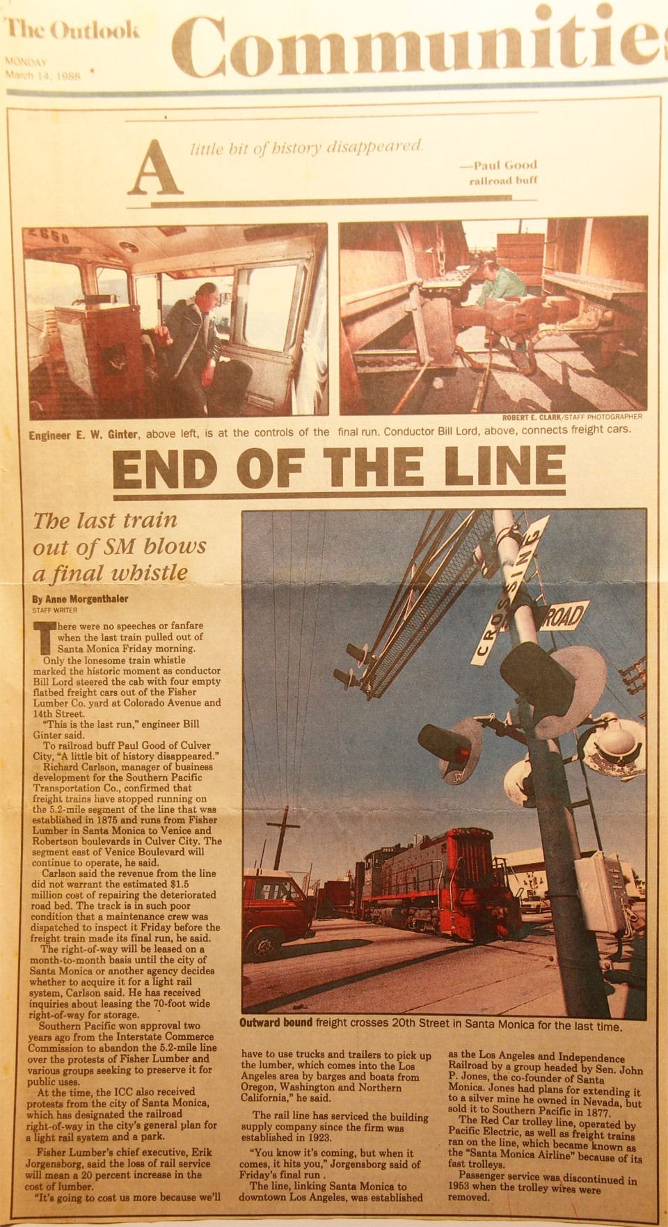
The Sawtelle Line was an interurban railway route primarily operated by the Pacific Electric Railway that ran between Downtown Los Angeles and Santa Monica, California. The line was established by the Pasadena and Pacific Railway between 1896 and 1901, with passenger service running until 1940.

The South Hollywood–Sherman Line was a suburban route of the Pacific Electric Railway. The line ran between Downtown Los Angeles and the suburb of Sherman. The line was named after Moses Sherman, who built the line and the Sherman street car yard on the line in West LA. The large 5.56-acre (2.25 ha) rail facility was on Santa Monica Boulevard just west of La Cienega Boulevard. The yard had a steam power house, a car barn and a shop building.

The Whittier Line was a Pacific Electric interurban line which traveled between Los Angeles and Whittier via Huntington Park, Rivera, and Los Nietos. A branch of the company's original Long Beach Line, operations along the line began in 1903. Due to its indirect route, passenger operations were eventually replaced by bus service on Whittier Boulevard after 1938. Tracks were largely retained for use by freight trains, eventually becoming the Union Pacific La Habra Subdivision. A short segment of the route is expected to be reactivated for passenger service as part of the Southeast Gateway Line.
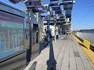
Culver City station is an elevated light rail station on the E Line of the Los Angeles Metro Rail system. The station is located on a dedicated right-of-way alongside Exposition Boulevard — between the intersection of Venice Boulevard and Robertson Boulevard on the west and the intersection of Washington Boulevard and National Boulevard on the east. The station is located in the city of Culver City, California, after which the station is named.
The Fullerton Line was an interurban route of the Pacific Electric Railway. It ran between Downtown Los Angeles and Fullerton, California. It opened in 1917 and hosted passenger service until 1938; the line was retained for freight for some time thereafter. After abandonment, the right of way between La Habra and Fullerton was mostly converted to a rail trail or built over.

The Hollywood Line was a local streetcar line of the Pacific Electric Railway. It primarily operated between Downtown Los Angeles and Hollywood, with some trips as far away as Beverly Hills and West Los Angeles. It was the company's busiest route prior to the opening of the Hollywood Subway. Designated as route 32, the line operated from 1909 until 1954.

The Long Beach Line was a major interurban railway operated by the Pacific Electric Railway between Los Angeles and Long Beach, California via Florence, Watts, and Compton. Service began in 1902 and lasted until 1961, the last line of the system to be replaced by buses.

The Venice Short Line was a Pacific Electric (PE) interurban railway line in Los Angeles which traveled from downtown Los Angeles to Venice, Ocean Park, and Santa Monica via Venice Boulevard. The route was especially busy on Sundays, as Venice was PE's most popular beachfront destination.
The Los Angeles Pacific Railroad (1896−1911) (LAP) was an electric public transit and freight railway system in Los Angeles County, California. At its peak it had 230 miles (370 km) of track extending from Downtown Los Angeles to the Westside, Santa Monica, and the South Bay towns along Santa Monica Bay.
The Western and Franklin Avenue Line was a Pacific Electric streetcar line which traveled from Los Angeles to Hollywood. It operated from 11th and Hill Streets via Hill, Sunset, Santa Monica Boulevard, Western Avenue, Franklin Avenue, Argyle Avenue, Yucca Street, and Vine Street to end at Hollywood and Vine Boulevards. It operated from 1908 to 1940. The Brush Canyon Line branched from this line at Bronson.

The Venice–Inglewood Line is a former railway line in Los Angeles County, California. The route was established by the Atchison, Topeka and Santa Fe Railway in 1887 before eventually being absorbed into the Pacific Electric interurban railway system. Service under electrification was very sparse, providing a suburban route between Venice and Inglewood.

The Redondo Beach via Playa del Rey was an interurban railway route of the Pacific Electric. It operated between the Hill Street Terminal and Cliffton, south of Redondo Beach, through the company's Western Division.

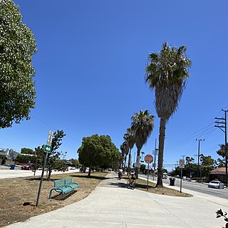
The Expo Bike Path is a 12-mile-long (19 km) rail with trail bicycle path and pedestrian route in Los Angeles County, California that travels roughly parallel to the Los Angeles Metro Rail's E Line between La Cienega/Jefferson and 17th Street/SMC stations. The Expo Bike Path is one of two major bicycle routes in Los Angeles that share dedicated rights-of-way with public transport, the other being the G Line Bikeway in the San Fernando Valley.


