| Division | Name | Map | From | Via | To | Abandoned | Post-rail history |
|---|
| S | Walker | | 6th & Main | Long Beach Avenue, Randolph Street | Walker (west shore of the Los Angeles River) | March 6, 1938 | N/A |
| S | Whittier | | 6th & Main | Long Beach Avenue, Randolph Street, private ROW, Philadelphia Street | Whittier | September 1, 1935 (cut back to Walker) | MTA Line 18, Montebello Bus Lines Line 10 (part of MTA Line 18 until 2004) |
| S | La Habra–Fullerton–Yorba Linda | | 6th & Main | Long Beach Avenue, Randolph Street, private ROW | Yorba Linda | July 10, 1930 | MTA Line 18, Montebello Bus Lines Line 10 (part of MTA Line 18 until 2004), Foothill Transit Line 285 (MTA Line 471 until 2004), Orange County Transportation Authority Line 29 (replacement buses only went to Brea) |
| S | Fullerton | | 6th & Main | Long Beach Avenue, Randolph Street, private ROW | Fullerton | November 13, 1930 | MTA Line 18, Montebello Bus Lines Line 10 (part of MTA Line 18 until 2004), Foothill Transit Line 285 (MTA Line 471 until 2004), Orange County Transportation Authority Lines 29, 47 |
| S | Bellflower | | 6th & Main | Long Beach Avenue, Santa Ana Boulevard, private ROW | Bellflower | May 25, 1958 | N/A |
| S | Santa Ana |  | 6th & Main | Long Beach Avenue, Santa Ana Boulevard, private ROW, Fourth Street | Santa Ana | July 2, 1950 (cut back to Bellflower) | MTA Line 460, Orange County Transportation Authority Line 83 |
| S | Santa Ana–Orange | | Santa Ana | | Orange | September 14, 1930 | Orange County Transportation Authority Line 53 |
| S | Santa Ana–Huntington Beach | | Santa Ana | | Huntington Beach | October 27, 1918 | N/A |
| S | Huntington Beach–La Bolsa | | Huntington Beach | | La Bolsa | November 9, 1928 | N/A |
| S | Seal Beach–Huntington Beach–Newport Beach | | 6th & Main | Long Beach Avenue, Willowbrook Avenue, private ROW, Electric Avenue, Pacific Coast Highway | Newport Beach | June 30, 1950 | Orange County Transportation Authority Line 1 |
| S | Balboa | | 6th & Main | Long Beach Avenue, Willowbrook Avenue, private ROW, Electric Avenue, Pacific Coast Highway, Balboa Boulevard | Balboa | June 9, 1940 (cut back to Newport Beach) | Orange County Transportation Authority Lines 1, 71 |
| S | Long Beach | | 6th & Main | Long Beach Avenue, Willowbrook Avenue, private ROW, Long Beach Boulevard | Long Beach | April 9, 1961 | MTA Line 60 and Blue Line |
| S | Watts Local | | 6th & Main | Long Beach Avenue | Watts | April 9, 1961 | MTA Line 56 (discontinued in 2003) |
| S | Long Beach–San Pedro | | Long Beach | Private ROW | San Pedro | January 2, 1949 | MTA Line 232 |
| S | Terminal Island | | 6th & Main; Long Beach | Long Beach Avenue, Willowbrook Avenue, private ROW, Henry Ford Avenue | Terminal Island | September 16, 1945 | N/A |
| S | San Pedro via Dominguez | | 6th & Main | Long Beach Avenue, Willowbrook Avenue, private ROW | San Pedro | December 7, 1958 | MTA Line 202 |
| S | Catalina Dock | | 6th & Main | Long Beach Avenue, Willowbrook Avenue, private ROW | Catalina Dock | October 12, 1958 (also had service from Long Beach via the Long Beach-San Pedro Line until 1949-04-30) | N/A |
| S | Torrance | | 6th & Main | Long Beach Avenue, Lanzit Avenue, Vermont Avenue, 166th Street, Normandie Avenue, Torrance Boulevard | Torrance | January 14, 1940 | N/A |
| S | San Pedro via Gardena | | 6th & Main | Long Beach Avenue, Lanzit Avenue, Vermont Avenue, 166th Street, Normandie Avenue, Torrance Boulevard, Cabrillo Avenue, Plaza del Amo, Normandie Avenue, Gaffey Street, private ROW | San Pedro | February 26, 1939 (cut back to Torrance; Carson Cutoff along Normandie Avenue had been abandoned on 1927-10-19, taking all trips through Torrance) | N/A |
| S | Redondo via Gardena | | 6th & Main | Long Beach Avenue, Lanzit Avenue, Athens Way, private ROW, Vermont Avenue, 166th Street, private ROW, 182nd Street, private ROW, Diamond Street, Catalina Avenue | Clifton | January 14, 1940 | N/A |
| S | Hawthorne–El Segundo | | 6th & Main | Long Beach Avenue, Lanzit Avenue, private ROW, Grand Avenue | El Segundo | October 31, 1930 | N/A |
| S | Hawthorne–El Nido | | Hawthorne | Hawthorne Boulevard | El Nido | October 25, 1933 | N/A |
| N | South Pasadena Local | | 6th & Main | Aliso Street, private ROW, Daly Street, Pasadena Avenue, Figueroa Street, Pasadena Avenue, Mission Street, Fair Oaks Avenue | Pasadena | January 2, 1935 (remained south of Mission Road until 1942-10-17) | MTA Line 176 |
| N | Annandale | | 6th & Main | Aliso Street, private ROW, Daly Street, Pasadena Avenue, Figueroa Street, Avenue 64 | Annandale | April 3, 1928 (1926-11-13 north of Adelaide Place) | MTA Line 256 |
| N | Pasadena Short Line | | 6th & Main | Aliso Street, private ROW, Soto Street, Huntington Drive, Fair Oaks Avenue | Pasadena | September 30, 1951 | MTA Line 260 |
| N | Pasadena via Oak Knoll | | 6th & Main | Aliso Street, private ROW, Soto Street, Huntington Drive, Oak Knoll Avenue, Lake Avenue | Pasadena | October 8, 1950 | MTA Line 485 |
| N | Mount Lowe | | 6th & Main | Aliso Street, private ROW, Soto Street, Huntington Drive, Fair Oaks Avenue, Colorado Boulevard, Lake Avenue, Mount Lowe Drive | Rubio Canyon (connecting with the Mount Lowe Railway) | September 15, 1936 | N/A |
| N | Sierra Vista Line | | 6th & Main | Aliso Street, private ROW, Soto Street, Huntington Drive | Sierra Vista | September 30, 1951 | MTA Lines 78 and 79 |
| N | Lamanda Park | | Pasadena | Colorado Boulevard | Lamanda Park | January 19, 1941 (cut back several blocks from Lamanda Park on 1936-03-01) | MTA Line 181 |
| N | Sierra Madre | | 6th & Main | Aliso Street, private ROW, Soto Street, Huntington Drive, Sierra Madre Boulevard | Sierra Madre | October 6, 1950 | MTA Line 487 |
| N | Monrovia–Glendora | | 6th & Main | Aliso Street, private ROW, Soto Street, Huntington Drive, Olive Avenue, Royal Oaks Drive, private ROW, 9th Street, private ROW | Glendora | September 30, 1951 | MTA Line 79, Foothill Transit Line 494 |
| N | Alhambra–San Gabriel | | 6th & Main | Aliso Street, private ROW, Soto Street, Huntington Drive, Main Street, Las Tunas Drive; loop through San Gabriel via Mission Drive, Junipero Serra Drive | Temple City | November 30, 1941 | MTA Line 78 |
| N | Shorb | | Pasadena | Fair Oaks Avenue, Huntington Drive, Main Street, Palm Avenue | Shorb | April 16, 1924 | N/A |
| N | El Monte–Baldwin Park | | 6th & Main | Aliso Street, private ROW, Ramona Boulevard | Baldwin Park | October 15, 1950 | MTA Line 490 |
| N | Covina | | 6th & Main | Aliso Street, private ROW, Ramona Boulevard, Badillo Street | Covina | March 28, 1947 (cut back to Baldwin Park) | MTA Line 490 |
| N | San Dimas | | 6th & Main | Aliso Street, private ROW, Ramona Boulevard, Badillo Street | Lone Hill | November 1, 1941 (cut back to Covina) | MTA Line 490, Foothill Transit Line 492 |
| N | San Dimas Local | | Lone Hill | Private ROW | San Dimas | July 4, 1924 | N/A |
| N | Pomona | | 6th & Main | Aliso Street, private ROW, Ramona Boulevard, Badillo Street, private ROW, White Avenue | Pomona | November 1, 1941 (cut back to Covina) | MTA Line 490, Foothill Transit Line 492 |
| N | Pomona–Claremont | | Pomona | Garey Avenue, private ROW, 1st Street | Claremont | January 1, 1933 | Foothill Transit Line 492 |
| N | Upland–Ontario | | Ontario | | Upland | October 6, 1928 | Omnitrans Line 83 |
| N | Ontario–San Antonio Heights | | Ontario | | San Antonio Heights | November 1, 1924 (cut back from San Antonio Heights to La Cima on 1924-07-03) | N/A |
| N | Upland–San Bernardino | | 6th & Main | | San Bernardino | November 1, 1941 | MTA Line 190, Foothill Transit Line 492, Omnitrans Lines 66, 14 |
| N | Redlands | | 6th & Main | | Redlands | July 20, 1936 | MTA Line 190, Foothill Transit Line 492, Omnitrans Lines 66, 14, 8 |
| N | Highland | | San Bernardino | | Highland | September 1, 1933 (branch to Patton on 1924-06-01) | N/A |
| N | Arrowhead | | San Bernardino | | Arrowhead Springs | September 1, 1932 | N/A |
| N | San Bernardino–Riverside | | San Bernardino | | Riverside | February 1, 1938 | Omnitrans Line 215 |
| N | Riverside–Rialto Line | | 6th & Main | | Riverside | June 9, 1940 | N/A |
| N | Riverside–Arlington | | Riverside | | Arlington | January 10, 1943 | Riverside Transit Agency Line 1 |
| N | Arlington–Corona | | Arlington | | Corona | August 11, 1931 | Riverside Transit Agency Line 1 |
| W | Redondo Beach via Playa del Rey | | Hill Street | Hill Street, Venice Boulevard, Culver Boulevard, Vista del Mar Avenue, The Strand, Hermosa Avenue, Harbor Drive, Catalina Avenue | Clifton | May 12, 1940 | Culver CityBus Line 7 (MTA Line 220 until 2006) |
| W | West 16th Street | | Hill Street | Hill Street, Venice Boulevard (16th Street), San Vicente Boulevard | Vineyard (extended 1940-07-07 to Genesee Street) | September 17, 1950 (Vineyard-Genesee Street shuttle remained until 1950-10-01) | MTA Line 733 |
| W | Venice Short Line | | Hill Street | Hill Street, Venice Boulevard, Pacific Avenue, Neilson Way, Ocean Avenue | Santa Monica | September 17, 1950 | MTA Line 733 |
| W | Sawtelle | | Hill Street | Hill Street, Venice Boulevard, San Vicente Boulevard, Burton Way, Santa Monica Boulevard | Santa Monica | July 7, 1940 | MTA Line 4; also Line 27 (Burton Way) until 2002 |
| W | Venice–Inglewood | | Ocean Park | Private ROW, Ballona Street | Inglewood | September 13, 1919 | N/A |
| W | Venice–Playa del Rey | | Venice | Pacific Avenue | Playa del Rey | July 13, 1936 | N/A |
| W | Westgate | | Hill Street | Hill Street, Venice Boulevard, San Vicente Boulevard, Burton Way, Santa Monica Boulevard, private ROW, San Vicente Boulevard, Ocean Avenue | Santa Monica | June 30, 1940 | Big Blue Bus Line 4 (MTA Line 22 until 2003) |
| W | Santa Monica Air Line | | 6th & Main | Long Beach Avenue, private ROW, Exposition Boulevard, private ROW | Santa Monica | November 26, 1953 | Expo Line in 2016-5-20 |
| W | Beverly Hills | | Subway Terminal or Hill Street | Glendale Boulevard or Hill Street, Sunset Boulevard, Hollywood Boulevard, Marshfield Way, private ROW, Santa Monica Boulevard | Beverly Hills | September 26, 1954 | MTA Line 217 |
| W | Venice via Hollywood | | Subway Terminal | Glendale Boulevard, Sunset Boulevard, Hollywood Boulevard, Marshfield Way, private ROW, Santa Monica Boulevard, Ocean Avenue, Neilson Way, Pacific Avenue | Venice | August 23, 1941 | N/A |
| W | Laurel Canyon | | Hill Street | Hill Street, Sunset Boulevard, Hollywood Boulevard, Marshfield Way, private ROW, Sunset Boulevard | Laurel Canyon | March 10, 1924 | N/A |
| W | Soldiers' Home | | Sawtelle | Private ROW | Soldiers' Home | 1920 | N/A |
| W | Coldwater Canyon | | Beverly Hills | Rodeo Drive | Coldwater Canyon (Beverly Hills Hotel) | January 15, 1923 | N/A |
| W | South Hollywood–Sherman | | Subway Terminal | Glendale Boulevard, Sunset Boulevard, Santa Monica Boulevard | Sherman | May 31, 1953 | MTA Line 4 |
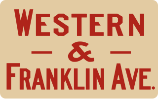
| W | Western and Franklin Avenue | | Hill Street | Hill Street, Sunset Boulevard, Santa Monica Boulevard, Western Avenue, Franklin Avenue | Hollywood (Hollywood and Vine) | March 17, 1940 | MTA Line 26 (removed from Franklin Avenue in 2006) |
| W | Brush Canyon | | Hollywood | Bronson Avenue, Canyon Drive | Brush Canyon | August 6, 1918 | N/A |
| W | Lankershim–Van Nuys | | Subway Terminal | Glendale Boulevard, Sunset Boulevard, Santa Monica Boulevard, Highland Avenue, Hollywood Freeway, Vineland Avenue, Chandler Boulevard, Van Nuys Boulevard | Van Nuys | December 28, 1952 | MTA Line 156 |
| W | Owensmouth | | Subway Terminal | Glendale Boulevard, Sunset Boulevard, Santa Monica Boulevard, Highland Avenue, Hollywood Freeway, Vineland Avenue, Chandler Boulevard, Van Nuys Boulevard, Sherman Way | Canoga Park (Owensmouth) | May 30, 1938 | MTA Line 163 |
| W | San Fernando | | Subway Terminal | Glendale Boulevard, Sunset Boulevard, Santa Monica Boulevard, Highland Avenue, Hollywood Freeway, Vineland Avenue, Chandler Boulevard, Van Nuys Boulevard, Parthenia Street, Sepulveda Boulevard, Brand Boulevard | San Fernando | May 30, 1938 | MTA Line 234 |
| W | Echo Park Avenue | | Hill Street | Hill Street, Sunset Boulevard, Echo Park Avenue | Elysian Heights | October 1, 1950 | Downtown Area Short Hop Pico Union/Echo Park |
| W | Edendale Local | | Subway Terminal | Glendale Boulevard | Edendale | June 17, 1955 (served Arcade Station via 6th Street, Figueroa Street, 2nd Street rather than Subway Terminal until 1940-09-08) | MTA Line 92 |
| W | Glendale | | Subway Terminal | Glendale Boulevard, Brand Boulevard | North Glendale | June 19, 1955 | MTA Line 92 |
| W | Burbank | | Subway Terminal | Glendale Boulevard, Brand Boulevard, Glenoaks Boulevard | Burbank | June 19, 1955 (cut back from Eton Drive on 1940-11-24) | MTA Line 92 |
| W | East Broadway | | Subway Terminal | Glendale Boulevard, Brand Boulevard, Broadway | Glendale | December 24, 1946 | N/A |