Griffith Park

Last updated

Griffith Park
Ferndell griffith park.jpg
Ferndell bridge, Griffith Park
Griffith Park
Type Urban park
Location Los Feliz, Los Angeles, California
Coordinates 34°8′N118°18′W / 34.133°N 118.300°W / 34.133; -118.300 (Griffith Park)
Area4,310 acres (1,740 ha)
Created1896
Operated byLos Angeles Department of Recreation & Parks
Visitors10 million
StatusOpen all year
Parking See below
Website www.laparks.org/griffithpark/
DesignatedJanuary 27, 2009
Reference no.942

Griffith Park is a large municipal park at the eastern end of the Santa Monica Mountains, in the Los Feliz neighborhood of Los Angeles, California. The park includes popular attractions such as the Los Angeles Zoo, the Autry Museum of the American West, the Griffith Observatory, and the Hollywood Sign. Due to its appearance in many films, the park is among the most famous municipal parks in North America. [1]

Contents

It has been compared to Central Park in New York City and Golden Gate Park in San Francisco, but it is much larger, less tamed, and more rugged than either of those parks. [2] The Los Angeles Recreation and Parks Commission adopted the characterization of the park as an "urban wilderness" on January 8, 2014. [3] [4] The park covers 4,310 acres (1,740 ha) of land, making it one of the largest urban parks in North America. [5] It is the second-largest city park in California, after Mission Trails Preserve in San Diego, and the 11th-largest municipally-owned park in the United States. [6]

History

Griffith donation

Griffith's entry in the San Quentin prison register Griffith J. Griffith San Quentin State Prison 03.jpg
Griffith's entry in the San Quentin prison register

After successfully investing in mining, Griffith J. Griffith purchased Rancho Los Feliz (near the Los Angeles River) in 1882 and started an ostrich farm there. Although ostrich feathers were commonly used in making women's hats in the late 19th century, Griffith's purpose was primarily to lure residents of Los Angeles to his nearby property developments, which supposedly were haunted by the ghost of Antonio Feliz (a previous owner of the property). After the property rush peaked, Griffith donated 3,015 acres (1,220 ha) to the city of Los Angeles on December 16, 1896. [7] [8]

Griffith was tried and convicted of shooting and severely wounding his wife in a 1903 incident. [9] When released from prison, he attempted to fund the construction of an amphitheater, observatory, planetarium, and a girls' camp and boys' camp in the park. As his reputation in the city was tainted by his crime, the city refused his money. [10]

Los Angeles River at Griffith Park, c. 1898-1910 Los Angeles River at Griffith Park, ca.1898-1910 (CHS-2033).jpg
Los Angeles River at Griffith Park, c.1898–1910

Griffith Park Aerodrome

In 1912, Griffith designated 100 acres (40 ha) of the park, at its northeast corner along the Los Angeles River, to be used to "do something to further aviation". The Griffith Park Aerodrome was the result. Aviation pioneers such as Glenn L. Martin and Silas Christofferson used it; afterwards the aerodrome was passed to the National Guard Air Service. Air operations continued on a 2,000-foot (600 m)-long runway until 1939, when it was closed, partly due to danger from interference with the approaches to Grand Central Airport across the river in Glendale, and because the City Planning commission complained that a military airport violated the terms of Griffith's deed. [11] The National Guard squadron moved to Van Nuys, and the aerodrome was demolished, though the rotating beacon and its tower remained for many years. From 1946 until the mid-1950s, Rodger Young Village occupied the area which had formerly been the Aerodrome. Today that site is occupied by the Los Angeles Zoo parking lot, the Gene Autry Western Heritage Museum, soccer fields, and the interchange between the Golden State Freeway and the Ventura Freeway.[ citation needed ]

Expansion

Girls eating in the mess hall of Griffith Park Girls' Camp, c. 1920 Griffith Park Girls Camp Mess Hall circa 1920.jpg
Girls eating in the mess hall of Griffith Park Girls' Camp, c. 1920

Griffith set up a trust fund for the improvements he envisioned, and after his death in 1919 the city began to build what Griffith had wanted. The amphitheater, called the Greek Theatre, was completed in 1930, and Griffith Observatory was finished in 1935. Subsequent to Griffith's original gift, further donations of land, city purchases, and the reversion of land from private to public have expanded the park to its present size.

In December, 1944 the Sherman Company donated 444 acres (180 ha) of Hollywoodland open space to Griffith Park. This large, passive, eco-sensitive property borders the Lake Hollywood reservoir (west), the former Hollywoodland sign (north), and Bronson Canyon (east) where it connects into the original Griffith donation. The Hollywoodland residential community is surrounded by this land. [12] [13] [14]

World War II

After the bombing of Pearl Harbor, the Civilian Conservation Corps camp contained within Griffith Park was converted to a holding center for Japanese Americans arrested as "enemy aliens" before they were transferred to more permanent internment camps. [15] The Griffith Park Detention Camp opened almost immediately after the Pearl Harbor attack, taking in 35 Japanese immigrants suspected of fifth column activity because they lived and worked near military installations. These men, mostly fishermen from nearby Terminal Island, were transferred to an Immigration and Naturalization Service detention station after a brief stay, but Issei internees arrested in the days and weeks following the outbreak of the war arrived soon after to take their place. Up to 550 Japanese Americans were confined in Griffith Park from 1941 to 1942, all subsequently transferred to Fort Lincoln, Fort Missoula and other DOJ camps. [16]

On July 14, 1942, the detention camp became a POW Processing Center for German, Italian and Japanese prisoners-of-war, operating until August 3, 1943, when the prisoners were transferred elsewhere. The camp was changed to the Army Western Corps Photographic Center and Camouflage Experimental Laboratory until the end of the war. [16]

Protest

On 17 March 1968, in Los Angeles, to protest entrapment and harassment by the Los Angeles Police Department, two drag queens known as "The Princess" and "The Duchess" held a St. Patrick's Day party at Griffith Park, a popular cruising spot and a frequent target of police activity. More than 200 gay men socialized through the day. [17]

Fires

Aftermath of the 2007 fire. Both visible and infra-red wavelengths of light have been used to make this satellite image. Vegetation appears in various shades of green, while the burned areas appear charcoal. Aftermath of Griffith Park Fire.jpg
Aftermath of the 2007 fire. Both visible and infra-red wavelengths of light have been used to make this satellite image. Vegetation appears in various shades of green, while the burned areas appear charcoal.

Hired as part of a welfare project, 3,780 men were in the park clearing brush on October 3, 1933, when a fire broke out in the Mineral Wells area in the northern part of the current park. Many of the workers volunteered or were ordered to fight the fire. In all, 29 men were killed and 150 were injured. Professional firefighters arrived and limited the blaze to 47 acres (19 ha). [18]

On May 12, 1961, a wildfire on the south side of the park burned 814 acres (329 ha). It also destroyed eight homes and damaged nine more, chiefly in the Beachwood Canyon area. [19]

Another fire occurred c. 1971 in the Toyon Canyon area. Repelled by the ugliness of the devastated area, Amir Dialameh replanted a portion of it himself by hand. Over the course of more than 30 years he tended the garden he built there, with the help of occasional volunteers. [20] Amir's Garden is featured in Visiting... with Huell Howser episode 1306. [21]

On May 8, 2007, a major wildfire burned more than 817 acres (331 ha), destroying the bird sanctuary, Dante's View, and Captain's Roost, and forcing the evacuation of hundreds of people. The fire came right up to one of the largest playgrounds in Los Angeles, Shane's Inspiration, and the Los Angeles Zoo, and threatened the Griffith Observatory, but left such areas intact. Several local organizations, including SaveGriffithPark.org, have been working since then with local officials to restore the park in a way that would benefit all. [22] It was the third fire of the year. [23] The city announced a $50 million plan to stabilize the burned slopes. The trees along Canyon Drive were allowed to grow back naturally, having been re-seeded by bird droppings. [22]

Addition of Cahuenga Peak

One hundred acres (40 ha) around Cahuenga Peak were purchased with funds from a broad spectrum of donors, in addition to $1.7 million from the city, [24] and added to the park in July 2010 [25] bringing the park's total acreage to 4,310 acres (1,740 ha).

Attractions

Invisible Square.svg
Mapscaleline.svg
3km
2miles
Red pog.svg
8
Invisible Square.svg
7
Invisible Square.svg
6
Invisible Square.svg
5
Invisible Square.svg

A statue of a standing bear, created in 1976 by Noack Foundry based on the design of German sculptor Renée Sintenis originally created in 1932, is located in the park. Its plaque reads "To the people of the United States of America in gratitude for their aid, friendship and protection. Presented to our sister city, Los Angeles by the people of free Berlin". [33] This is the same bear as that used to create the Golden Bear awards for the Berlin International Film Festival each year. [34]

Other activities

Equestrian use of utility roads Equestrian trail use in Griffith Park 2015-12-27.jpg
Equestrian use of utility roads

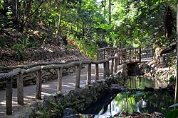
Much of the park comprises wild, rugged natural areas with hiking and equestrian trails, and this terrain separates the park into many areas or "pockets" of activities. Within the various areas are concessions, golf courses, picnic grounds, train rides, and tennis courts. In 2014, two baseball fields were proposed on the east side of Griffith Park that would remove 44 trees and replace four acres (1.6 ha) of picnic area, the largest picnic area in the park that is often used for large family gatherings, cultural fairs and festivals, reunions, and other special occasions. The plan may be altered to spare a sycamore that has been designated by the city as a "heritage tree", a living artifact of Los Angeles history. [35]

After its closure in 1966, the grounds of the Griffith Park Zoo were transformed into a recreation area. Some of the former animal enclosures were left in place, and picnic tables were installed.

The annual Bell-Jeff Invitational cross country race has been held in the park on the last Saturday in September since 1973. [36]

After 74 years in operation, [37] the Griffith Park Pony Rides closed on December 21, 2022. [38] [39] [40]

Hiking

View from the balcony at Griffith Observatory on Mount Lee and Cahuenga Peak with Wisdom tree visible to the West of the Hollywood sign View from the balcony at Griffith Observatory on the Hollywood sign and Mt. Lee 20220509 141352 (1).jpg
View from the balcony at Griffith Observatory on Mount Lee and Cahuenga Peak with Wisdom tree visible to the West of the Hollywood sign

Griffith Park is a popular hiking area. Orientation maps are located at the entrance to the parking lot near Griffith Observatory. A service road leads from the observatory to numerous hiking routs on and around Mount Lee; however, the immediate area where the Hollywood Sign is located is closed to the public since the area is home to the main communication tower for the City of Los Angeles. Hiking up to Wisdom tree on Cahuenga Peak from the South-western slopes of Mount Lee is accessible. [41] Visitors are expected to comply with safety requirements, and must be prepared and equipped adequately.

The Mount Lee Drive approach to the Mount Lee summit. View of Mt Lee Summit From Mt Lee Drive.jpg
The Mount Lee Drive approach to the Mount Lee summit.

Trails leading to the Hollywood Sign can be accessed from several official Griffith Park entrances. These include the Mt. Hollywood Trail, which can be accessed from the Griffith Observatory parking lot off Vermont Canyon Road or from Vermont Canyon Road just past the Greek Theater, the Bronson Canyon / Brush Canyon Trail (3200 Canyon Drive, Los Angeles, CA), [42] and a number of trailheads that begin near the Griffith Park Visitors Center off Crystal Springs Drive in the Los Feliz section of Los Angeles (free trail maps are available at the Visitors Center). [43] A once-popular trailhead originating at the top of Beachwood Drive was closed by court order in April 2017. [44]

Mount Lee

Mount Lee's hiking trails and fire roads are part of Griffith Park; as such it's easy to get lost and be redirected. Maps of the trails and the land around the hills should be studied before attempting to hike the area for the first time. [45]

Wildlife

An adult mountain lion, named P-22, [note 1] inhabited the park from 2012 to 2022. [46] An image of the cougar was captured on an automatic camera. [47] [48] [49] P-22 is likely not the first mountain lion to have taken up residence in Griffith Park, although the duration of his stay was remarkably long. A mountain lion's body was found in Griffith Park sometime in 1996 or 1997, after being hit by a vehicle. Another mountain lion was sighted several times in Griffith Park in 2004 and rangers found evidence (including deer remains) to support its presence there. [50]

An urban ecologist monitors wildlife within the park. [51] The ecologist has also been conducting a raptor study in the communities surrounding the park through volunteers since 2017. [52] Permanent signs on the Griffith Park Observatory deck warn of rattlesnakes in the surrounding area. [53]

Coyotes abound in Griffith Park and are generally active at night. Park visitors report frequent sightings during the day and have had their dogs attacked by coyotes. [54] Visitors are strongly discouraged from feeding Griffith Park coyotes including near "the base of Fern Canyon, where up to eight coyotes per day are present more or less continuously." [55]

The newly created habitat of a Miyawaki forest near the Bette Davis Picnic Area has attracted Western toads from the Los Angeles River. [56] [57]

Geology

Much of the exposed rock in Griffith Park is marine or non-marine sedimentary rock of Neogene and Quaternary formations, including the Lower, Middle and Upper Topanga, as well as the Monterey and Fernando formations. Both inclined bedding and fossil-bearing strata are common. Also present is late Miocene intrusive rock, generally strongly weathered and easily cleaved, as well as some dikes and purple and gray andesitic extrusive rock bodies. Faulting as well as clear contacts between rock bodies are also common. [58]

Climate

Climate data for Griffith Park, Los Angeles, California
MonthJanFebMarAprMayJunJulAugSepOctNovDecYear
Record high °F (°C)91
(33)
92
(33)
92
(33)
105
(41)
109
(43)
107
(42)
113
(45)
110
(43)
112
(44)
106
(41)
100
(38)
91
(33)
113
(45)
Mean daily maximum °F (°C)68
(20)
69
(21)
70
(21)
75
(24)
76
(24)
82
(28)
87
(31)
88
(31)
86
(30)
81
(27)
74
(23)
68
(20)
77
(25)
Mean daily minimum °F (°C)45
(7)
48
(9)
50
(10)
53
(12)
55
(13)
59
(15)
62
(17)
63
(17)
61
(16)
56
(13)
48
(9)
44
(7)
54
(12)
Record low °F (°C)27
(−3)
30
(−1)
32
(0)
37
(3)
39
(4)
39
(4)
46
(8)
46
(8)
44
(7)
40
(4)
31
(−1)
25
(−4)
25
(−4)
Average precipitation inches (mm)3.94
(100)
4.46
(113)
3.91
(99)
1.01
(26)
0.39
(9.9)
0.09
(2.3)
0.02
(0.51)
0.17
(4.3)
0.32
(8.1)
0.59
(15)
1.36
(35)
2.21
(56)
18.47
(469)
Source: [59] [60]

With its wide variety of scenes and close proximity to Hollywood and Burbank, various locations in the park have been used extensively in movies and television shows. [61] Griffith Park was the busiest destination in Los Angeles for on-location filming in 2011, with 346 production days, according to a FilmL.A. survey.[ citation needed ] Projects included the TV series Criminal Minds and The Closer . [62]

Griffith Observatory Griffith observatory 2006.jpg
Griffith Observatory
Mount Lee with the Hollywood Sign Griffith Observatory entrance lawn with Hollywood sign.jpg
Mount Lee with the Hollywood Sign

Some sites within the park that have appeared in media include:

See also

Similar large municipal parks elsewhere

Notes

  1. "P" for puma, another name for mountain lion, and "22" as he is the 22nd of his species which has been tracked by National Park Service rangers.

Related Research Articles

<span class="mw-page-title-main">Santa Monica Mountains</span> Mountain range of the Transverse Ranges in California, United States

The Santa Monica Mountains is a coastal mountain range in Southern California, next to the Pacific Ocean. It is part of the Transverse Ranges. The Santa Monica Mountains National Recreation Area encompasses this mountain range. Because of its proximity to densely populated regions, it is one of the most visited natural areas in California.

<span class="mw-page-title-main">Pacific Palisades, Los Angeles</span> Neighborhood in California, US

Pacific Palisades is a neighborhood in the Westside region of Los Angeles, California, situated about 20 miles (32 km) west of Downtown Los Angeles.

<span class="mw-page-title-main">Los Feliz, Los Angeles</span> Neighborhood of Los Angeles in California, United States

Los Feliz is a hillside neighborhood in the greater Hollywood area of Los Angeles, California, abutting Hollywood and encompassing part of the Santa Monica Mountains. The neighborhood is named after the Feliz family of Californios who had owned the area since 1795, when José Vicente Féliz was granted Rancho Los Feliz.

<span class="mw-page-title-main">Malibu Creek State Park</span> Wilderness park in Santa Monica Mountains of southern California

Malibu Creek State Park is a state park of California, United States, preserving the Malibu Creek canyon in the Santa Monica Mountains. The 8,215-acre (3,324 ha) park was established in 1974. Opened to the public in 1976, the park is also a component of Santa Monica Mountains National Recreation Area.

<span class="mw-page-title-main">Claremont Canyon Regional Preserve</span>

Claremont Canyon Regional Preserve is a small regional park mainly located in the city of Oakland, California, and administered by the East Bay Regional Park District. The park is named for the canyon in which it is situated, Claremont Canyon, out of which Claremont Creek flows on its way to its confluence with Temescal Creek. Originally, the canyon was named Harwood's Canyon, and then later as Telegraph Canyon. The name was changed to Claremont by a developer of the nearby Claremont district.

<span class="mw-page-title-main">Angeles National Forest</span> National forest in California, United States

The Angeles National Forest (ANF) of the U.S. Forest Service is located in the San Gabriel Mountains and Sierra Pelona Mountains, primarily within Los Angeles County in southern California. The ANF manages a majority of the San Gabriel Mountains National Monument.

<span class="mw-page-title-main">Henry W. Coe State Park</span> State park in California, U.S.

Henry W. Coe State Park is a state park of California, United States, preserving a vast tract of the Diablo Range. The park is located closest to the city of Morgan Hill, and is located in both Santa Clara and Stanislaus counties. The park contains over 87,000 acres (35,000 ha), making it the largest state park in northern California, and the second-largest in the state. Managed within its boundaries is a designated wilderness area of about 22,000 acres (8,900 ha). This is officially known as the Henry W. Coe State Wilderness, but locally as the Orestimba Wilderness. The 89,164-acre (36,083 ha) park was established in 1959.

<span class="mw-page-title-main">Hollywood Sign</span> Landmark in Los Angeles, California

The Hollywood Sign is an American landmark and cultural icon overlooking Hollywood, Los Angeles, California. Originally the Hollywoodland Sign, it is situated on Mount Lee, in the Beachwood Canyon area of the Santa Monica Mountains. Spelling out the word "Hollywood" in 50-foot-tall (15.2 m) white uppercase letters and 450 feet long, it was originally erected in 1923 as a temporary advertisement for a local real estate development, but due to increasing recognition the sign was left up, and replaced in 1978 with a more durable all-steel structure.

<span class="mw-page-title-main">Mount Lee</span> Mountain in California, United States

Mount Lee is a peak in the Santa Monica Mountains, located in Griffith Park in Los Angeles, California, USA. The Hollywood Sign is located on its southern slope.

<span class="mw-page-title-main">Upper Las Virgenes Canyon Open Space Preserve</span>

The Upper Las Virgenes Canyon Open Space Preserve is a large open space nature preserve owned and operated by the Santa Monica Mountains Conservancy spanning nearly 3,000 acres (1,200 ha) in the Simi Hills of western Los Angeles County and eastern Ventura County.

<span class="mw-page-title-main">Runyon Canyon Park</span> Park in Los Angeles

Runyon Canyon Park is a 160-acre (65 ha) park in Los Angeles, California, at the eastern end of the Santa Monica Mountains, managed by the Los Angeles Department of Recreation and Parks. The southern entrance to the park is located at the north end of Fuller Avenue in Hollywood. The northern entrance is off the 7300 block of Mulholland Drive. The Runyon Canyon Road, a fire road that is closed to public motor vehicle access, runs roughly through the center of the park between the northern and southern entrances along Runyon Canyon itself, and there are numerous smaller hiking trails throughout the park. The highest point in the park at an elevation of 1,320 ft is known as Indian Rock. Because of its proximity to residential areas of Hollywood and the Hollywood Hills, celebrity sightings are common. The park is also noted for having a fairly liberal dog policy, with dogs allowed off-leash in 90 of the park's 160 acres (0.65 km2). The park is part of the Santa Monica Mountains National Recreation Area.

<span class="mw-page-title-main">Verdugo Mountains</span> Mountain range of the Transverse Ranges in California, United States

The Verdugo Mountains, also known as the Verdugo Hills or simply The Verdugos, are a small, rugged mountain range of the Transverse Ranges system in Los Angeles County, California. Located just south of the western San Gabriel Mountains, the Verdugo Mountains region incorporates the cities of Burbank, Glendale, Pasadena, and La Cañada Flintridge; the unincorporated communities of Altadena and La Crescenta-Montrose; as well as the City of Los Angeles neighborhood of Sunland-Tujunga.

<span class="mw-page-title-main">Santa Monica Mountains National Recreation Area</span> Protected area in Southern California, US

The Santa Monica Mountains National Recreation Area is a United States national recreation area containing many individual parks and open space preserves, located primarily in the Santa Monica Mountains of Southern California. The SMMNRA is in the greater Los Angeles region, with two thirds of the parklands in northwest Los Angeles County, and the remaining third, including a Simi Hills extension, in southeastern Ventura County.

<span class="mw-page-title-main">Kenneth Hahn State Recreation Area</span> Los Angeles County recreation area opened 1984

Kenneth Hahn State Recreation Area, or Kenneth Hahn Park, is a state park unit of California in the Baldwin Hills Mountains of Los Angeles. The park is managed by the Los Angeles County Department of Parks and Recreation. As one of the largest urban parks and regional open spaces in the Greater Los Angeles Area, many have called it "L.A.'s Central Park". The 401-acre (1.62 km2) park was established in 1984. The land was previously the Baldwin Hills Reservoir, which failed catastrophically in the 1963 Baldwin Hills Dam disaster.

<span class="mw-page-title-main">Backbone Trail</span> Long-distance hiking trail in the United States

The Backbone Trail is a long-distance trail extending 67.79 miles (109.10 km) across the length of the Santa Monica Mountains in the U.S. state of California. Its western terminus is Point Mugu State Park, and its eastern terminus is Will Rogers State Historic Park in Pacific Palisades. The trail is open to hikers throughout its length. Dogs, mountain bicyclists and horseback riders are only allowed on portions of the trail as posted.

<span class="mw-page-title-main">Franklin Canyon Park</span> City park in Los Angeles, California

Franklin Canyon Park is a public municipal park located near Benedict Canyon, at the eastern end of the Santa Monica Mountains, in Los Angeles, California. The park comprises 605 acres (245 ha), and is located near the geographical center of the city of Los Angeles. Franklin Canyon is also the name of the canyon and surrounding neighborhood.

<span class="mw-page-title-main">Challenger Park</span>

Challenger Park is a 141.55-acre open-space park (57.28 ha) located in southern portion of Simi Valley, California in the Simi Hills. The park is owned and maintained by the Rancho Simi Recreation and Park District. Challenger Park is used for mountain hiking, mountain biking, jogging, and horseback riding but with a focus on the preservation of wildlife habitat. The scenery lining the trails includes extensive oak woodlands, chaparral, and coastal sage scrub. The terrain varies greatly with rolling green hills and steep mountainous hills and canyons. The park offers miles of trails connecting to Long Canyon, Oak Canyon, Trough Canyon, Lone Oak Canyon, and other adjoining open-space nature areas in the southern section of the Simi Valley. There is a fairly easy hike to Thousand Oaks, CA via Long Canyon trails. To get to Oak Canyon, Old Windmill Park and Coyote Hills Park, you must cross Long Canyon Road. Fences run along the Long Canyon Road with dirt paths. There are also lights at the signals with push buttons for hikers, and raised buttons for equestrians. Adjacent to Challenger Park is also Bridle Trails, a private hiking area. There are scenic views of the City of Simi Valley from the park and it is a native habitat for numerous species of animals, including mule deer, mountain lions, coyotes, rattlesnakes, crawdads, California king-snakes, grey foxes, bobcats, as well as red-tailed hawks, barn owls, and numerous other raptors.

<span class="mw-page-title-main">Sage Ranch Park</span> Public park and nature preserve in Ventura County, California

Sage Ranch Park is a 625-acre park (253 ha) and wildlife corridor located at a 2,000 feet (610 m) height in the northwestern Simi Hills on the northwestern plateau of the Simi Valley, bordering Los Angeles County and its San Fernando Valley. The campground area used to be a cattle ranch and later a filmset for Western movies. Sage Ranch Park is today an intermountain wildlife corridor, which links the Simi Hills with the Santa Susana- and Santa Monica Mountains. The mountainous park is mostly known for its unique sandstone rock formations, maybe particularly on its western side where the Sandstone Ridge and Turtle Rock are situated. On its northern side, there are great panoramic rural and metropolitan views of the Simi Valley, as well as surrounding Simi Hills, Santa Susana Mountains and beyond. It is home to numerous sandstone formations, caves, outcroppings, tilted rock formations, several hiking trails, a camping ground, as well as native flora and wildlife. The area is lined with coastal sage scrub and other flora includes chaparral, bush lupine, California poppy, sunflowers, Cream Cups, bracken, sword fern, prickly pear cactus, eucalyptus trees, oak woodland of ceanothus, coffee berry, California buckwheat, sycamore, Walnut Tree, ferns, orange- and avocado trees. It is a critical cross-mountain wildlife corridor and is home to fauna such as mountain lions, bobcats, eagles, vultures, owls, rattle snakes, coyotes, hawks, grey fox, king snakes, and more. Bordering Sage Ranch to the south is the Rocketdyne Santa Susana Field Laboratory, in which the nearby Burro Flats Painted Cave is located.

<span class="mw-page-title-main">Arroyo Conejo Open Space</span> Park in Ventura County, California, United States of America

Arroyo Conejo Open Space is a 302-acre (122 ha) open space reserve in the western Simi Hills in northern Newbury Park, Ventura County, California. Most of it is part of the 250-acre (100 ha) Arroyo Conejo Nature Preserve.

The Matilija Wilderness is a 29,207-acre (11,820 ha) wilderness area in Ventura and Santa Barbara Counties, Southern California. It is managed by the U.S. Forest Service, being situated within the Ojai Ranger District of the Los Padres National Forest. It is located adjacent to the Dick Smith Wilderness to the northwest and the Sespe Wilderness to the northeast, although it is much smaller than either one. The Matilija Wilderness was established in 1992 in part to protect California condor habitat.

References

  1. Schreiner, C. (2020). Discovering Griffith Park: A Local's Guide. Mountaineers Books. ISBN   978-1-68051-267-0 . Retrieved September 30, 2020.
  2. Multiple sources:
  3. "Griffith Park's Vision Plan". Friends of Griffith Park. Retrieved October 3, 2021.
  4. A Vision for Griffith Park (PDF) (Report). City of Los Angeles Department of Recreation and Parks. January 8, 2014.
  5. "Griffith Park". Archived from the original on July 28, 2016. Retrieved December 2, 2010.
  6. "The 150 Largest City Parks" (PDF). The Trust for Public Land.
  7. Griffith Park Archived January 15, 2010, at the Wayback Machine
  8. "Gift To Los Angeles: Capitalist G. J. Griffith Donates as a Christmas Present a Magnificent Park Site". Vol. 81, no. 17. Los Angeles Herald. December 17, 1896. p. 3. Retrieved November 17, 2015.
  9. "Death Summons Noble Woman", Los Angeles Sunday Times, November 13, 1904
  10. Morrison, Patt (May 3, 2022). "Griffith Park is named for a guy who shot his wife — and other true stories of L.A. parks". Los Angeles Times. Retrieved May 7, 2022.
  11. "Extension of Guard Airfield at Griffith Park Held Illegal". The Los Angeles Times. November 10, 1939. p. 38. Retrieved April 28, 2023.
  12. Los Angeles City Archives, Piper Tech, Minutes of Meeting of Board of Playground and Recreation Commissioners, Monday, December 18, 1944
  13. Los Angeles City Ordinance 90638
  14. Quitclaim deed, Sherman Company, City of Los Angeles 2049 (Sherman Library and Gardens)
  15. Campa, Andrew J. (April 28, 2023). "Griffith Park's little-known history as a prison camp for Japanese, German, Italian immigrants". Los Angeles Times. Retrieved April 28, 2023.
  16. 1 2 Masumoto, Marie. "Griffith Park" Densho Encyclopedia. Retrieved 13 Jun 2014.
  17. Witt, Lynn, Sherry Thomas and Eric Marcus (eds.) (1995). Out in All Directions: The Almanac of Gay and Lesbian America, p. 210. New York, Warner Books. ISBN   0-446-67237-8.
  18. "The Fire of '33" Archived December 2, 2019, at the Wayback Machine , Glendale News-Press, October 1–4, 1993. Accessed May 8, 2007.
  19. A Holocaust Strikes the Hollywood Hills Archived August 12, 2007, at the Wayback Machine , Otto Firgens, Los Angeles City Fire Department
  20. "Amir's Garden - Since 1971". Amirsgarden.org. Retrieved February 17, 2016.
  21. "Amir's Garden- Visiting (1306) – Huell Howser Archives at Chapman University". October 16, 2005.
  22. 1 2 "City to repair fire damage in Griffith Park" Ashraf Khalil, Los Angeles Times May 11, 2007
  23. "Fire Forces Griffith Park Evacuations" Archived May 10, 2007, at the Wayback Machine , KNBC.com, 11:27 pm PDT May 8, 2007
  24. "Hugh Hefner Saves The Hollywood Sign". Beverly Hills Courier. Retrieved June 3, 2010.
  25. It's Official: Griffith Park Grows by More than 100 Acres with Addition of Cahuenga Peak Archived May 10, 2012, at the Wayback Machine . LAist (June 18, 2010). Retrieved on August 25, 2013.
  26. "Griffith Park". City of Los Angeles Department of Recreation & Parks. Archived from the original on July 22, 2016. Retrieved March 10, 2016.
  27. Tremaine, Julie (October 14, 2020). "The story behind the California attraction that inspired Disneyland". SFGate . Retrieved October 14, 2020.
  28. Lewis, Randy (July 21, 2014). "George Harrison Memorial Tree killed ... by beetles; replanting due". Los Angeles Times.
  29. Lewis, Randy (February 20, 2015). "George Harrison tree -- killed by beetles -- to be replanted Feb. 25". Los Angeles Times.
  30. Bob Pool (October 8, 2013). "Discontent brewing under the Hollywood sign". Los Angeles Times. Archived from the original on October 13, 2013.
  31. Bob Pool (October 9, 2013). "Hollywood sign tourists, sightseers annoy local residents". Los Angeles Times.
  32. Walker, Alissa (November 21, 2014). "Why People Keep Trying to Erase the Hollywood Sign From Google Maps". Gizmodo . Retrieved November 21, 2014.
  33. "Renee Sintenis, Standing Bear, Los Angeles". Public Art in Los Angeles and Southern California. Archived from the original on September 23, 2022. Retrieved September 23, 2022.
  34. François, Emmanuelle (March 2, 2018). "The woman behind the Bär". Exberliner. Retrieved September 23, 2022.
  35. Sahagun, Louis (September 12, 2014). "Plans to add baseball fields to Griffith Park may draw legal challenge". Los Angeles Times .
  36. "Big Field Expected for Bell-Jeff Invitational". Los Angeles Times . September 30, 1989. Retrieved September 4, 2018.
  37. "Griffith Park Pony Rides Historical Marker". www.hmdb.org. Retrieved December 22, 2022.
  38. Scauzillo, Steve (December 22, 2022). "End of era: Children take last pony rides as city closes Griffith Park favorite". Daily News. Retrieved December 22, 2022.
  39. Scauzillo, Steve (January 8, 2023). "Historic structures at Griffith Park pony ride may hamper city's plans". Daily News. Retrieved January 10, 2023.
  40. Historic-Cultural Monument Application for the Griffith Park (PDF) (Report). Cultural Heritage Commission. October 30, 2008. CASE NO.: CHC-2008-2724-HCM.
  41. Lopez, Steve (November 10, 2022). "A hike to L.A.'s Wisdom Tree calms post-election nerves. And the view is perfect". Los Angeles Times. Retrieved November 12, 2022.
  42. "The Easy Hollywood Sign Hike (Directions & Parking)". HikingGuy.com. March 31, 2015. Retrieved December 10, 2018.
  43. hollywoodsign.org
  44. "Griffith Park groups lose legal battle over pathway to see Hollywood sign". Los Angeles Times. March 22, 2018. Retrieved January 12, 2020.
  45. "Griffith Park Trail Map" (PDF). www.laparks.org. Retrieved January 12, 2020.
  46. Steve Winter, Ghost Cats, National Geographic, December 2013.
  47. Keefe, Alexa (November 14, 2013) A Cougar Ready for His Closeup National Geographic
  48. "LA's Mountain Lion Is A Solitary Cat With A Knack For Travel". NPR . April 19, 2015. Retrieved April 20, 2015.
  49. Nijhuis, Michelle (April 20, 2015). "The Mountain Lions of Los Angeles". The New Yorker .
  50. Hymon, Steve; Sciaudone, Christiana (April 29, 2004). "A Mountain Lion Far From Home" . Los Angeles Times . Retrieved December 18, 2022.
  51. Lovett, Ian (September 14, 2011). "Baying at the Bard, Appropriately and Otherwise". The New York Times. ISSN   0362-4331 . Retrieved March 3, 2023.
  52. Kim, Dakota (March 2, 2023). "Go bird watching with an urban ecologist and learn about L.A.'s predators of the sky". Los Angeles Times. Retrieved March 2, 2023.
  53. Hicks, Reva (May 23, 2012). "Rattlesnake Warning: They're Shy, but Dangerous". NBC Southern California. Retrieved March 20, 2019. the Southern Pacific rattlesnake [is] found in Griffith Park -- a place where humans, dogs and rattlesnakes share the trails.
  54. Wolfe, Chris; Habeshian, Sareen (January 26, 2022). "Actor Travis Van Winkle warns hikers after his dog was attacked by coyotes at Griffith Park". KTLA. Retrieved March 3, 2023.
  55. Carey, Matthew (June 18, 2017). "LA park rangers warn visitors: Stop feeding the coyotes!". Los Angeles Daily News. Retrieved March 2, 2023.
  56. Buckley, Cara (August 24, 2023). "Tiny Forests With Big Benefits". The New York Times. ISSN   0362-4331 . Retrieved September 14, 2023.
  57. Wagner, Tara Lynn (October 25, 2021). "In the face of a huge climate crisis, can micro forests be the answer?". spectrumnews1.com. Retrieved September 14, 2023.
  58. Helman, Daniel (2012). "Public Geology at Griffith Park in Los Angeles: A Sample Teachers' Guide". Electronic Green Journal. 1 (33). doi: 10.5070/G313310917 . S2CID   129401303 . Retrieved August 18, 2018.
  59. "Griffith Park, CA Monthly Weather" . Retrieved February 23, 2021.
  60. "Zipcode 90027" . Retrieved March 24, 2021.
  61. Rode, Erin (January 26, 2024). "There's a secret mystery forest in the middle of this big city park". SFGATE. Retrieved January 26, 2024.
  62. "Top Film Locations for 2011". Los Angeles Times . December 15, 2011. Archived from the original on December 15, 2011.