The South Bay is a region of the Los Angeles metropolitan area, located in the southwest corner of Los Angeles County. The name stems from its geographic location stretching along the southern shore of Santa Monica Bay. The South Bay contains sixteen cities plus portions of the City of Los Angeles and unincorporated portions of the county. The area is bounded by the Pacific Ocean on the south and west and generally by the City of Los Angeles on the north and east.

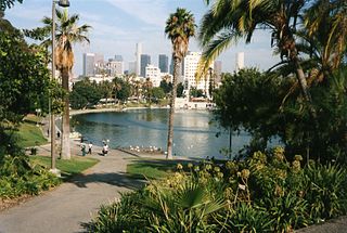
MacArthur Park is a park dating back to the late 19th century in the Westlake neighborhood of Los Angeles. In the early 1940s, it was renamed after General Douglas MacArthur, and later designated City of Los Angeles Historic Cultural Monument #100.

Brentwood is a suburban neighborhood in the Westside region of Los Angeles, California.

Century City is a 176-acre neighborhood and business district in Los Angeles, California, United States. Located on the Westside to the south of Santa Monica Boulevard around 10 miles (16 km) west of Downtown Los Angeles, Century City is one of the most prominent employment centers in the Los Angeles metropolitan area, and its skyscrapers form a distinctive skyline on the city's westside.

Mar Vista is a neighborhood on the Westside of Los Angeles, California. In 1927, Mar Vista became the 70th community to be annexed to Los Angeles. It was designated as an official city neighborhood in 2006.
West Los Angeles is an area within the city of Los Angeles, California, United States. The residential and commercial neighborhood is divided by the Interstate 405 freeway, and each side is sometimes treated as a distinct neighborhood, mapped differently by different sources. Each lies within the larger Westside region of Los Angeles County.

Sawtelle is a neighborhood in West Los Angeles, on the Westside of Los Angeles, California. The short-lived City of Sawtelle grew around the Pacific Branch of the National Home for Disabled Volunteer Soldiers, later the Sawtelle Veterans Home, and was incorporated as a city in 1899. Developed by the Pacific Land Company, and named for its manager W. E. Sawtelle, the City of Sawtelle was independent for fewer than 30 years before it was annexed by the City of Los Angeles.

Athens is an unincorporated community in the South Los Angeles region of Los Angeles County, California, numbering 9,101 people in the 2000 census. It is the home site of Los Angeles Southwest College.

Del Rey is a neighborhood in the Westside of Los Angeles, surrounded on three sides by Culver City, California. Within it lie a police station, the largest public housing complex on the Westside, a public middle school and six public elementary schools. It is served by a neighborhood council and a residents association. Del Rey, with a 32,000+ population, has a large number of military veterans.

Wilshire Boulevard (['wɪɫ.ʃɚ]) is a prominent 15.83 mi (25.48 km) boulevard in the Los Angeles area of Southern California, extending from Ocean Avenue in the city of Santa Monica east to Grand Avenue in the Financial District of downtown Los Angeles. One of the principal east–west arterial roads of Los Angeles, it is also one of the major city streets through the city of Beverly Hills. Wilshire Boulevard runs roughly parallel to Santa Monica Boulevard from Santa Monica to the west boundary of Beverly Hills. From the east boundary, it runs a block south of Sixth Street to its terminus.

Olympic Boulevard is a major arterial road in Los Angeles, California. It stretches from Ocean Avenue on the western end of Santa Monica to East Los Angeles—farther than Wilshire Boulevard and most other streets.

The Westgate Line was a suburban route operated by the Pacific Electric Railway from 1911 to 1940. This line was one of four lines connecting Downtown Los Angeles and Santa Monica that did not run through Hollywood. The line is notable for taking a circuitous route towards its end, along San Vicente Boulevard, mainly because it was built to encourage construction of new homes near Pacific Palisades.
The Los Angeles County Civil Defense and Disaster Commission is a nine-member panel created in 1961 to prepare for the threat of nuclear war, in addition to the perennial Los Angeles County concerns of flooding, landslides, fires, and earthquakes.

Pershing Square is a small public park in Downtown Los Angeles, California, one square block in size, bounded by 5th Street to the north, 6th Street to the south, Hill Street to the east, and Olive Street to the west. Originally dedicated in 1866 by Mayor Cristóbal Aguilar as La Plaza Abaja, the square has had numerous names over the years until it was finally dedicated in honor of General John J. Pershing in 1918.

Bob Hope Patriotic Hall is a 10-story building that was dedicated as Patriotic Hall by the Los Angeles Board of Supervisors in 1925 and was built to serve veterans of Indian Wars, Spanish–American War, World War I and to support the Grand Army of the Republic. It serves as the home of the Los Angeles County Department of Military and Veterans Affairs. Patriotic hall was rededicated to honor of Bob Hope and renamed "Bob Hope Patriotic Hall" on November 12, 2004.

Manchester Square is a neighborhood in Los Angeles, California, within the South Los Angeles region.

Gloria Molina Grand Park, commonly known as Grand Park, is a 12-acre (4.9 ha) park located in the civic center of Los Angeles, California. First developed in 1966 as the 'Civic Center Mall' with plazas, fountains and a Court of Flags, it is now a part of the larger redevelopment known as the Grand Avenue Project, with its first phase having opened in July 2012. Grand Park is part of a joint venture by the city of Los Angeles and Los Angeles County. It was designed and built by the Los-Angeles–based multidisciplinary design firm Rios Clementi Hale Studios. Park programming and entertainment, security and upkeep are maintained by the nearby Los Angeles Music Center.

Austin Conrad Shafer was a schoolteacher, property owner and real estate agent who served on the Los Angeles, California, Common Council, the legislative branch of the city, in the 19th century and was president of that city's school board.

Baldwin Hills/Crenshaw is a neighborhood in the south region of the city of Los Angeles defined by the Mapping L.A. project of the Los Angeles Times in 2009. The Times combines two city-designated neighborhoods: the upscale, principally home-owning Baldwin Hills residential district to the south and the more concentrated apartment area of the Crenshaw district to the north.

The 2017 Los Angeles elections were held on March 7, 2017 in Los Angeles, California. Voters elected candidates in a nonpartisan primary, with runoff elections scheduled for May 16, 2017. Eight of the fifteen seats in the City Council were up for election, as well as the offices of Mayor, City Attorney and City Controller. Four ballot measures were also on the ballot.


