
Chatsworth is a suburban neighborhood in Los Angeles, California, in the San Fernando Valley.
Newbury Park is a populated place and town in Ventura County, California, United States. Most of it lies within the western Thousand Oaks city limits, while unincorporated areas include Casa Conejo and Ventu Park. The town is located in Southern California around 8 miles (13 km) from the Pacific Ocean and has a mild year-round climate, scenic mountains, and environmental preservation. About 28,000 residents of Thousand Oaks reside in Newbury Park.

The Puente Hills are a chain of hills, one of the lower Transverse Ranges, in an unincorporated area in eastern Los Angeles County, California, in the United States. The western end of the range is often referred to locally as the Whittier Hills.

Located in Los Angeles County, California's San Gabriel Valley, the Boy Scouts of America's San Gabriel Valley Council (#40) was one of five councils serving Los Angeles County. It was headquartered in Pasadena.

The Verdugo Mountains, also known as the Verdugo Hills or simply The Verdugos, are a small, rugged mountain range of the Transverse Ranges system in Los Angeles County, California. Located just south of the western San Gabriel Mountains, the Verdugo Mountains region incorporates the cities of Burbank, Glendale, Pasadena, and La Cañada Flintridge; the unincorporated communities of Altadena and La Crescenta-Montrose; as well as the City of Los Angeles neighborhood of Sunland-Tujunga.

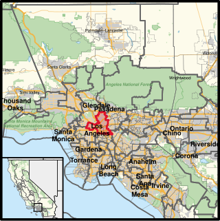
The Santa Monica Mountains National Recreation Area is a United States national recreation area containing many individual parks and open space preserves, located primarily in the Santa Monica Mountains of Southern California. The SMMNRA is in the greater Los Angeles region, with two thirds of the parklands in northwest Los Angeles County, and the remaining third, including a Simi Hills extension, in southeastern Ventura County.

Montecito Heights is a neighborhood in the Northeast Los Angeles region of Los Angeles, California. The population in 2000 was estimated at 16,768.

Ernest Eugene Debs was an American politician. He was a California State Assembly member from 1942 to 1947, a Los Angeles city councilman from 1947 to 1958 and a member of the Los Angeles County Board of Supervisors from 1958 to 1974.

The Arroyo Seco Bicycle Path is an approximately 2-mile (3.2 km) long Class I bicycle path along the Arroyo Seco river channel and canyon in the Northeast Los Angeles region of Los Angeles County, California. It parallels the Arroyo Seco Parkway, which is also a part of the canyon.
California's 34th congressional district is a U.S. congressional district in California. Located in Los Angeles County, the district is represented by Democrat Jimmy Gomez. Its previous U.S. representative, Democrat Xavier Becerra of Los Angeles, resigned January 24, 2017, to become attorney general of California. Representative Gomez won a special election on June 6, 2017, beating fellow Democrat Robert Lee Ahn to replace Becerra. He was later sworn in as the district's U.S. representative on July 11, 2017.

Cypress Park is a densely populated neighborhood of 10,000+ residents in Northeast Los Angeles, California. Surrounded by hills on three sides, it sits in the valley created by the Los Angeles River and the Arroyo Seco. It is the site of the Rio de Los Angeles State Park, the Los Angeles River Bike Path and other recreational facilities. It hosts one private and four public schools.

Kenneth Hahn State Recreation Area, or Kenneth Hahn Park, is a state park unit of California in the Baldwin Hills Mountains of Los Angeles. The park is managed by the Los Angeles County Department of Parks and Recreation. As one of the largest urban parks and regional open spaces in the Greater Los Angeles Area, many have called it "L.A.'s Central Park". The 401-acre (1.62 km2) park was established in 1984. The land hs previously been the Baldwin Hills Dam, which catastrophically collapsed in 1963.

Eaton Canyon is a major canyon beginning at the Eaton Saddle near Mount Markham and San Gabriel Peak in the San Gabriel Mountains in the Angeles National Forest, United States. Its drainage flows into the Rio Hondo river and then into the Los Angeles River. It is named after Judge Benjamin S. Eaton, who lived in the Fair Oaks Ranch House in 1865 not far from Eaton Creek.
Bell Canyon Park is a large open-space regional park located in the Simi Hills at the western end of the San Fernando Valley in West Hills, Los Angeles and Bell Canyon, California. Bell Creek, a primary tributary to the Los Angeles River, flows through the park with riparian zone vegetation along its natural banks. The geographic landmark Escorpión Peak is high above it to the south in adjacent El Escorpión Park.
The San Rafael Hills are a mountain range in Los Angeles County, California. They are one of the lower Transverse Ranges, and are parallel to and below the San Gabriel Mountains, adjacent to the San Gabriel Valley overlooking the Los Angeles Basin.

Wildwood Regional Park is a suburban regional park in the western Simi Hills and Conejo Valley, in Ventura County, California. It is located in western Thousand Oaks, northern Newbury Park, and southern Moorpark.
Satwiwa was a former Chumash village in the Santa Monica Mountains of Newbury Park, California. The current Satwiwa Native American Indian Culture Center is operated by the National Park Service in cooperation with the Friends of Satwiwa. Satwiwa has been inhabited by Chumash Indians for over 10,000 years. It is situated at the foothills of Boney Mountain, a sacred mountain for the Chumash.

Arroyo Conejo Open Space is a 302-acre (122 ha) open space reserve in the western Simi Hills in northern Newbury Park, Ventura County, California. Most of it is part of the 250-acre (100 ha) Arroyo Conejo Nature Preserve.

Mount Clef Ridge is a 1,076 ft volcanic mountain in Thousand Oaks, California. It is a volcanic outcrop that resulted from lava eruptions 30 million years ago. The ridge was formerly under ownership by the Janss Corporation, but was acquired by the Conejo Recreation and Park District (CRPD) in 1967. Trails here are available from Santa Rosa Valley, Newbury Park and Wildwood Regional Park. Although being a major feature of Wildwood, it occupies its own open-space area bordering Wildwood's northern boundaries. Mount Clef Ridge Open Space Area occupies 212 acres. From the ridge are great panoramic views of Santa Rosa Valley, Conejo Valley, Hill Canyon, as well as the Santa Susana-, Santa Monica- and Topatopa Mountains. The open-space area is home to plants such as coastal sage scrub, chaparral, Lyon's pentachaeta and Conejo dudleya. The fauna includes mountain lions, deer, coyotes, gray foxes, and more.


