Northridge is a neighborhood in the San Fernando Valley region of the City of Los Angeles. The community is home to California State University, Northridge, and the Northridge Fashion Center.

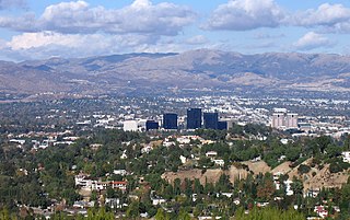
Woodland Hills is a neighborhood bordering the Santa Monica Mountains in the San Fernando Valley region of Los Angeles, California.

Van Nuys is a neighborhood in the central San Fernando Valley region of Los Angeles, California. Home to Van Nuys Airport and the Valley Municipal Building, it is the most populous neighborhood in the San Fernando Valley.

Manhattan Beach is a city in southwestern Los Angeles County, California, United States, on the Pacific coast south of El Segundo, west of Hawthorne and Redondo Beach, and north of Hermosa Beach. As of the 2010 census, the population was 35,135.

Rosemead is a city in Los Angeles County, California, United States. As of the 2010 census, it had a population of 53,764. Rosemead is part of a cluster of cities, along with Alhambra, Arcadia, Temple City, Monterey Park, San Marino, and San Gabriel, in the west San Gabriel Valley with a growing Asian-American population.

Hesperia is a city in San Bernardino County, California, United States. It is located 35 miles (56 km) north of downtown San Bernardino in Victor Valley and surrounded by the Mojave Desert. Because of its relatively high elevation and the unique and moderate weather patterns of the region, Hesperia is part of what is locally called the High Desert. The name "Hesperia" means "western land". The 2019 census report estimates that the city has a population of 95,750.

Canoga Park is a neighborhood in the San Fernando Valley region of the City of Los Angeles, California. Before the Mexican–American War, the district was part of a rancho, and after the American victory it was converted into wheat farms and then subdivided, with part of it named Owensmouth as a town founded in 1912. It joined Los Angeles in 1917 and was renamed Canoga Park on March 1, 1931, after Canoga, New York.

Chatsworth is a suburban neighborhood in the City of Los Angeles, California, in the San Fernando Valley.

Reseda is a neighborhood in the San Fernando Valley region of Los Angeles, California. It was founded in 1912, and its central business district started developing in 1915. The neighborhood was devoted to agriculture for many years. Earthquakes struck the area in 1971 San Fernando earthquake and 1994 Northridge earthquake.

Wilmington is a neighborhood in the Harbor region of Los Angeles, California, covering 9.14 square miles (23.7 km2).

Watts is a neighborhood in southern Los Angeles, California. It is located within the South Los Angeles region, bordering the cities of Lynwood and South Gate to the east and southeast, respectively, and the unincorporated community of Willowbrook to the south.

Studio City is a neighborhood in the city of Los Angeles, California, in the southeast San Fernando Valley, just west of the Cahuenga Pass. It is named after the studio lot that was established in the area by film producer Mack Sennett in 1927, now known as Radford Studio Center.

North Hollywood is a neighborhood of Los Angeles, California in the San Fernando Valley with residential blocks and the NoHo Arts District. Arts in NoHo include the El Portal Theatre as well as many new playhouses, art galleries, sound studios, and the Academy of TV Arts and Sciences. North Hollywood is one of the few subway-accessible neighborhoods in Los Angeles.

Pacoima is a neighborhood in Los Angeles, California. Pacoima is one of the oldest neighborhoods in the San Fernando Valley region of LA.

Sun Valley is a neighborhood in Los Angeles, California in the San Fernando Valley region. The neighborhood is known for its overall youthful population and moderate racial diversity. There are three recreation centers in Sun Valley, one of which is a historic site. The neighborhood has thirteen public schools—including John H. Francis Polytechnic High School and Sun Valley High School—and four private schools.

West Hills is a suburban / residential community in the western San Fernando Valley region of the City of Los Angeles, California. The percentage of residents aged 35 and older is among the highest in Los Angeles County.

Granada Hills is a suburban neighborhood in the San Fernando Valley region of the City of Los Angeles. The community has a sports program and a range of city recreation centers. The neighborhood has fourteen public and ten private schools.

Sawtelle is a district in the Westside of the city of Los Angeles, California, partially within the West Los Angeles subregion. It was established in 1899 and named after a manager of the Pacific Land Company who was initially responsible for its development and promotion.

Harbor City is a highly diverse neighborhood in the Harbor region of Los Angeles, California, with a population upward of 36,000 people. Originally part of the Rancho San Pedro Spanish land grant, the 2.58-square-mile (6.7 km2) Harbor City was brought into Los Angeles as a preliminary step in the larger city's consolidation with the port cities of Wilmington and San Pedro.


