Elysian Park, Los Angeles

Last updated

Elysian Park
Elysian park.JPG
Location map Los Angeles.png
Red pog.svg
Elysian Park
Location in Central Los Angeles
USA Los Angeles Metropolitan Area location map.svg
Red pog.svg
Elysian Park
Location in Los Angeles Metropolitan Area
Coordinates: 34°04′50″N118°14′29″W / 34.08056°N 118.24139°W / 34.08056; -118.24139
Country United States
State California
County Los Angeles
CityLos Angeles
Time zone Pacific
Area code 213/323

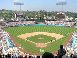
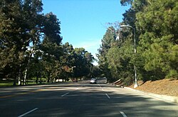
Elysian Park is a neighborhood in Central Los Angeles, California, United States. The city park, Elysian Park, [1] and Dodger Stadium are within the neighborhood, as are an all-boys Catholic high school and an elementary school.

Contents

History

Historic Barlow Respiratory Hospital first opened in 1902. BarlowRespiratoryHospitalHospital.jpg
Historic Barlow Respiratory Hospital first opened in 1902.

On August 2, 1769, the Portolá expedition (the first Europeans to see inland areas of California) camped close to the Los Angeles River near what is now the southeastern corner of the city park. California Historical Landmark #655 (Portolá Trail Campsite) is at the park's Meadow Road entrance.

Geography

Elysian Park neighborhood boundaries Elysian Park neighborhood.png
Elysian Park neighborhood boundaries

According to the Mapping L.A. project of the Los Angeles Times , the Elysian Park neighborhood is flanked on the north and northeast by Elysian Valley, on the east by Lincoln Heights, on the southeast and south by Chinatown and on the southwest, west and northwest by Echo Park. [2] Street and other boundaries are: the northern apex at Exit 138 of the Golden State Freeway, thence southeasterly along the freeway, southerly along the Los Angeles River, westerly along North Broadway, northwesterly along Stadium Way, Academy Road and northerly along Elysian Park Drive. [3] [4]

Demographics

Park entrance, with Broadway on the right, about 1900 North Broadway entrance to Elysian Park, ca.1900 (CHS-163).jpg
Park entrance, with Broadway on the right, about 1900
Waterfall and rock garden behind the former Police Academy, 1956 Elysian Waterfall.jpg
Waterfall and rock garden behind the former Police Academy, 1956
Los Angeles Police Academy, 2005 LAPDacademy.jpg
Los Angeles Police Academy, 2005
Dodger Stadium, 2007 Dodger Stadium.jpg
Dodger Stadium, 2007

The 2000 U.S. census of the Elysian Park neighborhood counted 2,530 residents in its 1.65 square miles, which includes all the city park land as well as Dodger Stadium—an average of 1,538 people per square mile, one of the lowest population densities in Los Angeles county. In 2008 the city estimated that the population had increased to 2,659. The median age for residents was 31, about average for Los Angeles; the percentage of residents aged 11 to 18 were among the county's highest. [3]

The neighborhood was moderately ethnically diverse. The breakdown was Latinos, 47.6%; Asians, 43.4%; whites, 3.1%; blacks, 2.1%, and others, 3.7%. China (32.3%) and Mexico (27.3%) were the most common places of birth for the 54.4% of the residents who were born abroad, a high figure compared to rest of the city. [3]

The median yearly household income in 2008 dollars was $28,263, low for Los Angeles; a high percentage of households had an income of $20,000 or less. The average household size of 3.1 people was high for the city of Los Angeles. Renters occupied 81.9% of the housing stock, and house- or apartment owners 18.1%. [3]

Education

Thirteen percent of the neighborhood residents aged 25 and older had earned a four-year degree by 2000, an average figure for the city. [3]

The schools operating within the Elysian Park neighborhood borders are: [5]

At Solano Avenue Elementary School, things are done right. Parents chip in, teachers stick around for years, children learn, and the surrounding community claims it for their own. The campus is a thing of pride-no graffiti or trash problems here. [6]

Principal John Stoll noted that nearly half the children began school speaking limited English, having been raised in Spanish or Cantonese-speaking homes. The school was "adopted" by the Los Angeles Dodgers in 1980, and it was known for sending the student choir to Dodger Stadium to sing the National Anthem before a ballgame. It is a Solano tradition to hold culmination ceremonies at Dodger Stadium. The class of 2001, however, did not have this privilege. [6]

Park

The park is one of largest in Los Angeles at 600 acres (2.4 km2). [1] It is also the city's oldest park, founded in 1886 by the Elysian Park Enabling Ordinance. It hosted shooting as well as the shooting part of the modern pentathlon event for the 1932 Summer Olympics. [7] In 1964, the Citizens Committee to Save Elysian Park was founded to prevent the City of Los Angeles from constructing the Municipal Convention Center on 62 acres (250,000 m2) of park land.

In 1968, it hosted a hippie "Love-in." [8]

Figueroa Street Tunnels

The Figueroa Street Tunnels take northbound State Route 110 (the Pasadena Freeway) through the park.

Solano Canyon

Solano Canyon is a canyon within Elysian Park and also the name of a residential district at the southern extremity of the Elysian Park neighborhood, directly north of the Los Angeles State Historic Park. The district is bisected near its southern tip by the Arroyo Seco Parkway, and it shares a border with Chinatown.

Solano Canyon was also an old name for a ravine in the Hollywood Hills that was later named Runyon Canyon. [9] [10]

See also

Related Research Articles

<span class="mw-page-title-main">Arleta, Los Angeles</span> Neighborhood of Los Angeles in California, United States

Arleta is a neighborhood in the San Fernando Valley region of the city of Los Angeles, California, with a high percentage of Latino residents and of people born outside the United States.

<span class="mw-page-title-main">Echo Park</span> Neighborhood of Los Angeles, California, US

Echo Park is a neighborhood in the east-central region of Los Angeles, California. Located to the northwest of Downtown, it is bordered by Silver Lake to the west and Chinatown to the east. The culturally diverse neighborhood has become known for its trendy local businesses, as well as its popularity with artists, musicians and creatives. The neighborhood is centered on the eponymous Echo Park Lake.

<span class="mw-page-title-main">Los Feliz, Los Angeles</span> Neighborhood of Los Angeles in California, United States

Los Feliz is a hillside neighborhood in the greater Hollywood area of Los Angeles, California, abutting Hollywood and encompassing part of the Santa Monica Mountains. The neighborhood is named after the Feliz family of Californios who had owned the area since 1795, when José Vicente Feliz was granted Rancho Los Feliz.

<span class="mw-page-title-main">Chinatown, Los Angeles</span> Neighborhood of Los Angeles

Chinatown is a neighborhood in Downtown Los Angeles, California, that became a commercial center for Chinese and other Asian businesses in Central Los Angeles in 1938. The area includes restaurants, shops, and art galleries, but also has a residential neighborhood with a low-income, aging population of about 20,000 residents.

<span class="mw-page-title-main">Granada Hills, Los Angeles</span> Neighborhood of Los Angeles

Granada Hills is a suburban neighborhood in the San Fernando Valley region of the City of Los Angeles. The community has a sports program and a range of city recreation centers. The neighborhood has fourteen public and ten private schools.

<span class="mw-page-title-main">Pico-Union, Los Angeles</span> Neighborhood of Los Angeles in California, United States of America

Pico-Union is a neighborhood in Central Los Angeles, California. The name "Pico-Union" refers to the neighborhood that surrounds the intersection of Pico Boulevard and Union Avenue. Located immediately west of Downtown Los Angeles, it is home to over 40,000 residents.

West Los Angeles is an area within the city of Los Angeles, California. The residential and commercial neighborhood is divided by the Interstate 405 freeway, and each side is sometimes treated as a distinct neighborhood, mapped differently by different sources. Each lies within the larger Westside region of Los Angeles County.

<span class="mw-page-title-main">Glassell Park, Los Angeles</span> Neighborhood of Los Angeles in California, USA

Glassell Park is a neighborhood of Northeast Los Angeles, California, in the San Rafael Hills.

Central Los Angeles is the historical urban region of the City of Los Angeles, California.

<span class="mw-page-title-main">Chavez Ravine</span> Canyon located in Los Angeles, California, United States

Chavez Ravine is a shallow canyon in Los Angeles, California. It sits in a large promontory of hills north of downtown Los Angeles, next to Major League Baseball's Dodger Stadium. Chavez Ravine was named for Julian Chavez, a Los Angeles councilman in the 19th century who originally purchased the land in the Elysian Park area.

<span class="mw-page-title-main">Elysian Valley, Los Angeles</span> Neighborhood of Los Angeles in California, United States of America

Elysian Valley, commonly known as Frogtown, is a neighborhood in Central Los Angeles, California, adjoining the Los Angeles River. It has two parks, both maintained by the Mountains Recreation and Conservation Authority (MRCA). The Frogtown Art Walk is a biennial event managed by the Elysian Valley Arts Collective to celebrate local area artists. Knightsbridge Theatre is a repertory theater company located in the neighborhood.

<span class="mw-page-title-main">Cypress Park, Los Angeles</span> Neighborhood of Los Angeles

Cypress Park is a densely populated neighborhood of 10,000+ residents in Northeast Los Angeles, California. Surrounded by hills on three sides, it sits in the valley created by the Los Angeles River and the Arroyo Seco. It is the site of the Rio de Los Angeles State Park, the Los Angeles River Bike Path and other recreational facilities. It hosts one private and four public schools.

<span class="mw-page-title-main">University Park, Los Angeles</span> Neighborhood of Los Angeles in California, United States

University Park is a 1.17 square miles (3.0 km2) neighborhood in the South Los Angeles region of Los Angeles, California. It is the home of the University of Southern California (USC), Mount St. Mary's College and Hebrew Union College. Additionally, the neighborhood is the home of the historic Shrine Auditorium.

<span class="mw-page-title-main">Valley Glen, Los Angeles</span> Neighborhood of Los Angeles in California, United States of America

Valley Glen is a neighborhood in southeastern section of the San Fernando Valley in Los Angeles, California. Once part of Van Nuys and North Hollywood, it became a separate neighborhood in 1998. Valley Glen is home to Los Angeles Valley College and the Great Wall of Los Angeles, a half-mile-long California-history mural listed on the National Register of Historic Places.

Vermont-Slauson is a 1.44-square-mile neighborhood within the South Los Angeles region of Los Angeles, California.

<span class="mw-page-title-main">Exposition Park, Los Angeles</span> Neighborhood of Los Angeles in California, United States

Exposition Park is a neighborhood in the south region of Los Angeles, California. It is home to Exposition Park, which includes the Los Angeles Memorial Coliseum, BMO Stadium, Exposition Rose Garden and three museums: the California African American Museum, the California Science Center and the Natural History Museum of Los Angeles County. It is also home to a Science Center Academy.

<span class="mw-page-title-main">Hollywood Hills West, Los Angeles</span>

Hollywood Hills West is a neighborhood within Central Los Angeles, California.

Victor Heights, sometimes referred to as the Forgotten Edge, is a neighborhood in Central Los Angeles.

The Los Angeles Aerial Rapid Transit Project is a proposed aerial gondola in Los Angeles, California, United States, connecting Los Angeles Union Station to the Dodger Stadium property with an intermediate station at the Los Angeles State Historic Park. The will also serve Elysian Park adjacent to the stadium.

References

  1. 1 2 Smith, Doug (December 21, 2015). "Recovery plan lies dormant as Elysian Park's exotic trees die off". Los Angeles Times . Retrieved February 4, 2017.
  2. "Central L.A.," Mapping L.A., Los Angeles Times
  3. 1 2 3 4 5 "Elysian Park," Mapping L.A., Los Angeles Times
  4. The Thomas Guide, Los Angeles County, 2004, pp. 594, 634
  5. "Elysian Park Schools", Mapping L.A., Los Angeles Times
  6. 1 2 3 Marilyn Martinez, "Pride at Solano Helps Earn It State Honor," Los Angeles Times, June 18, 1995, page 8
  7. 1932 Summer Olympics official report. Archived July 7, 2010, at the Wayback Machine p. 74.
  8. William Drummond, "Police Arrest 76 Hippies at Easter Love-In Festivities," Los Angeles Times, April 15, 1968, page 3
  9. "M'Cormack Buys Estate," Los Angeles Times, December 22, 1929, page D-1
  10. "M'Cormack's Wife Arrives," Los Angeles Times, January 14, 1931, page A-10