Monterey Formation

Last updated
Monterey Formation
Stratigraphic range: Early to Late Miocene, 18–6  Ma
MontereyFm.jpg
Outcrop of Monterey Formation, Gaviota State Park, California
Typesedimentary
Unit of Los Angeles Basin
Underlies Sisquoc Formation, Capistrano Formation
Overlies Rincon Formation
Lithology
Primary Shale, sandstone
Other Diatomite, oil shale
Location
Coordinates 33°36′N117°42′W / 33.6°N 117.7°W / 33.6; -117.7
Approximate paleocoordinates 33°06′N114°54′W / 33.1°N 114.9°W / 33.1; -114.9
RegionFlag of California.svg  California
CountryFlag of the United States.svg  United States
Type section
Named for Monterey, California
Upper Miocene Migeulito member exposed at Hazard Reef, Montana de Oro State Park. This is the first onshore outcrop of the Monterey Formation south of the Monterey Peninsula. Large exposures continue south along the coast, often associated with important oilfields. Hazard Reef at MdO, SLO.jpg
Upper Miocene Migeulito member exposed at Hazard Reef, Montana de Oro State Park. This is the first onshore outcrop of the Monterey Formation south of the Monterey Peninsula. Large exposures continue south along the coast, often associated with important oilfields.
Tar "volcano" in the old Carpinteria Asphalt mine. Heavy oil exudes from joint cracks in the upturned Monterey shale forming the floor of mine. 1906 photo, U.S. Geological Survey Bulletin 321 Tar volcano in the Carpinteria Asphalt mine.jpg
Tar "volcano" in the old Carpinteria Asphalt mine. Heavy oil exudes from joint cracks in the upturned Monterey shale forming the floor of mine. 1906 photo, U.S. Geological Survey Bulletin 321
External image
Searchtool.svg Out-of-phase detachment folds and low-angle faults in the Monterey Formation at “the Boathouse” section, Vandenberg Air Force Base
Fold in Monterey Formation Monterey-fold.jpg
Fold in Monterey Formation
Fossil crab (Pinnixa galliheri), Monterey Formation, Pacific Grove, California. Carapace is about 3 cm. wide. Pinnixa galliheri 01 SR EC 07-01-04.jpg
Fossil crab (Pinnixa galliheri), Monterey Formation, Pacific Grove, California. Carapace is about 3 cm. wide.
Diatomite (diatomaceous earth), Monterey Formation, from a diatomite quarry just south of Lompoc Diatomite (diatomaceous earth) Monterey Formation at a diatomite quarry just south of Lompoc.jpg
Diatomite (diatomaceous earth), Monterey Formation, from a diatomite quarry just south of Lompoc
Heavy oil saturated sandstone from a unit of the Monterey Formation. Tar Sandstone California.jpg
Heavy oil saturated sandstone from a unit of the Monterey Formation.

The Monterey Formation is an extensive Miocene oil-rich geological sedimentary formation in California, with outcrops of the formation in parts of the California Coast Ranges, Peninsular Ranges, and on some of California's off-shore islands. The type locality is near the city of Monterey, California. [1] The Monterey Formation is the major source-rock for 37 to 38 billion barrels of oil in conventional traps such as sandstones. [2] This is most of California's known oil resources. [3] The Monterey has been extensively investigated and mapped for petroleum potential, and is of major importance for understanding the complex geological history of California. Its rocks are mostly highly siliceous strata that vary greatly in composition, stratigraphy, and tectono-stratigraphic history.

Contents

The US Energy Information Administration (EIA) estimated in 2014 that the 1,750 square mile Monterey Formation could, as an unconventional resource, yield about 600 million barrels of oil, from tight oil contained in the formation, down sharply from their 2011 estimate of a potential 15.4 billion barrels. [4] [5] An independent review by the California Council on Science and Technology found both of these estimates to be "highly uncertain." [6] Despite intense industry efforts, there has been little success to date (2013) in producing Monterey-hosted tight oil/shale oil, except in places where it is already naturally fractured, and it may be many years, if ever, before the Monterey becomes a significant producer of shale oil. [7]

The Monterey Formation strata vary. Its lower Miocene members show indications of weak coastal upwelling, with fossil assemblages and calcareous-siliceous rocks formed from diatoms and coccolithophorids. Its middle and upper Miocene upwelling-rich assemblages, and its unique highly siliceous rocks from diatom-rich plankton, became diatomites, porcelainites, and banded cherts. [8] It generally dates to between 16 and 7 million years ago, but some sections are as early as 18 million years old or as young as 6 million years old. Most of the formation's sediments appear to represent siliceous shales deposited at the edge of the continental shelf or in abyssal plains in the lower to middle bathyal zone. These deep-sea sediments were brought to the surface via tectonic activity. A similar depositional environment and geologic history is known for the adjacent, contemporaneous Modelo Formation, which preserves a similar paleobiota. [9]

Shale oil resources and exploitation

The Monterey formation has long been recognized as the primary source of the oil produced from other formations in Southern California; the Monterey itself has been very productive where it is naturally fractured. Since 2011, the possibility that hydraulic fracturing might make the Monterey Shale productive over large areas has gained widespread public attention. [10]

According to the US Energy Information Administration (EIA) in 2011, the 1,750-square-mile (4,500 km2) Monterey Shale Formation contained more than half of the United States's total estimated technically recoverable shale oil (tight oil contained in shale, as distinct from oil shale) resource, about 15.4 billion barrels (2.45×10^9 m3). [11] In 2012, the EIA revised its recoverable volume downward, to 13.7 billion barrels (2.18×10^9 m3). [12] As of 2013 advances in hydraulic fracturing commonly called "fracking," and the high price of oil resulted in spirited bidding by oil companies for leases. Occidental Petroleum and Venoco were reported to have been major players. The deposit lies 6,000 and 15,000 feet (1,800 and 4,600 m) below the surface.

A widely cited March 2013 study released by the University of Southern California (USC) estimated that if extensive resource play development of the Monterey through hydraulic fracturing were successful, it could generate as many as 2.8 million jobs and as much as $24.6 billion in state and local taxes. [13] However, observers have pointed out that as of 2012, however large its theoretical potential, no one as yet has succeeded in making the Monterey Shale widely economic through hydraulic fracturing; to date it has been economic only in those limited locations already naturally fractured. [14]

Richard Behl, a geology professor who heads the "Monterey And Related Sediments" (MARS) consortium at California State University Long Beach, said that "The [EIA] numbers probably were overblown, but it was a simple method and had an essence of truth." Compared to other shale oil plays, the Monterey formation is much thicker and more laterally extensive, but also much more geologically complex and deformed. See the linked photos from a field trip to Monterey outcrops at Vandenberg Air Force Base. "To say California geology is complex is an understatement. ... The Monterey play is no slam-dunk." [15] In 2013, Bakken shale-oil pioneer Harold Hamm said the Monterey "might have a lot of potential, but there are reasons why it’s not being produced." [16]

J. David Hughes, a Canadian geoscientist and Fellow of Post Carbon Institute, published a report [5] in December 2013 analyzing the assumptions behind the EIA's forecast of Monterey tight oil production and the USC's forecast of resulting job and tax revenue growth. He found the EIA report's assumptions on prospective well productivity to be "extremely optimistic," and the total estimate of 15.4 billion barrels of recoverable oil "highly overstated." He also found the USC study's assumption that development of the Monterey shale could increase California oil production as much as seven-fold to be "unfounded," and the economic projections regarding jobs and tax revenue to be "extremely suspect." [17]

Source rock

The Monterey Formation is considered the source of 84% of the oil in known fields of the San Joaquin Basin, a total of 12.2 billion barrels of oil. Of this, 112 million barrels of oil in known fields is produced from the Monterey itself. [18]

The Monterey formation is the source for such giant oilfields as the Kern River, Elk Hills, Midway-Sunset Oil Field, [15] and probable source for the overlying North and South Belridge Oil Fields.

History

Monterey Formation oil was discovered at the Orcutt Oil Field in the Santa Maria Basin of Santa Barbara County in 1901. This was quickly followed by other Monterey discoveries nearby, including the Cat Canyon Oil Field and Lompoc Oil Field. Each of these early Monterey discoveries depended on natural fractures in the Monterey.

The Monterey Formation is one of the reservoirs in the Elk Hills Oil Field as well as one of the reservoirs (Belridge Diatomite) of the Lost Hills Oil Field, both located in Kern County. [19]

Major Monterey production was also discovered in offshore oil fields, such as the South Ellwood Oil Field in the Santa Barbara Channel, [20] and the Point Arguello Field in the Santa Maria Basin. [21] :3

The North Shafter and Rose oil fields of Kern County, which produce primarily from the Monterey Formation, were discovered in 1983, but attempts to produce the oil have not been highly economic. [22] Some horizontal wells were drilled in the Rose field in the early 2000s, with 2,500-foot lateral lengths and single-stage open-hole fracs; the results were said to be improvements over vertical wells. [23]

Carbon dioxide injection has been tested in the Monterey shale, with mixed results. "The main problem was that the carbon dioxide didn't increase production as much as hoped. ... That could be because the rock formation is so jumbled up, it's hard to find the right spot in which to inject the carbon dioxide." [24]

Oil companies such as Occidental Petroleum are using acidizing to stimulate production in Monterey wells, and other companies are experimenting with proprietary mixes of hydrochloric and hydrofluoric acids. "There's a lot of discussion around the Monterey Shale that it doesn't require fracking, that acidizing will be enough to open up the rock," said Chris Faulkner, chief executive officer of Breitling Oil and Gas. [25]

Opposition and regulation

The Monterey Formation underlies the southern half of the San Joaquin Valley, a prime agricultural region. The possibility of environmental damage has caused some farmers in Kern County to press for close regulation of hydraulic fracturing. [26]

Opponents say that hydraulic fracturing poses risks in the seismically active region. [27]

The California legislature passed a bill regulating fracking in September 2013. Some environmentalists criticised the bill as being too lax. [28] Some environmentalists promised not to rest until fracking is banned completely. Oil industry representatives criticized the bill as too restrictive. The measure was supported by state Sen. Fran Pavley, author of a fracking bill defeated the previous year. [29] The bill, which Governor Jerry Brown promised to sign, provided for disclosure of chemical used, pre-testing of nearby water wells, and a study on environmental and safety issues to be completed by January 2015. [30] Given the very limited success with fracking the Monterey to date, some find the controversy "much ado about little." [16]

In Santa Barbara County, Santa Maria Energy LLC (SME) has proposed a total of 136 wells in the Monterey formation that would use cyclic steam injection to produce tight oil. In 2013, the county planning commission declined its staff's recommendation to approve the project, calling for more study on concerns raised by environmentalists about greenhouse-gas emissions. [24] The County Board of Supervisors approved the proposed project on November 18, 2013, and SME was cited as a model operator and applicant during the proceedings.

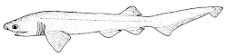
Vertebrate paleofauna

The Monterey Formation preserves a very diverse, primarily marine assemblage of fossil taxa. The most diverse assemblage with the most well-preserved, articulated specimens originates from the presumably Tortonian-aged diatomite deposits exposed in the former Celite Company/Johns Mansfield quarry in Lompoc. However, the age and even formation of these deposits is disputed, as some sources attribute them to the overlying Sisquoc Formation instead. [31]

Cartilaginous fish

Based on the Paleobiology Database: [32]

GenusSpeciesLocationMemberMaterialNotesImages
Carcharhinus C. sp.Leisure WorldA requiem shark. Carcharhinus hemiodon nmfs 2.png
Carcharodon C. arnoldi LompocA relative of the great white shark.
C. hastalis Lamnidae - Isurus hastalis.JPG
C. planus Leisure World
Cetorhinus C. sp.Leisure WorldA relative of the basking shark. Requin pellerin Cetorhinus maximus.jpg
Galeocerdo G. aduncus Aliso ViejoA relative of the tiger shark. Galeocerdo cuvier01.jpg
Hexanchus H. sp.A sixgill shark. Hexanchus griseus (Bluntnose sixgill shark).gif
Isurus I. sp.A mako shark. Isurus oxyrinchus.jpg
Myliobatis sp.Laguna Niguel, Leisure WorldAn eagle ray. Myliobatis hamlyni.jpg
Otodus O. megalodon Altamira Shale, Laguna Niguel, Leisure World, El ToroAltamira Shale, LowerA megatooth shark, the megalodon. Otodus megalodon restoration.png
Sphyrna S. sp.Laguna NiguelA hammerhead shark. Sphyrna couardi.gif
Strongyliscus S. robustusLompocIsolated dorsal spineA bullhead shark.

Bony fish

Based on Fierstine et al (2012) and the Paleobiology Database. [32] [33]

GenusSpeciesLocationMemberMaterialNotesImages
Acipenseridae indet.Mission ViejoDisarticulated partial skeleton.A sturgeon of uncertain affinities.
Achrestogrammus A. achrestusLompocArticulated partial skeletonA presumed greenling.
Araeosteus A. rothiLompocArticulated skeletonsA relative of the prowfish.
Argyropelecus A. affinis Valmonte DiatomiteArticulated skeletons, whereabouts uncertainThe modern Pacific hatchetfish. FMIB 53392 Argyropelecus alfinis Brauer (Valdivia).jpeg
A. bullockii LompocArticulated skeletonsA marine hatchetfish.
Bathylagus B. angelensis Bairdstown, El Modena, LompocArticulated skeletonsA deep-sea smelt. Bathylagus euryops 46786071731.jpg
Bolbocara B. gyrinusLompocArticulated skeletonA grenadier. Bolbocara cropped.png
Chauliodus C. eximius LompocArticulated skeletonsA viperfish. Chauliodus eximus LACM.jpg
Cyclothone (=Rogenio) C. cf. solitudinis BairdstownArticulated skeletonA bristlemouth. Cyclothone microdon1.jpg
C. sp.El Modena
Cynoscion C. eprepes LompocPartial articulated skeletonsA weakfish. Cynoscion nebulosus.jpg
Decapterus D. hopkinsi Articulated skeletonsA mackerel scad. Decapterus punctatus.jpg
Drimys D. defensorLompocArticulated skeletonA barracudina. Drimys Seriola.JPG
Eclipes E. cf. extensusAltamira ShaleArticulated skeletonsA cod.
E. manniLompoc
E. veternusEl Modena
Emmachaere E. rhomalea (=E. rhachites)LompocArticulated skeletons.A goosefish.
Eoscorpius E. primaevusBairdstownLost partial skeletonA presumed sablefish, but potentially a scombrid.
Etringus E. sp.Altamira ShaleScalesA herring.
Eriquius E. plectrodesLompocArticulated skeleton.A surfperch.
Eritima E. evidesBairdstownArticulated skeleton.A cardinalfish.
Euleptorhamphus E. peronides LompocArticulated skeletons.A halfbeak. Attribution to Euleptorhamphus doubted. FMIB 42409 Euleptorhamphus longirostris (Cuvier).jpeg
Euzaphleges E. longurioLompocArticulated skeletons.A euzaphlegid scombroid. Euzaphleges longurio.JPG
Evesthes E. jordaniLompocArticulated skeletons.A large-tooth flounder.
Forfex F. hypuralisPine CanyonArticulated skeletonA forficid beloniform. [34]
Ganoessus G. clepsydraEl ModenaArticulated skeleton.A herring.
G. michaelisButtleArticulated skeleton.
Ganolytes G. aratusLompocArticulated skeleton.A herring.
Gasterosteus G. aculeatus LompocArticulated skeletons.The modern three-spined stickleback. Three-spined stickleback 2.jpg
Hexagrammidae indet.LompocLost headless skeletonA greenling.
Hippoglossoides H. pristinus LompocArticulated skeletonA righteye flounder. Hippoglossoides platessoides.jpg
Hipposyngnathus H. imporcitorLompocArticulated skeletonsA pipefish. Hipposyngnathus neriticus Oligozan Jamna Dolna Polen Ch1817.jpg
Ioscion I. morganiLompocLost partial articulated skeletonAn ioscionid percomorph, potential carangid affinities.
Istiophoridae indet.PredentaryA marlin of uncertain affinities.
Lampanyctus (=Engraulites) L. remifer LompocArticulated skeletons.A lanternfish, formerly considered an anchovy. Lampanyctus macdonaldi.jpg
Lampanyctinae indet.LompocArticulated skeletonA lanternfish.
Lampris L. zatima Lompoc, El Capitan BeachArticulated partial skeletonsA relative of the opah. Lampris zatima 2.jpg
Lirosceles L. elegansLompocArticulated skeletonA cottid sculpin.
Lompoquia L. culveriLompocArticulated skeletonA drumfish. Lompoquia retropes.JPG
L. retropes
Makaira M. nigricans ( sensu lato )Rostral fragmentThe modern blue marlin. Blue marlin (Duane Raver).png
Megalops ? M. vigilax (=Starrias ischyrus)LompocArticulated partial skeletonA tarpon. Tarpon.jpg
Molidae indet.An ocean sunfish.
Ocystias O. sagittaLompocLost articulated skeletonA scombrid.
Ophiodon O. ozymandias LompocPartial articulated segmentA relative of the lingcod. Ophiodon ozymandias.jpg
Opisthonema O. palosverdensis Altamira ShaleArticulated skeletonA thread herring. Opisthonema oglinum RR 090120 0991 (50358043746).jpg
Ozymandias O. gilbertiLompocVertebral segment, skullA scombrid.
Paralichthys P. antiquus LompocHead, body fragmentA large-tooth flounder. FMIB 51521 Summer Flounder; Plaice Paralichthys dentatus.jpeg
Plectrites P. classeniLompocArticulated skeletonsA seabream.
Pleuronichthys P. veliger LompocArticulated skeletonA righteye flounder. Pleuronichthys decurrens, Curlfin Sole, upper surface.jpg
Protanthias P. fossilisLompocArticulated skeletonAn anthias.
Pseudoseriola P. sanctaeineziaeLompocArticulated skeletonA relative of the bluefish.
Quaesita Q. quisquiliaEl ModenaArticulated skeletonsA deep-sea smelt.
Quisque Q. gilbertiEl ModenaSlab with numerous articulated skeletons.A herring.
Rythmias R. starriLompocArticulated skeletonsA seabream.
Sarda S. stockii LompocLost partial skeletonA bonito. Sarda sarda.jpg
Scomber S. cf. japonicus (=Turio wilburi, T. culveri, Thyrsion velox, Pneumatophorus cf. grex)LompocArticulated skeletonsA true mackerel, tentatively referred to the modern chub mackerel. Scomber japonicus drawing.jpg
S. sanctaemonicae (=Auxides sanctaemonicae)Brown's CanyonPartial articulated skeletonA true mackerel. [35]
Scomberessus S. acutillusEl ModenaArticulated skeletons.A saury, possibly conspecific with Scomberesox edwardsi .
Scorpaena S. ensiger El ModenaArticulated skeletonsA scorpionfish. Scorpaena colorata.jpg
Scorpaenidae indet. (= Lutjanus hagari)El ModenaArticulated skeletonA scorpionfish, potentially in Stereolepis .
Sebastes S. apostates LompocArticulated skeletonsA rockfish. Sebastes melanops drawing.jpg
S. davidi
S. defunctus
S. ineziae
S. longirostris
S. porteousi
S. thermophilus
S. velox
Sebastinus S. sp.LompocLost specimenA rockfish.
Seriola S. sanctaebarbarae LompocArticulated skeletonsAn amberjack. Seriola sanctae barbarae.JPG
Syngnathus S. avus Bairdstown, El ModenaArticulated skeletonsA pipefish. Syngnathus rostellatus.jpg
Thyrsocles T. kriegeriLompocArticulated skeletonsA euzaphlegid. Euzaphlegidae.JPG
Thunnus T. starksi LompocArticulated skeleton, head fragmentA tuna. Thunnus thynnus.jpg
T. sp.Altamira ShaleArticulated skeleton, fragments
Trossulus ?T. exoletusLompocLost articulated skeletonsA presumed euzaphlegid.
Tunita T. octaviaEl ModenaPartial articulated skeletonA scombrid.
Xestias X. iratusLompocSkull, articulated skeletonA scombrid.
Xyne X. grexLompocMultiple slabs with numerous articulated skeletonsA herring, known from huge fossilized mass mortality assemblages of spawning individuals.
Xyrinius X. barbaraeCarpenteriaLost skeletonsA herring that may be potentially conspecific with Xyne grex. It is uncertain whether X. houshi is from the Monterey Formation.
X. elmodenaeEl Modena
?X. houshi
Zanteclites Z. hubbsiBairdstownArticulated skeletonA Neotropical silverside.
Zelosis Z. hadleyiEl ModenaArticulated skeletonA halfbeak.

Birds

Based on the Paleobiology Database: [32]

GenusSpeciesLocationMemberMaterialNotesImages
Aethia A. rossmoori LowerAn auklet. Aethia psittacula -Alaska Maritime National Wildlife Refuge, Alaska, USA -two-8.jpg
Alcodes A. ulnulusLowerA Lucas auk.
Cerorhinca C. dubia LompocA relative of the rhinoceros auklet. Wiki-utou2.jpg
C. sp.Lower
Diomedea D. sp.A great albatross. Diomedea exulans - SE Tasmania.jpg
Fulmarus F. hammeri LowerA fulmar. Southern Fulmar - Eaglehawk Neck.jpg
Gavia G. brodkorbi A loon. PacificLoon24.jpg
Limosa L. vanrossemi LompocA godwit. Black-tailed Godwit Uferschnepfe.jpg
Morus M. lompocanus Lompoc, MontereyA gannet. Morus bassanus adu.jpg
M. magnus
M. media (=Miosula) [36] Lompoc
M. willetti (=Sula willetti) [36] Lompoc
Microsula M. sp.LowerA sulid.
Miomancalla M. wetmoreiA Lucas auk. Photograph and line drawing of the skull of Miomancalla howardi compared with the skull of Pinguinus impennis cropped.jpg
Oceanodroma O. sp.A storm petrel.
Osteodontornis O. orriTepusquet CreekA pseudotooth bird. Osteodontornis BW cropped.png
Palaeoscinis P. turdirostrisTepusquet CreekArticulated skeletonA songbird.
Phoebastria P. anglica A North Pacific albatross. Starr 080614-9950 Phoebastria immutabilis.jpg
Procellaridae indet.Tepusquet CreekA tubenose of uncertain affinities.
Praemancalla P. lagunensisLowerA Lucas auk.
Presbychen P. abavusLowerA goose.
Puffinus P. barnesi A shearwater.
P. calhouni Lower Manx Shearwater.JPG
P. diatomicus Lompoc
P. priscus Lower
Uria U. brodkorbi LompocArticulated skeleton.A murre. Bulletin (1971-) (20235204818).jpg

Reptiles

Based on the Paleobiology Database: [32]

GenusSpeciesLocationMemberMaterialNotesImages
Crocodylia indet.A crocodilian of uncertain affinities.
aff. Dermochelys D. sp.LowerA potential relative of the leatherback turtle. Dermochelys coriacea (beach).jpg
Psephophorus P. sp.LowerA dermochelyid sea turtle. Psephophorus sp. LACM.jpg

Mammals

Cetaceans

GenusSpeciesLocationMemberMaterialNotesImages
Albicetus A. oxymycterusSanta BarbaraA physeteroid toothed whale. Skeletal reconstruction in right lateral view of the skull of Albicetus.png
Albireonidae indet.Laguna NiguelAn albireonid toothed whale.
Atocetus A. nasalisLaguna NiguelA kentriodontid toothed whale. Atocetus iquensis skull 4554.jpg
" Balaenoptera " "B." ryani Monterey BayA baleen whale of uncertain affinities.
Delphinapterinae indet.Laguna NiguelA relative of the beluga whale.
Delphinavus D. newhalliSuey RanchA delphinidan of uncertain affinities.
aff. Kampholophos K. sp.El ToroA kentriodontid toothed whale.
Kogiidae indet.Laguna NiguelA relative of the dwarf sperm whales.
Liolithax L. kernensisEl Toro, Leisure WorldA kentriodontid toothed whale.
aff. Messapicetus M. sp.Laguna NiguelA beaked whale. Messapicetus gregarius e M. longirostris.jpg
Mixocetus M. sp.Laguna NiguelA tranatocetid baleen whale. Mixocetus elysius LACM.jpg
Nannocetus N. sp.Laguna NiguelA cetothere.
Norrisanima N. miocaenaLompocA stem-rorqual whale.
Piscolithax P. tedfordiLaguna NiguelA porpoise.
Pithanodelphis P. sp.Laguna Niguel, El ToroA kentriodontid toothed whale.
Salumiphocaena S. stocktoniPalos Verdes, El ToroValmonteA porpoise.
Scaldicetus S. sp.El ToroA physeterid toothed whale. Scaldicetus grandis cropped.jpg
Zarhinocetus Z. errabundusAliso ViejoLowerAn allodelphinid toothed whale.

Perissodactylans

GenusSpeciesLocationMemberMaterialNotesImages
Pliohippus P. sp.El ToroAn equine. Pliohippus pernix Wikipedia Juandertal.jpg

Desmostylians

GenusSpeciesLocationMemberMaterialNotesImages
Desmostylus D. hesperusMonterey Bay, San Luis Obispo, Solvang, Palos Verdes, Leisure WorldA desmostylian. Desmostylus 3 NT.jpg
Jamilcotatus J. boreiosSanta Cruz IslandA desmostylian, not officially named.
Neoparadoxia N. cecilialinaMission ViejoA paleoparadoxiid desmostylian. Neoparadoxia cecilialina LACM.jpg
Paleoparadoxia P. sp.Palos Verdes, Leisure WorldAltamira ShaleA paleoparadoxiid desmostylian. Palaeoparadoxia recon.jpg

Carnivorans

GenusSpeciesLocationMemberMaterialNotesImages
Allodesmus A. cf. sinanoensisLeisure WorldLowerA desmatophocid pinniped.
Atopotarus A. courseniPalos VerdesAltamiraA desmatophocid pinniped. Atopotarus courseni LACM 1376.jpg
Borophagus B. sp.El ToroA borophagine canid. Borophagus cropped 2.png
Imagotaria I. downsiLompoc, Laguna Niguel, Leisure WorldAn odobenid pinniped. Imagotaria downsi.jpg
Monachinae indet.Laguna NiguelA monachine seal.
Pithanotaria P. starriLompoc, Mission Viejo, Laguna NiguelAn eared seal. Pithanotaria starri.jpg
Pontolis P. barroniAliso ViejoAn odobenid pinniped. Pontolis barroni LACM.jpg
P. cf. magnusPalos VerdesValmonte Pontolis magnus.jpg

Sirenians

GenusSpeciesLocationMemberMaterialNotesImages
Dioplotherium D. allisoniEl ToroLowerA dugongid related to the dugong. Dioplotherium manigaulti.jpg
Dusisiren D. dewanaUpperA dugongid related to Steller's sea cow. Dusisiren jordani life restoration.jpg
D. jordaniLompoc, Moulton Ranch, Laguna Niguel, Leisure World
Metaxytherium M. sp.Leisure WorldA dugongid. Metaxytherium albifontanum.jpg

Paleoflora

The Monterey Formation contains some of the few examples of fossilized non-calcareous algae in the world, which tend to be preserved in diatomite. [37]

Brown algae

GenusSpeciesLocationMemberMaterialNotesImages
Paleocystophora P. suboppositaA brown algae, family Cystoseiraceae.
Paleohalidrys P. californicaA brown algae, family Cystoseiraceae.
P. occidentalis
P. superba
Julescraneia J. grandicornisA kelp, family Lessoniaceae.

Plants (green and red algae)

GenusSpeciesLocationMemberMaterialNotesImages
Caulerpites C. denticulataA green alga.
Chondrides C. flexilisA red alga.
Paleosiphonia P. oppositicladaA red alga.

See also

Related Research Articles

<span class="mw-page-title-main">Barnett Shale</span> Geological formation in Texas, United States

The Barnett Shale is a geological formation located in the Bend Arch-Fort Worth Basin. It consists of sedimentary rocks dating from the Mississippian period in Texas. The formation underlies the city of Fort Worth and underlies 5,000 mi2 (13,000 km2) and at least 17 counties.

<span class="mw-page-title-main">Shale gas</span> Natural gas trapped in shale formations

Shale gas is an unconventional natural gas that is found trapped within shale formations. Since the 1990s, a combination of horizontal drilling and hydraulic fracturing has made large volumes of shale gas more economical to produce, and some analysts expect that shale gas will greatly expand worldwide energy supply.

<span class="mw-page-title-main">Bakken formation</span> Geological rock formation known for crude oil and gas production

The Bakken Formation is a rock unit from the Late Devonian to Early Mississippian age occupying about 200,000 square miles (520,000 km2) of the subsurface of the Williston Basin, underlying parts of Montana, North Dakota, Saskatchewan and Manitoba. The formation was initially described by geologist J. W. Nordquist in 1953. The formation is entirely in the subsurface, and has no surface outcrop. It is named after Henry O. Bakken (1901–1982), a farmer in Tioga, North Dakota, who owned the land where the formation was initially discovered while drilling for oil.

<span class="mw-page-title-main">Bend Arch–Fort Worth Basin</span> Major petroleum producing region in Texas and Oklahoma

The Bend Arch–Fort Worth Basin Province is a major petroleum producing geological system which is primarily located in North Central Texas and southwestern Oklahoma. It is officially designated by the United States Geological Survey (USGS) as Province 045 and classified as the Barnett-Paleozoic Total Petroleum System (TPS).

<span class="mw-page-title-main">South Belridge Oil Field</span> Oil field in Kern County, California, USA

The South Belridge Oil Field is a large oil field in northwestern Kern County, San Joaquin Valley, California, about forty miles west of Bakersfield. Discovered in 1911, and having a cumulative production of over 2,000 million barrels (320,000,000 m3) of oil equivalent at the end of 2023, it is the fourth-largest oil field in California, after the Midway-Sunset Oil Field, Kern River Oil Field, and Wilmington Oil Field, and is the sixth-most productive field in the United States. Its estimated remaining reserves, as of the end of 2008, were around 494 million barrels (78,500,000 m3) out of approximately 10.2 billion barrels of original oil in place, and it had 6,253 active wells. The principal operator on the field was Aera Energy LLC, a joint venture between Royal Dutch Shell and ExxonMobil. Additionally, the field included the only onshore wells in California owned and operated by ExxonMobil.

<span class="mw-page-title-main">Lost Hills Oil Field</span> Kern County, California oilfield

The Lost Hills Oil Field is a large oil field in the Lost Hills Range, north of the town of Lost Hills in western Kern County, California, in the United States.

<span class="mw-page-title-main">Oil reserves in the United States</span> Oil reserves located in the United States

Within the petroleum industry, proven crude oil reserves in the United States were 44.4 billion barrels (7.06×10⁹ m3) of crude oil as of the end of 2021, excluding the Strategic Petroleum Reserve.

<span class="mw-page-title-main">Shale gas in the United States</span>

Shale gas in the United States is an available source of unconventional natural gas. Led by new applications of hydraulic fracturing technology and horizontal drilling, development of new sources of shale gas has offset declines in production from conventional gas reservoirs, and has led to major increases in reserves of U.S. natural gas. Largely due to shale gas discoveries, estimated reserves of natural gas in the United States in 2008 were 35% higher than in 2006.

The Duvernay Formation is a stratigraphical unit of Frasnian age in the Western Canadian Sedimentary Basin.

<span class="mw-page-title-main">Utica Shale</span> Stratigraphical unit of Upper Ordovician age in the Appalachian Basin

The Utica Shale is a stratigraphical unit of Upper Ordovician age in the Appalachian Basin. It underlies much of the northeastern United States and adjacent parts of Canada.

<span class="mw-page-title-main">Shale gas in Canada</span>

The inclusion of unconventional shale gas with conventional gas reserves has caused a sharp increase in estimated recoverable natural gas in Canada. Until the 1990s success of hydraulic fracturing in the Barnett Shales of north Texas, shale gas was classed as "unconventional reserves" and was considered too expensive to recover. There are a number of prospective shale gas deposits in various stages of exploration and exploitation across the country, from British Columbia to Nova Scotia.

<span class="mw-page-title-main">Tight oil</span> Light crude oil in petroleum-bearing formations

Tight oil is light crude oil contained in unconventional petroleum-bearing formations of low permeability, often shale or tight sandstone. Economic production from tight oil formations requires the same hydraulic fracturing and often uses the same horizontal well technology used in the production of shale gas. While sometimes called "shale oil", tight oil should not be confused with oil shale or shale oil. Therefore, the International Energy Agency recommends using the term "light tight oil" for oil produced from shales or other very low permeability formations, while the World Energy Resources 2013 report by the World Energy Council uses the terms "tight oil" and "shale-hosted oil".

<span class="mw-page-title-main">Fracking</span> Fracturing bedrock by pressurized liquid

Hydraulic fracturing is a well stimulation technique involving the fracturing of formations in bedrock by a pressurized liquid. The process involves the high-pressure injection of "fracking fluid" into a wellbore to create cracks in the deep rock formations through which natural gas, petroleum, and brine will flow more freely. When the hydraulic pressure is removed from the well, small grains of hydraulic fracturing proppants hold the fractures open.

Shale gas is an unconventional natural gas produced from shale, a type of sedimentary rock. Shale gas has become an increasingly important source of natural gas in the United States over the past decade, and interest has spread to potential gas shales in Canada, Europe, Asia, and Australia. One analyst expects shale gas to supply as much as half the natural gas production in North America by 2020.

<span class="mw-page-title-main">Bazhenov Formation</span> Oil-bearing rock formation in Russia

The Bazhenov Formation or Bazhenov Shale is a geological stratum in the West Siberian basin. It was formed from sediment deposited in a deep-water sea in Tithonian–early Berriasian time. The sea covered more than one million square kilometers in the central basin area. Highly organic-rich siliceous shales were deposited during this time in anoxic conditions on the sea bottom. The sea was connected to the world's oceans and contains trace minerals derived from dissolved minerals and organic materials similar to sapropel sediments in the Black Sea.

<span class="mw-page-title-main">Cline Shale</span>

As of 2013 the Cline Shale, also referred to as the "Wolfcamp/Cline Shale", the "Lower Wolfcamp Shale", or the "Spraberry-Wolfcamp shale", or even the "Wolfberry", is a promising Pennsylvanian oil play east of Midland, Texas which underlies ten counties: Fisher, Nolan, Sterling, Coke, Glasscock, Tom Green, Howard, Mitchell, Borden and Scurry counties. Exploitation is projected to rely on hydraulic fracturing.

an organic rich shale, with Total Organic Content (TOC) of 1-8%, with silt and sand beds mixed in. It lies in a broad shelf, with minimal relief and has nice light oil of 38-42 gravity with excellent porosity of 6-12% in thickness varying 200 to 550 feet thick.

<span class="mw-page-title-main">Eagle Ford Group</span> Texas rock formation associated with petroleum deposits

The Eagle Ford Group is a sedimentary rock formation deposited during the Cenomanian and Turonian ages of the Late Cretaceous over much of the modern-day state of Texas. The Eagle Ford is predominantly composed of organic matter-rich fossiliferous marine shales and marls with interbedded thin limestones. It derives its name from outcrops on the banks of the West Fork of the Trinity River near the old community of Eagle Ford, which is now a neighborhood within the city of Dallas. The Eagle Ford outcrop belt trends from the Oklahoma-Texas border southward to San Antonio, westward to the Rio Grande, Big Bend National Park, and the Quitman Mountains of West Texas. It also occurs in the subsurface of East Texas and South Texas, where it is the source rock for oil found in the Woodbine, Austin Chalk, and the Buda Limestone, and is produced unconventionally in South Texas and the "Eaglebine" play of East Texas.

<span class="mw-page-title-main">Tuscaloosa Marine Shale</span>

The Tuscaloosa Marine Shale is a 90-million-year-old Late Cretaceous sedimentary rock formation across the Gulf Coast region of the United States.

<span class="mw-page-title-main">Fracking in Canada</span>

Fracking in Canada was first used in Alberta in 1953 to extract hydrocarbons from the giant Pembina oil field, the biggest conventional oil field in Alberta, which would have produced very little oil without fracturing. Since then, over 170,000 oil and gas wells have been fractured in Western Canada. Fracking is a process that stimulates natural gas or oil in wellbores to flow more easily by subjecting hydrocarbon reservoirs to pressure through the injection of fluids or gas at depth causing the rock to fracture or to widen existing cracks.

<span class="mw-page-title-main">Unconventional (oil and gas) reservoir</span> Type of hydrocarbon reservoir

Unconventional reservoirs, or unconventional resources are accumulations where oil and gas phases are tightly bound to the rock fabric by strong capillary forces, requiring specialized measures for evaluation and extraction.

References

  1. M.N. Bramlette (1946). The Monterey Formation of California and the Origin of its Siliceous Rocks. USGS Professional Paper 212.
  2. Monterey Shale Gets New Look, AAPG Explorer, Nov 2010. Accessed 03/21/2014
  3. The Monterey Formation of California: New Research Directions by Richard J. Behl, California State University, Long Beach, 2012
  4. Sahagun, Louis (May 21, 2014) "U.S. officials cut estimate of recoverable Monterey Shale oil by 96%" Los Angeles Times
  5. 1 2 Drilling California: A Reality Check on the Monterey Shale J. David Hughes, Post Carbon Institute, 2013.
  6. CCST Releases Report on Well Stimulation Technologies, August 28, 2014. "The 2011 EIA report suggested 15-billion barrels of recoverable oil in these source rocks but a subsequent 2014 correction by EIA reduced the estimate to 0.6 billion barrels. Recovering these resources would certainly require well stimulation. However, Berkeley Lab investigators found no reports of successful production from these deep source rocks and had questions about the EIA estimation methodology. The study's review of the two resource projections from deep source rocks in the Monterey Formation developed by EIA concluded that both these estimates are highly uncertain."
  7. So Much Shale Oil—but So Hard to Get, Wall Street Journal, Updated Sept. 23, 2013
  8. Burnett, William C.; Stanley R. Riggs, eds. (1990-05-25). Phosphate Deposits of the World: Volume 3, Neogene to Modern Phosphorites (Cambridge Earth Science Series). Cambridge University Press. ISBN   0-521-33370-9.
  9. Knott, Jeffrey R.; Sarna-Wojcicki, Andrei M.; Barron, John A.; Wan, Elmira; Heizler, Lynn; Martinez, Priscilla (2022-09-26), Aiello, Ivano W.; Barron, John A.; Ravelo, A. Christina (eds.), "Tephrochronology of the Miocene Monterey and Modelo Formations, California", Understanding the Monterey Formation and Similar Biosiliceous Units across Space and Time, Geological Society of America, pp. 187–214, doi:10.1130/2022.2556(08), ISBN   978-0-8137-2556-7 , retrieved 2024-11-18
  10. Josie Garthwaite, Monterey Shale shakes up California energy future, National Geographic, 27 May 2013.
  11. US Energy Information administration, Review of emerging resources US shale gas and shale oil plays, July 2011.
  12. US Energy Information Administration, Geology and technology drive estimates of technically recoverable resources, 20 July 2012.
  13. The Monterey Shale and California’s Economic Future University of Southern California, USC Price School of Public Policy, (March 2013.
  14. David Brown, The Monterey Shale, big deal, or big bust?, AAPG Explorer, Nov, 2012.
  15. 1 2 Monterey Shale Continues to Tempt and Tease, AAPG Explorer, February 2013
  16. 1 2 Monterey/Santos: Operators struggle with cracking code, World Oil, Nov. 2013 (Google title to bypass paywall)
  17. Purd'homme, Alex (December 29, 2013) "'Fracking' the Monterey Shale -- boon or boondoggle?" Los Angeles Times
  18. Magoon and others, , US Geological Survey, Professional Paper 1713, Chapter 8.
  19. S.A. Reid and J.L. McIntyre, Monterey Formation porcelanite reservoirs of the Elk Hills Field, Kern County, California, American Association of Petroleum Geologists Bulletin, 2001, v.85 n.1 p.169-189.
  20. Pressure buildup analysis in a naturally fractured reservoir, 1983.
  21. Mero, W.E., Thurston, S.P., and Kropschot, R.E., 1992, The Point Arguello Field, In Giant Oil and Gas Fields of the Decade, 1978–1988, AAPG Memoir 54, Halbouty, M.T., editor, Tulsa: American Association of Petroleum Geologists, ISBN   0891813330
  22. Robert Sterling and others, North Shafter and Rose fields, Houston Geological Society Bulletin, 2003.
  23. W.A. Minner and others, Rose field, Society of Petroleum Engineers, 2003.
  24. 1 2 Oil Firms Seek to Unlock Big California Field, Wall Street Journal, Sept. 22, 2013
  25. Acidizing could rival fracking in Monterey Shale, San Francisco Chronicle, August 25, 2013
  26. Norimitsu Onishi (June 1, 2013). "Fracking Tests Ties Between California 'Oil and Ag' Interests". The New York Times. Retrieved June 2, 2013.
  27. Norimitsu Onishi (February 3, 2013). "Vast Oil Reserve May Now Be Within Reach, and Battle Heats Up". The New York Times. Retrieved February 4, 2013.
  28. Mark Melincoe, Brown says he'll sign California bill regulating fracking, Bloomberg, 12 Sept, 2013.
  29. Stephen Stock, California fracking law has huge holes, critics argue, NBC Bay Area, 13 Sept. 2013
  30. California lawmakers approve fracking bill, NBC Bay Area, 12 Sept. 2013.
  31. "PBDB Collection". paleobiodb.org. Retrieved 2024-12-16.
  32. 1 2 3 4 Czaplewski, John J. "PBDB Navigator". paleobiodb.org. Retrieved 2024-09-24.
  33. California Academy of Sciences (1890). Occasional papers of the California Academy of Sciences. California Academy of Sciences. San Francisco : California Academy of Sciences.
  34. "PBDB Collection". paleobiodb.org. Retrieved 2024-09-24.
  35. "PBDB Taxon". paleobiodb.org. Retrieved 2024-09-24.
  36. 1 2 Ksepka, Daniel T.; Tennyson, Alan J. D. (2024-01-01). "Oldest fossil record of Sulidae from New Zealand". Journal of Ornithology. 165 (1): 277–280. doi:10.1007/s10336-023-02117-0. ISSN   2193-7206.
  37. "Monterey Formation - Algae". ucmp.berkeley.edu. Retrieved 2024-11-18.