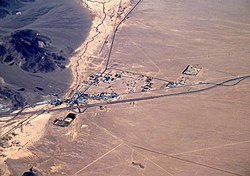
For the census-designated place formerly called Baker, see Boron, California.
Baker, California | |
---|---|
Coordinates: 35°16′33″N116°03′57″W / 35.27583°N 116.06583°W | |
Country | United States |
State | California |
County | San Bernardino |
Area | |
• Total | 2.69 sq mi (6.96 km2) |
• Land | 2.69 sq mi (6.96 km2) |
• Water | 0.00 sq mi (0.00 km2) 0% |
Elevation | 942 ft (287 m) |
Population (2020) | |
• Total | 442 |
• Density | 164.43/sq mi (63.49/km2) |
Time zone | UTC-8 (Pacific) |
• Summer (DST) | UTC-7 (PDT) |
ZIP codes | 92309 |
Area codes | 442/760 |
FIPS code | 06-03512 |
GNIS feature IDs | 238894, 2628708 |
U.S. Geological Survey Geographic Names Information System: Baker, California |
Baker is a census-designated place located in San Bernardino County, California, US. [2] As of the 2010 census, the CDP had a total population of 735. Baker's ZIP Code is 92309 and the community is within area codes 442 and 760.
Baker was founded as a station on the Tonopah and Tidewater Railroad in 1908 and was named for Richard C. Baker, business partner of Francis Marion Smith in building the railroad. Baker later became president of the T&T himself. [3] [4]
Baker was established in 1929 by Ralph Jacobus Fairbanks (1857–1942), who was an American prospector, entrepreneur, and pioneer who established several towns in the Death Valley area of California, including Fairbanks Springs (1904–05) and Shoshone (1910).
It is the site of a vacant, 223-bed for-profit prison formerly operated by Cornell Corrections which experienced a major riot on December 2, 2003, four weeks before it was temporarily closed. [5] It was permanently closed on December 25, 2009. GEO Group purchased Cornell Companies, its owner, on August 12, 2010. [6] It had previously experienced escapes in August and November 1995 and two on July 15, 1997. [7]
Baker is located at (35.265099, -116.074768). Baker is located in the Mojave Desert at the junction of Interstate 15 and SR 127 (Death Valley Road). Its elevation is approximately 930 feet (283.5 m) above sea level, which is much lower than either Barstow or Las Vegas, due to its location at the southern end of the Death Valley geological depression. The Cronese Mountains are located southwest of the community. According to the United States Census Bureau, the CDP covers an area of 2.7 square miles (7.0 km2), all of it land. Summer temperatures in Baker routinely exceed 110 °F (43.3 °C); 2007 saw a record of 125 °F (51.7 °C).
Climate data for Baker, California. | |||||||||||||
---|---|---|---|---|---|---|---|---|---|---|---|---|---|
Month | Jan | Feb | Mar | Apr | May | Jun | Jul | Aug | Sep | Oct | Nov | Dec | Year |
Record high °F (°C) | 80 (27) | 92 (33) | 96 (36) | 106 (41) | 116 (47) | 119 (48) | 124 (51) | 124 (51) | 119 (48) | 110 (43) | 92 (33) | 82 (28) | 124 (51) |
Mean daily maximum °F (°C) | 63.1 (17.3) | 68.6 (20.3) | 76.8 (24.9) | 84.3 (29.1) | 94.9 (34.9) | 104.8 (40.4) | 110.2 (43.4) | 107.9 (42.2) | 100.2 (37.9) | 87.1 (30.6) | 72.6 (22.6) | 62.4 (16.9) | 86.1 (30.1) |
Mean daily minimum °F (°C) | 34.6 (1.4) | 39.4 (4.1) | 45.6 (7.6) | 51.7 (10.9) | 61.3 (16.3) | 70.2 (21.2) | 77.0 (25.0) | 75.4 (24.1) | 67.2 (19.6) | 54.7 (12.6) | 42.8 (6.0) | 33.9 (1.1) | 54.5 (12.5) |
Record low °F (°C) | 16 (−9) | 21 (−6) | 24 (−4) | 34 (1) | 38 (3) | 43 (6) | 53 (12) | 54 (12) | 42 (6) | 32 (0) | 23 (−5) | 14 (−10) | 14 (−10) |
Average precipitation inches (mm) | 0.47 (12) | 0.71 (18) | 0.51 (13) | 0.20 (5.1) | 0.11 (2.8) | 0.07 (1.8) | 0.27 (6.9) | 0.46 (12) | 0.41 (10) | 0.25 (6.4) | 0.31 (7.9) | 0.41 (10) | 4.19 (106) |
Source: The Western Regional Climate Center [8] |
Census | Pop. | Note | %± |
---|---|---|---|
2010 | 735 | — | |
2020 | 442 | −39.9% | |
U.S. Decennial Census [9] |
The 2010 United States Census [10] reported that Baker had a population of 735. The population density was 273.5 inhabitants per square mile (105.6/km2). The racial makeup of Baker was 302 (41.1%) White (26.5% Non-Hispanic White), [11] 1 (0.1%) African American, 5 (0.7%) Native American, 10 (1.4%) Asian, 14 (1.9%) Pacific Islander, 380 (51.7%) from other races, and 23 (3.1%) from two or more races. Hispanic or Latino of any race were 502 persons (68.3%).
The Census reported that 731 people (99.5% of the population) lived in households, 4 (0.5%) lived in non-institutionalized group quarters, and 0 (0%) were institutionalized.
There were 215 households, out of which 122 (56.7%) had children under the age of 18 living in them, 106 (49.3%) were opposite-sex married couples living together, 39 (18.1%) had a female householder with no husband present, 23 (10.7%) had a male householder with no wife present. There were 29 (13.5%) unmarried opposite-sex partnerships, and 1 (0.5%) same-sex married couples or partnerships. 28 households (13.0%) were made up of individuals, and 4 (1.9%) had someone living alone who was 65 years of age or older. The average household size was 3.40. There were 168 families (78.1% of all households); the average family size was 3.74.
The population was spread out, with 277 people (37.7%) under the age of 18, 80 people (10.9%) aged 18 to 24, 236 people (32.1%) aged 25 to 44, 121 people (16.5%) aged 45 to 64, and 21 people (2.9%) who were 65 years of age or older. The median age was 26.1 years. For every 100 females, there were 113.7 males. For every 100 females age 18 and over, there were 111.1 males.
There were 303 housing units at an average density of 112.7 per square mile (43.5/km2), of which 116 (54.0%) were owner-occupied, and 99 (46.0%) were occupied by renters. The homeowner vacancy rate was 1.7%; the rental vacancy rate was 20.8%. 414 people (56.3% of the population) lived in owner-occupied housing units and 317 people (43.1%) lived in rental housing units.
According to the 2010 United States Census, Baker had a median household income of $33,068, with 9.9% of the population living below the federal poverty line. [12]
Baker's economy is based primarily on tourism. The town is frequently used as a stop for food and fuel by drivers on Interstate 15 between Los Angeles and Las Vegas. Baker is approximately 90 miles (144.8 km) southwest of Las Vegas. It is the last town for those traveling on SR 127 north to Death Valley National Park or south to the Mojave National Preserve. Until recently there was one motel in Baker, the Santa Fe Motel, formerly the Wills Fargo Motel, but as of 2023 the motel has closed.
Baker Airport is a small facility owned by the U.S. Department of the Interior, Bureau of Land Management, but it is managed by San Bernardino County Department of airports [13]
In the California State Legislature, Baker is in the 12th Senate District , represented by Republican Shannon Grove, and in the 34th Assembly District , represented by Republican Tom Lackey. [14]
In the United States House of Representatives, Baker is in California's 23rd congressional district , represented by Republican Jay Obernolte. [15]
Since Baker is an unincorporated community of San Bernardino County, County CEO, Leonard X. Hernandez, would be considered the Chief Administrator of Baker.
Water, Sanitary Sewers, Trash Collection Services, Fire Protection, Television Translators, Road Maintenance, Street Lighting, Park and Recreation is administered by the Baker Community Services District [16]
The Mars Science Laboratory Team tested an engineering model of the Curiosity rover in the desert near Baker. [17]
Clark County is a county located in the U.S. state of Nevada. As of the 2020 census, the population was 2,265,461. Most of the county population resides in the Las Vegas Census County Divisions, which hold 2,196,623 people as of the 2020 Census, across 435 square miles (1,130 km2). It is by far the most populous county in Nevada, and the 11th most populous county in the United States. It covers 7% of the state's land area but holds 73% of the state's population, making Nevada the most centralized state in the United States.
Mohave Valley is an unincorporated community and census-designated place (CDP) in Mohave County, Arizona, United States. The population was 2,693 at the 2020 census. It is geographically connected to Needles, California, Fort Mohave and Bullhead City.
Palo Verde is a census-designated place (CDP) in Imperial County, California. Its name comes from the native desert tree, Palo Verde, which in turn takes its name from the Spanish for stick (palo) and green (verde), sharing its name with the Palo Verde Valley, the valley it is located.
Boron is a census-designated place (CDP) in Kern County, California, United States. Boron is 15 miles (24 km) southwest of Red Rock Mountain at an elevation of 2,467 feet (752 m). The population was 2,086 at the 2020 census, up from 2,025 at the 2000 census. Boron is named after the element boron and is the site of the world's largest source of the boron compound boric acid.
Inyokern is a census-designated place (CDP) in Kern County, California, United States. Its name derives from its location near the border between Inyo and Kern Counties. Inyokern is located 8 miles (13 km) west of Ridgecrest, at an elevation of 2,434 feet (742 m). It is on the western side of the Indian Wells Valley. The population was 988 in the 2020 census, down from 1,099 in the 2010 census. It was a railroad town established along the Southern Pacific railroad's Lone Pine Branch and with WWII became site of the Naval Air Weapons Station China Lake.
Rosamond is an unincorporated community in Kern County, California, US, near the Los Angeles county line. Rosamond is part of Greater Los Angeles and is located in the Mojave Desert just north of Lancaster and Palmdale, two of the largest cities in Antelope Valley. As of the 2010 Census, Rosamond's population was 18,150. For statistical purposes, the United States Census Bureau has defined Rosamond as a census-designated place (CDP).
Joshua Tree is a census-designated place (CDP) in San Bernardino County, California, United States. The population was 7,414 at the 2010 census. At approximately 2,700 feet above sea level, Joshua Tree and its surrounding communities are located in the High Desert of California. The center of the business district in Joshua Tree is on California State Route 62.
Victorville is a city in Victor Valley in San Bernardino County, California. Its population as of the 2020 census was 134,810.
Cal-Nev-Ari is a census-designated place on U.S. Route 95 in Clark County, Nevada, United States, near the state's southernmost point. As of the 2010 census, the town had a population of 244. The town's name is a syllabic abbreviation of California, Nevada and Arizona.
Indian Springs is an unincorporated town and a census-designated place located on U.S. Route 95 next to Creech Air Force Base in northwestern Clark County and southern Nevada.
Mesquite is a city in Clark County, Nevada, United States adjacent to the Arizona state line and 80 miles (130 km) northeast of Las Vegas on Interstate 15. As of the 2020 census, the city had a population of 20,471. The city is located in the Virgin River valley adjacent to the Virgin Mountains in the northeastern part of the Mojave Desert. It is home to a growing retirement community, as well as several casino resorts and golf courses.
Searchlight is an unincorporated town and census-designated place (CDP) in Clark County, Nevada, United States, at the topographic saddle between two mountain ranges. At the 2020 census it had a population of 445.
Spring Valley is an unincorporated town and census-designated place in Clark County, Nevada, United States, located 2 miles (3 km) west of the Las Vegas Strip. The population was 215,597 at the 2020 census. Spring Valley was formed in May 1981.
Winchester is an unincorporated town and census-designated place (CDP) in Clark County, Nevada, United States that contains part of the Las Vegas Strip. It is one of a number of CDPs in the unincorporated urbanized area directly south of Las Vegas. The population was 36,403 at the 2020 census. It is governed by the Clark County Commission with advice from the Winchester Town Advisory Board. "Winchester, NV" does not appear in postal addresses; the United States Postal Service has assigned "Las Vegas, NV" as the place name for the ZIP codes containing Winchester.
Helendale or Silver Lakes is an unincorporated community and census-designated place located in the Victor Valley of the Mojave Desert, within San Bernardino County, California.
Elizabeth Lake is a census-designated place (CDP) and unincorporated community on Elizabeth Lake (lake), in Los Angeles County, California, United States. As of the 2010 census it had a population of 1,756.
Oak Hills is a census-designated place in the Victor Valley of the Mojave Desert, within San Bernardino County, California.
Searles Valley is a census-designated place (CDP) in the Searles Valley of the Mojave Desert, in northwestern San Bernardino County, California.
Pahrump is an unincorporated town located at the southernmost tip of Nye County, Nevada, United States, about 62 miles (100 km) west of Las Vegas. Pahrump lies adjacent to the Nevada–California border and the area had a population of 44,738 as of the 2020 census.
Spring Valley Lake is a census-designated place in the Victor Valley of the Mojave Desert, within San Bernardino County, California. It is located in Apple Valley and San Bernardino County, California on the Mojave River.