Alpine County, California

Last updated

Alpine County, California
Alpine County
Alpine county sign.jpg
Markleeville Trip (20).jpg
20050723-1411-0739-CarsonPass-CA.jpg
Images, from top down, left to right: an Alpine County line road sign during a snow storm, Alpine County Courthouse, a view eastward from Carson Pass overlooking Red Lake
Flag of Alpine County, California.svg
Seal of Alpine County, California.png
Alpine County, California
Interactive map of Alpine County
Map of California highlighting Alpine County.svg
Location in the state of California
CountryFlag of the United States.svg United States
State Flag of California.svg  California
Region Sierra Nevada
Incorporated March 16, 1864 [1]
Named for Its location in the Sierra Nevada resembling the (Swiss) Alps
County seat Markleeville
Largest community Alpine Village
Government
  Type Council–CAO
  Body
Board of Supervisors [2]
  • Charles Dobson
  • Ron Hames
  • Irvin Jim
  • Terry Woodrow
  • David Griffith
  ChairIrvin Jim
  Vice ChairTerry Woodrow
  County Administrative OfficerNichole Williamson
Area
  Total743 sq mi (1,920 km2)
  Land738 sq mi (1,910 km2)
  Water4.8 sq mi (12 km2)
Highest elevation
[3]
11,464 ft (3,494 m)
Population
 (2020)
  Total1,204
  Density1.6/sq mi (0.63/km2)
Time zone UTC−8 (Pacific Standard Time)
  Summer (DST) UTC−7 (Pacific Daylight Time)
Area codes 209, 530
Congressional district 3rd
GNIS feature ID 1675840
Website www.alpinecountyca.gov

Alpine County is a county in the eastern part of the U.S. state of California located within the Sierra Nevada on the state border with Nevada. As of the 2020 Census, the population was 1,204, [4] making it California's least populous county. The county seat and largest community is Markleeville. [5]

Contents

History

Woods Lake, situated in Alpine County Woods-Lake-Sierra-Nevada-Alpine-Janine-Sprout.jpg
Woods Lake, situated in Alpine County

The Washoe people, a Great Basin tribe, inhabited the Sierra Nevada on the CaliforniaNevada boundary, with the Hung A Lel Ti band populating the Diamond Valley including what would become Alpine County.

Kit Carson and John C. Frémont were among the first explorers to bring nationwide attention to the Sierra Nevada region in their winter 1844 expedition, though the first known westerners to actually explore the area were Jedediah Smith and Joseph R. Walker. Though gold spurred the infrastructural development of Alpine County, the Comstock Lode found near Virginia City, Nevada and the subsequent silver boom was what triggered Alpine County's growth, even attracting gold miners from neighboring Nevada. [6] This prompted the formation on March 16, 1864, from parts of Amador County, Calaveras County, El Dorado County, Mono County and Tuolumne County. [1] It was named Alpine County due to its resemblance to the Swiss Alps. [7] At its formation, it had a population numbering around 11,000. By 1868, however, the local silver mines had proven unfruitful of replicating the Nevada silver boom and the population fell to about 685 in the 1870 Census, a decline that would steadily continue through the 1950s. [8] [9] Silver Mountain (established as Köngsberg) [10] was designated the county seat following the discovery of silver nearby by Norwegian miners. [11] Markleeville, established by Jacob Markley in 1861 as a 160-acre claim encompassing a bridge and toll station, became the new county seat in 1875. [1] The collapse of the silver industry and closing of mines was finalized with the demonetization of silver in 1873, and Silver Mountain was abandoned by 1886, with most businesses moving to Markleeville. [6] [11]

Following the devastating collapse of the silver industry, the population began quickly declining until the 1950s, falling to an all-time low of 241 in 1930. [9] During this time, its small economy limited the county to serving primarily as a trading center for the local farming and lumber industries, as well as fishing and hunting during the 1930s. Several lots in the county were left vacant. [6]

Alpine County finally managed an economic rebound with the construction of the Bear Valley and Kirkwood ski resorts in the late 1960s, the latter of which is split with Amador County. The population shot up from 484 in 1970 to 1,097 in 1980, a 126.65% increase, and has remained around that level. [9] The three national forests (Eldorado, Humboldt–Toiyabe and Stanislaus) means 96% of the county is owned by the federal government, [12] providing opportunities for economic development and tourism to the skiing resorts as well as historical tourism and outdoor recreation. [13]

Geography

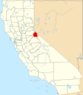
According to the United States Census Bureau, the county has an area of 743 square miles (1,920 km2), of which 738 square miles (1,910 km2) is land and 4.8 square miles (12 km2) (0.7%) is water. [14] The federal government owns about 96% of Alpine County, the highest percentage in California, [12] including three national forests: Eldorado (54,318 acres, or 7.81% of the 695,098-acre total), Stanislaus (119,805 acres, or 13.32% of the 899,427 acre-total) and Humboldt–Toiyabe (233,962 acres, or 3.72% of the 6,290,945 acre-total). [15] [16]

Adjacent counties

National protected areas

Demographics

Historical population
CensusPop.Note
1870 685
1880 539−21.3%
1890 66723.7%
1900 509−23.7%
1910 309−39.3%
1920 243−21.4%
1930 241−0.8%
1940 32334.0%
1950 241−25.4%
1960 39764.7%
1970 48421.9%
1980 1,097126.7%
1990 1,1131.5%
2000 1,2088.5%
2010 1,175−2.7%
2020 1,2042.5%
2023 (est.)1,141 [17] −5.2%
U.S. Decennial Census [18]
1790–1960 [19] 1900–1990 [20]
1990–2000 [21] 2010 [22] 2020 [23]

2020 census

Alpine County, California - Demographic Profile
(NH = Non-Hispanic)
Race / EthnicityPop 2010 [22] Pop 2020 [23] % 2010% 2020
White alone (NH)85280172.51%66.53%
Black or African American alone (NH)0100.00%0.83%
Native American or Alaska Native alone (NH)21021417.87%17.77%
Asian alone (NH)7120.60%1.00%
Pacific Islander alone (NH)000.00%0.00%
Some Other Race alone (NH)170.09%0.58%
Mixed Race/Multi-Racial (NH)21761.79%6.31%
Hispanic or Latino (any race)84847.15%6.98%
Total1,1751,204100.00%100.00%

Note: the US Census treats Hispanic/Latino as an ethnic category. This table excludes Latinos from the racial categories and assigns them to a separate category. Hispanics/Latinos can be of any race.

2019 American Community Survey estimates

2019 American Community Survey 5-Year Estimates: Alpine County, California
Population [24]
GroupEstimatePercent
Total population1,039
Sex [24]
GroupEstimatePercent
Male55453.32%
Female48546.68%
Sex ratio (males per 100 females)92.8114.2
Age [24]
GroupEstimatePercent
Under 5 years444.23%
5 to 9 years504.81%
10 to 14 years737.03%
15 to 19 years595.68%
20 to 24 years434.14%
25 to 29 years212.02%
30 to 34 years454.33%
35 to 39 years868.28%
40 to 44 years625.97%
45 to 49 years131.25%
50 to 54 years434.14%
55 to 59 years737.03%
60 to 64 years11611.16%
65 to 69 years979.34%
70 to 74 years13312.80%
75 to 79 years545.20%
80 to 84 years40.38%
85 years and over232.21%
Median age (years)52.2
Age dependency ratio 97.2
Old-age dependency ratio59.0
Child dependency ratio38.1
Race [25]
GroupEstimatePercent
White59957.65%
Black or African American90.87%
American Indian or Alaska Native35333.97%
--- Cherokee tribal grouping00.00%
--- Chippewa tribal grouping00.00%
--- Navajo tribal grouping00.00%
--- Sioux tribal grouping00.00%
Asian100.96%
--- Asian Indian00.00%
--- Chinese00.00%
--- Filipino00.00%
--- Japanese00.00%
--- Korean00.00%
--- Vietnamese50.48%
--- Other Asian50.48%
Native Hawaiian and other Pacific Islander60.58%
--- Native Hawaiian60.58%
--- Guamanian or Chamorro00.00%
--- Samoan00.00%
--- Other Pacific Islander00.00%
Some other race90.87%
Two or more races535.10%
--- White and Black or African American00.00%
--- White and American Indian and Alaska Native474.52%
--- White and Asian00.00%
--- Black or African American and

American Indian and Alaska Native

00.00%
Hispanic or Latino and race [25]
GroupEstimatePercent
Hispanic or Latino13012.51%
--- Mexican11611.16%
--- Puerto Rican00.00%
--- Cuban00.00%
--- Other Hispanic or Latino141.35%
Not Hispanic or Latino90987.49%
--- White55153.03%
--- Black or African American90.87%
--- American Indian and Alaska Native31430.22%
--- Asian100.96%
--- Native Hawaiian and other Pacific Islander00.00%
--- Some other race00.00%
--- Two or more races252.41%
Voting Age Population [25]
GroupEstimatePercent
Voting Age Population81578.44%
--- Male42841.19%
--- Female38737.25%
Nativity and citizenship status [26]
GroupEstimatePercent
Native (born in the United States)98694.90%
--- Born in California52450.43%
--- Born in other U.S. state44642.93%
------ Northeastern state656.26%
------ Midwestern state656.26%
------ Southern state413.95%
------ Western state27526.47%
--- Native born outside U.S. states161.54%
------ Puerto Rico 00.00%
------ U.S. Island Areas 00.00%
------ Born abroad of American parents 161.54%
Foreign Born535.10%
--- Naturalized U.S. citizen302.89%
------ Europe 161.54%
------ Asia 141.35%
------ Africa 00.00%
------ Oceania 00.00%
------ Latin America 00.00%
------ Northern America 00.00%
--- Not a U.S. citizen232.21%
------ Europe 00.00%
------ Asia 50.48%
------ Africa 00.00%
------ Oceania 00.00%
------ Latin America 181.73%
------ Northern America 00.00%

2010 Census

The 2010 United States Census reported that Alpine County had a population of 1,175. The racial makeup of Alpine County was 881 (75.0%) White, 0 (0.0%) African American, 240 (20.4%) Native American, 7 (0.6%) Asian, 0 (0.0%) Pacific Islander, 19 (1.6%) from other races, and 28 (2.4%) from two or more races. Hispanic or Latino of any race were 84 persons (7.1%). [27]

2000

As of the census [28] of 2000, there were 1,208 people, 483 households, and 295 families residing in the county. The population density was 2 people per square mile (0.77 people/km2). There were 1,514 housing units at an average density of 2 per square mile (0.77/km2). The racial makeup of the county was 73.7% White, 0.6% Black or African American, 18.9% Native American, 0.3% Asian, 0.1% Pacific Islander, 1.4% from other races, and 5.1% from two or more races. 7.8% of the population were Hispanic or Latino of any race. 12.1% were of German, 12.1% Irish, 9.3% English, 6.5% American and 5.7% Italian ancestry. 95.0% spoke English, 3.1% Spanish and 2.0% Washo as their first language.

There were 483 households, out of which 25.5% had children under the age of 18 living with them, 43.9% were married couples living together, 11.0% had a female householder with no husband present, and 38.9% were non-families. 27.7% of all households were made up of individuals, and 5.4% had someone living alone who was 65 years of age or older. The average household size was 2.50 and the average family size was 2.96.

In the county, the population was spread out, with 22.8% under the age of 18, 10.4% from 18 to 24, 27.5% from 25 to 44, 29.3% from 45 to 64, and 9.9% who were 65 years of age or older. The median age was 39 years. For every 100 females there were 110.8 males. For every 100 females age 18 and over, there were 117.2 males.

The median income for a household in the county was $41,875, and the median income for a family was $50,250. Males had a median income of $36,544 versus $25,800 for females. The per capita income for the county was $24,431. About 12.0% of families and 19.5% of the population were below the poverty line, including 27.4% of those under age 18 and 10.1% of those age 65 or over.

Politics

Throughout the 20th century, Alpine County was a Republican stronghold in presidential and congressional elections. From 1892 until 2004, the only Democrat to carry Alpine County in a presidential election was Franklin Roosevelt in 1932 and 1936. In 1964, Alpine was one of only five counties in the state to back Barry Goldwater. It was among the five most Republican counties in the entire nation in 1892, [29] 1908, [30] 1920, [31] and 1928. [32] Warren Harding and Herbert Hoover gained over ninety percent of the county's vote. However, Alpine has become more of a Democratic county in recent elections. It was carried by John Kerry in 2004 and has stayed in the Democratic column since. No Republican has won a majority in the county since 1988.

United States presidential election results for Alpine County, California
Year Republican Democratic Third party
No.%No.%No.%
2020 24432.71%47663.81%263.49%
2016 21736.05%33455.48%518.47%
2012 23636.09%38959.48%294.43%
2008 25236.31%42260.81%202.88%
2004 31144.37%37353.21%172.43%
2000 28147.95%26545.22%406.83%
1996 26443.00%25842.02%9214.98%
1992 22235.18%21534.07%19430.74%
1988 30655.43%23041.67%162.90%
1984 26456.65%19441.63%81.72%
1980 25455.10%13328.85%7416.05%
1976 22550.34%18942.28%337.38%
1972 36663.54%19533.85%152.60%
1968 15059.29%8332.81%207.91%
1964 12457.67%9142.33%00.00%
1960 13276.74%4023.26%00.00%
1956 11479.72%2920.28%00.00%
1952 14888.10%2011.90%00.00%
1948 10676.81%2518.12%75.07%
1944 9868.53%4531.47%00.00%
1940 12566.49%6232.98%10.53%
1936 7446.54%8553.46%00.00%
1932 5347.32%5650.00%32.68%
1928 4994.23%35.77%00.00%
1924 5288.14%58.47%23.39%
1920 6491.43%68.57%00.00%
1916 6072.29%2327.71%00.00%
1912 810.00%3442.50%3847.50%
1908 7587.21%1112.79%00.00%
1904 7489.16%910.84%00.00%
1900 6982.14%1517.86%00.00%
1896 4049.38%3948.15%22.47%
1892 6575.58%1719.77%44.65%

In November 2008, Alpine was one of just three counties in California's interior in which voters rejected Proposition 8, the ballot initiative to amend the California Constitution to reject the legal extension of the title of marriage to same-sex couples. Alpine voters rejected Proposition 8 by 56.4 percent to 43.6 percent. The other interior counties in which Proposition 8 failed to receive a majority of votes were neighboring Mono and Yolo counties. [33]

Alpine County is in California's 3rd congressional district , represented by Republican Kevin Kiley. [34] In the State Assembly, the county is in the 5th Assembly District , represented by Republican Joe Patterson. [35] In the State Senate, the county is in the 1st Senate District , represented by Republican Brian Dahle. [36]

Due to its low population density, Alpine County votes entirely by mail, one of two counties in California which do so. [37] In the June 2014 primary elections, about 22% of registered voters statewide went to the polls; in Alpine County, the number was almost 70%, the highest of any county in the state. [38]

Stonewall Nation

Gay activist Don Jackson seriously presented an idea for taking over Alpine County at a December 28, 1969, gay liberation conference in Berkeley, California. The project, which eventually became known as Stonewall Nation, was subsequently surreptitiously used by fellow gay activists Morris Kight and Don Kilhefner as an agitation and propaganda tool with no serious plans to bring the idea to fruition. [39] Once the political theater aspect of the project was exposed, planning for the Alpine County project came to a halt even among demoralized true believers.

Posse Comitatus controversy

In the late 1970s, the Posse Comitatus organization attempted to take over Alpine County by settling there and fielding candidates in local elections. [40] The Posse thought winning local elections in Alpine County was their best opportunity to take control of a single county. The group fielded a candidate for sheriff and registered fictitious voters using post office boxes and vacant lots as their addresses. Six people were prosecuted for voter fraud, the false registrations were thrown out, and the incumbent sheriff was re-elected. [41]

Voter registration statistics

Transportation

Major highways

Airport

Alpine County Airport is a general aviation airport in the Eastern Sierra about 4 miles (6.4 km) from the town of Markleeville. The airport consists of a simple airstrip with an apron for small light aircraft to park. The airport has no buildings, no lights, and is rarely used. The airport is popular with astronomers due to the clear, dark skies.[ citation needed ]

Communities

Locator map of communities in Alpine County Map of Alpine County, California.png
Locator map of communities in Alpine County

All communities in Alpine County are unincorporated:

The only other counties in California with no incorporated cities are Mariposa and Trinity.

Population ranking

The population ranking of the following table is based on the 2020 census of Alpine County. [43]

county seat

RankCity/Town/etc.Municipal typePopulation (2020 Census)
1 Woodfords Community [44] AIAN 225
2 Alpine Village CDP224
3 Mesa Vista CDP217
4 Markleeville CDP191
5 Kirkwood (partially in Amador County )CDP190
6 Bear Valley CDP128

See also

Notes

  1. Percentage of registered voters with respect to total population. Percentages of party members with respect to registered voters follow.
  2. 1 2 3 4 5 For statistical purposes, defined by the United States Census Bureau as a census-designated place (CDP).

Related Research Articles

<span class="mw-page-title-main">Nevada</span> U.S. state

Nevada is a landlocked state in the Western region of the United States. It borders Oregon to the northwest, Idaho to the northeast, California to the west, Arizona to the southeast, and Utah to the east. Nevada is the 7th-most extensive, the 32nd-most populous, and the 9th-least densely populated of the U.S. states. Nearly three-quarters of Nevada's people live in Clark County, which contains the Las Vegas–Paradise metropolitan area, including three of the state's four largest incorporated cities. Nevada's capital is Carson City. Las Vegas is the largest city in the state.

<span class="mw-page-title-main">Yolo County, California</span> County in California, United States

Yolo County, officially the County of Yolo, is a county located in the northern portion of the U.S. state of California. Yolo County was one of the original counties of California, created in 1850 at the time of statehood. As of the 2020 census, the population was 216,403. Its county seat is Woodland.

<span class="mw-page-title-main">Amador County, California</span> County in California, United States

Amador County is a county located in the U.S. state of California, in the Sierra Nevada. As of the 2020 census, the population was 40,474. The county seat is Jackson. Amador County, located within California's Gold Country, is known as "The Heart of the Mother Lode". There is a substantial viticultural industry in the county.

<span class="mw-page-title-main">Calaveras County, California</span> County in California, United States

Calaveras County, officially the County of Calaveras, is a county in both the Gold Country and High Sierra regions of the U.S. state of California. As of the 2020 census, the population was 45,292. The county seat is San Andreas. Angels Camp is the county's only incorporated city. Calaveras is Spanish for "skulls"; the county was reportedly named for the remains of Native Americans discovered by the Spanish explorer Captain Gabriel Moraga.

<span class="mw-page-title-main">El Dorado County, California</span> County in California, United States

El Dorado County, officially the County of El Dorado, is a county located in the U.S. state of California. As of the 2020 census, the population was 191,185. The county seat is Placerville. The county is part of the Sacramento-Roseville-Arden-Arcade, CA Metropolitan Statistical Area. It is located entirely in the Sierra Nevada, from the historic Gold Country in the western foothills to the High Sierra in the east. El Dorado County's population has grown as Greater Sacramento has expanded into the region. Where the county line crosses US 50 at Clarksville, the distance to Sacramento is 15 miles. In the county's high altitude eastern end at Lake Tahoe, environmental awareness and environmental protection initiatives have grown along with the population since the 1960 Winter Olympics, hosted at the former Squaw Valley Ski Resort in neighboring Placer County.

<span class="mw-page-title-main">Inyo County, California</span> County in California, United States

Inyo County is a county in the eastern central part of the U.S. state of California, located between the Sierra Nevada and the state of Nevada. In the 2020 census, the population was 19,016. The county seat is Independence. Inyo County is on the east side of the Sierra Nevada and southeast of Yosemite National Park in Central California. It contains the Owens River Valley; it is flanked to the west by the Sierra Nevada and to the east by the White Mountains and the Inyo Mountains. With an area of 10,192 square miles (26,400 km2), Inyo is the second-largest county by area in California, after San Bernardino County. Almost one-half of that area is within Death Valley National Park. However, with a population density of 1.8 people per square mile, it also has the second-lowest population density in California, after Alpine County.

<span class="mw-page-title-main">Lassen County, California</span> County in California, United States

Lassen County is a county located in the northeastern portion of the U.S. state of California. As of the 2020 census, the population was 32,730. The county seat and only incorporated city is Susanville. Lassen County comprises the Susanville, California, micropolitan statistical area. A former farming, mining, and lumber area, its economy now depends on employment at one federal and two state prisons; the former in Herlong and the latter two in Susanville. In 2007, half the adults in Susanville worked in one of the facilities.

<span class="mw-page-title-main">Madera County, California</span> County in California, United States

Madera County, officially the County of Madera, is located at the geographic center of the U.S. state of California. It features a varied landscape, encompassing the eastern San Joaquin Valley and the central Sierra Nevada, with Madera serving as the county seat. Established in 1893 from part of Fresno County, Madera County reported a population of 156,255 in the 2020 census.

<span class="mw-page-title-main">Mariposa County, California</span> County in California, United States

Mariposa County is a county located in the U.S. state of California. As of the 2020 U.S. Census, the population was 17,131. The county seat is Mariposa. It is located in the western foothills of the Sierra Nevada mountains, north of Fresno, east of Merced, and southeast of Stockton.

<span class="mw-page-title-main">Mono County, California</span> County in California, United States

Mono County is a county located in the east central portion of the U.S. state of California. As of the 2020 census, the population was 13,195, making it the fourth-least populous county in California. The county seat is Bridgeport. The county is located east of the Sierra Nevada between Yosemite National Park and Nevada. The only incorporated town in the county is Mammoth Lakes, which is located at the foot of Mammoth Mountain. Other locations, such as June Lake, are also famous as skiing and fishing resorts. Located in the middle of the county is Mono Lake, a vital habitat for millions of migratory and nesting birds. The lake is located in a wild natural setting, with pinnacles of tufa arising out of the salty and alkaline lake. Also located in Mono County is Bodie, the official state gold rush ghost town, which is now a California State Historic Park.

<span class="mw-page-title-main">Nevada County, California</span> County in California, United States

Nevada County is a county located in the U.S. state of California, in the Sierra Nevada. As of the 2020 census, its population was 102,241. The county seat is Nevada City. Nevada County comprises the Truckee-Grass Valley micropolitan statistical area, which is also included in the Sacramento-Roseville combined statistical area, part of the Mother Lode Country.

<span class="mw-page-title-main">Placer County, California</span> County in California, United States

Placer County, officially the County of Placer, is a county located in the U.S. state of California. As of the 2020 census, the population was 404,739. The county seat is Auburn.

<span class="mw-page-title-main">Sierra County, California</span> County in California, United States

Sierra County is a county located in the U.S. state of California. As of the 2020 census, the population was 3,236, making it California's second-least populous county. The county seat is Downieville; the sole incorporated city is Loyalton. The county is in the Sierra Nevada, northeast of Sacramento on the border with Nevada.

<span class="mw-page-title-main">Tehama County, California</span> County in California, United States

Tehama County is a county located in the northern part of the U.S. state of California. As of the 2020 census, the population was 65,829. The county seat and largest city is Red Bluff.

<span class="mw-page-title-main">Tulare County, California</span> County in California, United States

Tulare County is a county located in the U.S. state of California. As of the 2020 census, the population was 473,117. The county seat is Visalia. The county is named for Tulare Lake, once the largest freshwater lake west of the Great Lakes. Drained for agricultural development, the site is now in Kings County, which was created in 1893 from the western portion of the formerly larger Tulare County.

<span class="mw-page-title-main">Tuolumne County, California</span> County in California, United States

Tuolumne County, officially the County of Tuolumne, is a county located in the U.S. state of California. As of the 2020 census, the population was 55,620. The county seat and only incorporated city is Sonora.

<span class="mw-page-title-main">Yuba County, California</span> County in California, United States

Yuba County is located in north-central Central Valley, California, United States. As of the 2020 U.S. Census, its population was 81,575. Yuba County is included in the Yuba City metropolitan statistical area, which is also included in the Sacramento–Roseville combined statistical area. The county is in the Central Valley region along the Feather River; the county seat is Marysville.

<span class="mw-page-title-main">Douglas County, Nevada</span> County in Nevada, United States

Douglas County is a county in the northwestern part of the U.S. state of Nevada. As of the 2020 census, the population was 49,488. Its county seat is Minden. Douglas County comprises the Gardnerville Ranchos, NV Micropolitan Statistical Area, which is also included in the Reno–Carson City–Fernley, NV Combined Statistical Area.

<span class="mw-page-title-main">Washoe County, Nevada</span> County in Nevada, United States

Washoe County is a county in the U.S. state of Nevada. As of the 2020 census, the population was 486,492, making it Nevada's second-most populous county. Its county seat is Reno. Washoe County is included in the Reno, NV Metropolitan Statistical Area.

<span class="mw-page-title-main">Markleeville, California</span> Census-designated place in California, United States

Markleeville is a census-designated place (CDP) and the county seat of Alpine County, California, United States. The population was 191 at the 2020 census, down from 210 at the 2010 census.

References

  1. 1 2 3 "Alpine County General Plan" (PDF). February 2009. p. 7. Archived from the original (PDF) on July 21, 2011. Retrieved March 10, 2011.
  2. "Board of Supervisors | Alpine County, CA - Official Website".
  3. "Sonora Peak". Peakbagger.com. Retrieved March 30, 2015.
  4. "Alpine County, California". United States Census Bureau . Retrieved January 30, 2022.
  5. "NACo County Explorer". National Association of Counties . Retrieved June 7, 2011.
  6. 1 2 3 "History of Alpine County". Alpine County Chamber of Commerce & Visitor's Center. Archived from the original on November 28, 2020. Retrieved January 19, 2021.
  7. William Bright; Erwin Gustav Gudde (November 30, 1998). 1500 California place names: their origin and meaning. University of California Press. p. 14. ISBN   978-0-520-21271-8 . Retrieved January 20, 2012.
  8. "Historical Census Browser". University of Virginia Library . Archived from the original on March 31, 2016. Retrieved September 24, 2015 via Wayback Machine.
  9. 1 2 3 Forstall, Richard L., ed. (March 27, 1995). "Population of Counties by Decennial Census: 1900 to 1990". United States Census Bureau . Archived from the original on April 10, 2000. Retrieved September 24, 2015.
  10. Durham, David L. (1998). California's Geographic Names: A Gazetteer of Historic and Modern Names of the State. Clovis, Calif.: Word Dancer Press. p. 1202. ISBN   1-884995-14-4.
  11. 1 2 Miller, Donald C. (1978). Ghost Towns of California. Boulder, Colorado: Pruett Publishing Company. p. 104. ISBN   0871085178.
  12. 1 2 Sabalow, Ryan; Kasler, Dale; Reese, Phillip (January 9, 2016). "Rural Californians sympathize with protesters' goals in Oregon standoff". The Sacramento Bee .
  13. "Permits & Other Info". Alpine County Chamber of Commerce. Archived from the original on September 28, 2020. Retrieved November 24, 2021.
  14. "2010 Census Gazetteer Files". United States Census Bureau. August 22, 2012. Retrieved September 24, 2015.
  15. "Land Areas of the National Forest System" (PDF). United States Forest Service . September 30, 2015. Archived (PDF) from the original on January 25, 2016. Retrieved January 20, 2021.
  16. "Table 6 – NFS Acreage by State, Congressional District and County". United States Forest Service . November 18, 2008. Archived from the original on October 18, 2020. Retrieved January 20, 2021 via Wayback Machine.
  17. "Annual Estimates of the Resident Population for Counties: April 1, 2020 to July 1, 2023". United States Census Bureau. Retrieved March 26, 2024.
  18. "Census of Population and Housing from 1790-2000". US Census Bureau . Retrieved January 24, 2022.
  19. "Historical Census Browser". University of Virginia Library. Retrieved September 24, 2015.
  20. Forstall, Richard L., ed. (March 27, 1995). "Population of Counties by Decennial Census: 1900 to 1990". United States Census Bureau. Retrieved September 24, 2015.
  21. "Census 2000 PHC-T-4. Ranking Tables for Counties: 1990 and 2000" (PDF). United States Census Bureau. April 2, 2001. Retrieved September 24, 2015.
  22. 1 2 "P2 HISPANIC OR LATINO, AND NOT HISPANIC OR LATINO BY RACE - 2010: DEC Redistricting Data (PL 94-171) - Alpine County, California". United States Census Bureau .
  23. 1 2 "P2 HISPANIC OR LATINO, AND NOT HISPANIC OR LATINO BY RACE - 2020: DEC Redistricting Data (PL 94-171) - Alpine County, California". United States Census Bureau .
  24. 1 2 3 "2019 ACS Age and Sex 5-Year Estimates". United States Census Bureau . Archived from the original on January 28, 2021. Retrieved January 20, 2021.
  25. 1 2 3 "2019 ACS Demographic and Housing 5-Year Estimates". United States Census Bureau . Archived from the original on January 21, 2021. Retrieved January 20, 2021.
  26. "2019 ACS Place of Birth by Nativity and Citizenship Status 5-Year Estimates". United States Census Bureau . Archived from the original on January 21, 2021. Retrieved January 20, 2021.
  27. "2010 Census P.L. 94-171 Summary File Data". United States Census Bureau.
  28. "U.S. Census website". United States Census Bureau . Retrieved January 31, 2008.
  29. Dave Leip’s Atlas of U.S. Presidential Elections; 1892 Presidential Election Statistics
  30. Dave Leip’s Atlas of U.S. Presidential Elections; 1908 Presidential Election Statistics
  31. Dave Leip’s Atlas of U.S. Presidential Elections; 1920 Presidential Election Statistics
  32. Dave Leip’s Atlas of U.S. Presidential Elections; 1928 Presidential Election Statistics
  33. "California results". Los Angeles Times . September 16, 2014. Retrieved March 26, 2018.
  34. "California's 3rd Congressional District - Representatives & District Map". Civic Impulse, LLC. Retrieved June 9, 2023.
  35. "Members Assembly". State of California. Retrieved March 18, 2013.
  36. "Senators". State of California. Retrieved March 18, 2013.
  37. "No voters at these polls". Los Angeles Times. Retrieved March 17, 2013.
  38. Mehta, Seema (June 17, 2014). "California's least-populous county takes voting seriously". Los Angeles Times.
  39. "In 1970, a Group of Gay Angelenos Plotted to Turn a Rural California County into a Gay Utopia". June 2021.
  40. Levitas, Daniel (January 20, 2004). The Terrorist Next Door: The Militia Movement and the Radical Right. Macmillan. p. 164. ISBN   9781429941808 . Retrieved June 29, 2014.
  41. Duncan, Dayton (September 2000). Miles from Nowhere: Tales from America's Contemporary Frontier. University of Nebraska Press. p. 259. ISBN   0803266278 . Retrieved June 29, 2014.
  42. 1 2 3 4 5 6 7 8 9 10 11 12 "Statement of Vote, November 8, 2022, General Election" (PDF). California Secretary of State. Retrieved May 5, 2023.
  43. "2020 U.S. Census website". United States Census Bureau . Retrieved December 6, 2021.
  44. Staff, Website Services & Coordination. "US Census Bureau 2010 Census Interactive Population Map". www.census.gov. Retrieved March 26, 2018.[ permanent dead link ]

38°35′N119°48′W / 38.58°N 119.80°W / 38.58; -119.80