Mesa Vista, California

Last updated

Mesa Vista
Alpine County California Incorporated and Unincorporated areas Mesa Vista Highlighted.svg
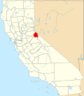
Location in Alpine County and the state of California
Usa edcp location map.svg
Red pog.svg
Mesa Vista
Location in the United States
Coordinates: 38°48′26″N119°47′46″W / 38.80722°N 119.79611°W / 38.80722; -119.79611
Country Flag of the United States (23px).png  United States
State Flag of California.svg  California
County Alpine
Government
   State Senate Megan Dahle (R) [1]
   State Assembly Joe Patterson (R) [2]
   U. S. Congress Mike Thompson (D) [3]
Area
[4]
  Total
4.875 sq mi (12.627 km2)
  Land4.875 sq mi (12.627 km2)
  Water0 sq mi (0 km2)  0%
Elevation
5,486 ft (1,672 m)
Population
 (2020) [5]
  Total
217
  Density45/sq mi (17/km2)
Time zone UTC-8 (Pacific (PST))
  Summer (DST) UTC-7 (PDT)
ZIP code
96120
Area code 530
FIPS code 06-47086
GNIS feature ID 1877181, 2408820

Mesa Vista (corruption of Vista de la Mesa, Spanish for "View of Table") is a census-designated place (CDP) in Alpine County, California, United States. The population was 200 at the 2010 census, up from 182 at the 2000 census.

Contents

Geography

According to the United States Census Bureau, the CDP has a total area of 4.9 square miles (13 km2), all land.

Demographics

2010

The 2010 United States Census [6] reported that Mesa Vista had a population of 200. The population density was 41.0 inhabitants per square mile (15.8/km2). The racial makeup of Mesa Vista was 178 (89.0%) White, 0 (0.0%) African American, 15 (7.5%) Native American, 2 (1.0%) Asian, 0 (0.0%) Pacific Islander, 0 (0.0%) from other races, and 5 (2.5%) from two or more races. Hispanic or Latino of any race were 11 persons (5.5%).

The Census reported that 200 people (100% of the population) lived in households, 0 (0%) lived in non-institutionalized group quarters, and 0 (0%) were institutionalized.

There were 83 households, out of which 21 (25.3%) had children under the age of 18 living in them, 56 (67.5%) were opposite-sex married couples living together, 5 (6.0%) had a female householder with no husband present, 1 (1.2%) had a male householder with no wife present. There were 9 (10.8%) unmarried opposite-sex partnerships, and 0 (0%) same-sex married couples or partnerships. 12 households (14.5%) were made up of individuals, and 3 (3.6%) had someone living alone who was 65 years of age or older. The average household size was 2.41. There were 62 families (74.7% of all households); the average family size was 2.68.

The population was spread out, with 40 people (20.0%) under the age of 18, 4 people (2.0%) aged 18 to 24, 33 people (16.5%) aged 25 to 44, 87 people (43.5%) aged 45 to 64, and 36 people (18.0%) who were 65 years of age or older. The median age was 50.8 years. For every 100 females, there were 94.2 males. For every 100 females age 18 and over, there were 107.8 males.

There were 103 housing units at an average density of 21.1 per square mile (8.2/km2), of which 83 were occupied, of which 73 (88.0%) were owner-occupied, and 10 (12.0%) were occupied by renters. The homeowner vacancy rate was 1.3%; the rental vacancy rate was 28.6%. 176 people (88.0% of the population) lived in owner-occupied housing units and 24 people (12.0%) lived in rental housing units.

2000

As of the census [7] of 2000, there were 182 people, 72 households, and 49 families residing in the CDP. The population density was 10.7 people per square mile (4.1/km2). There were 85 housing units at an average density of 5.0 per square mile (1.9/km2). The racial makeup of the CDP was 87.36% White, 3.30% Black or African American, 6.04% Native American, 0.55% from other races, and 2.75% from two or more races. 4.40% of the population were Hispanic or Latino of any race.

There were 72 households, out of which 30.6% had children under the age of 18 living with them, 58.3% were married couples living together, 8.3% had a female householder with no husband present, and 30.6% were non-families. 23.6% of all households were made up of individuals, and 2.8% had someone living alone who was 65 years of age or older. The average household size was 2.53 and the average family size was 2.98.

In the CDP, the population was spread out, with 23.6% under the age of 18, 3.8% from 18 to 24, 25.8% from 25 to 44, 36.3% from 45 to 64, and 10.4% who were 65 years of age or older. The median age was 44 years. For every 100 females, there were 97.8 males. For every 100 females age 18 and over, there were 101.4 males.

The median income for a household in the CDP was $55,781, and the median income for a family was $65,250. Males had a median income of $33,750 versus $25,625 for females. The per capita income for the CDP was $21,906. None of the families and 1.7% of the population were living below the poverty line, including no under eighteens and 6.3% of those over 64.

Related Research Articles

<span class="mw-page-title-main">Dennehotso, Arizona</span> CDP in Apache County, Arizona

Dennehotso is a census-designated place (CDP) in Apache County, Arizona, United States. The population was 746 at the 2010 census.

<span class="mw-page-title-main">Moenkopi, Arizona</span> Community in Coconino County, Arizona

Moenkopi is a census-designated place (CDP) in Coconino County, Arizona, United States, adjacent to the southeast side of Tuba City off U.S. Route 160. The population was 964 at the 2010 census.

<span class="mw-page-title-main">Second Mesa, Arizona</span> CDP in Navajo County, Arizona

Second Mesa is a census-designated place (CDP) in Navajo County, Arizona, on the Hopi Reservation, atop the 5,700-foot mesa. As of the 2020 census, the CDP population was 843, spread among three Hopi Indian villages, Musungnuvi, Supawlavi, and Songoopavi. The Hopi Cultural Center is on Second Mesa.

<span class="mw-page-title-main">Shongopovi, Arizona</span> CDP in Navajo County, Arizona

Shongopovi is a census-designated place (CDP) in Navajo County, Arizona, United States. It is located on the Second Mesa, within the Hopi Reservation.

<span class="mw-page-title-main">Mesa, California</span> Census-designated place in California, United States

Mesa is a census-designated place (CDP) in Inyo County, California, United States. The population was 251 at the 2010 census, up from 214 at the 2000 census.

<span class="mw-page-title-main">Ford City, California</span> Census-designated place in California, United States

Ford City is a census-designated place (CDP) in Kern County, California, United States. Ford City is located 1 mile (1.61 km) north of Taft, at an elevation of 892 feet (272 m). The population was 4,348 at the 2020 census, up from 4,278 at the 2010 census. It is immediately north of Taft, between the huge Midway-Sunset Oil Field to the southwest, and the almost exhausted Buena Vista Oil Field to the northeast. State Route 119 passes east of town from its junction with SR 33 to the south.

<span class="mw-page-title-main">Mountain Mesa, California</span> Census-designated place in California, United States

Mountain Mesa is a census-designated place (CDP) in Kern County, California, United States. Mountain Mesa is located 2 miles (3.2 km) west of South Lake at an elevation of 2,641 feet (805 m). The population was 777 at the 2010 census, up from 716 at the 2000 census.

<span class="mw-page-title-main">Meadow Vista, California</span> Census-designated place in California, United States

Meadow Vista is a census-designated place (CDP) in Placer County, California, United States. It is part of the Sacramento–Arden-Arcade–Roseville Metropolitan Statistical Area. The population was 3,217 at the 2010 census, up from 3,096 at the 2000 census.

<span class="mw-page-title-main">Tahoe Vista, California</span> Census-designated place in California, United States

Tahoe Vista is a census-designated place located on the north shore of Lake Tahoe in Placer County, California. It is part of the Sacramento–Arden-Arcade–Roseville Metropolitan Statistical Area. The population was 1,433 at the 2010 census, down from 1,668 at the 2000 census.

<span class="mw-page-title-main">Mohawk Vista, California</span> Census-designated place in California, United States

Mohawk Vista is a census-designated place in Plumas County, California, United States. The population was 159 at the 2010 census, up from 121 at the 2000 census.

<span class="mw-page-title-main">Valle Vista, California</span> Place in California, United States

Valle Vista is a unincorporated area in Riverside County, California, United States and is located in the San Jacinto Valley. Valle Vista is adjacent to and east of the cities of San Jacinto and Hemet. The population was 11,036 at the 2010 census, up from 8,356 at the 2000 census. For statistical purposes, the United States Census Bureau has defined Valle Vista as a census-designated place (CDP).

<span class="mw-page-title-main">Vandenberg Village, California</span> Census-designated place in California, United States

Vandenberg Village is a census-designated place (CDP) in the unincorporated area of Santa Barbara County, California, United States. The population was 6,497 at the 2010 census, up from 5,802 at the 2000 census.

<span class="mw-page-title-main">Buena Vista, San Jose</span> Neighborhood of San Jose in Santa Clara, California, United States

Buena Vista is a former census-designated place (CDP) in Santa Clara County, California, United States. The population was 1,704 at the 2000 census. The area is now part of the city of San Jose.

<span class="mw-page-title-main">Mono Vista, California</span> Census-designated place in California, United States

Mono Vista is a census-designated place (CDP) in Tuolumne County, California, United States. The population was 3,127 at the 2010 census, up from 3,072 at the 2000 census.

<span class="mw-page-title-main">Orlo Vista, Florida</span> Census-designated place & Unincorporated community in Florida, United States

Orlo Vista is an unincorporated community and census-designated place in Orange County, Florida, United States. While the spelling "Orlo Vista" is used by the U.S. Postal Service, the community is shown as Orlovista on federal maps. The population of the Orlovista census-designated place was 6,123 at the 2010 census. It is part of the Orlando–Kissimmee Metropolitan Statistical Area. The boundaries of the Orlovista CDP are West Colonial Drive on the north, Pine Hills Road on the east, Old Winter Garden Road and Carter Street at the Orlando city limits on the south, and Hiawassee Road on the west.

<span class="mw-page-title-main">Buena Vista, Michigan</span> Place in Michigan, United States

Buena Vista is an unincorporated community and census-designated place (CDP) within Buena Vista Charter Township, Saginaw County in the U.S. state of Michigan. The U.S. Census Bureau has defined a census-designated place (CDP) with the same name for statistical purposes. The CDP has no official status as a municipality and the boundaries defined by the Census Bureau may not precisely correspond to local understanding of the Buena Vista area. The CDP consists of an area adjacent to the city of Saginaw on its east side and mostly east of Interstate 75. The population was 7,845 at the 2000 census.

<span class="mw-page-title-main">Vista Center, New Jersey</span> Populated place in Ocean County, New Jersey, US

Vista Center is an unincorporated community and census-designated place (CDP) located within Jackson Township in Ocean County, in the U.S. state of New Jersey. As of the 2010 United States Census, the CDP's population was 3,689.

<span class="mw-page-title-main">Chula Vista, Maverick County, Texas</span> CDP in Texas, United States

Chula Vista, formerly known as Rosita North, is a census-designated place (CDP) in Maverick County, Texas, United States. The population was 5,100 at the 2020 census.

<span class="mw-page-title-main">Mount Vista, Washington</span> Census-designated place in Washington, United States

Mount Vista is a census-designated place (CDP) in Clark County, Washington, United States. It includes the Vancouver campus of Washington State University. The population of Mount Vista was 10,051 at the 2020 census.

Vista West is a census-designated place (CDP) in Natrona County, Wyoming, United States. It is part of the Casper, Wyoming Metropolitan Statistical Area. The population was 951 at the 2010 census.

References

  1. "Senators". State of California. Retrieved March 18, 2013.
  2. "Members Assembly". State of California. Retrieved March 18, 2013.
  3. "California's 4th Congressional District - Representatives & District Map". Civic Impulse, LLC. Retrieved March 1, 2013.
  4. "2010 Census U.S. Gazetteer Files – Places – California". United States Census Bureau.
  5. "US Census Bureau". www.census.gov. Retrieved August 13, 2024.
  6. "2010 Census Interactive Population Search: CA - Mesa Vista CDP". U.S. Census Bureau. Archived from the original on July 15, 2014. Retrieved July 12, 2014.
  7. "U.S. Census website". United States Census Bureau . Retrieved January 31, 2008.