Bear Valley, Alpine County, California

Last updated
Bear Valley
Bear Valley lodge 2007.jpg
A snowbound cabin in Bear Valley
Alpine County California Incorporated and Unincorporated areas Bear Valley Highlighted.svg
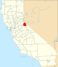
Location in Alpine County and the state of California
Usa edcp relief location map.png
Red pog.svg
Bear Valley
Location in the United States
Coordinates: 38°27′53″N120°02′24″W / 38.46472°N 120.04000°W / 38.46472; -120.04000
Country Flag of the United States (23px).png  United States
State Flag of California.svg  California
County Alpine
Government
   State Senate Brian Dahle (R) [1]
   State Assembly Joe Patterson (R) [2]
   U. S. Congress Mike Thompson (D) [3]
Area
[4]
  Total5.18 sq mi (13.41 km2)
  Land5.16 sq mi (13.35 km2)
  Water0.02 sq mi (0.06 km2)  0.42%
Elevation
7,100 ft (2,164 m)
Population
 (2020)
  Total128
  Density24.83/sq mi (9.59/km2)
Time zone UTC-8 (Pacific (PST))
  Summer (DST) UTC-7 (PDT)
ZIP code
95223
Area code 209
FIPS code 06-04716
GNIS feature ID 1658018, 2407814
Website www.bearvalleymusic.org
Butterfly Mariposa Lily on Fremont Peak, above Bear Valley. Fremont Peak Mariposa Lily.jpg
Butterfly Mariposa Lily on Fremont Peak, above Bear Valley.

Bear Valley is a census-designated place in Alpine County, California, best known as the location of the Bear Valley ski area. The population was 121 at the 2010 census, down from 133 at the 2000 census.

Contents

Geography

Bear Valley is within the Stanislaus National Forest and is reached by State Route 4. According to the United States Census Bureau, the CDP has a total area of 5.2 square miles (13 km2), of which 99.58% is land and 0.42% is water. Although inside Alpine County, Bear Valley Fire Department has contracted with California Department of Forestry, San Andreas, for dispatching.[ citation needed ]

Climate

Bear Valley's central Sierra location and elevation gives it a warm-summer Mediterranean climate that is nearly a subarctic climate. Precipitation is seen for a lot of the year except for the middle of the summer, which can experience rare, but not unseen, thunderstorms. Late fall to early spring brings in most of the yearly precipitation, typically in the form of abundant snowfall. Furthermore, summers are warm with cool nights while winters are cold and relatively long.

Climate data for Bear Valley, California
MonthJanFebMarAprMayJunJulAugSepOctNovDecYear
Mean daily maximum °F (°C)40.0
(4.4)
39.8
(4.3)
43.7
(6.5)
49.2
(9.6)
58.3
(14.6)
67.7
(19.8)
75.8
(24.3)
74.7
(23.7)
69.1
(20.6)
58.6
(14.8)
46.9
(8.3)
39.5
(4.2)
55.3
(12.9)
Daily mean °F (°C)29.8
(−1.2)
29.4
(−1.4)
32.0
(0.0)
36.8
(2.7)
45.5
(7.5)
53.4
(11.9)
60.3
(15.7)
59.4
(15.2)
53.4
(11.9)
44.8
(7.1)
35.3
(1.8)
29.2
(−1.6)
42.4
(5.8)
Mean daily minimum °F (°C)19.6
(−6.9)
19.7
(−6.8)
20.4
(−6.4)
24.5
(−4.2)
32.7
(0.4)
39.0
(3.9)
44.7
(7.1)
44.0
(6.7)
38.6
(3.7)
30.6
(−0.8)
23.7
(−4.6)
18.9
(−7.3)
29.7
(−1.3)
Average precipitation inches (mm)11.80
(300)
12.16
(309)
11.40
(290)
5.94
(151)
4.64
(118)
1.20
(30)
0.44
(11)
0.37
(9.4)
0.91
(23)
3.50
(89)
6.48
(165)
11.70
(297)
70.54
(1,792.4)
Average snowfall inches (cm)75.7
(192)
71.8
(182)
80.6
(205)
30.9
(78)
12.0
(30)
0.5
(1.3)
0.0
(0.0)
0.0
(0.0)
1.0
(2.5)
8.2
(21)
22.4
(57)
73.7
(187)
376.8
(955.8)
Source: PRISM [5]

History

Bear Valley post office opened in 1967. [6]

Demographics

Historical population
CensusPop.Note
2020 128
U.S. Decennial Census [7]
1850–1870 [8] [9] 1880-1890 [10]
1900 [11] 1910 [12] 1920 [13]
1930 [14] 1940 [15] 1950 [16]
1960 [17] 1970 [18] 1980 [19]
1990 [20] 2000 [21] 2010 [22]

2010

The 2010 United States Census [23] reported that Bear Valley had a population of 121. The population density was 23.4 inhabitants per square mile (9.0/km2). The racial makeup of Bear Valley was 119 (98.3%) White, 0 (0.0%) African American, 0 (0.0%) Native American, 1 (0.8%) Asian, 0 (0.0%) Pacific Islander, 0 (0.0%) from other races, and 1 (0.8%) from two or more races. Hispanic or Latino of any race were 1 persons (0.8%).

The Census reported that 121 people (100% of the population) lived in households, 0 (0%) lived in non-institutionalized group quarters, and 0 (0%) were institutionalized.

There were 67 households, out of which 11 (16.4%) had children under the age of 18 living in them, 27 (40.3%) were opposite-sex married couples living together, 0 (0%) had a female householder with no husband present, 0 (0%) had a male householder with no wife present. There were 4 (6.0%) unmarried opposite-sex partnerships, and 0 (0%) same-sex married couples or partnerships. 33 households (49.3%) were made up of individuals, and 4 (6.0%) had someone living alone who was 65 years of age or older. The average household size was 1.81. There were 27 families (40.3% of all households); the average family size was 2.67.

The population was spread out, with 18 people (14.9%) under the age of 18, 7 people (5.8%) aged 18 to 24, 28 people (23.1%) aged 25 to 44, 51 people (42.1%) aged 45 to 64, and 17 people (14.0%) who were 65 years of age or older. The median age was 48.8 years. For every 100 females, there were 124.1 males. For every 100 females age 18 and over, there were 139.5 males.

There were 531 housing units at an average density of 102.6 per square mile (39.6/km2), of which 67 were occupied, of which 47 (70.1%) were owner-occupied, and 20 (29.9%) were occupied by renters. The homeowner vacancy rate was 29.9%; the rental vacancy rate was 75.3%. 94 people (77.7% of the population) lived in owner-occupied housing units and 27 people (22.3%) lived in rental housing units.

2000

As of the census [24] of 2000, there were 133 people, 67 households, and 32 families residing in the CDP. The population density was 25.8 inhabitants per square mile (10.0/km2). There were 431 housing units at an average density of 83.8 per square mile (32.4/km2). The racial makeup of the CDP was 90.23% White, 2.26% Native American, 0.75% from other races, and 6.77% from two or more races. 3.76% of the population were Hispanic or Latino of any race.

There were 67 households, out of which 22.4% had children under the age of 18 living with them, 29.9% were married couples living together, 7.5% had a female householder with no husband present, and 52.2% were non-families. 41.8% of all households were made up of individuals, and none had someone living alone who was 65 years of age or older. The average household size was 1.99 and the average family size was 2.75.

In the CDP the population was spread out, with 16.5% under the age of 18, 8.3% from 18 to 24, 33.1% from 25 to 44, 37.6% from 45 to 64, and 4.5% who were 65 years of age or older. The median age was 42 years. For every 100 females, there were 118.0 males. For every 100 females age 18 and over, there were 131.3 males.

The median income for a household in the CDP was $49,583, and the median income for a family was $44,375. Males had a median income of $36,875 versus $27,500 for females. The per capita income for the CDP was $32,252. There were 14.3% of families and 8.1% of the population living below the poverty line, including 9.1% of those under 18 and 0.0% of those over 64.

See also

Related Research Articles

<span class="mw-page-title-main">Bertsch–Oceanview, California</span> Census-designated place in California, United States

Bertsch–Oceanview is a census-designated place (CDP) in Del Norte County, California, United States. The community is located east of Crescent City, at an elevation of 20 feet (6.1 m), Bertsch–Oceanview has a total area of 5.9 square miles (15 km2) of which 5.5 square miles (14 km2) is land and 0.3 square miles (0.78 km2) is water. Its population is 2,520 as of the 2020 census, up from 2,436 from the 2010 census. The Elk Valley Rancheria Indian reservation is located within Bertsch–Oceanview.

<span class="mw-page-title-main">Bowles, California</span> Census-designated place in California, United States

Bowles is a census-designated place (CDP) in Fresno County, California, United States. The population was 166 at the 2010 census, down from 182 at the 2000 census. Bowles is located 11 miles (18 km) south of downtown Fresno, at an elevation of 279 feet.

<span class="mw-page-title-main">Bear Valley Springs, California</span> Place in California, United States

Bear Valley Springs is a guarded-gate community in Kern County, California, United States. The unincorporated community is in the Tehachapi Mountains and is part of the greater Tehachapi area. The elevation ranges from 4,121 feet (1,256 m) to 6,934 feet (2,113 m). The population fluctuates between a low during the winter months when snow is common, to a high in the summer months when its elevation keeps it much cooler than surrounding areas and major cities. The population was 5,172 at the 2010 census, up from 4,232 at the 2000 census. For statistical purposes, the United States Census Bureau has defined Bear Valley Springs as a census-designated place (CDP). The census definition of the area may not precisely correspond to local understanding of the area with the same name.

<span class="mw-page-title-main">Bodfish, California</span> Census-designated place in California, United States

Bodfish is a census-designated place (CDP) in the southern Kern River Valley of the Southern Sierra Nevada, in Kern County, California.

<span class="mw-page-title-main">Charter Oak, California</span> Census designated place in California, United States

Charter Oak is a census-designated place (CDP) in Los Angeles County, California, approximately 26 miles (42 km) east of downtown Los Angeles. The population was 9,310 at the 2010 census, up from 9,027 at the 2000 census.

<span class="mw-page-title-main">Citrus, California</span> Census-designated place in California, United States

Citrus is a census-designated place (CDP) in Los Angeles County, California, United States. It is located in the San Gabriel Valley between Azusa to the north and west, Glendora to the east, and Covina to the south. The population was 10,866 at the 2010 census, up from 10,581 at the 2000 census. Citrus is named after Citrus Avenue, which passes through the community.

<span class="mw-page-title-main">Tamalpais-Homestead Valley, California</span> Census-designated place in California, United States

Tamalpais-Homestead Valley is a census-designated place (CDP) in Marin County, California, United States. The population was 11,492 at the 2020 census.

<span class="mw-page-title-main">Covelo, California</span> Census-designated place in California, United States

Covelo is a census-designated place (CDP) in Mendocino County, California, United States. Covelo is located 14 miles (23 km) east-northeast of Laytonville, at an elevation of 1,398 feet (426 m). The population was 1,394 at the 2020 census, up from 1,255 at the 2010 census. 405 acres (1.64 km2) of Covelo is part of the Round Valley Indian Reservation.

<span class="mw-page-title-main">Boronda, California</span> Census-designated place in California, United States

Boronda is an unincorporated community and census-designated place (CDP) in Monterey County, California, United States. The population was 1,760 at the 2020 census. Boronda is located directly west of Salinas and is named after José Eusebio Boronda, a Californio ranchero, and located on the lands of his Rancho Rincón del Sanjón.

<span class="mw-page-title-main">Chualar, California</span> Unincorporated community in California, United States

Chualar is an unincorporated community and census-designated place (CDP) in the Salinas Valley of Monterey County, California, United States. Chualar is located 10 miles (16 km) southeast of Salinas, at an elevation of 115 feet (35 m). The population was 1,185 at the 2020 census.

<span class="mw-page-title-main">Alta Sierra, California</span> Census-designated place in Nevada County, California, U.S.

Alta Sierra is a census-designated place (CDP) in Nevada County, California, United States. The population was 6,911 at the 2010 census, up from 6,522 at the 2000 census.

<span class="mw-page-title-main">Cherry Valley, California</span> Census-designated place in California, United States

Cherry Valley is a census-designated place (CDP) in Riverside County, California, United States. The population was 6,362 at the 2010 census, up from 5,891 at the 2000 census. It is situated at the most northwestern point of the San Gorgonio Pass.

<span class="mw-page-title-main">Big Bear City, California</span> Unincorporated community in California, United States

Big Bear City is an unincorporated community in San Bernardino County, California, United States along the east shore of Big Bear Lake and surrounded by the San Bernardino National Forest. It is 27 miles (43 km) northeast of the city of San Bernardino, and immediately east of the incorporated city of Big Bear Lake. For statistical purposes, the United States Census Bureau has defined Big Bear City as a census-designated place (CDP). Its population was 12,304 at the 2010 census, up from 5,779 at the 2000 census. Big Bear City is mostly residential, with smaller houses and cabins laid out in typical square block fashion. Big Bear is on the Pacific Crest Trail.

<span class="mw-page-title-main">Casa de Oro-Mount Helix, California</span> Census designated place in California, United States

Casa de Oro-Mount Helix is a census-designated place (CDP) in the East County region of San Diego County, California.

<span class="mw-page-title-main">Aptos Hills-Larkin Valley, California</span> Census-designated place in California, United States

Aptos Hills-Larkin Valley is an unincorporated community in Santa Cruz County, California, United States. It is identified as one of several small communities with a combined population of 24,402 forming the unincorporated town of Aptos by the local Chamber of Commerce along with:

<span class="mw-page-title-main">China Lake Acres, California</span> Census-designated place in California, United States

China Lake Acres is a census-designated place (CDP) in Kern County, California, United States. The population was 1,876 at the 2010 census, up from 1,761 at the 2000 census.

<span class="mw-page-title-main">Carmel Valley Village, California</span> Unincorporated community in California, United States

Carmel Valley Village is an unincorporated community and census-designated place (CDP) in Monterey County, California, United States. At the time of the 2020 census the CDP population was 4,524, up from 4,407 at the 2010 census. In November 2009, a majority of residents voted against incorporation.

<span class="mw-page-title-main">Green Valley Farms, Texas</span> Census-designated place in Texas, United States

Green Valley Farms is a census-designated place (CDP) in Cameron County, Texas, United States. The population was 655 at the 2020 census, down from 1,272 at the 2010 census. It is part of the Brownsville–Harlingen Metropolitan Statistical Area.

<span class="mw-page-title-main">Bear Valley, Mariposa County, California</span> Census-designated place in California, United States

Bear Valley is a census-designated place in Mariposa County, California, United States. It is located 10.5 miles (16.9 km) south-southeast of Coulterville, at an elevation of 2,054 feet (626 m). Bear Valley has been designated California Historical Landmark #331. The population was 156 at the 2020 census.

<span class="mw-page-title-main">Bear Creek, Merced County, California</span> Census-designated place in California, United States

Bear Creek is a census-designated place in Merced County, California. It is located 3.5 miles (5.6 km) east of Merced, at an elevation of 190 feet. The population was 273 at the 2020 United States census, down from 290 at the 2010 census.

References

  1. "Senators". State of California. Retrieved March 18, 2013.
  2. "Members Assembly". State of California. Retrieved March 18, 2013.
  3. "California's 4th Congressional District - Representatives & District Map". Civic Impulse, LLC. Retrieved March 1, 2013.
  4. "2020 U.S. Gazetteer Files". United States Census Bureau. Retrieved October 30, 2021.
  5. "Bear Valley, CA". PRISM. Retrieved February 19, 2023.
  6. Durham, David L. (1998). California's Geographic Names: A Gazetteer of Historic and Modern Names of the State. Clovis, Calif.: Word Dancer Press. p. 1146. ISBN   1-884995-14-4.
  7. "Decennial Census by Decade". United States Census Bureau .
  8. "1870 Census of Population - Population of Civil Divisions less than Counties - California - Almeda County to Sutter County" (PDF). United States Census Bureau .
  9. "1870 Census of Population - Population of Civil Divisions less than Counties - California - Tehama County to Yuba County" (PDF). United States Census Bureau .
  10. "1890 Census of Population - Population of California by Minor Civil Divisions" (PDF). United States Census Bureau .
  11. "1900 Census of Population - Population of California by Counties and Minor Civil Divisions" (PDF). United States Census Bureau .
  12. "1910 Census of Population - Supplement for California" (PDF). United States Census Bureau .
  13. "1920 Census of Population - Number of Inhabitants - California" (PDF). United States Census Bureau .
  14. "1930 Census of Population - Number and Distribution of Inhabitants - California" (PDF). United States Census Bureau .
  15. "1940 Census of Population - Number of Inhabitants - California" (PDF). United States Census Bureau .
  16. "1950 Census of Population - Number of Inhabitants - California" (PDF). United States Census Bureau .
  17. "1960 Census of Population - General population Characteristics - California" (PDF). United States Census Bureau .
  18. "1970 Census of Population - Number of Inhabitants - California" (PDF). United States Census Bureau .
  19. "1980 Census of Population - Number of Inhabitants - California" (PDF). United States Census Bureau .
  20. "1990 Census of Population - Population and Housing Unit Counts - California" (PDF). United States Census Bureau .
  21. "2000 Census of Population - Population and Housing Unit Counts - California" (PDF). United States Census Bureau .
  22. "2010 Census of Population - Population and Housing Unit Counts - California" (PDF). United States Census Bureau .
  23. "2010 Census Interactive Population Search: CA - Bear Valley CDP". U.S. Census Bureau. Archived from the original on July 15, 2014. Retrieved July 12, 2014.
  24. "U.S. Census website". United States Census Bureau . Retrieved 2008-01-31.

Sources

"Tuolumne-Calaveras Unit: 2005 Pre-Fire Management Plan September 28, 2005 Edition," California Department of Forestry and Fire Protection, 09-28-2005, pp. 16.