Eldorado National Forest | |
---|---|
Location | El Dorado, Amador, Alpine, Placer counties, California, and Douglas County, Nevada, United States |
Nearest city | Placerville, CA |
Coordinates | 38°45′N120°20′W / 38.750°N 120.333°W Coordinates: 38°45′N120°20′W / 38.750°N 120.333°W |
Area | 596,724 acres (2,414.86 km2) |
Established | July 28, 1910 |
Governing body | U.S. Forest Service |
Website | Eldorado National Forest |
Eldorado National Forest is a U.S. National Forest located in the central Sierra Nevada mountain range, in eastern California.
Most of the forest (72.8%) lies in El Dorado County. In descending order of land area the others counties are: Amador, Alpine, and Placer counties in California; and Douglas County in Nevada with 78 acres (320,000 m2). [1] The forest is bordered on the north by the Tahoe National Forest, on the east by the Lake Tahoe Basin Management Unit, on the southeast by the Humboldt–Toiyabe National Forest, and to the south by the Stanislaus National Forest.
Eldorado National Forest headquarters are located in Placerville, California. There are local ranger district offices in Camino, Georgetown, Pioneer, and Pollock Pines. [2]
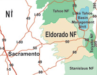
A complicated ownership pattern exists. The parcels of other ownership (private or other agency land) are mostly isolated and surrounded on all sides by government land. An opposite pattern occurs outside of the forest boundary, where several small scattered pieces of national forest lands are separated from the main body and surrounded by lands of other ownership.
The forest ranges in elevation from 1,000 feet (300 m) in the foothills to more than 10,000 feet (3,000 m) above sea level along the Sierra crest. The mountainous topography is broken by the steep canyons of the Mokelumne, Cosumnes, American, and Rubicon rivers. Plateaus of generally moderate relief are located between these steep canyons.
The Desolation Wilderness is located within the forest's boundaries, as is most of the Mokelumne Wilderness (which extends into neighboring Stanislaus National Forest and Humboldt–Toiyabe National Forest).
A cool montane version of Mediterranean climate extends over most of the forest, with warm, dry summers and cold, wet winters.
A wide variety of hardwoods, conifers, shrubs, native grasses, and forbs are represented in the various Eldorado National Forest ecosystems.
The principal plant communities found here are:
Old-growth forests totaling 122,000 acres (49,000 ha) have been identified in the Eldorado National Forest, consisting of: [3]
The major commercial forest species are white fir, red fir, ponderosa pine, Jeffrey pine, sugar pine, Douglas fir, and incense cedar.
Water is a major resource of the Eldorado National Forest. The forest receives about 56 inches (1,400 mm) of precipitation annually. Average annual runoff is about 29 inches (740 mm). This is equal to an annual water yield of 2.4 acre-feet (3,000 m3) per acre (737,000 m³/km²); therefore National Forest lands yield an estimated 1,444,000 acre-feet (1.781×10⁹ m3) annually.
The Eldorado National Forest has a high density of transportation routes, with 2,367 miles (3,809 km) of roads, and 349 miles (562 km) of trails. Roads under Forest Service jurisdiction total 2,158 miles (3,473 km). There are 209 miles (336 km) of county roads, and 400 miles (640 km) of private roads within the National Forest boundaries.
The forest was established on July 28, 1910, from a portion of Tahoe National Forest and other lands. [4]
Sierra National Forest is a U.S. National Forest located on the western slope of central Sierra Nevada in Central California and bounded on the northwest by Yosemite National Park and the south by Kings Canyon National Park. The forest is known for its mountain scenery and beautiful lakes. Forest headquarters are located in Clovis, California. There are local ranger district offices in North Fork and Prather.
Stanislaus National Forest is a U.S. National Forest which manages 898,099 acres of land in four counties in the Sierra Nevada in Northern California. It was established on February 22, 1897, making it one of the oldest national forests. It was named after the Stanislaus River.
The ecology of the Sierra Nevada, located in the U.S. states of California and Nevada, is diverse and complex: the plants and animals are a significant part of the scenic beauty of the mountain range. The combination of climate, topography, moisture, and soils influences the distribution of ecological communities across an elevation gradient from 500 to 14,500 feet. Biotic zones range from scrub and chaparral communities at lower elevations, to subalpine forests and alpine meadows at the higher elevations. Particular ecoregions that follow elevation contours are often described as a series of belts that follow the length of the Sierra Nevada. There are many hiking trails, paved and unpaved roads, and vast public lands in the Sierra Nevada for exploring the many different biomes and ecosystems.
The San Francisco Peaks are a volcanic mountain range in San Francisco volcanic field in north central Arizona, just north of Flagstaff and a remnant of the former San Francisco Mountain. The highest summit in the range, Humphreys Peak, is the highest point in the state of Arizona at 12,633 feet (3,851 m) in elevation. The San Francisco Peaks are the remains of an eroded stratovolcano. An aquifer within the caldera supplies much of Flagstaff's water while the mountain itself is in the Coconino National Forest, a popular recreation site. The Arizona Snowbowl ski area is on the western slopes of Humphreys Peak, and has been the subject of major controversy involving several tribes and environmental groups.
Sequoia National Forest is located in the southern Sierra Nevada mountains of California. The U.S. National Forest is named for the majestic Giant Sequoia trees which populate 38 distinct groves within the boundaries of the forest.
Tahoe National Forest is a United States National Forest located in California, northwest of Lake Tahoe. It includes the 8,587-foot (2,617 m) peak of Sierra Buttes, near Sierra City, which has views of Mount Lassen and Mount Shasta. It is located in parts of six counties: Sierra, Placer, Nevada, Yuba, Plumas and El Dorado. The forest has a total area of 871,495 acres. Its headquarters is in Nevada City, California. There are local ranger district offices in Camptonville, Foresthill, Sierraville and Truckee.
Plumas National Forest is a 1,146,000-acre (4,638 km2) United States National Forest located at the northern terminus of the Sierra Nevada, in northern California. The Forest was named after its primary watershed, the Rio de las Plumas, or Feather River.
California mixed evergreen forest is a plant community found in the mountain ranges of California and southwestern Oregon.
Salmo-Priest Wilderness is a 41,335 acre (167.28 km2) wilderness area located in the Selkirk Mountains in the northeast corner of Washington state, within the Colville National Forest and the Kaniksu National Forest.
The South Sierra Wilderness is a federally designated wilderness area in the Southern Sierra Nevada, in eastern California. It is located 65 miles (105 km) northeast of Bakersfield, and is southwest of Owens Lake and Olancha.
The Klamath Mountains ecoregion of Oregon and California lies inland and north of the Coast Range ecoregion, extending from the Umpqua River in the north to the Sacramento Valley in the south. It encompasses the highly dissected ridges, foothills, and valleys of the Klamath and Siskiyou Mountains. It corresponds to the Level III ecoregion designated by the Environmental Protection Agency and to the Klamath-Siskiyou forests ecoregion designated by the World Wide Fund for Nature.
The Mokelumne Wilderness is a 105,165-acre federally designated wilderness area located 70 miles (110 km) east of Sacramento, California. It is within the boundaries of three national forests: Stanislaus, Eldorado and Toiyabe. First protected under the Wilderness Act of 1964, the Mokelumne's borders were expanded under the California Wilderness Act of 1984 with the addition of 55,000 acres. The wilderness takes its name from the Mokelumne River, which was named after a Mi-wok Indian village located on the riverbank in California's Central Valley.
The Sierra Nevada lower montane forest is a plant community along a strip along the western and eastern edges of the Sierra Nevada mountain range in California. This zone is also known as a yellow pine forest.
The Mediterranean California lower montane black oak–conifer forest is a major forest association and ecosystem of the California mixed evergreen forest bioregion in certain mountain ranges in California and southern Oregon in the Western United States; and Baja California in northwest Mexico.
The Wasatch and Uinta montane forest is a temperate coniferous forest ecoregion in the Wasatch Range and Uinta Mountains of the western Rocky Mountains system, in the Western United States.
Ed Z'berg Sugar Pine Point State Park is a state park in California in the United States. It occupies nearly two miles of the western shore of Lake Tahoe and a total of about 1,000 hectares of forested mountains in El Dorado County. Originally called Sugar Pine Point State Park, its name was changed in 2003 to honor Edwin L. Z'berg, a California state assemblyman who specialized in environmental legislation and worked to develop state parks and other natural areas.
Mixed coniferous forest is a vegetation type dominated by a mixture of broadleaf trees and conifers. It is generally located in mountains, below the upper montane vegetation type.
The upper montane forest is a vegetation type generally found above the mixed coniferous forest and below the subalpine forest vegetation types. Most of what grows in upper montane forests are conifers, because of the short growing season.
The Sierra Nevada upper montane forest is a vegetation type found below the treeline in the United States Sierra Nevada range. It is generally located above the mixed coniferous forest and below the alpine zone. Overstory trees are typically cone shaped to shed the snow.