San Luis National Wildlife Refuge

Last updated
San Luis National Wildlife Refuge
IUCN category IV (habitat/species management area)
San Luis National Wildlife Refuge.JPG
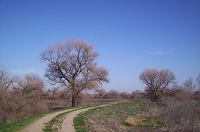
North levee, San Luis Refuge - March, 2007
Usa edcp relief location map.png
Red pog.svg
Map of the United States
Location Merced County, California, United States
Nearest city Los Banos, California
Coordinates 37°12′00″N120°48′04″W / 37.19994°N 120.80103°W / 37.19994; -120.80103 Coordinates: 37°12′00″N120°48′04″W / 37.19994°N 120.80103°W / 37.19994; -120.80103 [1]
Area26,600 acres (108 km2)
Established1966
Governing body U.S. Fish and Wildlife Service
Website San Luis National Wildlife Refuge

The San Luis National Wildlife Refuge in the San Joaquin Valley of central California is one of the great remnants of a historically bountiful wintering grounds for migratory waterfowl on the Pacific Flyway. Located in the Bear Creek, Salt Slough, and San Joaquin River floodplain, it hosts a myriad of tree-lined channels and oxbows, wetlands and native grasslands.

Contents

Thousands of acres of wetlands, fed by an intricate set of canals, are managed to produce natural food supplies for migratory waterfowl. San Luis also contains the most extensive network of pristine native grasslands, shrubs, and vernal pools that still remain within the Central Valley.

Thousands upon thousands of mallard, pintail, green-winged teal, and ring-necked ducks flock into the managed wetlands; while the wood duck lives throughout the tree-lined slough channels.

Herons and egrets nest in mature oaks and willows and feed on the refuge's abundant frog and crayfish populations. A wide diversity of songbirds, hawks, and owls also use refuge habitat.

Hunting is allowed in the winter season on a portion of the refuge, which also holds a herd of reintroduced endangered tule elk, the smallest subspecies of all American elks.

Photos

San Luis National Wildlife Refuge 1.jpg
San Luis National Wildlife Refuge 2.jpg
San Luis National Wildlife Refuge 3.jpg
San Luis National Wildlife Refuge 4.jpg
San Luis National Wildlife Refuge Sign.jpg

See also

Related Research Articles

<span class="mw-page-title-main">Tulare Lake</span> Freshwater dry lake in the southern San Joaquin Valley, California, United States

Tulare Lake is a freshwater dry lake with residual wetlands and marshes in the southern San Joaquin Valley, California, United States. After Lake Cahuilla disappeared in the 17th century, Tulare Lake was the largest freshwater lake west of the Mississippi River and the second-largest freshwater lake entirely in the United States, based upon surface area. A remnant of Pleistocene-era Lake Corcoran, Tulare Lake dried up after its tributary rivers were diverted for agricultural irrigation and municipal water uses.

<span class="mw-page-title-main">Shiawassee National Wildlife Refuge</span>

The Shiawassee National Wildlife Refuge is a 9,870.35 acres (39.9439 km2) National Wildlife Refuge in Saginaw County managed by the United States Fish and Wildlife Service. It is located in the central portion of the lower peninsula of the U.S. state of Michigan, approximately 25 miles (40 km) south of the Saginaw Bay in Lake Huron and five miles (8 km) south of the city of Saginaw in the county's Spaulding and James townships. It was established in 1953 to provide habitat for migratory waterfowl.

<span class="mw-page-title-main">California Central Valley grasslands</span> Temperate grasslands, savannas, and shrublands ecoregion in California, United States

The California Central Valley grasslands is a temperate grasslands, savannas, and shrublands ecoregion in California's Central Valley. It a diverse ecoregion containing areas of desert grassland, prairie, savanna, riparian forest, marsh, several types of seasonal vernal pools, and large lakes such as now-dry Tulare Lake, Buena Vista Lake, and Kern Lake.

<span class="mw-page-title-main">Monte Vista National Wildlife Refuge</span> United States National Wildlife Refuge in southern Colorado.

Monte Vista National Wildlife Refuge is a United States National Wildlife Refuge located in southern Colorado. The refuge is located in the San Luis Valley south of the town of Monte Vista, Colorado in southeastern Rio Grande County, Colorado, in the watershed of the Rio Grande. It was established in 1953 by the Migratory Bird Conservation Commission to provide a habitat for wildlife, particularly waterfowl, in the San Luis Valley.

Browns Park National Wildlife Refuge is a 13,450-acre (5,440 ha) U.S. National Wildlife Refuge located in northwestern Colorado. It is located in Moffat County in the extreme northwestern corner of the state, in an isolated mountain valley of Browns Park on both sides of the Green River, approximately 25 miles (40 km) below Flaming Gorge Dam. Established in 1965, the refuge is managed by the United States Fish and Wildlife Service office in Maybell, Colorado. The refuge is approximately 53 miles (85 km) northwest of Maybell on State Highway 318. The refuge consists of bottomland and adjacent benchland. The western border of the refuge is the Colorado-Utah state line. The refuge is surrounded by adjacent lines of the Bureau of Land Management. The refuge contains the site of the former Fort Davy Crockett that was constructed in 1837 to protect trappers against attacks by Blackfoot Native Americans.

<span class="mw-page-title-main">Suisun Marsh</span> Largest brackish water marsh on west coast of US

Located in northern California, the Suisun Marsh has been referred to as the largest brackish water marsh on west coast of the United States of America. The marsh land is part of the San Francisco Bay tidal estuary, and subject to tidal ebb and flood. The marsh is home to many species of birds and other wildlife, and is formed by the confluence of the Sacramento and San Joaquin rivers between Martinez and Suisun City, California and several other smaller, local watersheds. Adjacent to Suisun Bay, the marsh is immediately west of the legally defined Sacramento-San Joaquin Delta as well as part of the San Francisco Bay estuary.

<span class="mw-page-title-main">Baskett Slough National Wildlife Refuge</span>

Baskett Slough National Wildlife Refuge is in northwestern Oregon, 10 miles (16 km) west of Salem in Polk County. The Refuge consists of 1,173 acres (4.75 km²) of cropland, which provide forage for wintering geese, 300 acres (1.2 km²) of forests, 550 acres (2.2 km²) of grasslands, and 500 acres (2.0 km²) of shallow water seasonal wetlands and 35 acres (0.14 km²) of permanent open water. In 1965, Baskett Slough National Wildlife Refuge was created to help ensure some of the original habitat remained for species preservation. The refuge is managed by the U.S. Fish and Wildlife Service, an agency of the U.S. Department of the Interior.

The Kesterson Reservoir is part of the current San Luis National Wildlife Refuge in California. Formerly a unit of the Kesterson National Wildlife Refuge, the reservoir was an important stopping point for migratory waterfowl. Kesterson once consisted of 12 evaporation ponds totaling approximately 1,280 acres, and was historically used for agricultural drainage. Kesterson gained national attention during the latter half of the 20th century due to selenium toxicity and rapid die off of migratory waterfowl, fish, insects, plants and algae. The reservoir was closed in 1986, and concentrations of selenium at the site have continued to be monitored throughout remediation efforts.

<span class="mw-page-title-main">Yolo Bypass Wildlife Area</span> Wildlife area

The Yolo Bypass Wildlife Area is located within the Yolo Bypass in Yolo County, California. The wildlife area is managed by the California Department of Fish and Wildlife with the intent of restoring and managing a variety of wildlife habitats in the Yolo Basin, a natural basin in the north part of the Sacramento-San Joaquin River Delta. The creation of the wildlife area was spearheaded by the Yolo Basin Foundation. The California Department of Fish and Wildlife and Yolo Basin Foundation are the core partners in the operation of this unique community resource. Located at 38.550515°N 121.626291°W

The San Luis National Wildlife Refuge Complex is located in the northern San Joaquin Valley, within Merced County and Stanislaus County of California. The complex, with four federal National Wildlife Refuges, is managed by the U.S Fish & Wildlife Service.

<span class="mw-page-title-main">Hagerman National Wildlife Refuge</span> Nature reserve in northwestern Grayson County, Texas, United States

Hagerman National Wildlife Refuge (HNWR), a haven for migratory birds and other wildlife, lies in northwestern Grayson County, Texas, on the Big Mineral Arm of Lake Texoma, on the Red River between Oklahoma and Texas. This National Wildlife Refuge is made up of water, marsh, and upland habitat. Visitors can hike, observe wildlife, hunt, and fish throughout the year.

<span class="mw-page-title-main">Stone Lakes National Wildlife Refuge</span> Wildlife refuge near Sacramento, California

The Stone Lakes National Wildlife Refuge, located south of Sacramento, California, lies within the Sacramento-San Joaquin delta, the destination of thousands of migrating waterfowl, shorebirds, and other water birds. The refuge was established in 1994.

The San Joaquin River National Wildlife Refuge is a protected area of along the San Joaquin River in the northern San Joaquin Valley, California. It is within San Joaquin County and Stanislaus County.

<span class="mw-page-title-main">Pixley National Wildlife Refuge</span> Wildlife Refuge in the San Joaquin Valley

Pixley National Wildlife Refuge is located 35 miles (56 km) south of Tulare, California and 45 miles (72 km) north of Bakersfield in the San Joaquin Valley. The 6,939-acre (2,808 ha) nature refuge represents one of the few remaining examples of the grasslands, vernal pools, and playas that once bordered historic Tulare Lake, the largest lake west of the Great Lakes until the late 19th century.

<span class="mw-page-title-main">Kern National Wildlife Refuge</span> Protected area

Kern National Wildlife Refuge is a 11,249-acre (45.52 km2) protected area located in the southern portion of California's San Joaquin Valley, 20 miles west of the city of Delano. Situated on the southern margin of what was once the largest freshwater wetland complex in the western United States, Kern National Wildlife Refuge provides an optimum wintering habitat for migratory birds with an emphasis on waterfowl and water birds.

<span class="mw-page-title-main">Merced National Wildlife Refuge</span> Nature reserve in California

The Merced National Wildlife Refuge encompasses 10,262 acres (41.53 km2) of wetlands, native grasslands, vernal pools, and riparian areas in California. It was established in 1951 under the Lea Act to attract wintering waterfowl from adjacent farmland where their foraging was causing crop damage. In the last few decades, changes in agricultural practices and refuge management have reduced these wildlife/crop issues.

Grasslands Wildlife Management Area lies within the San Joaquin River basin in California and supports the largest remaining block of wetlands in the Central Valley, containing 70,000 acres (280 km2) of private wetlands and associated, and surrounding 53,000 acres (210 km2) of state and federal lands. Perpetual conservation easements on private lands have been purchased by the United States Fish and Wildlife Service.

<span class="mw-page-title-main">Butte Sink Wildlife Management Area</span> Wetlands managed as part of the Sacramento National Wildlife Refuge Complex

Butte Sink Wildlife Management Area is located in Colusa, Butte, and Sutter Counties. It is wetlands managed as part of the Sacramento National Wildlife Refuge Complex and is not open to the public.

<span class="mw-page-title-main">Refuge Water Supply Program</span> US program to supply wetlands in central California with water

The Refuge Water Supply Program (RWSP) is administered by the United States Department of the Interior jointly by the Bureau of Reclamation and Fish and Wildlife Service and tasked with acquiring a portion and delivering a total of 555,515 acre feet (AF) of water annually to 19 specific protected wetland areas in the Central Valley of California as mandated with the passing of the Central Valley Project Improvement Act signed on October 30, 1992, by President George H. W. Bush.

The Grassland Ecological Area, also known as the Grasslands Ecological Area is a designated Ramsar Site in Central California. It covers an area of 650 square kilometres (250 sq mi) along the San Joaquin River in California's Central Valley. The wetlands are on the Pacific Flyway, and are an important habitat for resident and migratory waterbirds.

References

  1. "San Luis National Wildlife Refuge". Geographic Names Information System . United States Geological Survey, United States Department of the Interior.

PD-icon.svg This article incorporates public domain material from websites or documents of the United States Fish and Wildlife Service .