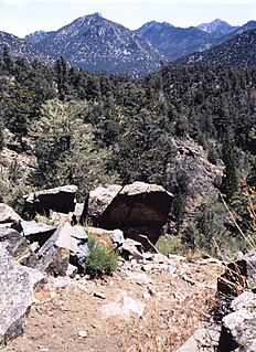
The Owens Peak Wilderness is a 73,767-acre (298.52 km2) wilderness area comprising the rugged eastern face of the Sierra Nevada Mountains. Owens Peak (8,445 ft) is the high point. The land was set aside with the passage of the California Desert Protection Act of 1994 by the US Congress.

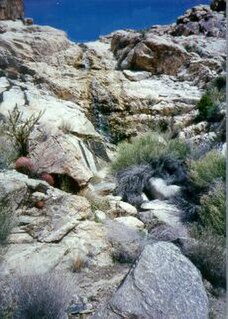
The El Paso Mountains Wilderness was created in 1994 and now has a total of 23,780 acres (96.2 km2). All of the wilderness is in the northern Mojave Desert in eastern Kern County, California and is managed by the Bureau of Land Management. It is located south of Ridgecrest, California.

The Piute Mountains are a mountain range located in the Eastern Mojave Desert and within Mojave Trails National Monument, in San Bernardino County, California.

The Bigelow Cholla Garden Wilderness is in the eastern Mojave Desert and within Mojave Trails National Monument, located in San Bernardino County, California.

The Scodie Mountains are a sub-mountain range of the Southern Sierra Nevada rising from the Mojave Desert, and located in Kern County, California.

Old Woman Mountains Wilderness is a wilderness area in the Old Woman Mountains of the eastern Mojave Desert. It is located south of Essex in San Bernardino County, California.

The Darwin Falls Wilderness is a protected area in the northern Mojave Desert adjacent to Death Valley National Park. The 8,189-acre (3,314 ha) wilderness area was created by the California Desert Protection Act of 1994 and is managed by the Bureau of Land Management as part of the National Wilderness Preservation System.

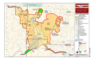
The Black Rock Desert–High Rock Canyon Emigrant Trails National Conservation Area is the federal land in northwestern Nevada, under the Bureau of Land Management-BLM management and protection, and the ten Wilderness Areas within it.

The Kiavah Wilderness is a federally designated wilderness area located in the Mojave Desert, Scodie Mountains, and southern Sierra Nevada in Kern County, California, United States. California State Route 178 connects the town of Lake Isabella to State Highway 14 in the east, crossing Walker Pass at the north boundary of the wilderness.

The Sacatar Trail Wilderness is a federally designated wilderness area located 20 miles (32 km) northwest of Ridgecrest, California USA. It was created in 1994 with the passage of the California Desert Protection Act - Public Law 103-433 - and is managed by the Bureau of Land Management (BLM). The wilderness is 51,900 acres (210 km2) in size and protects portions of the southern Sierra Nevada Mountain Range.

The Piper Mountain Wilderness is a federally designated wilderness area located in the White Mountains 20 miles (32 km) northeast of Big Pine, California in Inyo County, California.

The Sylvania Mountains Wilderness is a federally designated wilderness area located 30 miles (48 km) east of Bishop in the state of California. The wilderness is 18,677acres in size and is managed by the Bureau of Land Management (BLM). The California Desert Protection Act of 1994 created the Sylvania Mountains Wilderness and was added to the National Wilderness Preservation System. The wilderness is bordered by Nevada stateline on the east, Piper Mountain Wilderness on the west and Death Valley National Park to the south.

The Chimney Peak Wilderness is a 13,134-acre (53.15 km2) wilderness area located 20 miles (32 km) northwest of Ridgecrest, in southeastern Tulare County, California.

The Cleghorn Lakes Wilderness is a 33,475-acre (135.47 km2) wilderness area in the southern Mojave Desert. It is located 16 miles (26 km) northeast of Twentynine Palms, California, and 20 miles (32 km) north of Joshua Tree National Park. It is managed by the Bureau of Land Management.

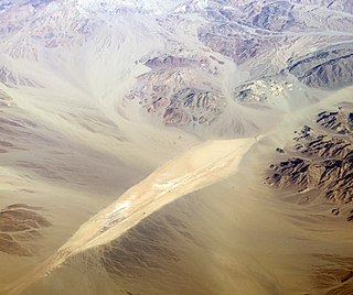
Broadwell Lake, sometimes called Broadwell Dry Lake, is a dry lake bed in the Mojave Desert of San Bernardino County, California, 75 km (47 mi) east of Barstow. Flanked by the Cady Mountains and the Bristol Mountains, the lake is approximately 7 km (4.3 mi) long and 2 km (1.2 mi) at its widest point.

Jawbone Canyon is a geographic feature in the Mojave Desert and a Bureau of Land Management area located in Kern County, California, 20 miles (32 km) north of Mojave on CA 14. The area is a popular destination for hikers and off road vehicle enthusiasts.

Spirit Mountain Wilderness Area is a 33,518-acre (13,564 ha) wilderness area located in the Newberry Mountains in Clark County, Nevada, 10 miles (16 km) northwest of Laughlin. Spirit Mountain lies within the area. It is managed by the Bureau of Land Management and the National Park Service.

The Stateline Wilderness is a wilderness area located in San Bernardino County, California, approximately three miles northwest of Primm, Nevada and I-15. Having an area of approximately 7,004 acres (2,834 ha), it contains the eastern terminus of the 15-mile-long (24 km) Clark Mountain Range.

Mount Manchester is the highest peak in the Dead Mountains of extreme northeastern San Bernardino County, California, in the Mojave Desert.

Mojave Trails National Monument is a large U.S. National Monument located in the state of California between Interstates 15 and 40. It partially surrounds the Mojave National Preserve. It was designated by President Obama on February 12, 2016, along with Castle Mountains National Monument and Sand to Snow National Monument. It is under the control of the Bureau of Land Management.


