Sacramento River National Wildlife Refuge

Last updated
Sacramento River National Wildlife Refuge
IUCN category IV (habitat/species management area)
Sacramento River National Wildlife Refuge.jpg
Relief map of California.png
Red pog.svg
Map of the United States
Usa edcp relief location map.png
Red pog.svg
Sacramento River National Wildlife Refuge (the United States)
Location Butte County, Glenn County, Tehama County, California, United States
Nearest city Chico, California
Coordinates 39°42′25″N121°57′15″W / 39.7069°N 121.9542°W / 39.7069; -121.9542 Coordinates: 39°42′25″N121°57′15″W / 39.7069°N 121.9542°W / 39.7069; -121.9542 [1]
Area10,146 acres (41.06 km2)
Established1989
Governing body U.S. Fish and Wildlife Service
Website Sacramento River National Wildlife Refuge

Sacramento River National Wildlife Refuge is located along the Sacramento River in the Sacramento Valley of California. Landscape is very flat, bordered by the Sierra and Coast ranges, with intensive agriculture (rice, with walnut, almond, and prune orchards along the river). This riparian community is one of the most important wildlife habitats in California and North America.

Sacramento River river in Northern and Central California, USA

The Sacramento River is the principal river of Northern California in the United States, and is the largest river in California. Rising in the Klamath Mountains, the river flows south for 400 miles (640 km) before reaching the Sacramento–San Joaquin River Delta and San Francisco Bay. The river drains about 26,500 square miles (69,000 km2) in 19 California counties, mostly within the fertile agricultural region bounded by the Coast Ranges and Sierra Nevada known as the Sacramento Valley, but also extending as far as the volcanic plateaus of Northeastern California. Historically, its watershed has reached as far north as south-central Oregon where the now, primarily, endorheic (closed) Goose Lake rarely experiences southerly outflow into the Pit River, the most northerly tributary of the Sacramento.

Sacramento Valley Northern part of the Central Valley in California, United States of America

The Sacramento Valley is the area of the Central Valley of the U.S. state of California that lies north of the Sacramento–San Joaquin River Delta and is drained by the Sacramento River. It encompasses all or parts of ten Northern California counties. Although many areas of the Sacramento Valley are rural, it contains several urban areas, including the state capital, Sacramento.

California State of the United States of America

California is a state in the Pacific Region of the United States. With 39.6 million residents across a total area of about 163,696 square miles (423,970 km2), California is the most populous U.S. state and the third-largest by area. The state capital is Sacramento. The Greater Los Angeles Area and the San Francisco Bay Area are the nation's second- and fifth-most populous urban regions, with 18.7 million and 9.7 million residents respectively. Los Angeles is California's most populous city, and the country's second-most populous, after New York City. California also has the nation's most populous county, Los Angeles County, and its largest county by area, San Bernardino County. The City and County of San Francisco is both the country's second-most densely populated major city after New York City and the fifth-most densely populated county, behind only four of the five New York City boroughs.

Contents

The refuge is currently in an active acquisition phase, and includes the Llano Seco Unit. Large-scale riparian habitat restoration is ongoing. Riparian habitat along the Sacramento River is critically important for various threatened species, fisheries, migratory birds, plants, and the natural system of the river itself.

Threatened species

Threatened species are any species which are vulnerable to endangerment in the near future. Species that are threatened are sometimes characterised by the population dynamics measure of critical depensation, a mathematical measure of biomass related to population growth rate. This quantitative metric is one method of evaluating the degree of endangerment.

Fishery entity engaged in raising or harvesting fish which is determined by some authority to be a fishery

Generally, a fishery is an entity engaged in raising or harvesting fish which is determined by some authority to be a fishery. According to the FAO, a fishery is typically defined in terms of the "people involved, species or type of fish, area of water or seabed, method of fishing, class of boats, purpose of the activities or a combination of the foregoing features". The definition often includes a combination of fish and fishers in a region, the latter fishing for similar species with similar gear types.

Restoration

There has been an 85% reduction of riparian vegetation throughout the Sacramento Valley and foothills region, and probably over a 95 percent reduction along this area's major river systems. The relatively small amount of Riparian forest woodlands that remains provides a strikingly disproportionate amount of habitat value for wildlife.

Riparian forest forested or wooded area of land adjacent to a body of water

A riparian forest or riparian woodland is a forested or wooded area of land adjacent to a body of water such as a river, stream, pond, lake, marshland, estuary, canal, sink or reservoir.

Related Research Articles

Sacramento National Wildlife Refuge Complex

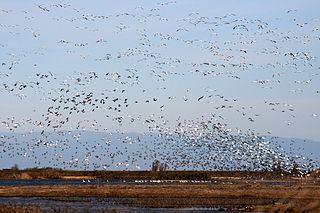
The Sacramento National Wildlife Refuge Complex is part of the United States system of National Wildlife Refuges (NWR). It is located in northern California, in the valley of the Sacramento River.

Baskett Slough National Wildlife Refuge protected area

Baskett Slough National Wildlife Refuge is located in northwestern Oregon, 10 miles (16 km) west of Salem in Polk County. Situated in open farmland near the eastern foothills of the Oregon Coast Range with the broad Willamette Valley and the Cascade Range to the east, elevations range from 185 to 414 feet MSL. The Willamette Valley, with its mild, rainy winter climate, is an ideal environment for wintering waterfowl. The valley was once a rich mix of wildlife habitats with extensive wetlands, meandering stream channels and vast seasonal marshes. Today, the valley is a mix of farmland and growing cities, with few areas remaining for wildlife. The Refuge consists of 1,173 acres (4.75 km²) of cropland, which provide forage for wintering geese, 300 acres (1.2 km²) of forests, 550 acres (2.2 km²) of grasslands, and 500 acres (2.0 km²) of shallow water seasonal wetlands and 35 acres (0.14 km²) of permanent open water. In 1965, Baskett Slough National Wildlife Refuge was created to help ensure some of the original habitat remained for species preservation. The refuge is managed by the U.S. Fish and Wildlife Service, an agency of the U.S. Department of the Interior.

Valley elderberry longhorn beetle subspecies of beetle

The valley elderberry longhorn beetle,, is a subspecies of longhorn beetle native to the riparian forests of the Central Valley of California from Redding to Bakersfield. It is listed as a federally threatened species, although it is likely to be removed from the endangered species list.

Bandon Marsh National Wildlife Refuge

Bandon Marsh National Wildlife Refuge is a U.S. National Wildlife Refuge on Oregon's coast. It is one of six National Wildlife Refuges comprising the Oregon Coast National Wildlife Refuge Complex and is renowned among bird watchers for being able to view rare shorebirds including ruff, Hudsonian godwit, and Mongolian plover. The refuge was last expanded in 1999, it now has 889 acres (3.60 km2) in two units: Bandon Marsh and Ni-les'tun.

California protected areas

According to the California Protected Areas Database (CPAD), in the state of California, United States, there are over 14,000 inventoried protected areas administered by public agencies and non-profits. In addition, there are private conservation areas and other easements. They include almost one-third of California's scenic coastline, including coastal wetlands, estuaries, beaches, and dune systems. The California State Parks system alone has 270 units and covers 1.3 million acres (5,300 km2), with over 280 miles (450 km) of coastline, 625 miles (1,006 km) of lake and river frontage, nearly 18,000 campsites, and 3,000 miles (5,000 km) of hiking, biking, and equestrian trails.

Rappahannock River Valley National Wildlife Refuge wildlife refuge

The Rappahannock River Valley National Wildlife Refuge was established in 1996 to protect and enhance fish, wildlife, plants and their habitats for future generations. On the Rappahannock River Valley National Wildlife Refuge, birds raise their young in native habitats of field, forest and marsh. They find rest and nourishment during migration and a haven in winter. U.S. Fish & Wildlife staff manage refuge lands and waters with an emphasis on species whose populations have declined, assisting them on the road to recovery.

The San Luis National Wildlife Refuge Complex is located in the northern San Joaquin Valley, within Merced County and Stanislaus County of California. The complex, with four federal National Wildlife Refuges, is managed by the U.S Fish & Wildlife Service.
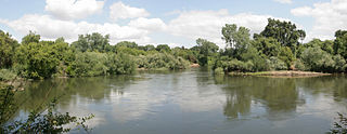
Bill Williams River National Wildlife Refuge

The Bill Williams River National Wildlife Refuge protects the lower course of the Bill Williams River, to its mouth at Lake Havasu reservoir, in western Arizona. It is located within eastern La Paz and Mohave Counties, in the Lower Colorado River Valley region.

Cibola National Wildlife Refuge

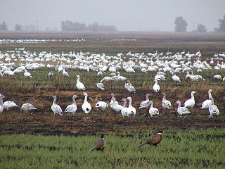
Cibola National Wildlife Refuge is a U.S. National Wildlife Refuge in the floodplain of the lower Colorado River between Arizona and California and surrounded by a fringe of desert ridges and washes. The refuge encompasses both the historic Colorado River channel as well as a channelized portion constructed in the late 1960s. Along with these main waterbodies, several important backwaters are home to many wildlife species that reside in this Yuma Desert portion of the Sonoran Desert. Because of the river's life-sustaining water, wildlife here survive in an environment that reaches 120 °F (49 °C) in the summer and receives an average of only 2 inches (5.1 cm) of rain per year.

Bitter Creek National Wildlife Refuge

The Bitter Creek National Wildlife Refuge is located in the foothills of the southwestern San Joaquin Valley in Kern County, California. The refuge is one of four units of the Hopper Mountain National Wildlife Refuge Complex for California condors.

Franz Lake National Wildlife Refuge

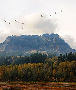
Franz Lake National Wildlife Refuge is located in southwest Washington State, within the Columbia River Gorge National Scenic Area. The refuge provides a variety of habitats including riparian wetlands, Columbia River riparian corridor blocks, transitional woodlands from lower elevation willows, and cottonwoods to mid-elevation old-growth fir and cedar with associated native understory shrubs, open meadows, and numerous streams and seeps.

Toppenish National Wildlife Refuge

Toppenish National Wildlife Refuge is located on the Yakama Indian Reservation about 6 miles south of Toppenish, Washington, in the agriculturally intensive Yakima Valley of eastern Washington state. Using the waters of Toppenish and Snake Creeks and supplemented with summer irrigation, managers are able to provide a mosaic of refuge wetlands interspersed with lush riparian and native upland habitats.

Sutter National Wildlife Refuge

Sutter National Wildlife Refuge, the southern-most refuge in the Sacramento National Wildlife Refuge Complex, is located in the Sacramento Valley of California, about 50 miles (80 km) north of the metropolitan area of Sacramento. The refuge consists of about 2,600 acres (11 km2), consisting primarily of wetland impoundments with some riparian and grassland habitat.

Stone Lakes National Wildlife Refuge Wildlife refuge near Sacramento, California

The Stone Lakes National Wildlife Refuge, located south of Sacramento, California, lies within the Sacramento-San Joaquin delta, the destination of thousands of migrating waterfowl, shorebirds, and other water birds. The refuge was established in 1994.

San Joaquin River National Wildlife Refuge

The San Joaquin River National Wildlife Refuge is a protected area of along the San Joaquin River in the northern San Joaquin Valley, California. It is within San Joaquin County and Stanislaus County

Salinas River National Wildlife Refuge

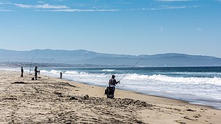
Salinas River National Wildlife Refuge is located approximately 11 miles north of Monterey, California, and 3 miles south of Castroville, California, at the point where the Salinas River empties into Monterey Bay. The 367-acre (1.49 km2) refuge encompasses several habitat types including sand dunes, pickleweed salt marsh, river lagoon, riverine habitat, and a saline pond. The refuge was established in 1974 because of its "particular value in carrying out the national migratory bird management program."

Ellicott Slough National Wildlife Refuge

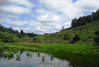
The Ellicott Slough National Wildlife Refuge is a United States National Wildlife Refuge located in the northern part of the Monterey Bay area of California.

Delevan National Wildlife Refuge

The Delevan National Wildlife Refuge is one of six refuges in the Sacramento National Wildlife Refuge Complex in the Sacramento Valley of central northern California.

Colusa National Wildlife Refuge

Colusa National Wildlife Refuge is one of six refuges in the Sacramento National Wildlife Refuge Complex located in the Sacramento Valley of north-central California. The refuge is located in Colusa County, California. It is around 70 miles (110 km) north of metropolitan Sacramento.
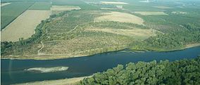
Refuge Water Supply Program US program to supply wetlands in central California with water

The Refuge Water Supply Program (RWSP) is administered by the United States Department of the Interior jointly by the Bureau of Reclamation and Fish and Wildlife Service and tasked with acquiring a portion and delivering a total of 555,515 acre feet (AF) of water annually to 19 specific protected wetland areas in the Central Valley of California as mandated with the passing of the Central Valley Project Improvement Act signed on October 30, 1992 by President George H. W. Bush.

References

  1. "Sacramento River National Wildlife Refuge - Capay & Phelan Island Units" (PDF). U.S. Fish and Wildlife Service.

PD-icon.svg This article incorporates  public domain material from websites or documents ofthe United States Fish and Wildlife Service .

United States Fish and Wildlife Service US Federal Government agency

The United States Fish and Wildlife Service is an agency of the US federal government within the US Department of the Interior dedicated to the management of fish, wildlife, and natural habitats. The mission of the agency is "working with others to conserve, protect, and enhance fish, wildlife, plants and their habitats for the continuing benefit of the American people."