A nature reserve is a protected area of importance for flora, fauna, funga, or features of geological or other special interest, which is reserved and managed for purposes of conservation and to provide special opportunities for study or research. They may be designated by government institutions in some countries, or by private landowners, such as charities and research institutions. Nature reserves fall into different IUCN categories depending on the level of protection afforded by local laws. Normally it is more strictly protected than a nature park. Various jurisdictions may use other terminology, such as ecological protection area or private protected area in legislation and in official titles of the reserves.

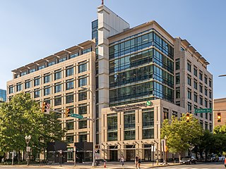
The Nature Conservancy (TNC) is a global environmental organization headquartered in Arlington, Virginia. As of 2021, it works via affiliates or branches in 79 countries and territories, as well as across every state in the US.

The Headwaters Forest Reserve is a group of old growth coast redwood groves in the Northern California coastal forests ecoregion near Humboldt Bay of the U.S. state of California. Comprising about 7,472 acres (30.24 km2), it is managed by the Bureau of Land Management (BLM) as part of the National Landscape Conservation System.

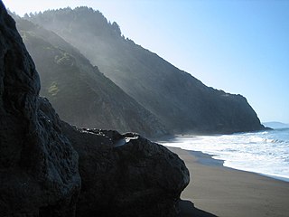
The Lost Coast is a mostly natural and undeveloped area of the California North Coast in Humboldt and Mendocino Counties, which includes the King Range. It was named the "Lost Coast" after the area experienced depopulation in the 1930s. In addition, the steepness and related geotechnical challenges of the coastal mountains made this stretch of coastline too costly for state highway or county road builders to establish routes through the area, leaving it the most undeveloped and remote portion of the California coast. Without any major highways, communities in the Lost Coast region such as Petrolia, Shelter Cove, and Whitethorn are somewhat isolated from the rest of California.

Point Blue Conservation Science, founded as and formerly named the Point Reyes Bird Observatory (PRBO), is a California-based wildlife conservation and research non-profit organization.

The Minnesota Department of Natural Resources, or Minnesota DNR, is the agency of the U.S. state of Minnesota charged with conserving and managing the state's natural resources. The agency maintains areas such as state parks, state forests, recreational trails, and recreation areas as well as managing minerals, wildlife, and forestry throughout the state. The agency is divided into six divisions - Ecological & Water Resources, Enforcement, Fish & Wildlife, Forestry, Lands & Minerals, and Parks & Trails.

The Mattole River is a river on the north coast of California, that flows northerly, then westerly into the Pacific Ocean. The vast majority of its 62 miles (100 km) course is through southern Humboldt County, though a short section of the river flows through northern Mendocino County. Communities, from north to south, closely associated with the Mattole River include: Petrolia, Honeydew, Ettersburg, Thorn Junction, and Whitethorn. The river enters the ocean at the Mattole Estuary about 4 miles (6.4 km) west-southwest of Petrolia and 10 miles (16 km) south of Cape Mendocino.

Save the Redwoods League is a nonprofit organization whose mission is to protect and restore coast redwood and giant sequoia trees through the preemptive purchase of development rights of notable areas with such forests.
Petrolia is an unincorporated community in Humboldt County, California, 10 miles (16 km) southeast of Cape Mendocino, at an elevation of 121 feet (37 m) above sea level, within ZIP Code 95558, and area code 707. Petrolia was the site of the first oil well drilled in California.
Natural Lands is a non-profit land conservation organization with headquarters in Media, Pennsylvania, dedicated to the management, protection, and conservation of eastern Pennsylvania and southern New Jersey's native forests, fields, streams, and wetlands. The organization owns and manages 43 nature preserves—and one public garden totaling more than 23,000 acres—located in 13 counties in Pennsylvania and New Jersey. Nineteen of the preserves are open to the public for recreational use; the others have limited visitation due to the presence of sensitive ecosystems or limited facilities.

Since declaring independence in 1981, Belize has enacted many environmental protection laws aimed at the preservation of the country's natural and cultural heritage, as well as its wealth of natural resources. These acts have established a number of different types of protected areas, with each category having its own set of regulations dictating public access, resource extraction, land use and ownership.

According to the California Protected Areas Database (CPAD), in the state of California, United States, there are over 14,000 inventoried protected areas administered by public agencies and non-profits. In addition, there are private conservation areas and other easements. They include almost one-third of California's scenic coastline, including coastal wetlands, estuaries, beaches, and dune systems. The California State Parks system alone has 270 units and covers 1.3 million acres (5,300 km2), with over 280 miles (450 km) of coastline, 625 miles (1,006 km) of lake and river frontage, nearly 18,000 campsites, and 3,000 miles (5,000 km) of hiking, biking, and equestrian trails.

Reinstein Woods Nature Preserve is located near the city of Buffalo in the Town of Cheektowaga in Erie County, New York, USA. Reinstein Woods Nature Preserve is a 292-acre (118 ha) forested complex that also includes wetlands and ponds, located within a developed suburban area. The nature preserve also features an environmental education center.
The Prairie Habitat Joint Venture is a partnership between governments, organizations, and conservation groups in the provinces of Manitoba, Saskatchewan, and Alberta in Canada. It is one of four Canadian habitat joint ventures operating as part of the North American Waterfowl Management Plan, and is contiguous with the Prairie Pothole Joint Venture in the United States.
Sudbury Valley Trustees (SVT) is a regional open space land trust headquartered at Wolbach Farm in Sudbury, Massachusetts.
Conserving Carolina is a non-profit conservation organization working to preserve water and land resources in Western North Carolina. Conserving Carolina was created in July 2017, from a merger of two previously separate organizations, Carolina Mountain Land Conservancy and Pacolet Area Conservancy. The combined organization maintains a primary office in Hendersonville, North Carolina, and a regional office in Columbus, North Carolina.
Lava Lake Land & Livestock is a lamb producer located between the Pioneer Mountains and Craters of the Moon National Monument and Preserve in South Central Idaho. The ranch consists of 24,000 acres (97 km2) of private land and over 900,000 acres (3,600 km2) of lands administered by the Bureau of Land Management (BLM), United States Forest Service, National Park Service, and the Idaho Department of Lands.

Joshua's Tract Conservation and Historic Trust, or Joshua's Trust, is a non-profit 501(c)(3) land trust operating in northeast Connecticut. Joshua's Trust was incorporated in 1966 to help conserve property of significant natural or historic interest. As of 2011, the Trust protects more than 5,000 acres, maintains 42 miles (68 km) of trails that are open to the public, holds educational outreach programs, and publishes the Joshua's Tract Walkbook.

The Black Kettle National Grassland, in Roger Mills County, Oklahoma, and Hemphill County, Texas, contains 31,286 acres (12,661 ha) of which 30,710 acres (12,430 ha) are in Oklahoma.

The Big Sur Land Trust is a private 501(c)(3) non-profit located in Monterey, California, that has played an instrumental role in preserving land in California's Big Sur and Central Coast regions. The trust was the first to conceive of and use the "conservation buyer" method in 1989 by partnering with government and developers to offer tax benefits as an inducement to sell land at below-market rates. Since 1978, with the support of donors, funders and partners, it has conserved over 40,000 acres through conservation easements, acquisition and transfer of land to state, county and city agencies. It has placed conservation easements on 7,000 acres and has retained ownership of over 4,000 acres.


