Sutter National Wildlife Refuge | |
---|---|
IUCN category IV (habitat/species management area) | |
Map of the United States | |
Location | Sutter County, California, United States |
Nearest city | Yuba City, California |
Coordinates | 39°04′59″N121°45′22″W / 39.08294°N 121.75608°W Coordinates: 39°04′59″N121°45′22″W / 39.08294°N 121.75608°W [1] |
Area | 2,591 acres (10.49 km2) |
Established | 1945 |
Governing body | U.S. Fish and Wildlife Service |
Website | Sutter National Wildlife Refuge |
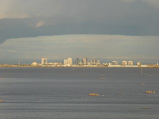
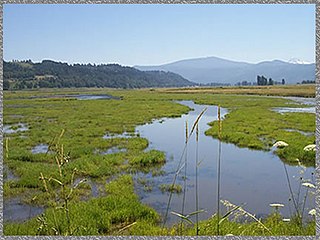
Sutter National Wildlife Refuge, the southern-most refuge in the Sacramento National Wildlife Refuge Complex, is located in the Sacramento Valley of California, about 50 miles (80 km) north of the metropolitan area of Sacramento. The refuge consists of about 2,600 acres (11 km2), consisting primarily of wetland impoundments with some riparian and grassland habitat.
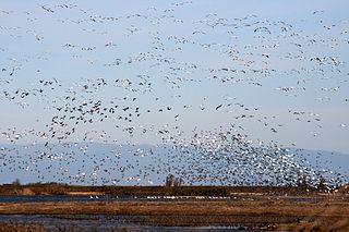
The Sacramento National Wildlife Refuge Complex is part of the United States system of National Wildlife Refuges (NWR). It is located in northern California, in the valley of the Sacramento River.
The Sacramento Valley is the area of the Central Valley of the U.S. state of California that lies north of the Sacramento–San Joaquin River Delta and is drained by the Sacramento River. It encompasses all or parts of ten Northern California counties. Although many areas of the Sacramento Valley are rural, it contains several urban areas, including the state capital, Sacramento.
California is a state in the Pacific Region of the United States. With 39.6 million residents, California is the most populous U.S. state and the third-largest by area. The state capital is Sacramento. The Greater Los Angeles Area and the San Francisco Bay Area are the nation's second and fifth most populous urban regions, with 18.7 million and 8.8 million residents respectively. Los Angeles is California's most populous city, and the country's second most populous, after New York. California also has the nation's most populous county, Los Angeles County, and its largest county by area, San Bernardino County. The City and County of San Francisco is both the country's second-most densely populated major city after New York and the fifth-most densely populated county, behind only four of the five New York City boroughs.
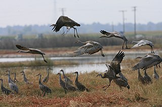
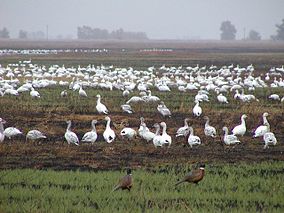
About 80 percent of the refuge is located in the Sutter Bypass, a floodwater bypass from the Sacramento River that floods at least once a year and may cover portions of the refuge with up to 12 feet (3.7 m) of water. Sutter Refuge typically supports wintering populations of more than 175,000 ducks and 50,000 geese.
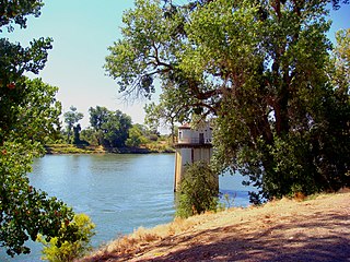
The Sacramento River is the principal river of Northern California in the United States, and is the largest river in California. Rising in the Klamath Mountains, the river flows south for 400 miles (640 km) before reaching the Sacramento–San Joaquin River Delta and San Francisco Bay. The river drains about 26,500 square miles (69,000 km2) in 19 California counties, mostly within the fertile agricultural region bounded by the Coast Ranges and Sierra Nevada known as the Sacramento Valley, but also extending as far as the volcanic plateaus of Northeastern California. Historically, its watershed has reached as far north as south-central Oregon where the now, primarily, endorheic (closed) Goose Lake rarely experiences southerly outflow into the Pit River, the most northerly tributary of the Sacramento.
Duck is the common name for a large number of species in the waterfowl family Anatidae which also includes swans and geese. Ducks are divided among several subfamilies in the family Anatidae; they do not represent a monophyletic group but a form taxon, since swans and geese are not considered ducks. Ducks are mostly aquatic birds, mostly smaller than the swans and geese, and may be found in both fresh water and sea water.
Geese are waterfowl of the family Anatidae. This group comprises the genera Anser and Branta . Chen, a genus comprising 'white geese', is sometimes used to refer to a group of species that are more commonly placed within Anser. Some other birds, mostly related to the shelducks, have "goose" as part of their names. More distantly related members of the family Anatidae are swans, most of which are larger than true geese, and ducks, which are smaller.
The mixed riparian forest habitat on the refuge is important for breeding and migrating passerine birds, and supports a large heron/egret rookery. The refuge provides habitat for several Federal and State endangered and threatened species, including giant garter snake, winter-run Chinook salmon, yellow-billed cuckoo, and Swainson's hawk.
A passerine is any bird of the order Passeriformes, which includes more than half of all bird species. Sometimes known as perching birds or – less accurately – as songbirds, passerines are distinguished from other orders of birds by the arrangement of their toes, which facilitates perching. With more than 110 families and some 6,409 identified species, Passeriformes is the largest order of birds and among the most diverse orders of terrestrial vertebrates.
The herons are long-legged freshwater and coastal birds in the family Ardeidae, with 64 recognised species, some of which are referred to as egrets or bitterns rather than herons. Members of the genera Botaurus and Ixobrychus are referred to as bitterns, and, together with the zigzag heron, or zigzag bittern, in the monotypic genus Zebrilus, form a monophyletic group within the Ardeidae. Egrets are not a biologically distinct group from the herons, and tend to be named differently because they are mainly white or have decorative plumes in breeding plumage. Herons, by evolutionary adaptation, have long beaks.
Egrets are herons which have white or buff plumage, and develop fine plumes during the breeding season. Egrets are not a biologically distinct group from the herons and have the same build.
The Yolo Bypass is one of two flood bypasses in California's Sacramento Valley located in Yolo and Solano Counties. Through a system of weirs, the bypass diverts floodwaters from the Sacramento River away from the state's capital city of Sacramento and other nearby riverside communities.
Browns Park National Wildlife Refuge is a 13,450-acre (5,440 ha) U.S. National Wildlife Refuge located in northwestern Colorado. It is located in Moffat County in the extreme northwestern corner of the state, in an isolated mountain valley of Browns Park on both sides of the Green River, approximately 25 miles (40 km) below Flaming Gorge Dam. Established in 1965, the refuge is managed by the United States Fish and Wildlife Service office in Maybell, Colorado. The refuge is approximately 53 miles (85 km) northwest of Maybell on State Highway 318. The refuge consists of bottomland and adjacent benchland. The western border of the refuge is the Colorado-Utah state line. The refuge is surrounded by adjacent lines of the Bureau of Land Management. The refuge contains the site of the former Fort Davy Crockett constructed in 1837 to protect trappers against attacks by Blackfoot Native Americans.
Ankeny National Wildlife Refuge is located in the fertile Willamette Valley of northwestern Oregon, 12 miles (19 km) south of Salem. The valley was once a rich mix of wildlife habitats. Valley wetlands were once extensive, with meandering stream channels and vast seasonal marshes. Today, the valley is a mix of farmland and growing cities, with few areas remaining for wildlife.
Baskett Slough National Wildlife Refuge is located in northwestern Oregon, 10 miles (16 km) west of Salem in Polk County. Situated in open farmland near the eastern foothills of the Oregon Coast Range with the broad Willamette Valley and the Cascade Range to the east, elevations range from 185 to 414 feet MSL. The Willamette Valley, with its mild, rainy winter climate, is an ideal environment for wintering waterfowl. The valley was once a rich mix of wildlife habitats with extensive wetlands, meandering stream channels and vast seasonal marshes. Today, the valley is a mix of farmland and growing cities, with few areas remaining for wildlife. The Refuge consists of 1,173 acres (4.75 km²) of cropland, which provide forage for wintering geese, 300 acres (1.2 km²) of forests, 550 acres (2.2 km²) of grasslands, and 500 acres (2.0 km²) of shallow water seasonal wetlands and 35 acres (0.14 km²) of permanent open water. In 1965, Baskett Slough National Wildlife Refuge was created to help ensure some of the original habitat remained for species preservation. The refuge is managed by the U.S. Fish and Wildlife Service, an agency of the U.S. Department of the Interior.
The Yolo Bypass Wildlife Area is located within the Yolo Bypass in Yolo County, California. The wildlife area is managed by the California Department of Fish and Wildlife with the intent of restoring and managing a variety of wildlife habitats in the Yolo Basin, a natural basin in the north part of the Sacramento-San Joaquin River Delta. The creation of the wildlife area was spearheaded by the Yolo Basin Foundation. The California Department of Fish and Wildlife and Yolo Basin Foundation are the core partners in the operation of this unique community resource. Located at 38.550515°N 121.626291°W
The San Luis National Wildlife Refuge Complex is located in the northern San Joaquin Valley, within Merced County and Stanislaus County of California. The complex, with four federal National Wildlife Refuges, is managed by the U.S Fish & Wildlife Service.
Situated along the Pee Dee River, Pee Dee National Wildlife Refuge contains 8,443 acres (34.17 km2) in Anson and Richmond Counties, North Carolina. The refuge was established to provide wintering habitat for migratory waterfowl.
Franz Lake National Wildlife Refuge is located in southwest Washington State, within the Columbia River Gorge National Scenic Area. The refuge provides a variety of habitats including riparian wetlands, Columbia River riparian corridor blocks, transitional woodlands from lower elevation willows, and cottonwoods to mid-elevation old-growth fir and cedar with associated native understory shrubs, open meadows, and numerous streams and seeps.
Located on the Columbia River, 10 miles (16 km) east of Vancouver, Washington, the 1,049-acre Steigerwald Lake National Wildlife Refuge consists of historic riverine flood plain habitat, semi-permanent wetlands, cottonwood-dominated riparian corridors, pastures, and remnant stands of Oregon white oak.
Cold Springs National Wildlife Refuge is a 3,117-acre (12.61 km2) National Wildlife Refuge located 7 miles (10 km) northeast of Hermiston and 3 miles (5 km) south of the Columbia River in Umatilla County, Oregon; The refuge was established in 1909 as a preserve and breeding ground for native birds. It consists of diverse wetland habitats surrounded by upland habitat of big sagebrush and native steppe grasses. A riparian component of willow and cottonwood provides refuge for birds, mammals, and other animals.
McKay Creek National Wildlife Refuge is a United States National Wildlife Refuge located between plains and the Blue Mountains of Eastern Oregon. The refuge provides habitat for rare and endangered species and breeding and migratory birds. The lack of other local wetland habitats elevates the importance of this refuge as a home to a variety of wildlife and plant species in an arid environment.
The Stone Lakes National Wildlife Refuge, located south of Sacramento, California, lies within the Sacramento-San Joaquin delta, the destination of thousands of migrating waterfowl, shorebirds, and other water birds. The refuge was established in 1994.
The San Joaquin River National Wildlife Refuge is a protected area of along the San Joaquin River in the northern San Joaquin Valley, California. It is within San Joaquin County and Stanislaus County
Sacramento River National Wildlife Refuge is located along the Sacramento River in the Sacramento Valley of California. Landscape is very flat, bordered by the Sierra and Coast ranges, with intensive agriculture. This riparian community is one of the most important wildlife habitats in California and North America.
The Delevan National Wildlife Refuge is one of six refuges in the Sacramento National Wildlife Refuge Complex in the Sacramento Valley of central northern California.
Colusa National Wildlife Refuge is one of six refuges in the Sacramento National Wildlife Refuge Complex located in the Sacramento Valley of north-central California. The refuge is located in Colusa County, California. It is around 70 miles (110 km) north of metropolitan Sacramento.
The Merced National Wildlife Refuge encompasses 10,262 acres (41.53 km2) of wetlands, native grasslands, vernal pools, and riparian areas in California. It was established in 1951 under the Lea Act to attract wintering waterfowl from adjacent farmland where their foraging was causing crop damage. In the last few decades, changes in agricultural practices and refuge management have reduced these wildlife/crop issues.
Butte Sink Wildlife Management Area is located in Colusa, Butte, and Sutter Counties. It is wetlands managed as part of the Sacramento National Wildlife Refuge Complex and is not open to the public.
The Sutter Basin is a 264 sq mi (680 km2) area of the Sacramento Valley in the U.S. state of California, and is part of the Feather River drainage basin. The basin includes the Sutter Basin Fire Protection District of ~127 sq mi (330 km2) and uses irrigation from the Thermalito Afterbay's Sutter-Butte Canal. The Feather River and the Sutter By-Pass are the basin's east and southwest borders.
The United States Fish and Wildlife Service is an agency of the US Federal Government within the US Department of the Interior dedicated to the management of fish, wildlife, and natural habitats. The mission of the agency is "working with others to conserve, protect, and enhance fish, wildlife, plants and their habitats for the continuing benefit of the American people."