Point Lobos

Last updated

Point Lobos State Natural Reserve
IUCN category V (protected landscape/seascape) [1]
Whaler's Cove, Point Lobos, CA, US - May 2013.jpg
Looking north over Whaler's Cove, the largest of a number of coves in Point Lobos, and the location of Whalers Cabin.
Relief map of California.png
Red pog.svg
Usa edcp relief location map.png
Red pog.svg
Location Monterey County, California, United States
Nearest city Carmel-by-the-Sea
Coordinates 36°31′1.56″N121°56′33.36″W / 36.5171000°N 121.9426000°W / 36.5171000; -121.9426000
Area550 acres (220 ha) onshore;
775 acres (314 ha) offshore
Governing body California Department of Parks and Recreation
Designated1967

Point Lobos and the Point Lobos State Natural Reserve is a state park in California. Adjoining Point Lobos is "one of the richest marine habitats in California." [2] The ocean habitat is protected by two marine protected areas, the Point Lobos State Marine Reserve and Point Lobos State Marine Conservation Area. The sea near Point Lobos is considered one of the best locations for scuba diving on the Monterey Peninsula and along the California coast. [2]

Contents

Point Lobos is just south of Carmel-by-the-Sea, California, United States, and at the north end of the Big Sur coast of the Pacific Ocean. Point Lobos features a number of hiking trails, many alongside the ocean, and a smaller number of beaches. The historic Whalers Cabin, built by Chinese fishermen and later used by Japanese and Portuguese fishermen, is now a museum.

Point Lobos nearly became the site of a town. In 1896, the Carmelo Land and Coal Company subdivided the land into 1,000 lots and named the new town "Carmelito". Engineer Alexander Allan purchased the land and over many years bought back the lots that had been sold and erased the subdivision from the county records. As of 2017, more than one million annual visitors from around the world visited Point Lobos, which is restricted by only 150 on-site parking spaces. The majority of visitors must park on the shoulder of Highway 1 and walk into the reserve. [3] [4]

Geography and natural features

Along the Cypress Cove Trail, Point Lobos State Park CypressCoveTrail.jpg
Along the Cypress Cove Trail, Point Lobos State Park
A panoramic view of Headland Cove Point Lobos 17.jpg
A panoramic view of Headland Cove
Rocky coast at low tide Pt. Lobos labyrinth.jpg
Rocky coast at low tide
Wildflowers at Pt. Lobos, 2006 Pt. Lobos flower tower.jpg
Wildflowers at Pt. Lobos, 2006

The Point Lobos area is geologically unique and contains a rich and diverse plant and animal life both on shore and in the water. Called the "greatest meeting of land and water in the world" by Australian-born artist landscape artist Francis McComas, [5] [6] [7]

The Carmel submarine canyon lies just north of Point Lobos. Like Monterey Canyon to the north the canyon provides cold, nutrient-rich water to the surface during upwelling events. These nutrient-rich waters fuel the high primary productivity seen in Carmel and Monterey Bays, which in turn support the high diversity of life observed in the water and on land at Point Lobos.

Point Lobos is one of only two places where the Monterey Cypress are native. [8] The waters around Point Lobos contain extensive kelp forests.

Recreation and visitor impact

The reserve has several miles of trails. Visitors can view the coastal scenery, explore the coast, and picnic. California's marine protected areas encourage recreational and educational uses of the ocean. The quality of the underwater environment in the adjacent marine protected areas draws a large number of scuba divers. Whaler's Cove is often used by divers to begin their dives. [9] Other activities include kayaking, snorkeling, and diving. The large number of visitors is causing erosion in some places. The Point Lobos Foundation has coordinated volunteer days with the goal of planting hundreds of native species to restore eroded areas. [3] Point Lobos State Natural Reserve is planning[ when? ] to reduce overcrowding by requiring visitors to obtain reservations at peak times. [10]

Marine Protected Areas

Western Gull at S Shore Trail NorCal2018 Western gull at Point Lobos Monterey County S0789126.jpg
Western Gull at S Shore Trail
A Harbor Seal Phoca vitulina (Habor Seal), Point Lobos, CA, US - Diliff.jpg
A Harbor Seal
Brandt's Cormorant colony Phalacrocorax penicillatus (Brandt's Cormorant) colony, Point Lobos - Diliff.jpg
Brandt's Cormorant colony
Western Gull Larus occidentalis (Western Gull), Point Lobos, CA, US - May 2013.jpg
Western Gull

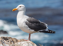
The original Point Lobos Ecological Reserve was created in 1973. It has become "one of the richest marine habitats in California." Divers may not take any fish or mollusks within the reserve. [2] The Point Lobos marine protected areas provide shelter to a wide range of fish, invertebrates, birds, and marine mammals, from those that rely on the near-shore kelp forest to those that inhabit the deep waters of the Carmel Submarine Canyon. [11]

In 2007, the California Department of Fish and Game expanded the ecological reserve and renamed it as the Point Lobos State Marine Reserve and Point Lobos State Marine Conservation Area. A no-take zone was extended from the east side of Monastery Beach to the mouth of MalPaso Creek. [12] They were two of 29 marine protected areas adopted during the first phase of the Marine Life Protection Act Initiative, a collaborative public process to create a statewide network of marine protected areas along the California coastline.

State Marine Reserve

Point Lobos SMR covers 5.36 square miles. [13] The SMR protects all marine life within its boundaries. Fishing and take of all living marine resources is prohibited. [14]

State Marine Conservation Area

Point Lobos SMCA covers 8.83 square miles. [13] Harvest of all living marine resources is prohibited in the conservation area except the recreational and commercial take of salmon, albacore, and the commercial take of spot prawn. [14]

Scientific monitoring

As specified by the Marine Life Protection Act, select marine protected areas along California's central coast are monitored by scientists to track their effectiveness and learn more about ocean health. Similar studies in marine protected areas located off of the Santa Barbara Channel Islands have already detected gradual improvements in fish size and number. [15]

Whaling Station Museum

Whalers Cabin was built around 1850 as a fisherman's hut. Whalers Cabin.jpg
Whalers Cabin was built around 1850 as a fisherman's hut.
Monterey cypress tree next to Whalers Cabin. Monterey Cypress Tree in Point Lobos State Natural Reserve, CA (July 2023).jpg
Monterey cypress tree next to Whalers Cabin.

The historic Whalers Cabin at Whaler's Cove was constructed in the 1850s to house Chinese and later Japanese fishermen. The Chinese used locally sourced pine and redwood for siding. The floor was originally dirt. The floor joists are supported by six whale vertebrae that rest on granite blocks quarried nearby. Originally, the floor was packed earth. There were originally about 10 cabins around the cove. The cabin may have been used by Portuguese whalers from the Azores, who harpooned whales off the coast and hauled their carcasses onshore at the cove. The Carmel Whaling Company operated from 1862 to 1879. From 1854 to the end of shore-based whaling in about 1900, there were only 16 shore whaling stations in California, with about 300 men involved. When kerosene oil was introduced in about 1880, whale oil became too expensive. Whaling was briefly reintroduced by the Japanese Whaling Company from 1898 to 1900. [16]

When the last resident moved out of the cabin in 1983, a park docent suggested turning the cabin into a museum. Improvements added after the Chinese era, like fiberboard walls and ceiling, wiring, and pipes were removed. Docents contacted descendants of the families who lived and worked at the cove to solicit contributions. California state parks exhibit specialists built displays around the artifacts. [16] It is the only building of this era that has been preserved. It houses the Whaling Station Museum dedicated to the cultural history of the point. The museum also highlights the history of Point Lobos, including its cinematic appearances and plans at the turn of the 20th century to develop the area for densely packed suburban housing. [17] [18]

History

Plot map of planned Point Lobos City, September 1890 Carmelito plot map 1890.png
Plot map of planned Point Lobos City, September 1890

The Ohlone people harvested shellfish including abalone from the waters around Point Lobos. Evidence has been found of a long-term village named Ichxenta, in a meadow near San Jose Creek adjacent to Point Lobos, that indicates the natives inhabited the area for about 2,500 years. The village meadow is currently known as the Polo Field. There are 19 midden sites within Point Lobos and five sites containing mortar holes used by the natives for grinding acorns and seeds. [19] [18]

It is likely that Sebastián Vizcaíno or some of his soldiers, who camped near the mouth of the Carmel River in 1602–03, may have visited the area to the south. Gaspar de Portolà and his exploring party camped at San Jose Creek in October 1769. Sergeant Jose Francisco Ortega conducted a study of the coast south of the Carmel River. [19] [18] :37 In about 1770, Spanish vaqueros from nearby Carmel Mission ran large herds of cattle in the area near Point Lobos. [20] [21]

Ichxenta was likely occupied until near the end of the Carmel Mission era, when the native population was decimated by disease, starvation, overwork, torture, and forced assimilation. [22] :114

Spanish and Mexican era

Governor Juan Bautista Alvarado granted Rancho San Jose y Sur Chiquito, two square leagues of land, in 1839 to Marcelino Escobar, Alcalde (or mayor) of Monterey, Alta California. The grant was from the south side of Carmel River, including Point Lobos, 11 miles (18 km) south to Palo Colorado Canyon. [23] [24]

Two of Escobar's sons, Juan and Agustin, obtained possession of the rancho shortly afterward, and sold it on August 26, 1841 to Doňa Maria Josefa de Abrego, who held power of attorney for her husband José Abrego to buy and sell land. She paid $250, one-half in silver, and one-half in gold, or about three cents per acre. [18] [20]

Ownership of Point Lobos was later complicated by the fact that when Juan and Augustin Escobar sold the rancho to Josefa de Abrego in 1841, they didn't obtain permission from their multiple brothers and sisters. The siblings later contested the sale. [18]

Under somewhat mysterious circumstances, on January 16, 1843, Maria Abrego deeded the rancho to a group of about 10 soldiers from the Monterey Presidio. Records confirm the soldiers paid nothing, and a legend attached to the transfer says a gambler lost a rancho in a card game. Her husband was known for his gambling habit. [18] On June 7, 1844, the soldiers turned the Rancho over to their superior officer, Colonel José Castro, former Governor Alvarado's brother-in-law. [12]

After the Mexican–American War, Mexico ceded California to the United States. The 1848 Treaty of Guadalupe Hidalgo provided that the land grants would be honored. But the Land Act of 1851 required owners to prove their ownership. Castro filed a claim on February 2, 1853, [18] but grew impatient with the outcome and sold the land in 1854 to Joseph S. Emery and Abner Bassett for $700, leaving to them the legal fight for ownership. [12] [25] The commission denied Castro's claim on August 28, 1855. [26] Castro died in 1860. [26] Emery and Bassett appealed the court's ruling. Bassett died in 1874, leaving his undivided one-half interest to his wife and eight children. Their half of the rancho was appraised at $15,000. [18]

In 1880, a lawsuit was filed in United States District Court to resolve the conflicting claims of more than two dozen putative property owners and squatters. On June 5, 1882, subject to confirmation of the original claim by Castro, the judges divided Escobar's original land grant into 34 parcels. [20] Later that year, Castro's original claim was validated by the court. The title was confirmed on December 24, 1885, and President Grover Cleveland signed the land patent on May 4, 1888, 35 years after Castro's initial filing. [27] All of the 34 claims from the 1880 lawsuit were invalidated as a result.

Industrial period

In 1851 a Chinese sailor, Quock Junk, ran aground at Point Lobos. He was rescued by members of the Ohlone tribe. He was later joined by four or five other Chinese families who built cottages at Whaler's Cove. They became the first commercial fishermen at the point.

On September 22, 1853, the Point Lobos lighthouse was linked by telegraph to San Francisco. The link was primarily used to transmit maritime and weather information. [28] From 1854 to 1858, a granite quarry was operated at what was later named Whaler's Cove. The granite was used to build the Old Monterey Jail, San Francisco Mint, portions of Fort Point, and buildings on the Navy's installation at Mare Island Naval Shipyard.

In 1862, Antonio Victorine, a Portuguese whaler from the Azores, arrived at Point Lobos, following the whale population. About fifty to seventy family members lived at Whaler's Cove. The men spotted whales from Whaler's Knoll and then rowed off shore about 1 mile (1.6 km) in 24-foot boats to harpoon the whales. They towed the whales back to Pt. Lobos to flense and harvest the blubber. They then towed the carcasses back out to sea. [29] [30]

Coal mining

Headstock of the Carmelo Land and Coal Company mine in upper Malpaso Canyon, south of Carmel, California, in 1895. Carmel coal mine headstock.png
Headstock of the Carmelo Land and Coal Company mine in upper Malpaso Canyon, south of Carmel, California, in 1895.

In 1874, a seam of low grade bituminous coal was found in upper Malpaso Canyon, southeast of Pt Lobos. [31] On September 6, 1888, shortly after the patent for Rancho San Jose y Sur Chiquito was approved, almost all of the owners banded together to form the Carmelo Land and Coal Company. In exchange for shares in the company, they sold their interest in the land for $1. [20] A mine was dug into the mountain near Malpaso Creek, and the coal was transported on ore carts via a tramway to a dog-hole port at Coal Chute Point, opposite the Chinese settlement at Whaler's Cove. The deep water allowed the workers to use the chute to deliver the coal directly to coastal steamers. [19] [18]

In 1890, Emory and Bassett's heirs subdivided Point Lobos into 1,000 parcels. They begin selling lots for $25 to $50 for a new town they initially named Point Lobos City, but later renamed Carmelito. [19] The lack of a bridge across the Carmel River and two national economic recessions during the 1890s combined to severely restrict sales. [21] [12] The outer portion of the point was reserved as the Point Lobos Park. [18]

In 1897, Alexander MacMillan Allan, a successful engineer from Pennsylvania, was hired to improve the coal mine operation. When he found the coal mine could not produce a profit, he purchased 640 acres (260 ha) of Point Lobos from the Carmelo Land and Coal Company in 1898. Marine biologist Gennosuke Kodani was already harvesting abalone from the area, a valuable delicacy in Japan. Allan partnered with him to build the Point Lobos Canning Company, which they operated until 1928. [32] Allan decided to move the remainder of his family from Oakland to Point Lobos. [33]

Label from a can of abalone produced by the Point Lobos Canning Company in 1905. Point Lobos abalone label 1905.jpg
Label from a can of abalone produced by the Point Lobos Canning Company in 1905.

Allan added a sand and gravel mining operation to the Abalone cannery. In 1899 he had a narrow gauge railroad built from nearby San Jose Beach to Coal Chute Point to transport sand for shipment by sea to glass manufacturers in Alameda. Sand mining continued through 1954. [21] [19] Allan established the Point Lobos Dairy at the mouth of San Jose Creek which was operated from 1903 until 1954. [12] He also became a successful race track architect and built the Santa Anita, Tanforan and Bay Meadows race tracks. [33] [34] One member of the family sold a portion they inherited to form the Carmel Meadows subdivision. [33]

Tollgate installed

In 1899, Allan and his wife Satie, who grew to appreciate the natural beauty of the point, were concerned about the increasing number of visitors. People had been visiting the point for many years to see the rare Monterey Cypress trees and enjoy the scenic coastline. The Allan family put up toll gates, prohibited camping, and charged visitors 50 cents a vehicle (about $10 today) to enter the point. Allan bought many of the residential lots that had been subdivided and later got the entire subdivision removed from the county record. [35] [20] [21] [12]

State interest in land

Scientists reported to the government that the Carmel area including Point Lobos was the "most picturesque spot on the Pacific Coast." In 1925, Point Lobos figured prominently in discussions for inclusion in the new state park system. Members of the Sierra Club and the Save the Redwoods League discussed preserving Point Lobos and Cypress Point as national parks or reserves. [18] Duncan McDuffie of the Save the Redwoods League hired the internationally known landscape architect Frederick Law Olmsted to research Point Lobos and report on the areas most noteworthy of preservation. Olmstead's report described Point Lobos as "the most outstanding example on the coast of California of picturesque rock and surf scenery in combination with unique vegetation, including typical Monterey cypress." [36] Point Lobos gained the attention of the newly established California State Park system, who considered taking the land using eminent domain. Allan initially resisted the idea of making the land a public park. [33] [37] The family persuaded the state to wait until Allan died. [4]

Land sold

On February 8, 1933, three years after Allan's death, the Allan family sold 348 acres (141 ha) to the State of California for $631,000 (equivalent to $11,385,015in 2022). The state promptly set about erasing evidence of human intrusion on the land, removing man-made structures like the abalone cannery, the railroad used to haul sand, and a number of homes and shacks, excepting a single Whalers Cabin. [4] The Allan family donated an additional 15 acres (6.1 ha) to the state of cypress-covered headlands at the western tip of the point as a memorial grove to Alexander and Satie Morgan Allan. The state added another 48 acres (19 ha) in 1975, expanding the reserve to almost 400 acres (160 ha). [38]

World War II use

At the beginning of World War II, a U.S. Army Coastal Defense Squad used the Whalers Cabin at Whaler's Cove for its headquarters. From 1942 to 1944, the cove was the site of a 4th Air Force Long-Range Radar site. Tents were set up to accommodate 90 men below Rat Hill. In July and August 1943, the U.S. Army established a training school for the 543rd Engineer Boat and Shore Regiment, 3rd Engineer Special Brigade, at Whaler's Cove at Point Lobos. The unit found that the cove was an ideal harbor for anchoring and maintaining their boats. The unit was later involved in 62 landings in the southwest Pacific. [39] [40] [12]

Modern changes

The Allan family retained the land to the east of Highway 1. Eunice Allan Riley, one of Alexander's three daughters, repurchased the last subdivided lots in the 1950s. [34] [12] [21] In 1960, 750 acres (300 ha) underwater acres were added as the first marine reserve in the United States. The marine reserve was designated an ecological reserve in 1973, and in 1992, was added to the Monterey Bay National Marine Sanctuary, the largest in the nation. [21] [38]

A large number of movies have been made in or around Point Lobos.

See also

Related Research Articles

<span class="mw-page-title-main">Big Sur</span> Coastal region of California, United States

Big Sur is a rugged and mountainous section of the Central Coast of the U.S. state of California, between Carmel Highlands and San Simeon, where the Santa Lucia Mountains rise abruptly from the Pacific Ocean. It is frequently praised for its dramatic scenery. Big Sur has been called the "longest and most scenic stretch of undeveloped coastline in the contiguous United States", a sublime "national treasure that demands extraordinary procedures to protect it from development", and "one of the most beautiful coastlines anywhere in the world, an isolated stretch of road, mythic in reputation". The views, redwood forests, hiking, beaches, and other recreational opportunities have made Big Sur a popular destination for visitors from across the world. With 4.5 to 7 million visitors annually, it is among the top tourist destinations in the United States, comparable to Yosemite National Park, but with considerably fewer services, and less parking, roads, and related infrastructure.

<span class="mw-page-title-main">Andrew Molera State Park</span> State park in California, United States

Andrew Molera State Park is a 4,800 acres (1,900 ha), relatively undeveloped state park on the Big Sur coast of California, United States, preserving land as requested by former owner Frances Molera. Situated at the mouth of the Big Sur River, the property was part of the Rancho El Sur land grant, and later owned by Californio pioneer John Bautista Rogers Cooper and his descendants. Cooper's grandchildren Andrew and Frances Molera inherited the property from their mother in 1918. Andrew popularized the artichoke in California in 1922, and died in 1931. In 1965, Frances sold the property to The Nature Conservancy, stipulating that the park to be created should be named for her brother.

<span class="mw-page-title-main">Monterey Bay National Marine Sanctuary</span> Marine protected area in California, U.S.

The Monterey Bay National Marine Sanctuary (MBNMS) is a federally protected marine area offshore of California's Big Sur and central coast in the United States. It is the largest US national marine sanctuary and has a shoreline length of 276 miles (444 km) stretching from just north of the Golden Gate Bridge at San Francisco to Cambria in San Luis Obispo County. Supporting one of the world's most diverse marine ecosystems, it is home to numerous mammals, seabirds, fishes, invertebrates and plants in a remarkably productive coastal environment. The MBNMS was established in 1992 for the purpose of resource protection, research, education, and public use.

Point Lobos Ranch is an 1,315-acre (532 ha) parcel of land owned by the state of California in the northern region of Big Sur, California, United States. San Jose Creek on the ranch was the site of an Ohlone village for thousands of years. Europeans first visited the site when the Portolá expedition camped at the site for 10 days in the winter of 1769.

<span class="mw-page-title-main">Garrapata State Park</span> State park in California, United States

Garrapata State Park is a state park of California, United States, located on California State Route 1 6.7 miles (10.8 km) south of Carmel-by-the-Sea and 18 miles (29 km) north of Big Sur Village on the Monterey coast. The 2,939-acre (1,189 ha) park was established in 1979. California sea lions, harbor seals and sea otters frequent the coastal waters while gray whales pass close by during their yearly migration.

<span class="mw-page-title-main">Point Sur State Historic Park</span> State park in Monterey County, California

Point Sur State Historic Park is a California State Park on the Big Sur coastline of Monterey County, California, United States, 19 miles (31 km) south of Rio Road in Carmel. The 1889 Point Sur Lighthouse is on the National Register of Historic Places.

<span class="mw-page-title-main">Carmel Bay State Marine Conservation Area</span> Marine protected area in Carmel Bay

Carmel Bay State Marine Conservation Area (SMCA) is a marine protected area in Carmel Bay. Carmel Bay is adjacent to the city of Carmel-by-the-Sea and is near Monterey, on California’s central coast. The marine protected area covers 2.12 square miles. Recreational fishing of finfish and limited commercial taking of kelp is permitted within the SMCA.

Carmelito was a planned settlement, initially called Point Lobos City, on Point Lobos in Monterey County, California It was located just north of Carmel Highlands and about 3 miles (4.8 km) south of Carmel on Highway 1. Located on the former Rancho San Jose y Sur Chiquito, the Carmelo Land and Coal Company planned the subdivision in 1890 when their coal mine on nearby Malpaso Creek proved to be unprofitable. They subdivided the land into 1,000 parcels and began selling lots for $25 to $50. The lack of a bridge across the Carmel River and two national economic recessions during the 1890s combined to severely restrict sales. Only a few small cabins were built.

<span class="mw-page-title-main">Rancho San José y Sur Chiquito</span>

Rancho San José y Sur Chiquito was a 8,876-acre (35.92 km2) Mexican land grant in present-day Big Sur, in Monterey County, California, given in 1835 to Teodoro Gonzalez and re-granted by Governor Juan Alvarado the same year to Marcelino Escobar. The grant, including Point Lobos, was located south of the Carmel River, extending inland along the coastal mountains, and south along the Pacific coast. It included San Jose Creek, Malpaso Creek, Soberanes Creek, Tres Pinos Creek, Garrapata Creek, and ended on the north side of Palo Colorado Canyon. A hand-drawn map created c. 1853 accompanying the grant indicated a road or trail was already present along the coast.

<span class="mw-page-title-main">Carmel Pinnacles State Marine Reserve</span> Marine protected area in Carmel Bay

Carmel Pinnacles State Marine Reserve (SMR) is a marine protected area in Carmel Bay including a unique underwater pinnacle formation with adjacent kelp forest, submarine canyon head, and surfgrass. Carmel Bay is adjacent to the city of Carmel-by-the-Sea and is near Monterey, on California's central coast.

<span class="mw-page-title-main">Malpaso Creek</span> River

Malpaso Creek is a small, coastal stream 5 miles (8.0 km) south of Carmel in Monterey County, California, United States. It is generally regarded as the northern border of Big Sur in central coastal California. A low grade bituminous coal deposit was found in upper Malpaso Canyon in 1874. Actor and director Clint Eastwood bought 650 acres (260 ha) of land in the vicinity of the creek and named his production company Malpaso Productions after the creek.

<span class="mw-page-title-main">Carmel Bay</span> Bay of the Pacific Ocean off the coast of California, United States

Carmel Bay is a bay of the Pacific Ocean, along the central coast of California in Monterey County. The bay is 4 mi (6.4 km) long and 2 mi (3.2 km) wide with its mouth about 3 mi (4.8 km) across, between Point Carmel to the south and Point Cypress to the north; Monterey Bay is about four coastline miles north, with Point Pinos intervening.

<span class="mw-page-title-main">Whalers Cabin</span> United States historic place

The Whalers Cabin near Carmel-by-the-Sea, California, is a historic building that is listed on the National Register of Historic Places. It is located in what is now Point Lobos State Natural Reserve, four miles south of Carmel.

<span class="mw-page-title-main">Big Sur Land Trust</span> Non-profit located in Monterey, California

The Big Sur Land Trust is a private 501(c)(3) non-profit located in Monterey, California, that has played an instrumental role in preserving land in California's Big Sur and Central Coast regions. The trust was the first to conceive of and use the "conservation buyer" method in 1989 by partnering with government and developers to offer tax benefits as an inducement to sell land at below-market rates. Since 1978, with the support of donors, funders and partners, it has conserved over 40,000 acres through conservation easements, acquisition and transfer of land to state, county and city agencies. It has placed conservation easements on 7,000 acres and has retained ownership of over 4,000 acres.

<span class="mw-page-title-main">Old Coast Road (Big Sur)</span> Pre-1920 dirt road in Monterey County, California

The Old Coast Road is a dirt road that still exists in part and preceded the current Big Sur Coast Highway along the northern coast of Big Sur, California. It was initially a trail created by Rumsen and Esselen Native Americans to travel along the coast in present-day Monterey County, California. Soon after the Spanish arrived, Governor Teodoro Gonzalez granted land that included portions of the trail as Rancho San Jose y Sur Chiquito to Marcelino Escobar in 1835. Governor Juan Alvarado re-granted the land to Escobar the same year. The Rancho included land from Carmel to near Palo Colorado Canyon. José Castro gained possession of the land in about 1848. He improved the trail from Monterey to Palo Colorado Canyon as early as 1853. A hand-drawn map created c. 1853 accompanying the grant indicated a road or trail was already present along the coast.

<span class="mw-page-title-main">José Abrego</span> Wealthy 19th century merchant

José Abrego arrived in Alta California in 1834 as a member of Compania Cosmopolitan A, part of the Hijar-Padrés colony. It was led by José Maria Hijar and Don José Maria Padrés. Abrego became a merchant in Monterey, California, and held a variety of political offices. He served as treasurer of the territory from 1839 to 1846. After the Mexican–American War, he continued to operate as a merchant. He became very wealthy and built a home that is still preserved in Monterey.

<span class="mw-page-title-main">Palo Corona Ranch</span> Historic Carmel Valley ranch

The 4,500 acres (1,800 ha) Palo Corona Ranch, also known as Fish Ranch, was once a private ranch located on the northern end of Big Sur, California, between Garrapata State Park to the west, Carmel Valley on the north, and Santa Lucia Preserve to the east. The ranch is now owned by Monterey Peninsula Regional Park District (MPRPD) In 2002, the Big Sur Land Trust and The Nature Conservancy acquired the land and transferred ownership to MPRPD in 2004, which created the Palo Corona Regional Park. Key habitat and resources include coastal grasslands and woodland, ponds, and perennial creeks.

<span class="mw-page-title-main">Palo Corona Regional Park</span> Public recreational area

The Palo Corona Regional Park is a 4,500 acres (1,800 ha) park owned by the Monterey Peninsula Regional Park District on land east of Big Sur Coast Highway and Garrapata State Park in California. The 9,898 acres (4,006 ha) property stretches southeast about 11 miles (18 km) from the near the Carmel River State Beach to the Los Padres National Forest. The park is long from north to south, bordered on the northwest by Highway 1 and across from Carmel River State Beach. It wraps around Point Lobos Ranch and abuts Santa Lucia Preserve to the east. In the middle, it is sandwiched by Mitteldorf Preserve and Garrapata State Park. Its southern border abuts Joshua Creek Canyon Ecological Reserve. Environmental interests were concerned that it would be converted to an estate-type development like that done for Rancho San Carlos. In May 2002, the Big Sur Land trust and The Nature Conservancy joined to buy the Ranch. Overall, the park directly and indirectly connects nine conservation properties preserved for their biological, recreation and scenic values. The area includes the former Rancho Caňada Country Club and golf course in Carmel Valley.

References

  1. "Protected Planet | Point Lobos State". Protected Planet. Retrieved October 16, 2020.
  2. 1 2 3 "Fantastic Diving | Point Lobos Foundation". pointlobos-org.cftvgy.org. Retrieved May 8, 2019.
  3. 1 2 With almost one million visitors a year point lobos state park is dealing with the consequences of some of the footprints being left behind. KION. November 19, 2017. Retrieved May 11, 2018.
  4. 1 2 3 Guara, Maria. "Point Lobos' natural beauty belies industrial past". SFGate. Retrieved May 10, 2018.
  5. "Marine Life | Point Lobos Foundation". www.pointlobos.org. Retrieved May 8, 2019.
  6. Conaway, James. "Big Sur's California Dreamin'". Smithsonian. Retrieved May 8, 2019.
  7. Stienstra, Tom (March 30, 2014). "Spectacular coastline at Point Lobos Reserve - SFChronicle.com". www.sfgate.com. Retrieved May 8, 2019.
  8. C.Michael Hogan and Michael P. Frankis. 2009. Monterey Cypress: Cupressus macrocarpa, GlobalTwitcher.com ed. N. Stromberg Archived 2017-09-06 at the Wayback Machine
  9. Department of Fish and Game. California Fish and Game Code section 2853 (b)(3) Archived 2013-03-26 at the Wayback Machine Marine Life Protection Act. Retrieved December 18, 2008.
  10. Big Sur plea: Tourists, honor our home
  11. Department of Fish and Game. "Appendix O. Regional MPA Management Plans". Master Plan for Marine Protected Areas (approved February 2008). Retrieved December 18, 2008.
  12. 1 2 3 4 5 6 7 8 The Whalers Cabin and The Whaling Station Museum (PDF), Point Lobos Foundation, 2017
  13. 1 2 California Department of Fish and Game. California Marine Life Protection Act Initiative Summary of Central Coast MPAs as Adopted by the California Fish and Game Commission Retrieved on December 22, 2008.
  14. 1 2 California Department of Fish and Game."Online Guide to California’s Central Coast Marine Protected Areas Retrieved on December 18, 2008.
  15. Castell, Jenn, et al. How do patterns of abundance and size structure differ between fished and unfished waters in the Channel Islands? Results from SCUBA surveys . Partnership for Interdisciplinary Studies of Coastal Oceans (PISCO) at University of California, Santa Barbara and University of California, Santa Cruz; Channel Islands National Park. Retrieved December 18, 2008.
  16. 1 2 "Whalers Cabin". Point Lobos Foundation. Archived from the original on February 3, 2015. Retrieved June 5, 2018.
  17. Bertao, David. The Portuguese Shore Whalers of California, 1854-1904. San Jose, CA: Portuguese Heritage Publications, 2006. Page 106.
  18. 1 2 3 4 5 6 7 8 9 10 11 Aubrey Drury, 1954, Point Lobos Reserve, California State Park , Department of Natural Resources, Sacramento, p. 78–85
  19. 1 2 3 4 5 "The Allan Memorial Grove at Point Lobos State Reserve" (PDF). California State Parks. 2004. Retrieved May 7, 2018.
  20. 1 2 3 4 5 Wiley, Marlene. "Point Lobos State Reserve". www.mnn.net. Retrieved May 7, 2018.
  21. 1 2 3 4 5 6 "Point Lobos History". www.pt-lobos.com. Retrieved May 7, 2018.
  22. Pritzker, Barry M. (2000). A Native American Encyclopedia: History, Culture, and Peoples . Oxford [u.a.]: Oxford Univ. Press. ISBN   978-0-19-513877-1.
  23. "Diseño del Rancho San José y Sur Chiquito: Calif". Calisphere.
  24. "Rancho San Jose y Sur Chiquito". Geographic Names Information System . United States Geological Survey, United States Department of the Interior.
  25. Hoover, Mildred B.; Rensch, Hero; Rensch, Ethel; Abeloe, William N. (1966). Historic Spots in California . Stanford University Press. ISBN   978-0-8047-4482-9.
  26. 1 2 Killea; Lucy Lytle (October 1966). "Journal of San Diego History". San Diego Historical Society. sandiegohistory.org. Archived from the original on April 11, 2005. Retrieved June 16, 2010.
  27. "Report of the Surveyor General 1844–1886" (PDF). Archived from the original (PDF) on May 4, 2009.
  28. Point Lobos State Reserve
  29. Grimes, Teresa; Heumann, Leslie (January 7, 1997). "Historic Context Statement Carmel-by-the-Sea". ci.carmel.ca.us. Retrieved December 30, 2017.
  30. "Allan House". Alliance of Monterey Area Preservationists. Retrieved May 10, 2018.
  31. Walton, John (2003). Storied Land: Community and Memory in Monterey. Berkeley, Calif.: University of California Press. ISBN   978-0520227231 . Retrieved May 7, 2018.
  32. Hirahara, Naomi (2001). Distinguished Asian American business leaders (1. ed.). Phoenix, Ariz.: Oryx. pp. 104–106. ISBN   9781573563444 . Retrieved May 7, 2018.
  33. 1 2 3 4 Rogers, Paul (December 2, 2010). "Land deal near Point Lobos closes more than a century of preservation". The Mercury News. Retrieved May 10, 2018.
  34. 1 2 "Obituary Margaret M. Allan" . Retrieved May 10, 2018.
  35. "History of Point Lobos". pointlobos.org. Point Lobos Foundation. Archived from the original on August 31, 2014. Retrieved May 7, 2018.
  36. "Map of Point Lobos Proposed California State Park, a part of Rancho San José y Sur Chiquito in Monterey County, Cal. - Price Estimate: $150 - $250". www.pbagalleries.com. Retrieved May 8, 2018.
  37. Johnson, Jim (October 16, 2015). "Point Lobos Stone House demolition, development plans rankle neighbors". Monterey Herald. Retrieved May 11, 2018.
  38. 1 2 "Point Lobos History - Point Lobos Foundation". www.pointlobos.org. Retrieved May 10, 2018.
  39. "Charles Wilson Spence's Obituary on The Augusta Chronicle". The Augusta Chronicle.
  40. "3rd ESB Engineer Special Brigade, 533rd EB&SR, 543rd EB&SR, 593rd EB&SR". ebsr.net. Retrieved May 11, 2018.