William Randolph Hearst Memorial State Beach

Last updated • 5 min readFrom Wikipedia, The Free Encyclopedia
Pier at Hearst State Beach Pier, W.R. Hearst State Beach, San Simeon, Calif. (6444492983).jpg
Pier at Hearst State Beach

William Randolph Hearst Memorial State Beach is located near the historic town of San Simeon along California State Route 1, in San Luis Obispo County, California, United States. It is named for newspaper magnate William Randolph Hearst (1863–1951), [1] whose family is closely associated with the area.

Contents

History

William Randolph Hearst Memorial State Beach is located in northern San Simeon, California, directly below historic Hearst Castle in San Luis Obispo County. William Randolph Hearst State Beach, or "The Cove" as it is locally known, was the hub of trade and shipping in the area, which was once home to the Hearst family newspaper empire.

Before the 1800s the land was known to be inhabited by the Chumash. [2] in the mid-1830s, Mission San Miguel was built and by the early 1850s a small Portuguese whaling village had been built on the peninsula jutting out into the sea. Over the course of ten years the small village managed to hunt down some 370 whales. Though records of what type of whales were not kept, it is assumed the majority of the whales were gray and humpbacks, as these are the whales that are commonly spotted in the area. This village was short-lived, because only ten years after it was built a severe drought caused the town to move to find fresh water. [3]

George Hearst bought nearly 50,000 acres, establishing the ground work for his son William's empire. The Hearst family owned all the land as far as the eye could see from their castle until the early 1950s when the family donated a huge section of land to the state and sold miles of shoreline to be reserved for public use. The pier George Hearst built in the 1800s no longer exists, but a new one was built in the 1900s just a few hundred yards down the beach that now stands in its place. Today the beach is a California state beach. [4]

The Cove Slack line.jpg
The Cove

Activities

William Randolph Hearst Memorial State Beach is a quiet place with an abundance of wildlife and nature that can be easily viewed. Hearst Memorial State Beach gives visitors the opportunity to hike, swim, fish and beachcomb. A popular beach spot, this protected cove also offers visitors pier fishing as well as kayak fishing, but there is no large boat launch from the beach. Fishing licenses are not required when fishing from the pier but limits are enforced. The beach has a variety of outdoor activities including, kayaking, kayak surfing, paddle boarding, slack lining, hiking, fishing, and swimming. Though kayak surfing is becoming more popular along the beach the water is mostly shore break and therefore it is difficult to surf on a normal surfboard. Located on the beach is a small kayak shop, Sea For Yourself Kayak Outfitter, a shop which provides kayak, paddle board, bike, and other beach gear rentals.

The beach has more than initially meets the eye. Sights include caves, beaches, arches, and an abundance of wildlife. Different types of wildlife that can be seen in the cove over a year include, but are not limited to, gray whales, humpback whales, bottlenose dolphins, sea lions, harbor seals, elephant seals, sea otters, and northern fur seals. Fishing from both the pier and by boat is also popular and common fish that are targeted here include, but are not limited to, rockfish including lingcod, cabezon, vermilion rockfish, and gopher cod. Other fishes include halibut, thresher sharks, smelt, surf perch, and the occasional stingray.

There is also a peninsula that juts out into the ocean that is still Hearst property today. Visitors are allowed to hike the path all the way out to the ocean. Just above the beach in the upper parking lot is a discovery center, which provides information about the history and the local wildlife. Picnic tables, barbecue grills and restrooms are available. This day-use area offers 24 picnic sites, 150 parking spaces, restrooms, water faucets, barbecue grill stands and easy beach access. Recreational activities include picnicking, swimming, fishing, boating, kayaking and sunbathing, including the kayak and boogie board concession in operation with equipment for rent every day from 10 a.m. to 4:30 p.m. [5]

The beach is day-use only; no camping or bonfires are allowed. Gates are closed just after sunset.

The beach today

On any given day you can expect to see people kayaking or paddle boarding on the calm waters of the Cove, or fishing the kelp beds. The beach is divided into two sections: from the parking lot down to the water is all state-owned and -maintained beach, but the other half of the area including the peninsula is private property still owned by the Hearst family today. By California state law, the beach up to the high-tide line is public property, freely acesssible to anyone. The residential area is fenced and posted, and there is a signboard on the public trail to San Simeon Point with the rules for public access. No camping or campfires are permitted on the Hearst Ranch property.

The Hearst warehouses are still standing today. Sebastian's is now a small grill serving all grass-fed Hearst beef, but used to serve as a small general store in the 1800s. There are also two newer buildings: one a small kayak rental shop, and the other a small nature and historic museum or discovery center. San Simeon Point, which is still Hearst property today, is covered in trees and has small trails that go out along its edges to its point, where on a clear day you can see the Piedras Blancas Lighthouse tower; it was built in the 1870s and is still in operation today. [6]

Climate

San Simeon has a mild climate, but it fluctuates day to day. During the summer temperatures can be in the nineties, or as low as the fifties on any given day. During the winter the weather is usually mild with temperatures hovering between the low forties and high sixties. On average San Simeon sees only around twenty inches of rain a year. Most days start with a layer of fog that burns off by mid-morning. [7] Once the fog has burned off, the historic Hearst Castle can be seen from the beach.

See also

Related Research Articles

<span class="mw-page-title-main">Newport Beach, California</span> City in Orange County, California

Newport Beach is a coastal city of about 85,000 in southern Orange County, California, United States. Located about 40 miles (64 km) southeast of downtown Los Angeles, Newport Beach is known for its sandy beaches. The city's harbor once supported maritime industries. Today it is used mostly for recreation. Balboa Island draws visitors with a waterfront path and easy access from the ferry to the shops and restaurants.
<span class="mw-page-title-main">Sea kayak</span> Light boat that is paddled

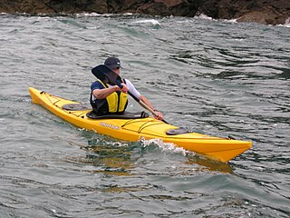
A sea kayak or touring kayak is a kayak used for the sport of paddling on open waters of lakes, bays, and oceans. Sea kayaks are seaworthy small boats with a covered deck and the ability to incorporate a spray deck. They trade off the manoeuvrability of whitewater kayaks for higher cruising speed, cargo capacity, ease of straight-line paddling (tracking), and comfort for long journeys.

<span class="mw-page-title-main">San Simeon, California</span> Small community on the coast of California

San Simeon is an unincorporated community on the Pacific coast of San Luis Obispo County, California, United States. Its position along State Route 1 is about halfway between Los Angeles and San Francisco, each of those cities being roughly 230 miles (370 km) away. A key feature of the area is Hearst Castle, a hilltop mansion built for William Randolph Hearst in the early 20th century that is now a tourist attraction. The area is also home to a large northern elephant seal rookery, known as the Piedras Blancas rookery, located 7 miles (11 km) north of San Simeon on Highway 1.
<span class="mw-page-title-main">Cape Henlopen State Park</span> State park in Delaware, United States

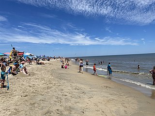
Cape Henlopen State Park is a Delaware state park on 5,193 acres (2,102 ha) on Cape Henlopen in Sussex County, Delaware, in the United States. William Penn made the beaches of Cape Henlopen one of the first public lands established in what has become the United States in 1682 with the declaration that Cape Henlopen would be for "the usage of the citizens of Lewes and Sussex County." Cape Henlopen State Park has a 24-hour and year-round fishing pier as well as campgrounds. The remainder of the park is only open from sunrise to sunset, and includes a bathhouse on the Atlantic Ocean, an area for surf-fishing, a disc golf course, and bicycle and walking paths. The beach at Herring Point is a popular surfing spot. The park is a stop on Delaware's Coastal Heritage Greenway.

<span class="mw-page-title-main">Ocean Beach, San Diego</span> Community of San Diego in California, United States

Ocean Beach is a beachfront neighborhood in San Diego, California.

<span class="mw-page-title-main">Monterey Bay National Marine Sanctuary</span> Marine protected area in California, U.S.

The Monterey Bay National Marine Sanctuary (MBNMS) is a federally protected marine area offshore of California's Big Sur and central coast in the United States. It is the largest US national marine sanctuary and has a shoreline length of 276 miles (444 km) stretching from just north of the Golden Gate Bridge at San Francisco to Cambria in San Luis Obispo County. Supporting one of the world's most diverse marine ecosystems, it is home to numerous mammals, seabirds, fishes, invertebrates and plants in a remarkably productive coastal environment. The MBNMS was established in 1992 for the purpose of resource protection, research, education, and public use.

<span class="mw-page-title-main">New Brighton State Beach</span> State beach in Santa Cruz County, California, United States

New Brighton State Beach is a 95 acres (38 ha) beach park on Monterey Bay in Santa Cruz County, California, consisting of a beach and campgrounds. The park is located east of Santa Cruz in Capitola, on Park Avenue off of Highway 1. The park is adjacent to Seacliff State Beach, which is known for its fishing pier and sunk concrete freighter, The Palo Alto. The beach overlooks Soquel Cove and Monterey Bay.

<span class="mw-page-title-main">Pacifica Pier</span> Fishing pier in Pacifica, California, US

Pacifica Pier is a fishing pier in Pacifica, in western San Mateo County, California. The L-shaped pier spans out into the Pacific Ocean for a quarter mile from the City of Pacifica. Its official name is the Rev. Herschell Harkins Memorial Pacifica Pier.
<span class="mw-page-title-main">Salt Point State Park</span> State park in California, United States

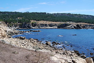
Salt Point State Park is a state park in Sonoma County, California, United States. The park covers 6,000 acres (2,428 ha) on the coast of Northern California, with 20 miles (32 km) of hiking trails and over 6 miles (9.7 km) of a rough rocky coastline including Salt Point which protrudes into the Pacific Ocean. The park also features the first underwater preserves in California. The constant impact of the waves forms the rocks into many different shapes. These rocks continue underwater providing a wide variety of habitats for marine organisms. The activities at Salt Point include hiking, camping, fishing, scuba diving and many others. The weather is often cool with fog and cold winds, even during the summer.
<span class="mw-page-title-main">Mendocino Headlands State Park</span> Park in Mendocino, California

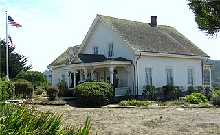
Mendocino Headlands State Park is a California State Park in Mendocino, California. It consists of 347 acres (1.4 km2) of undeveloped seaside bluffs and islets surrounding the town of Mendocino, two beaches, and the much larger Big River Unit stretching for eight miles (13 km) along both banks of the nearby Big River.
<span class="mw-page-title-main">La Jolla Shores</span> Beach in La Jolla, San Diego, California

La Jolla Shores, with its northern part Scripps Beach, is a beach and vacation/residential community of the same name in the community of La Jolla in San Diego, California. The La Jolla Shores business district is a mixed-use village encircling Laureate Park on Avenida de la Playa in the village of La Jolla Shores.

<span class="mw-page-title-main">Swami's</span>

Swami's is an area in San Diego County that contains Swami's Beach and other local attractions. The beach, also known as "Swami’s Reef'" and "Swamis", is an internationally known surfing spot, a point break located in Encinitas, San Diego County, California. Swami's was named after Swami Paramahansa Yogananda, because the grounds and hermitage of the Self-Realization Fellowship ashram, built in 1937, overlook this reef point. The name "Swami's" is also given to the sand beach that extends south from the point to the next beach access point, which is next to the San Elijo State Beach camping area; this more southerly surf spot often goes by the name "Pipes".

<span class="mw-page-title-main">Hearst San Simeon State Park</span> State park of California, United States

Hearst San Simeon State Park is a state park of California, United States, preserving rocky coast and rare habitats. It is located between Cambria and San Simeon. The 3,409-acre (1,380 ha) park was first established in 1932. The park includes the Santa Rosa Creek Natural Preserve, the San Simeon Natural Preserve and the Pa-nu Cultural Preserve, which were established in 1990.

<span class="mw-page-title-main">Camp Cherry Valley</span> Camp on Catalina Island, California

Camp Cherry Valley was a summer camp on the leeward side of Catalina Island, California, which is owned and operated by the Greater Los Angeles Area Council of the Boy Scouts of America. It is located two coves north of Two Harbors at Cherry Cove. The camp, valley and cove get their name from the Catalina cherry trees native to the island. It also offers non-Scouting programs on a year-round basis.

<span class="mw-page-title-main">Cambria State Marine Conservation Area</span> Marine protected area in California

Cambria State Marine Conservation Area (SMCA) is a marine protected area located off the coast of the city of Cambria, California on California’s central coast in San Luis Obispo County, California. The marine protected area covers 6.26 square miles (16.2 km2). Within the SMCA recreational fishing and take is allowed while commercial fishing and take of all living marine resources is prohibited.

<span class="mw-page-title-main">Piedras Blancas State Marine Reserve and Marine Conservation Area</span> Marine protected areas in California

Piedras Blancas State Marine Reserve (SMR) and Piedras Blancas State Marine Conservation Area (SMCA) are two adjoining marine protected areas that lie offshore of San Luis Obispo County on California's central coast. The combined area of these marine protected areas is 19.68 square miles (51.0 km2). The SMR protects all marine life within its boundaries. Fishing and take of all living marine resources is prohibited. Within the SMCA fishing and take of all living marine resources is prohibited except the commercial and recreational take of salmon and albacore.

<span class="mw-page-title-main">White Rock (Cambria) State Marine Conservation Area</span> Marine protected area off the coast of Cambria, California

White Rock (Cambria) State Marine Conservation Area (SMCA) is a marine protected area located off the coast of the city of Cambria, California on California’s central coast. The marine protected area covers 2.32 square miles (6.0 km2). Within the SMCA the take of all living marine resources is prohibited except the commercial take of giant kelp and bull kelp under certain conditions.

<span class="mw-page-title-main">Point Dume State Marine Conservation Area</span> Marine protected area in California, US

Point Dume State Marine Conservation Area (SMCA) and Point Dume State Marine Reserve (SMR) are two adjoining marine protected areas that extend offshore in Los Angeles County on California's south coast. Together, the areas cover 23.28 square miles (60.3 km2), protecting natural habitats and marine life by protecting or limiting removal of wildlife from within their boundaries.

Big Break Regional Shoreline is a regional park in Oakley, Contra Costa County, northern California. It is a part of the East Bay Regional Park District system.

References

  1. "William Randolph Hearst - Facts & Summary - HISTORY.com". HISTORY.com. Retrieved 2016-04-14.
  2. "San Simeon History - San Simeon's Best". San Simeon's Best. Retrieved 2016-04-05.
  3. "Visitor Information ★ San Simeon California Tourist Information, old San Simeon Village near Hearst Castle, location of William Randolph Hearst State Beach, San Simeon Post Office, the restored old San Simeon one-room schoolhouse, Sebastian's General Store and Cafe, Hearst's remarkable Spanish-style warehouses, old adobe Hearst Ranch cowboy housing and the new in 2010 Hearst Winery tasting room located in Sebastian's General Store at the west end of the historic old town of San Simeon, California". san-simeon-lodging.com. Retrieved 2016-04-05.
  4. "California State Parks". www.parks.ca.gov. Retrieved 2016-04-14.
  5. "William Randolph Hearst Memorial Beach". www.parks.ca.gov. Retrieved 2016-04-14.
  6. "San Simeon Piedras Blancas Light Station History and Tours". hearstcastle.org. Retrieved 2016-04-14.
  7. "William Randolph Hearst Memorial Beach". www.parks.ca.gov. Retrieved 2016-04-14.

35°38′35″N121°11′15″W / 35.64306°N 121.18750°W / 35.64306; -121.18750