| Wassama Round House State Historic Park | |
|---|---|
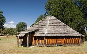 Wassama Round House | |
 Location in California  Wassama Round House State Historic Park (the United States) | |
| Location | Madera County, California |
| Nearest city | Ahwahnee |
| Coordinates | 37°22′28″N119°43′19″W / 37.37444°N 119.72194°W |
| Governing body | State of California |
| Official name | Wassama Roundhouse [1] |
| Reference no. | 1001 |
The Wassama Round House State Historic Park is in the Sierra Nevada foothills, in Madera County of central California.