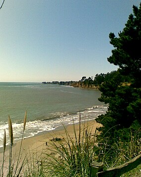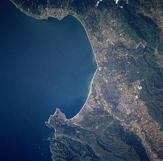
Santa Cruz is the county seat and largest city of Santa Cruz County, California. As of 2018 the U.S. Census Bureau estimated Santa Cruz's population at 64,725.

The Santa Cruz Mountains, part of the Pacific Coast Ranges, are a mountain range in central and northern California, United States. They form a ridge down the San Francisco Peninsula, south of San Francisco. They separate the Pacific Ocean from the San Francisco Bay and the Santa Clara Valley, and continue south to the Central Coast, bordering Monterey Bay and ending at the Salinas Valley. The range passes through the counties of San Mateo, Santa Clara, Santa Cruz, San Benito and Monterey, with the Pajaro River forming the southern boundary.

The Central Coast is an area of California, United States, roughly spanning the coastal region between Point Mugu and Monterey Bay. It lies northwest of Los Angeles County and south of San Francisco and San Mateo counties. Six counties make up the Central Coast: from south-to north, Ventura, Santa Barbara, San Luis Obispo, Monterey, San Benito, and Santa Cruz.

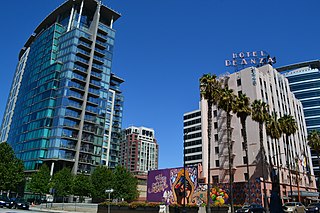
Silicon Valley Monterey Bay Council (#055), the result of a council merger between the Santa Clara County Council and the Monterey Bay Area Council, is a Boy Scouts of America council headquartered in San Jose, California. In 2004, the previous two councils served over 11,000 youth in over 400 Boy Scout troops, Cub Scout packs, Venturing crews, and Explorer posts. In 2012, the Monterey Bay Area Council announced that after 89 years as a separate council, it had agreed to merge back into the Santa Clara County Council. As of 2013, the council served 13,000 youth in four different counties.
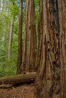
Big Basin Redwoods State Park is a state park in the U.S. state of California, located in Santa Cruz County, about 36 km (22 mi) northwest of Santa Cruz. The park contains almost all of the Waddell Creek watershed, which was formed by the seismic uplift of its rim, and the erosion of its center by the many streams in its bowl-shaped depression.
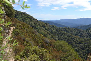
Castle Rock State Park is a 5,242-acre (2,121 ha) state park of California, USA, located along the crest of the Santa Cruz Mountains and almost entirely in Santa Cruz County, with parts extending into Santa Clara County and San Mateo County. It embraces coast redwood, Douglas fir, and madrone forest, most of which has been left in its wild, natural state. Steep canyons are sprinkled with unusual rock formations that are a popular rock climbing area. The forest here is lush and mossy, crisscrossed by 32 miles (51 km) of hiking trails. These trails are part of an even more extensive trail system that links the Santa Clara and San Lorenzo valleys with Castle Rock State Park, Big Basin Redwoods State Park, and the Pacific Coast. Due to its overnight parking lot, Castle Rock is a popular starting point for the Skyline-to-the-Sea Trail, a 30-mile (48 km) trail that begins near by at Saratoga Gap and leads to Waddell Beach north of Santa Cruz. There are two walk-in campgrounds within the park for overnight backpacking.
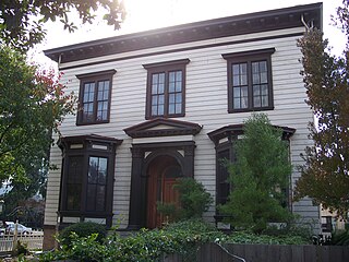
Thomas Fallon (1825–1885) was an Irish-born, Canadian-raised American capitalist and politician, the tenth Mayor of San Jose, California.

Seacliff State Beach is a state beach park on Monterey Bay, in the town of Aptos, Santa Cruz County, California. It is located off Highway 1 on State Park Drive, about 5 miles (8 km) south of Santa Cruz,. The beach is most known for the concrete ship SS Palo Alto lying in the water. North of Seacliff State Beach is New Brighton State Beach.
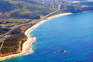
Crystal Cove State Park is a state park of California, United States, encompassing 3.2 miles (5.1 km) of Pacific coastline, inland chaparral canyons, and the Crystal Cove Historic District of beach houses. The park is located in Newport Beach. Crystal Cove is a stretch of coastal cliffs and a beachfront cove situated between the Pacific Coast Highway and the Pacific Ocean just north of Laguna Beach. The 3,936-acre (1,593 ha) park was established in 1979. The entire park hosts a total of 3 miles of beaches and tide pools, a 1,400 acre marine Conservation Area as well as underwater park, 400 acres of bluffs, and 2,400 acres of canyons.

The Santa Cruz Beach Boardwalk is an oceanfront amusement park in Santa Cruz, California. Founded in 1907, it is California's oldest surviving amusement park and one of the few seaside parks on the West Coast of the United States.

The Monterey Bay National Marine Sanctuary (MBNMS) is a US Federally protected marine area offshore of California's Big Sur and central coast. It is the largest US national marine sanctuary and has a shoreline length of 276 miles (444 km) stretching from just north of the Golden Gate Bridge at San Francisco to Cambria in San Luis Obispo County. Supporting one of the world’s most diverse marine ecosystems, it is home to numerous mammals, seabirds, fishes, invertebrates and plants in a remarkably productive coastal environment. The MBNMS was established in 1992 for the purpose of resource protection, research, education, and public use.

Point Lobos and the Point Lobos State Natural Reserve is the "crown jewel" of California’s 280 state parks. Australian-born artist landscape artist Francis McComas described the point as the "greatest meeting of land and water in the world." Adjoining Point Lobos is "one of the richest marine habitats in California." The ocean habitat is protected by two marine protected areas, the Point Lobos State Marine Reserve and Point Lobos State Marine Conservation Area. The sea near Point Lobos is considered one the best locations for scuba diving on the Monterey Peninsula and along the California coast.

Natural Bridges State Beach is a 65-acre (26 ha) California state park in Santa Cruz, California in the United States. The park features a natural bridge across a section of the beach. It is also well known as a hotspot to see monarch butterfly migrations. The Monarch Butterfly Natural Preserve is home to up to 150,000 monarch butterflies from October through early February.
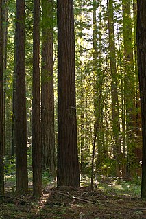
Navarro River Redwoods State Park is a state park in Mendocino County, California, consisting of 660 acres (2.7 km2) of second-growth redwood forest in a narrow stretch 11 miles (18 km) long on both banks of the Navarro River, from the town of Navarro to the river's confluence with the Pacific Ocean.
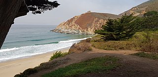
Gray Whale Cove State Beach is a California State Park between Pacifica, California, and Montara, California, by Highway 1 and approximately 18 miles south of San Francisco. It features a sheltered cove surrounded by abrupt cliffs, with trails connecting to nearby Montara Mountain and McNee Ranch State Park. It is located just south of Devil's Slide. The 3.1-acre (1.3 ha) park was established in 1966.

Kirby Cove Camp is a campground and scenic area managed by the Golden Gate National Recreation Area (GGNRA) in the Marin Headlands, California. It is located at sea level below Conzelman Road, which leads from the north end of the Golden Gate Bridge up and along the Marin Headlands overlooking the Golden Gate strait that leads into San Francisco Bay. A road behind a locked gate leads to Kirby Cove from just beyond Battery Spencer, the first set of bunkers encountered from Highway 101 at the north end of the Golden Gate Bridge.

This Timeline of the Portolá expedition tracks the progress during 1769 and 1770 of the first European exploration of the Spanish possession of Alta California, present-day California, United States. Missionary Juan Crespi kept a diary detailing the group's daily progress and detailed descriptions of their location, allowing modern researchers to reconstruct their journey. Portions of other diaries by Gaspar de Portolá, engineer Miguel Costansó, missionary Junípero Serra, army officer Jose de Canizares, and Sergeant José Ortega also survived. When analyzed as a whole, they provide detailed daily information on the route traveled and camping locations, as well as descriptions of the country and its native inhabitants.
