Monterey Bay

Last updated

Map of the Monterey Bay Area, depicting roads, urban areas, major rivers, and forested and grassy areas Monterey Bay Map (smaller).png
Map of the Monterey Bay Area, depicting roads, urban areas, major rivers, and forested and grassy areas

Monterey Bay is a bay of the Pacific Ocean located on the coast of the U.S. state of California, south of the San Francisco Bay Area. San Francisco itself is further north along the coast, by about 75 miles (120 km), accessible via CA 1 and US 101.

Contents

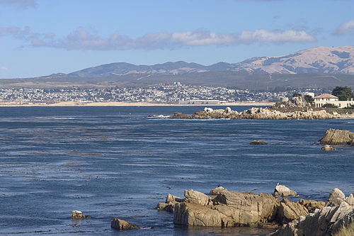
Santa Cruz is located at the north end of the bay, and Monterey is on the Monterey Peninsula at the south end. The "Monterey Bay Area" is a local colloquialism sometimes used to describe the whole of the Central Coast communities of Santa Cruz and Monterey counties.

Toponymy

Gaspar de Zuniga, 5th Count of Monterrey, namesake of Monterey Bay. GaspardeZugnigayAcevedo (cropped).jpg
Gaspar de Zúñiga, 5th Count of Monterrey, namesake of Monterey Bay.

The first European to enter Monterey Bay was Juan Rodríguez Cabrillo on November 16, 1542, while sailing northward along the coast on an imperial Spanish naval expedition. He named the bay Bahía de los Pinos, [1] probably because of the forest of pine trees first encountered while rounding the peninsula at the southern end of the bay. [2] Cabrillo's name for the bay was lost, but the westernmost point of the peninsula is still known as Point Pinos.

On December 10, 1595, Sebastián Rodríguez Cermeño crossed the bay and bestowed the name Bahía de San Pedro in honor of Saint Peter Martyr. [2] [3]

The present name for the bay was given in 1602 by Sebastián Vizcaíno, who had been tasked by the Spanish government to complete a detailed chart of the coast. On December 16, 1602 he rounded a large peninsula and entered a bay that he named Puerto de Monterrey in honor of Don Gaspár de Zúñiga y Acevedo, 5th Count of Monterrey, who was governor of New Spain and had dispatched the expedition. [1] [4] Monterrey is an alternate spelling of Monterrei, a municipality in the Galicia region of Spain from which the viceroy and his father (the Fourth Count of Monterrei) originated.

Monterey Bay, California South Monterey Bay.jpg
Monterey Bay, California
Cormorant "condo" in Monterey Bay Cormorant Condo in Monterey, CA.jpg
Cormorant "condo" in Monterey Bay

All other place names in the vicinity containing Monterey were so named because of their proximity to the bay. This includes the Presidio of Monterey, City of Monterey, County of Monterey and Monterey Canyon.

Geology

The Monterey Canyon, one of the largest underwater canyons in the world, begins off the coast of Moss Landing, in the center of Monterey Bay. It is 249 miles (401 km) long, although its shape changes regularly because of currents and sediment being left in the area. The canyon is much like that of a continental slope; the biology of the canyon changes significantly in different parts of the canyon. [5]

Flora and fauna

Monterey Bay is home to many species of marine mammals, including sea otters, harbor seals, and bottlenose dolphins; as well as being on the migratory path of gray and humpback whales and a breeding site for elephant seals. Killer whales are also found along the coast, especially when gray whales migrate, as they hunt the whales during their migration north. Many species of fish, sharks, mollusks such as abalone and squid, birds, and sea turtles also live in the bay. Several varieties of kelp grow in the bay, some becoming as tall as trees, forming what is known as a kelp forest.

Marine protected areas

Soquel Canyon State Marine Conservation Area, Portuguese Ledge State Marine Conservation Area, Pacific Grove Marine Gardens State Marine Conservation Area, Lovers Point State Marine Reserve, Edward F. Ricketts State Marine Conservation Area and Asilomar State Marine Reserve are marine protected areas in Monterey Bay. Like underwater parks, these marine protected areas help conserve ocean wildlife and marine ecosystems.

Communities around Monterey Bay

Panorama of Monterey Bay from Jacks Peak Park MontereyBayPanoramaFromJacksPeak.jpg
Panorama of Monterey Bay from Jacks Peak Park
Sea otter coming ashore, Moss Landing Moss-landing-otter.jpg
Sea otter coming ashore, Moss Landing
The Monterey Bay, as seen from space, stretches from Santa Cruz in the north to the Monterey Peninsula in the south Monterey Bay STS090-705-5.jpg
The Monterey Bay, as seen from space, stretches from Santa Cruz in the north to the Monterey Peninsula in the south

Clockwise around the bay, generally from north to south. Inland communities are indented:

Apple's desktop operating system, macOS Monterey, is named after this region.

See also

Related Research Articles

<span class="mw-page-title-main">Monterey, California</span> City in California, United States

Monterey is a city in Monterey County on the southern edge of Monterey Bay on the U.S. state of California's Central Coast. Founded on June 3, 1770, it functioned as the capital of Alta California under both Spain (1804–1821) and Mexico (1822–1846). During this period, Monterey hosted California's first theater, public building, public library, publicly funded school, printing press, and newspaper. It was originally the only port of entry for all taxable goods in California. In 1846, during the Mexican–American War of 1846–1848, the United States Flag was raised over the Customs House. After Mexico ceded California to the U.S. at the end of the war, Monterey hosted California's first constitutional convention in 1849.

<span class="mw-page-title-main">Monterey County, California</span> County in California, United States

Monterey County, officially the County of Monterey, is a county located on the Pacific coast in the U.S. state of California. As of the 2020 census, its population was 439,035. The county's largest city and county seat is Salinas.

<span class="mw-page-title-main">Central Coast (California)</span> Region of California in the United States

The Central Coast is an area of California, roughly spanning the coastal region between Point Mugu and Monterey Bay. It lies northwest of Los Angeles and south of the San Francisco Bay Area, and includes the rugged, rural, and sparsely populated stretch of coastline known as Big Sur.

<span class="mw-page-title-main">Monterey Bay National Marine Sanctuary</span> Marine protected area in California, U.S.

The Monterey Bay National Marine Sanctuary (MBNMS) is a federally protected marine area offshore of California's Big Sur and central coast in the United States. It is the largest US national marine sanctuary and has a shoreline length of 276 miles (444 km) stretching from just north of the Golden Gate Bridge at San Francisco to Cambria in San Luis Obispo County. Supporting one of the world's most diverse marine ecosystems, it is home to numerous mammals, seabirds, fishes, invertebrates and plants in a remarkably productive coastal environment. The MBNMS was established in 1992 for the purpose of resource protection, research, education, and public use.

<span class="mw-page-title-main">Point Lobos</span> Cape in California, USA

Point Lobos and the Point Lobos State Natural Reserve is a state park in California. Adjoining Point Lobos is "one of the richest marine habitats in California." The ocean habitat is protected by two marine protected areas, the Point Lobos State Marine Reserve and Point Lobos State Marine Conservation Area. The sea near Point Lobos is considered one of the best locations for scuba diving on the Monterey Peninsula and along the California coast.

<span class="mw-page-title-main">Monterey Canyon</span> Submarine canyon in Monterey Bay, California

Monterey Canyon, or Monterey Submarine Canyon, is a submarine canyon in Monterey Bay, California with steep canyon walls measuring a full 1 mile (1.6 km) in height from bottom to top, which height/depth rivals the depth of the Grand Canyon itself. It is the largest such submarine canyon along the West coast of the North American continent, and was formed by the underwater erosion process known as turbidity current erosion. Many questions remain unresolved regarding the exact nature of its origins, and as such it is the subject of several ongoing geological and marine life studies being carried out by scientists stationed at the nearby Monterey Bay Aquarium Research Institute, the Moss Landing Marine Laboratories, and other oceanographic institutions.

<span class="mw-page-title-main">Area code 831</span> Area code for Monterey, Salinas and Santa Cruz, California

Area code 831 is a telephone area code in the North American Numbering Plan for a small region of the U.S. state of California. The numbering plan area (NPA) comprises Monterey County, San Benito County, and Santa Cruz County. The area code was created in 1998 in an area code split of area code 408.

<span class="mw-page-title-main">Asilomar State Marine Reserve</span> Marine protected area in California

Asilomar State Marine Reserve (SMR) is one of four small marine protected areas (MPAs) located near the cities of Monterey and Pacific Grove, at the southern end of Monterey Bay on California’s central coast. The four MPAs together encompass 2.96 square miles (7.7 km2). The SMR protects all marine life within its boundaries. Fishing and take of all living marine resources is prohibited.

<span class="mw-page-title-main">Carmel Bay State Marine Conservation Area</span> Marine protected area in Carmel Bay

Carmel Bay State Marine Conservation Area (SMCA) is a marine protected area in Carmel Bay. Carmel Bay is adjacent to the city of Carmel-by-the-Sea and is near Monterey, on California’s central coast. The marine protected area covers 2.12 square miles. Recreational fishing of finfish and limited commercial taking of kelp is permitted within the SMCA.

<span class="mw-page-title-main">Carmel Pinnacles State Marine Reserve</span> Marine protected area in Carmel Bay

Carmel Pinnacles State Marine Reserve (SMR) is a marine protected area in Carmel Bay including a unique underwater pinnacle formation with adjacent kelp forest, submarine canyon head, and surfgrass. Carmel Bay is adjacent to the city of Carmel-by-the-Sea and is near Monterey, on California's central coast.

<span class="mw-page-title-main">Edward F. Ricketts State Marine Conservation Area</span> Marine protected area in California

Edward F. Ricketts State Marine Conservation Area is one of four small marine protected areas located near the cities of Monterey and Pacific Grove, at the southern end of Monterey Bay on California’s central coast. The four areas together encompass 2.96 square miles (7.7 km2). Within SMCAs fishing and take of all living marine resources is prohibited except the recreational take of finfish by hook-and-line and the commercial take of giant and bull kelp under certain conditions.

<span class="mw-page-title-main">Lovers Point State Marine Reserve</span> Marine protected area

Lovers Point State Marine Reserve (SMR) is one of four small marine protected areas located near the cities of Monterey and Pacific Grove, at the southern end of Monterey Bay on California’s central coast. The four MPAs together encompass 2.96 square miles (7.7 km2). The SMR protects all marine life within its boundaries. Fishing and take of all living marine resources is prohibited.

<span class="mw-page-title-main">Pacific Grove Marine Gardens State Marine Conservation Area</span> Marine protected area in California

Pacific Grove Marine Gardens State Marine Conservation Area is one of four small marine protected areas located near the cities of Monterey and Pacific Grove, at the southern end of Monterey Bay on California’s central coast. The four MPAs together encompass 2.96 square miles (7.7 km2). Within the SMCA fishing and take of all living marine resources is prohibited except the recreational take of finfish and the commercial take of giant and bull kelp by hand under certain conditions. According to the Frommer's guide, the Marine Gardens area is "renowned for ocean views, flowers, and tide-pool seaweed beds."

Portuguese Ledge State Marine Conservation Area (SMCA) is an offshore marine protected area in Monterey Bay. Monterey Bay is on California’s central coast with the city of Monterey at its south end and the city of Santa Cruz at its north end. The SMCA covers 10.9 square miles (28 km2). Within the SMCA fishing and take of all living marine resources is prohibited except the commercial and recreational take of pelagic finfish.

<span class="mw-page-title-main">Soquel Canyon State Marine Conservation Area</span> Marine protected area in Monterey Bay

Soquel Canyon State Marine Conservation Area (SMCA) is an offshore marine protected area in Monterey Bay. Monterey Bay is on California’s central coast with the city of Monterey at its south end and the city of Santa Cruz at its north end. The SMCA covers 23.41 square miles (60.6 km2). Within the SMCA, fishing and taking of any living marine resources is prohibited except the commercial and recreational take of pelagic finfish.

<span class="mw-page-title-main">Moss Landing Wildlife Area</span> California State wildlife preserve

Moss Landing Wildlife Area is a California State wildlife preserve on the shore of Elkhorn Slough.

<span class="mw-page-title-main">Monterey Peninsula</span> Peninsula in California, USA

The Monterey Peninsula anchors the northern portion on the Central Coast of California and comprises the cities of Monterey, Carmel, and Pacific Grove, and the resort and community of Pebble Beach.

<span class="mw-page-title-main">Carmel Bay</span> Bay of the Pacific Ocean off the coast of California, United States

Carmel Bay is a bay of the Pacific Ocean, along the central coast of California in Monterey County. The bay is 4 mi (6.4 km) long and 2 mi (3.2 km) wide with its mouth about 3 mi (4.8 km) across, between Point Carmel to the south and Point Cypress to the north; Monterey Bay is about four coastline miles north, with Point Pinos intervening.

References

  1. 1 2 Gudde, Erwin G. (1949). California Place Names. Berkeley, Calif.: University of California Press. p. 222. ASIN   B000FMOPP4.
  2. 1 2 Clark, Donald T. (1991). Monterey County Place Names. Carmel Valley, Calif.: Kestrel Press. p. 322. ISBN   978-1-880478-00-4.
  3. Wagner, Henry R. (1937). Cartography of the Northwest Coast of America to the Year 1800. Berkeley, Calif.: University of California Press. p. 398. ASIN   B001K5A42S.
  4. "Dr. Hart's Mansion - Pacific Grove, California". hartmansion.com. Retrieved January 6, 2021.
  5. "Monterey Canyon: Stunning deep-sea topography revealed | MBARI". www.mbari.org. February 22, 2016. Retrieved January 10, 2018.

Further reading

36°48′N121°54′W / 36.800°N 121.900°W / 36.800; -121.900