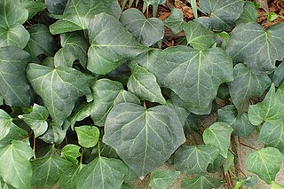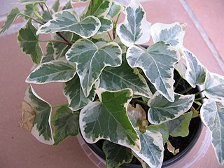
Hedera, commonly called ivy, is a genus of 12–15 species of evergreen climbing or ground-creeping woody plants in the family Araliaceae, native to Western Europe, Central Europe, Southern Europe, Macaronesia, northwestern Africa and across central-southern Asia east to Japan and Taiwan. Several species are cultivated as climbing ornamentals, and the name ivy especially denotes common ivy, known in North America as "English ivy", which is frequently planted to clothe brick walls.

Conium is a genus of flowering plants in the family Apiaceae. As of December 2020, Plants of the World Online accepts six species.

The Fairfield Osborn Preserve is a 450-acre nature reserve situated on the northwest flank of Sonoma Mountain in Sonoma County, California. There are eight plant communities within the property, oak woodland being the dominant type. Other communities include chaparral, Douglas fir woodland, native Bunch grass, freshwater marsh, vernal pool, pond and riparian woodland. The flora is extremely diverse including many native trees, shrubs, wildflowers, grasses, lichens and mosses. A diverse fauna inhabits this area including black-tailed deer, coyote, bobcat and an occasional mountain lion; moreover, there are abundant avifauna, amphibians, reptiles and insects.

Carbonera Creek is a 10.2-mile-long (16.4 km) watercourse in Santa Cruz County, California, that eventually flows to the San Lorenzo River.

Rubus armeniacus, the Himalayan blackberry or Armenian blackberry, is a species of Rubus in the blackberry group Rubus subgenus Rubus series Discolores Focke. It is native to Armenia and northern Iran, and widely invasive elsewhere. Both its scientific name and origin have been the subject of much confusion, with much of the literature referring to it as either Rubus procerus or Rubus discolor, and often mistakenly citing its origin as western European. Flora of North America, published in 2014, considers the taxonomy unsettled, and tentatively uses the older name Rubus bifrons.

Pinole Creek is a stream in western Contra Costa County, in the East Bay region of the San Francisco Bay Area, California.

The hemlock moth, also known as the defoliating hemlock moth or poison hemlock moth, is a nocturnal moth species of the family Depressariidae. Of Palaearctic origin, it was first found in North America in 1973 when it was accidentally introduced. The moth is now widespread throughout the northern half of the United States, southern Canada, northern Europe, and, more recently, New Zealand and Australia. The larval form grows to around 10 mm, while the adults wingspan is between 17 mm and 19 mm.

Conium maculatum, known as hemlock, or poison hemlock is a highly poisonous flowering plant in the carrot family Apiaceae, native to Europe and North Africa. It is herbaceous without woody parts and has a biennial lifecycle. A hardy plant capable of living in a variety of environments, hemlock is widely naturalised in locations outside its native range, such as parts of Australia, West Asia, and North and South America, to which it has been introduced. It is capable of spreading and thereby becoming an invasive weed.

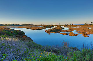
San Elijo Lagoon Ecological Reserve is one of the largest remaining coastal wetlands in San Diego County, California, United States.

Lupinus formosus, the summer lupine or western lupine, is a species of flowering plant in the legume family, Fabaceae. It is native to California and Oregon in the United States.

The Gardena Willows Wetland Preserve occupies 13.6 acres (55,000 m2) of land owned by the City of Gardena, in Los Angeles County, California. The preserve is the last intact remnant of the former Dominguez Slough, an important vernal marsh and riparian forest with riparian zones that once covered as much as 400 acres (1,600,000 m2) of this area, known as the South Bay region. The preserve has 9.4 acres (38,000 m2) of wetland and 4.2 acres (17,000 m2) of upland. The wetlands have a natural depression where water remains for such a significant time that plants and animals not adapted to water and saturated soils cannot survive. The upland, which remains dry outside of the rainy season, supports plants which thrive with these drier conditions. The slough is a part of the Dominguez Watershed, 96% of which is now covered with concrete and man-made structures. Located on the traditional lands of the Tongva, it is believed that these indigenous people were able to commute by canoe around much of the area. Tongva villages were located throughout much of what is now Los Angeles and Orange Counties as well as three southern Channel Islands as distant as 60 miles (97 km) from the coast of Los Angeles County.

Hedera algeriensis, the Algerian ivy, is a species of evergreen ivy native to the North African coast, including coastal mountains in Algeria.

Arastradero Creek is a mainly seasonal 2.4-mile-long (3.9 km) generally north by northeastward-flowing stream originating in the Palo Alto foothills of the Santa Cruz Mountains in Santa Clara County, California, United States. It is almost wholly protected by the Pearson–Arastradero Preserve, before joining Matadero Creek where its waters descend to San Francisco Bay.

The North Creek Forest is located in Bothell, Washington and surrounds a section of the 12.6-mile (20.3 km) North Creek and encompasses 64 acres of mature second growth mixed coniferous/hardwood forest with 7 streams and 9 wetlands. The forest forms a one mile long and up to 1/3- mile wide habitat corridor extending from Canyon Park Junior High School in the north almost to the North Creek wetlands near the University of Washington Bothell Campus, and eventually links to the Sammamish River in the south. The North Creek Forest is one of the last remaining mature coniferous forests in the Bothell area. The forest here filters and cools water in streams, wetlands and countless small springs and seeps, along an entire mile of watershed. The cooling of this water is crucial for 5 species of anadromous fish that spawn in North Creek including chum, coho, sockeye, chinook and steelhead. Many other ecosystem services are provided by this forest including carbon sequestration, reduction of surface runoff and cooling of ambient temperatures in surrounding neighborhood.

Boeing Creek and Shoreview Park is an 88-acre (360,000 m2) park system within Shoreline, Washington. The two parks share an internal border and both border Shoreline Community College. Boeing Creek Park mainly consists of forested areas. Shoreview Park contains recreational facilities including tennis courts, baseball and soccer fields and an off-leash dog area. The upper portion of Boeing Creek flows along the western edge of Boeing Creek and Shoreview Park.
Bushy Lake is a small lake located in Sacramento, California along the American River Parkway. The area is part of an ongoing restoration project, it also provides habitat to wildlife and offers nearby recreation opportunities. The area is prone to drought, erosion, species invasion, fire, and groups of transient populations. In the American River Parkway Plan, the lake is designated as a Nature Study Area and further protected by the Bushy Lake Preservation Act.

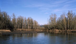
The Sandy River Delta is a natural area at the confluence of the Sandy and Columbia rivers in Oregon. Also known as "thousand acres", Sandy River Delta is composed of 1,400 acres administered by the United States Forest Service as part of the Columbia River Gorge National Scenic Area near the Portland metro area and the city of Troutdale.


