Capitola is a small seaside city in Santa Cruz County, California. Capitola is located on the northern shores of Monterey Bay, on the Central Coast of California. The city had a population of 9,456 at the 2024 census. Capitola is a popular tourist destination, owing to its beaches and restaurants.
The original settlement now known as Capitola grew out of what was then called Soquel Landing. Soquel Landing got its name from a wharf located at the mouth of Soquel Creek. This wharf, which dates back to the 1850s, served as an outlet for the produce and lumber grown in the interior. In 1865, Captain John Pope Davenport, a whaleman at Monterey, moved his operations to be near the wharf. Unable to capture any whales, he moved his operations the following year to Point Año Nuevo.[4][5]
In 1869, Frederick A. Hihn, who owned the property in the vicinity of the wharf, decided to develop it as a seaside resort. At first he leased the area to SamuelA. Hall and the area became known as Camp Capitola. Most authorities believe that it was Hihn who chose the name of Capitola, but they are unsure as to why he did so. Several possibilities have been asserted, one being that it was named for the heroine of The Hidden Hand, a novel by the popular author E. D. E. N. Southworth, favored by Hall's daughter Lulu. Capitola is known as the oldest beach resort on the West Coast.[6]
In the summer of 1961 hundreds of birds attacked the town. Most of the birds were sooty shearwaters, a normally non-aggressive species that rarely comes to shore. Alfred Hitchcock was a regular visitor to nearby Santa Cruz and read about this episode. He went on to direct a film—The Birds—based on the idea of hundreds of birds attacking humans. The reason for this attack remained unknown for over 25 years until it was discovered that the birds had been affected by domoic acid, a toxin produced by red algae.[7]
The Capitola Classic was a skateboarding event held in Capitola village in the late 1970s and early 1980s.[8] The Capitola Classic was known in skating circles for its annual downhill race, which was a head-to-head speed competition that drew top names in the sport, many local as well as international, including Santa Cruz, California local John Hutson, who held the world speed record for skateboarding at 53.45mph and dominated the event each year.[8] Starting in 2009 efforts were made to revive the event.[9]
On March 24, 2011, a drainage pipe burst following heavy rains, sending a surge of water through the historic village area.[10][11] Two days later cleanup operations were interrupted when the area was flooded again.[12][13][14][15]
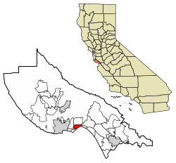
Geography
Capitola Village is located at the beach by the mouth of Soquel Creek.
According to the United States Census Bureau, the city has a total area of 1.7 square miles (4.4 square kilometers), of which 1.6 square miles (4.1km2) is land and 0.1 square miles (0.26km2) (4.92%) is water.
Capitola sits on the northeast shore of Monterey Bay. Cliffs mark access to several popular beaches, including New Brighton Beach, or drop directly to the rocky shoreline of the bay. Capitola Village sits in a depression among the cliffs so that the popular tourist and shopping area leads directly to Capitola Beach. Colorful houses and hotels line the slopes of the town leading back up to the clifftops.
The Venetian Court sits on the beach just east of the pier and is on the Register of National Historic Places as "The first Condominium Beach Community in the United States, built in 1924".[citation needed]
View of Capitola Beach and the Pacific Ocean from the southeast end of Esplanade Park
Climate
Capitola has mild weather throughout the year, enjoying a Mediterranean climate (Köppen Csb) characterized by cool, wet winters and warm, mostly dry summers. Due to its proximity to Monterey Bay, fog and low overcast are common during the night and morning hours, especially in the summer.[citation needed]
The census reported that 98.1% of the population lived in households, 1.0% lived in non-institutionalized group quarters, and 0.9% were institutionalized.[19]
There were 4,624 households, out of which 21.2% included children under the age of 18, 35.3% were married-couple households, 8.7% were cohabiting couple households, 35.9% had a female householder with no partner present, and 20.1% had a male householder with no partner present. 37.1% of households were one person, and 18.3% were one person aged 65 or older. The average household size was 2.11.[19] There were 2,409 families (52.1% of all households).[20]
The age distribution was 14.5% under the age of 18, 7.0% aged 18 to 24, 26.6% aged 25 to 44, 28.0% aged 45 to 64, and 23.9% who were 65years of age or older. The median age was 46.8years. For every 100 females, there were 87.3 males.[19]
There were 5,485 housing units at an average density of 3,441.0 unitsper square mile (1,328.6 units/km2), of which 4,624 (84.3%) were occupied. Of these, 48.1% were owner-occupied, and 51.9% were occupied by renters.[19]
In 2023, the US Census Bureau estimated that the median household income was $96,412, and the per capita income was $60,609. About 10.9% of families and 13.9% of the population were below the poverty line.[21]
The[update]2010 United States census[22] reported that Capitola had a population of 9,918. The population density was 5,919.0 inhabitants per square mile (2,285.3 inhabitants per square kilometer). The racial makeup of Capitola was 7,963 (80.3%) White, 123 (1.2%) African American, 59 (0.6%) Native American, 424 (4.3%) Asian, 10 (0.1%) Pacific Islander, 869 (8.8%) from other races, and 470 (4.7%) from two or more races. Hispanic or Latino of any race were 1,957 persons (19.7%).
The Census reported that 9,770 people (98.5% of the population) lived in households, 25 (0.3%) lived in non-institutionalized group quarters, and 123 (1.2%) were institutionalized.
There were 4,626 households, out of which 1,011 (21.9%) had children under the age of 18 living in them, 1,515 (32.7%) were opposite-sex married couples living together, 539 (11.7%) had a female householder with no husband present, 232 (5.0%) had a male householder with no wife present. There were 339 (7.3%) unmarried opposite-sex partnerships, and 55 (1.2%) same-sex married couples or partnerships. 1,735 households (37.5%) were made up of individuals, and 608 (13.1%) had someone living alone who was 65 years of age or older. The average household size was 2.11. There were 2,286 families (49.4% of all households); the average family size was 2.78.
The population was spread out, with 1,643 people (16.6%) under the age of 18, 930 people (9.4%) aged 18 to 24, 2,801 people (28.2%) aged 25 to 44, 3,005 people (30.3%) aged 45 to 64, and 1,539 people (15.5%) who were 65 years of age or older. The median age was 41.9 years. For every 100 females, there were 90.8 males. For every 100 females age 18 and over, there were 86.4 males.
There were 5,534 housing units at an average density of 3,302.7 unitsper square mile (1,275.2 units/km2), of which 2,152 (46.5%) were owner-occupied, and 2,474 (53.5%) were occupied by renters. The homeowner vacancy rate was 2.3%; the rental vacancy rate was 4.8%. 4,430 people (44.7% of the population) lived in owner-occupied housing units and 5,340 people (53.8%) lived in rental housing units.
Economy
Waterfront restaurants on Soquel Creek near Capitola BeachShops on the EsplanadeRiverview Historic District, located along Soquel CreekMission Revival style Venetian Court, built in 1924Houses located on Soquel Creek
Capitola Village and Esplanade is the heart of the Capitola Retail and Tourism Hub being a draw for tourist and locals alike with a variety of boutiques and restaurants. Forty-first Avenue is the retail and business corridor for a majority of larger national and regional business serving the community as a whole. The Capitola Mall, the only enclosed regional shopping center in Santa Cruz County is slated for redevelopment into a mixed use project with increasing pressure due to the failure of the traditional mall concept.[citation needed]
Top employers
According to Capitola's 2023 Annual Comprehensive Financial Report,[23] the principal employers in the city are:
Capitola is administered by a City Council which is made up of a Mayor, Vice-Mayor and three Councilmembers. The seats are rotated by the council annually, the current Mayor is Joe Clarke since January 30, 2025.[24][needs update]
↑As described by bandmate Peter Lewis, who regularly visited Spence during the latter years of his life, "The last five years I'd go up‚ he lived in a trailer up there‚ Capitola. I used to hang around with him; we'd spend the weekends together. But he just basically kind of hit the…he was helpless in a way, in terms of being able to define anything, or control his feelings." See Interview with Peter Lewis by Doug Collette, July 2007; www.stateofmindmusic.com.
This page is based on this Wikipedia article Text is available under the CC BY-SA 4.0 license; additional terms may apply. Images, videos and audio are available under their respective licenses.