Corralitos, California

Last updated
Corralitos
Santa Cruz County California Incorporated and Unincorporated areas Corralitos Highlighted.svg
Location in Santa Cruz County and the state of California
Usa edcp location map.svg
Red pog.svg
Corralitos
Location in the United States
Coordinates: 36°59′29″N121°48′7″W / 36.99139°N 121.80194°W / 36.99139; -121.80194 Coordinates: 36°59′29″N121°48′7″W / 36.99139°N 121.80194°W / 36.99139; -121.80194
Country United States
State California
County Santa Cruz
Area
[1]
  Total8.92 sq mi (23.10 km2)
  Land8.91 sq mi (23.07 km2)
  Water0.01 sq mi (0.04 km2)  0.16%
Elevation
269 ft (82 m)
Population
 (2020)
  Total2,342
  Density262.97/sq mi (101.53/km2)
Time zone UTC-8 (PST)
  Summer (DST) UTC-7 (PDT)
ZIP code
95076
Area code 831
FIPS code 06-16434
GNIS feature ID1658321

Corralitos (Spanish for "Small pens") is a census-designated place (CDP) in Santa Cruz County, California, United States. It is a rural area known for its agriculture of apples and strawberries, and its notable Corralitos Market and Sausage Co. Moreover, its location near the Pacific Ocean optimizes viticulture. [2]

Contents

The population was 2,326 at the 2010 census.

Geography

Corralitos is located at 36°59′29″N121°48′7″W / 36.99139°N 121.80194°W / 36.99139; -121.80194 (36.991303, -121.802013). [3] It is located on Corralitos Creek, a tributary of Salsipuedes Creek which is in turn the lowest tributary of the Pajaro River.

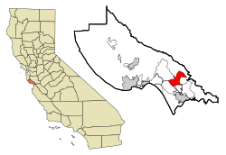
According to the United States Census Bureau, the CDP has a total area of 9.0 square miles (23 km2), of which, 9.0 square miles (23 km2) of it is land and 0.16% is water.

Demographics

Historical population
CensusPop.Note
2020 2,342
U.S. Decennial Census [4]

2010

The 2010 United States Census [5] reported that Corralitos had a population of 2,326. The population density was 258.4 inhabitants per square mile (99.8/km2). The racial makeup of Corralitos was 1,980 (85.1%) White, 16 (0.7%) African American, 12 (0.5%) Native American, 48 (2.1%) Asian, 190 (8.2%) from other races, and 79 (3.4%) from two or more races. Hispanic or Latino of any race were 532 persons (22.9%).

The Census reported that 99.7% of the population lived in households and 0.3% lived in non-institutionalized group quarters.

There were 829 households, out of which 257 (31.0%) had children under the age of 18 living in them, 511 (61.6%) were opposite-sex married couples living together, 62 (7.5%) had a female householder with no husband present, 42 (5.1%) had a male householder with no wife present. There were 51 (6.2%) unmarried opposite-sex partnerships, and 3 (0.4%) same-sex married couples or partnerships. 150 households (18.1%) were made up of individuals, and 65 (7.8%) had someone living alone who was 65 years of age or older. The average household size was 2.80. There were 615 families (74.2% of all households); the average family size was 3.09.

The population was spread out, with 504 people (21.7%) under the age of 18, 174 people (7.5%) aged 18 to 24, 482 people (20.7%) aged 25 to 44, 829 people (35.6%) aged 45 to 64, and 337 people (14.5%) who were 65 years of age or older. The median age was 45.1 years. For every 100 females, there were 98.5 males. For every 100 females age 18 and over, there were 98.3 males.

There were 888 housing units at an average density of 98.7 per square mile (38.1/km2), of which 73.9% were owner-occupied and 26.1% were occupied by renters. The homeowner vacancy rate was 0.8%; the rental vacancy rate was 2.3%. 74.5% of the population lived in owner-occupied housing units and 25.2% lived in rental housing units.

2000

As of the census [6] of 2000, there were 2,431 people, 815 households, and 621 families residing in the CDP. The population density was 270.0 inhabitants per square mile (104.2/km2). There were 846 housing units at an average density of 94.0 per square mile (36.3/km2). The racial makeup of the CDP was 81.61% White, 0.16% African American, 0.95% Native American, 2.30% Asian, 0.04% Pacific Islander, 10.98% from other races, and 3.95% from two or more races. Hispanic or Latino of any race were 19.13% of the population.

There were 815 households, out of which 36.3% had children under the age of 18 living with them, 65.0% were married couples living together, 8.6% had a female householder with no husband present, and 23.7% were non-families. 16.1% of all households were made up of individuals, and 4.8% had someone living alone who was 65 years of age or older. The average household size was 2.86 and the average family size was 3.22.

Corralitos market in Corralitos. Corralitos market.JPG
Corralitos market in Corralitos.

In the CDP, the population was spread out, with 25.5% under the age of 18, 5.8% from 18 to 24, 27.0% from 25 to 44, 27.1% from 45 to 64, and 14.5% who were 65 years of age or older. The median age was 40 years. For every 100 females, there were 96.8 males. For every 100 females age 18 and over, there were 90.5 males.

The median income for a household in the CDP was $70,781, and the median income for a family was $80,626. Males had a median income of $44,750 versus $31,500 for females. The per capita income for the CDP was $27,572. About 1.0% of families and 2.8% of the population were below the poverty line, including 0.8% of those under age 18 and none of those age 65 or over.

Government

In the California State Legislature, Corralitos is in the 17th Senate District , represented by Democrat John Laird, and in the 29th Assembly District , represented by Democrat Robert Rivas. [7]

In the United States House of Representatives, Corralitos is in California's 19th congressional district , represented by Democrat Jimmy Panetta. [8]

Related Research Articles

<span class="mw-page-title-main">Mignon, Alabama</span> CDP in Alabama, United States

Mignon is a census-designated place (CDP) in Talladega County, Alabama, United States. At the 2020 census, the population was 1,186.

<span class="mw-page-title-main">Tsaile, Arizona</span> Census-designated place in Arizona, United States

Tsaile is a census-designated place (CDP) in Apache County, Arizona, United States, on the Navajo Nation. The population was 1,205 at the 2010 census.

<span class="mw-page-title-main">Cartago, California</span> Census-designated place in California, United States

Cartago is a census-designated place in Inyo County, California, United States. Cartago is located on the west side of Owens Lake 3 miles (4.8 km) north-northwest of Olancha, at an elevation of 3629 feet. The population was 92 at the 2010 census, down from 109 at the 2000 census.

<span class="mw-page-title-main">Bodfish, California</span> Census-designated place in California, United States

Bodfish is a census-designated place (CDP) in the southern Kern River Valley of the Southern Sierra Nevada, in Kern County, California.

<span class="mw-page-title-main">Ford City, California</span> Census-designated place in California, United States

Ford City is a census-designated place (CDP) in Kern County, California, United States. Ford City is located 1 mile (1.61 km) north of Taft, at an elevation of 892 feet (272 m). The population was 4,348 at the 2020 census, up from 4,278 at the 2010 census. It is immediately north of Taft, between the huge Midway-Sunset Oil Field to the southwest, and the almost exhausted Buena Vista Oil Field to the northeast. State Route 119 passes east of town from its junction with SR 33 to the south.

<span class="mw-page-title-main">Amesti, California</span> Census-designated place in California, United States

Amesti is a census-designated place (CDP) in Santa Cruz County, California, United States. The population was 2,637 as of the 2020 United States census.

<span class="mw-page-title-main">London, California</span> Census designated place in California, United States

London is a census designated place (CDP) in Tulare County, California, United States. The population was 1,869 at the 2010 census, up from 1,848 at the 2000 census.

<span class="mw-page-title-main">Fort Benning South, Georgia</span> CDP in Georgia, United States

Fort Benning South is a former census-designated place (CDP) in Chattahoochee County, Georgia, United States. It is part of the Columbus, Georgia-Alabama Metropolitan Statistical Area. The population was 11,737 at the 2000 census. The area is now part of the consolidated city of Cusseta.

<span class="mw-page-title-main">Vernon, Illinois</span> Village in Illinois, United States

Vernon is a village in Marion County, Illinois, United States. The population was 129 at the 2010 census.

<span class="mw-page-title-main">Rossville, Maryland</span> Census-designated place in Maryland, United States

Rossville is an unincorporated community and census-designated place in Baltimore County, Maryland, United States. The population was 15,147 at the 2010 census.

<span class="mw-page-title-main">Spokane, Missouri</span> Census-designated place in Missouri, United States

Spokane is a census-designated place in Christian County, Missouri, United States. The population was 177 at the 2010 census. It is part of the Springfield, Missouri, Metropolitan Statistical Area.

<span class="mw-page-title-main">Hayward, Missouri</span> Census-designated place in Missouri, United States

Hayward is a census-designated place and former village in Pemiscot County, Missouri, United States. The population was 131 at the 2010 census.

<span class="mw-page-title-main">Clinton, Montana</span> CDP in Montana, United States

Clinton is a census-designated place (CDP) in Missoula County, Montana, United States. It is part of the 'Missoula, Montana Metropolitan Statistical Area'. The CDP was named for General Sir Henry Clinton. The population was 1,052 at the 2010 census, an increase from its population of 549 in 2000.

<span class="mw-page-title-main">Presidential Lakes Estates, New Jersey</span> Census-designated place in New Jersey, United States

Presidential Lakes Estates is an unincorporated community and census-designated place (CDP) located within Pemberton Township, in Burlington County, New Jersey, United States. As of the 2010 United States Census, the CDP's population was 2,365.

<span class="mw-page-title-main">Upper Fruitland, New Mexico</span> CDP in New Mexico, United States

Upper Fruitland is a census-designated place (CDP) in San Juan County, New Mexico, United States. The population was 1,664 at the 2000 census. It is part of the Farmington Metropolitan Statistical Area.

<span class="mw-page-title-main">Regina, New Mexico</span> CDP in New Mexico, United States

Regina is a census-designated place (CDP)) in Sandoval County, New Mexico, United States. The population was 99 at the 2000 census. It is part of the Albuquerque Metropolitan Statistical Area. It was named for Regina, Saskatchewan.

Colonial Heights is a census-designated place (CDP) in Sullivan County, Tennessee, United States. It is surrounded by the city of Kingsport.

<span class="mw-page-title-main">Verlot, Washington</span> CDP in Washington, United States

Verlot is a census-designated place (CDP) in Snohomish County, Washington, United States. The population was 285 at the 2010 census.

<span class="mw-page-title-main">Elbow Lake, Becker County, Minnesota</span> Census-designated place in Minnesota, US

Elbow Lake is a census-designated place in Becker and Clearwater counties in Minnesota, United States. Its population was 95 at the 2010 census.

<span class="mw-page-title-main">Elwood, New Jersey</span> Census-designated place in New Jersey, United States

Elwood is an unincorporated community and census-designated place (CDP) located within Mullica Township in Atlantic County, New Jersey, United States. As of the 2010 United States Census, the CDP's population was 1,437. At previous censuses, the area was listed by the U.S. Census Bureau as the Elwood-Magnolia CDP. The area is served as United States Postal Service ZIP code 08217.

References

  1. "2020 U.S. Gazetteer Files". United States Census Bureau. Retrieved October 30, 2021.
  2. "Magic in the Wines from Corralitos | The PinotFile: Volume 6, Issue 39". www.princeofpinot.com. Retrieved 2020-10-26.
  3. "US Gazetteer files: 2010, 2000, and 1990". United States Census Bureau. 2011-02-12. Retrieved 2011-04-23.
  4. "Census of Population and Housing". Census.gov. Retrieved June 4, 2016.
  5. "2010 Census Interactive Population Search: CA - Corralitos CDP". U.S. Census Bureau. Archived from the original on July 15, 2014. Retrieved July 12, 2014.
  6. "U.S. Census website". United States Census Bureau . Retrieved 2008-01-31.
  7. "Statewide Database". UC Regents. Archived from the original on February 1, 2015. Retrieved December 30, 2014.
  8. "California's 20th Congressional District - Representatives & District Map". Civic Impulse, LLC.