
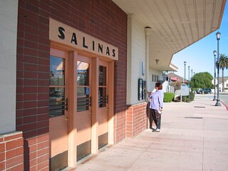
Monterey County, officially the County of Monterey, is a county located on the Pacific coast in the U.S. state of California. As of the 2020 census, its population was 439,035. The county's largest city and county seat is Salinas.
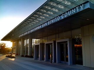
San Benito County, officially the County of San Benito, is a county located in the Coast Range Mountains of the U.S. state of California. As of the 2020 census, the population was 64,209. The county seat is Hollister.

Santa Cruz County, officially the County of Santa Cruz, is a county on the Pacific coast of the U.S. state of California. As of the 2020 census, the population was 270,861. The county seat is Santa Cruz. Santa Cruz County comprises the Santa Cruz–Watsonville, CA Metropolitan Statistical Area, which is also included in the San Jose–San Francisco–Oakland, CA Combined Statistical Area. The county is on the California Central Coast, south of the San Francisco Bay Area region. The county forms the northern coast of the Monterey Bay, with Monterey County forming the southern coast.

Monterey Bay is a bay of the Pacific Ocean located on the coast of the U.S. state of California, south of the San Francisco Bay Area and its major city at the south of the bay, San Jose. San Francisco itself is further north along the coast, by about 75 miles, accessible via Highway 1 and Highway 280.

Hollister is a city in and the county seat of San Benito County, located in the Central Coast region of California. With a 2020 United States census population of 41,678, Hollister is one of the largest cities in the Monterey Bay Area and a member of the Association of Monterey Bay Area Governments. The city is an agricultural town known primarily for its local Blenheim apricots, olive oil, vineyards, pomegranates, and chocolate.

Northern California is a geographic and cultural region that generally comprises the northern portion of the U.S. state of California. Spanning the state's northernmost 48 counties, its main population centers include the San Francisco Bay Area, the Greater Sacramento area, the Redding, California, area south of the Cascade Range, and the Metropolitan Fresno area. Northern California also contains redwood forests, along with most of the Sierra Nevada, including Yosemite Valley and part of Lake Tahoe, Mount Shasta, and most of the Central Valley, one of the world's most productive agricultural regions.

The Central Coast is an area of California, roughly spanning the coastal region between Point Mugu and Monterey Bay. It lies northwest of Los Angeles County and south of San Mateo and Santa Clara counties, and includes the rugged, undeveloped stretch of coastline known as Big Sur. From south to north, there are six counties that make up the Central Coast: Ventura, Santa Barbara, San Luis Obispo, Monterey, San Benito, and Santa Cruz.

Silicon Valley Monterey Bay Council (#055), the result of a council merger between the Santa Clara County Council and the Monterey Bay Area Council, is a Boy Scouts of America council headquartered in San Jose, California. In 2004, the previous two councils served over 11,000 youth in over 400 Boy Scout troops, Cub Scout packs, Venturing crews, and Explorer posts. In 2012, the Monterey Bay Area Council announced that after 89 years as a separate council, it had agreed to merge back into the Santa Clara County Council. As of 2013, the council served 13,000 youth in four different counties.

Central California is generally thought of as the middle third of the state, north of Southern California, which includes Los Angeles, and south of Northern California, which includes San Francisco. It includes the northern portion of the San Joaquin Valley, part of the Central Coast, the central hills of the California Coast Ranges and the foothills and mountain areas of the central Sierra Nevada.

The Diocese of El Camino Real is a diocese of the Episcopal Church in the United States of America, located in northern and central California. The diocese includes the cities of San Jose, Monterey, Santa Cruz, and San Luis Obispo. The diocese includes all Episcopal congregations in the counties of Santa Clara, Santa Cruz, San Benito, Monterey, and San Luis Obispo.

This article describes the present Diocese of Monterey in California. The entity previously known as the Diocese of Monterey from 1849 until 1859, and subsequently known as the Diocese of Monterey-Los Angeles from 1859 until 1922, is the present Archdiocese of Los Angeles. The entity known as the Diocese of Monterey-Fresno from 1922 until 1967 was canonically suppressed with the simultaneous erection of the present Diocese of Monterey in California and the present Diocese of Fresno.

Area code 831 is a telephone area code in the North American Numbering Plan (NANP) for a small region of the U.S. state of California. The numbering plan area (NPA) comprises Monterey County, San Benito County, and Santa Cruz County. The area code was created on July 11, 1998 in a split from area code 408.
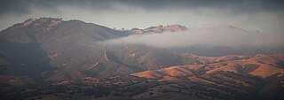
The Gabilan Range or Gabilán Range are a mountain range in the inner California Coast Ranges System, located in Monterey County and San Benito County of central California. Pinnacles National Park is located in the southern section of the range.

The Pajaro River is a U.S. river in the Central Coast region of California, forming part of the border between San Benito and Santa Clara Counties, the entire border between San Benito and Santa Cruz County, and the entire border between Santa Cruz and Monterey County. Flowing roughly east to west, the river empties into Monterey Bay, west of Watsonville, California.

Branciforte Creek is a 5.8-mile (9.3 km) long watercourse in Santa Cruz County, California, United States. Branciforte Creek rises on the western slopes of the Santa Cruz Mountains and discharges to the San Lorenzo River, which in turn empties into the Pacific Ocean. Within the State of California Branciforte Creek is classified within the Central Coast Basin. As of the year 2002, the State of California has designated Branciforte Creek as impaired with respect to turbidity and pathogens. The Branciforte watershed consists of 6,231 acres (25.22 km2), approximately 70 percent of which is covered with mixed evergreen forest, conifer forest and other undisturbed habitats.

KSCZ-LD, virtual channel 16, is a low-powered television station licensed to San Jose and San Francisco, California, United States. It broadcasts mostly Vietnamese-language programming from atop Mount Allison in unincorporated Alameda County. The station is owned by Venture Technologies Group. Until 2017, the station served the Central Coast media market.
The Santa Cruz County Board of Supervisors is the governing body for Santa Cruz County, California. As required by California Law, the board comprises five elected members, each of whom represents one of five districts.
In California, councils of governments are voluntary organizations of local governments within a specific region. They are organized as joint powers authorities and funded by dues from their member governments. They play a number of official roles in state governmental processes such as developing regional housing need allocations (RHNAs).
The Monterey County Rail Extension is a planned commuter rail extension that would bring Caltrain passenger service south of its existing Gilroy, California terminus to Salinas in Monterey County, using the existing Coast Line owned by Union Pacific (UPRR). Implementation of the rail extension will occur over three phases, starting from Salinas and moving north. When construction is complete, there will be four trains operated over the extended line per weekday: two northbound trains that depart from Salinas and travel to San Francisco in the morning, and two southbound trains that return to Salinas in the afternoon.

