Boronda, California

Last updated • 4 min readFrom Wikipedia, The Free Encyclopedia

Boronda, California
Monterey County California Incorporated and Unincorporated areas Boronda Highlighted.svg
Location in Monterey County and the state of California
Usa edcp location map.svg
Red pog.svg
Boronda
Location in the United States
Coordinates: 36°41′56″N121°40′30″W / 36.69889°N 121.67500°W / 36.69889; -121.67500
Country Flag of the United States (23px).png  United States
State Flag of California.svg  California
County Monterey
Government
   State senator Shannon Grove (R) [1]
   Assemblymember Dawn Addis (D) [1]
   U. S. rep. Vince Fong (R) [2]
Area
[3]
  Total0.57 sq mi (1.5 km2)
  Land0.57 sq mi (1.5 km2)
  Water0.00 sq mi (0.0 km2)  0%
Elevation
[4]
62 ft (19 m)
Population
 (2020) [5]
  Total1,760
  Density3,066.20/sq mi (1,183.87/km2)
Time zone UTC-8 (PST)
  Summer (DST) UTC-7 (PDT)
ZIP code
93907 (Salinas)
Area code 831
FIPS code 06-07578
GNIS feature ID 1853377

Boronda is an unincorporated community and census-designated place (CDP) in Monterey County, California, United States. The population was 1,760 at the 2020 census. [5] Boronda is located directly west of Salinas and is named after José Eusebio Boronda, a Californio ranchero, and located on the lands of his Rancho Rincón del Sanjón.

Contents

Geography

Boronda is named after Jose Eusebio Boronda, a Californio ranchero and located on the lands of his Rancho Rincon del Sanjon. Jose Eusebio Boronda.jpg
Boronda is named after José Eusebio Boronda, a Californio ranchero and located on the lands of his Rancho Rincón del Sanjón.

Boronda is located in northern Monterey County at 36°41′56″N121°40′30″W / 36.69889°N 121.67500°W / 36.69889; -121.67500 , [4] in the Salinas Valley. It is bordered to the east by the city of Salinas, the Monterey county seat.

According to the United States Census Bureau, the CDP has a total area of 0.57 square miles (1.5 km2), all of it land. [3]

Demographics

Historical population
CensusPop.Note
2000 1,325
2010 1,71029.1%
2020 1,7602.9%
U.S. Decennial Census [6]
1850–1870 [7] [8] 1880-1890 [9]
1900 [10] 1910 [11] 1920 [12]
1930 [13] 1940 [14] 1950 [15]
1960 [16] 1970 [17] 1980 [18]
1990 [19] 2000 [20] 2010 [21]

2010

The 2010 United States Census [22] reported that Boronda had a population of 1,710. The population density was 3,106.5 inhabitants per square mile (1,199.4/km2). The racial makeup of Boronda was 661 (38.7%) White, 10 (0.6%) African American, 26 (1.5%) Native American, 116 (6.8%) Asian, 7 (0.4%) Pacific Islander, 774 (45.3%) from other races, and 116 (6.8%) from two or more races. Hispanic or Latino of any race were 1,457 persons (85.2%).

The Census reported that 1,710 people (100% of the population) lived in households, 0 (0%) lived in non-institutionalized group quarters, and 0 (0%) were institutionalized.

There were 394 households, out of which 237 (60.2%) had children under the age of 18 living in them, 227 (57.6%) were opposite-sex married couples living together, 83 (21.1%) had a female householder with no husband present, 30 (7.6%) had a male householder with no wife present. There were 29 (7.4%) unmarried opposite-sex partnerships, and 2 (0.5%) same-sex married couples or partnerships. 41 households (10.4%) were made up of individuals, and 15 (3.8%) had someone living alone who was 65 years of age or older. The average household size was 4.34. There were 340 families (86.3% of all households); the average family size was 4.52.

The population was spread out, with 558 people (32.6%) under the age of 18, 224 people (13.1%) aged 18 to 24, 476 people (27.8%) aged 25 to 44, 334 people (19.5%) aged 45 to 64, and 118 people (6.9%) who were 65 years of age or older. The median age was 27.2 years. For every 100 females, there were 102.4 males. For every 100 females age 18 and over, there were 102.1 males.

There were 413 housing units at an average density of 750.3 per square mile (289.7/km2), of which 183 (46.4%) were owner-occupied, and 211 (53.6%) were occupied by renters. The homeowner vacancy rate was 4.7%; the rental vacancy rate was 3.2%. 778 people (45.5% of the population) lived in owner-occupied housing units and 932 people (54.5%) lived in rental housing units.

2000

As of the census [23] of 2000, there were 1,325 people, 309 households, and 269 families residing in the CDP. The population density was 2,336.4 inhabitants per square mile (902.1/km2). There were 332 housing units at an average density of 585.4 per square mile (226.0/km2). The racial makeup of the CDP was 32.08% White, 1.74% Black or African American, 2.26% Native American, 9.74% Asian, 0.60% Pacific Islander, 44.08% from other races, and 9.51% from two or more races. 72.53% of the population were Hispanic or Latino of any race.

There were 309 households, out of which 53.1% had children under the age of 18 living with them, 63.8% were married couples living together, 13.3% had a female householder with no husband present, and 12.9% were non-families. 9.7% of all households were made up of individuals, and 2.9% had someone living alone who was 65 years of age or older. The average household size was 4.27 and the average family size was 4.42.

In the CDP, the population was spread out, with 35.0% under the age of 18, 11.0% from 18 to 24, 29.6% from 25 to 44, 14.7% from 45 to 64, and 9.7% who were 65 years of age or older. The median age was 28 years. For every 100 females, there were 109.3 males. For every 100 females age 18 and over, there were 104.5 males.

The median income for a household in the CDP was $46,797, and the median income for a family was $43,309. Males had a median income of $26,089 versus $22,692 for females. The per capita income for the CDP was $15,365. About 7.6% of families and 10.9% of the population were below the poverty line, including 7.6% of those under age 18 and 20.7% of those age 65 or over.

Schools

Boronda currently has two active schools, Boronda Meadows Elementary and Boronda DIA. Boronda Meadows Elementary is part of the Salinas City Elementary School District and was opened in 2005. During the 2005–2006 school year, Boronda Meadows enrolled 571 students in grades K-6. Enrollment for the 2016–17 school year is approximately 730. Boronda School, 1114 Fontes Lane, was closed at the end of the 2005 school year. Many of the students and staff were transferred to Boronda Meadows. The old Boronda school housed the Monterey County Office of Education's Community Day School from 2007 - 2015. The Salinas City Elementary School District reopened Boronda School in the fall of 2015 as a dual immersion language magnet school. It has been renamed "Dual Immersion Academy Salinas" or DIAS- Boronda and for the 2016–17 school year has approximately 100 students enrolled.

Related Research Articles

<span class="mw-page-title-main">Monterey County, California</span> County in California, United States

Monterey County, officially the County of Monterey, is a county located on the Pacific coast in the U.S. state of California. As of the 2020 census, its population was 439,035. The county's largest city and county seat is Salinas.

<span class="mw-page-title-main">Armona, California</span> Census-designated place in California, United States

Armona is a census-designated place (CDP) in Kings County, California, United States. Armona is located 3.5 miles (5.6 km) west-southwest of Hanford, at an elevation of 239 feet (73 m). It is part of the Hanford–Corcoran Metropolitan Statistical Area. The population was 4,156 at the 2010 census. Armona's motto is "Small and Proud".

<span class="mw-page-title-main">Cobb, California</span> Census designated place in California, United States

Cobb is a census designated place (CDP) in Lake County, California, United States. Cobb is located 1 mile (1.6 km) northwest of Whispering Pines, at an elevation of 2,631 feet (802 m). The population was 1,778 at the 2010 census, up from 1,638 at the 2000 census.

<span class="mw-page-title-main">Alondra Park, California</span> Census designated place in California, United States

Alondra Park, also known as El Camino Village, is a census designated place (CDP) in the South Bay region of Los Angeles County, California, United States. It is the unincorporated area north of Alondra Community Regional Park and El Camino College. It is east of Lawndale, south of Hawthorne, west of Gardena, and north of Torrance. Manhattan Beach Boulevard and Crenshaw Boulevard are the two major cross streets in the area. The population was 8,569 at the 2020 census, down from 8,592 at the 2010 census. There is an official Alondra Park Post Office of the U.S. Postal Service in nearby Gardena, California. Urbanized cement-lined Dominguez Creek bisects a portion of Alondra Park.

<span class="mw-page-title-main">Aromas, California</span> Census-designated place in California, United States

Aromas is an unincorporated community and census-designated place (CDP) in Monterey County and San Benito County, California, United States. The population was 2,708 at the 2020 census.

<span class="mw-page-title-main">Bradley, California</span> Unincorporated community in California, United States

Bradley is an unincorporated community and census-designated place (CDP) in Monterey County, California, on the Salinas River 14 miles (23 km) south-southeast of San Ardo and 20 miles (32 km) north of Paso Robles. Bradley sits at an elevation of 548 feet (167 m). The population was 69 at the 2020 census, down from 93 at the 2010 census.

<span class="mw-page-title-main">Castroville, California</span> Unincorporated community in California, United States

Castroville is an unincorporated town and census-designated place (CDP) in Monterey County, California, United States. At the time of the 2020 census the population was 7,515, up from 6,481 in 2010. Castroville is known for its artichoke crop and for the annual Castroville Artichoke Festival, leading to its nickname as the "Artichoke Center of the World".

<span class="mw-page-title-main">Chualar, California</span> Unincorporated community in California, United States

Chualar is an unincorporated community and census-designated place (CDP) in the Salinas Valley of Monterey County, California, United States. Chualar is located 10 miles (16 km) southeast of Salinas, at an elevation of 115 feet (35 m). The population was 1,185 at the 2020 census.

<span class="mw-page-title-main">Elkhorn, California</span> Census-designated place in California, United States

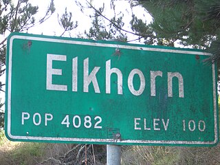
Elkhorn is an unincorporated community and census-designated place (CDP) in Monterey County, California, United States.

<span class="mw-page-title-main">Prunedale, California</span> Place in California, United States

Prunedale is a unincorporated community in Monterey County, California, United States. It is located 8 miles (13 km) north of Salinas at an elevation of 92 feet (28 m). The population was 18,885 as of the 2020 census, up from 17,560 in 2010. For statistical purposes, the United States Census Bureau has defined Prunedale as a census-designated place (CDP). Plum trees were grown in Prunedale in the early days of its founding, but the trees died soon after due to poor irrigation and fertilizer.

<span class="mw-page-title-main">San Lucas, California</span> Census-designated place in California, United States

San Lucas is an unincorporated community and census-designated place (CDP) in Monterey County, California, United States. It was founded in 1886 and named after the Rancho San Lucas, which was granted in 1842. The post office was first established in 1892.

<span class="mw-page-title-main">Spreckels, California</span> Unincorporated community in California, United States

Spreckels is an unincorporated community and census-designated place (CDP) in the Salinas Valley of Monterey County, California, United States. Spreckels is located 3 miles (5 km) south of Salinas, at an elevation of 62 ft (19 m). Its population was 692 at the 2020 census.

<span class="mw-page-title-main">Bonsall, California</span> Census-designated place in California, United States

Bonsall is a census-designated place (CDP) in San Diego County, California. The population was 3,982 at the 2010 census, up from 3,401 at the 2000 census.

<span class="mw-page-title-main">Cottonwood, California</span> Census-designated place in the United States

Cottonwood is a census-designated place (CDP) in Shasta County, California, United States. Its population is 6,268 as of the 2020 census, up from 3,316 from the 2010 census. Cottonwood was a stagecoach town where a settlement was established in 1849. The first Post Office was opened in 1852. Cottonwood is equidistant between Redding and Red Bluff, 15 miles (24 km) in either direction. It is 4 miles (6.4 km) south of Anderson.

<span class="mw-page-title-main">Carmel Valley Village, California</span> Unincorporated community in California, United States

Carmel Valley Village is an unincorporated community and census-designated place (CDP) in Monterey County, California, United States. In 1946, Byington Ford and Tirey L. Ford Jr. developed the Carmel Valley Village, which included an airpark, shops, and homes. At the time of the 2020 census the CDP population was 4,524, up from 4,407 at the 2010 census. In November 2009, a majority of residents voted against incorporation.

<span class="mw-page-title-main">Homestead Meadows North, Texas</span> Census-designated place in Texas, United States

Homestead Meadows North is a census-designated place (CDP) in El Paso County, Texas, United States. The population was 5,124 at the 2010 census. It is part of the El Paso Metropolitan Statistical Area.

<span class="mw-page-title-main">Doffing, Texas</span> Census-designated place in Texas

Doffing is a census-designated place (CDP) in Hidalgo County, Texas, United States. The population was 5,091 at the 2010 United States Census. It is part of the McAllen–Edinburg–Mission Metropolitan Statistical Area.

<span class="mw-page-title-main">Midway North, Texas</span> Census-designated place in Texas

Midway North is a census-designated place (CDP) in Hidalgo County, Texas, United States. The population was 4,232 at the 2020 United States Census. It is part of the McAllen–Edinburg–Mission Metropolitan Statistical Area.

<span class="mw-page-title-main">Falcon Village, Texas</span> CDP in Texas, United States

Falcon Village is a census-designated place (CDP) in Starr County, Texas, United States. The population was 3 at the 2020 census.

<span class="mw-page-title-main">Mirando City, Texas</span> Census-designated place in Webb County, Texas, United States

Mirando City is a census-designated place (CDP) in Webb County, Texas, United States. It is approximately 30 miles east of Laredo and 130 miles southwest of Corpus Christi. The population was 166 at the 2010 census. The town gets its name from Nicolás Mirando, a Spanish land grantee. The population of Mirando City was highest in 1929, at an estimated 1500.

References

  1. 1 2 "Statewide Database". UC Regents. Archived from the original on February 1, 2015. Retrieved November 9, 2014.
  2. "California's 20th Congressional District - Representatives & District Map". Civic Impulse, LLC. Retrieved September 24, 2014.
  3. 1 2 "2022 U.S. Gazetteer Files: California". United States Census Bureau. Retrieved November 14, 2022.
  4. 1 2 U.S. Geological Survey Geographic Names Information System: Boronda, California
  5. 1 2 "P1. Race – Boronda CDP, California: 2020 DEC Redistricting Data (PL 94-171)". U.S. Census Bureau. Retrieved November 14, 2022.
  6. "Decennial Census by Decade". United States Census Bureau .
  7. "1870 Census of Population - Population of Civil Divisions less than Counties - California - Almeda County to Sutter County" (PDF). United States Census Bureau .
  8. "1870 Census of Population - Population of Civil Divisions less than Counties - California - Tehama County to Yuba County" (PDF). United States Census Bureau .
  9. "1890 Census of Population - Population of California by Minor Civil Divisions" (PDF). United States Census Bureau .
  10. "1900 Census of Population - Population of California by Counties and Minor Civil Divisions" (PDF). United States Census Bureau .
  11. "1910 Census of Population - Supplement for California" (PDF). United States Census Bureau .
  12. "1920 Census of Population - Number of Inhabitants - California" (PDF). United States Census Bureau .
  13. "1930 Census of Population - Number and Distribution of Inhabitants - California" (PDF). United States Census Bureau .
  14. "1940 Census of Population - Number of Inhabitants - California" (PDF). United States Census Bureau .
  15. "1950 Census of Population - Number of Inhabitants - California" (PDF). United States Census Bureau .
  16. "1960 Census of Population - General population Characteristics - California" (PDF). United States Census Bureau .
  17. "1970 Census of Population - Number of Inhabitants - California" (PDF). United States Census Bureau .
  18. "1980 Census of Population - Number of Inhabitants - California" (PDF). United States Census Bureau .
  19. "1990 Census of Population - Population and Housing Unit Counts - California" (PDF). United States Census Bureau .
  20. "2000 Census of Population - Population and Housing Unit Counts - California" (PDF). United States Census Bureau .
  21. "2010 Census of Population - Population and Housing Unit Counts - California" (PDF). United States Census Bureau .
  22. "2010 Census Interactive Population Search: CA - Boronda CDP". U.S. Census Bureau. Archived from the original on July 15, 2014. Retrieved July 12, 2014.
  23. "U.S. Census website". United States Census Bureau . Retrieved January 31, 2008.