
Monterey County, officially the County of Monterey, is a county located on the Pacific coast in the U.S. state of California. As of the 2020 census, its population was 439,035. The county's largest city and county seat is Salinas.

Castroville is an unincorporated town and census-designated place (CDP) in Monterey County, California, United States. At the time of the 2020 census the population was 7,515, up from 6,481 in 2010. Castroville is known for its artichoke crop and for the annual Castroville Artichoke Festival, leading to its nickname as the "Artichoke Center of the World".
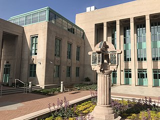
Salinas is a city in the U.S. state of California and the county seat of Monterey County. With a population of 163,542 in the 2020 Census, Salinas is the most populous city in Monterey County. Salinas is an urban area located along the eastern limits of the Monterey Bay Area, lying just south of the San Francisco Bay Area and 10 miles (16 km) southeast of the mouth of the Salinas River. The city is located at the mouth of the Salinas Valley, about eight miles (13 km) from the Pacific Ocean, and it has a climate more influenced by the ocean than the interior.

The Santa Cruz Mountains are a mountain range in central and Northern California, United States, constituting a part of the Pacific Coast Ranges. They form a ridge down the San Francisco Peninsula, south of San Francisco. They separate the Pacific Ocean from the San Francisco Bay and the Santa Clara Valley, and continue south to the Central Coast, bordering Monterey Bay and ending at the Salinas Valley. The range passes through the counties of San Mateo, Santa Clara, and Santa Cruz, with the Pajaro River forming the southern boundary.

The Salinas Valley is one of the major valleys and most productive agricultural regions in California. It is located west of the San Joaquin Valley and south of San Francisco Bay and the Santa Clara Valley.

The Salinas River is the longest river of the Central Coast region of California, running 175 miles (282 km) and draining 4,160 square miles (10,800 km2). It flows north-northwest and drains the Salinas Valley that slices through the central California Coast Ranges south of Monterey Bay. The river begins in southern San Luis Obispo County, originating in the Los Machos Hills of the Los Padres National Forest. From there, the river flows north into Monterey County, eventually making its way to connect with the Monterey Bay, part of the Pacific Ocean, approximately 5 miles (8.0 km) south of Moss Landing. The river is a wildlife corridor, and provides the principal source of water from its reservoirs and tributaries for the farms and vineyards of the valley.
California's 18th congressional district is a congressional district located in the U.S. state of California. The district is currently represented by Democrat Zoe Lofgren. Since the 2022 election, the district is landlocked and includes all of San Benito County and parts of Santa Clara and Monterey counties, including Salinas, Hollister, Watsonville, Gilroy, Soledad, and downtown and eastern San Jose.

Area code 831 is a telephone area code in the North American Numbering Plan for a small region of the U.S. state of California. The numbering plan area (NPA) comprises Monterey County, San Benito County, and Santa Cruz County. The area code was created in 1998 in an area code split of area code 408.
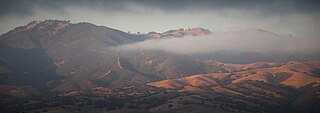
The Gabilan Range or Gabilán Range are a mountain range in the inner California Coast Ranges System, located in Monterey County and San Benito County of central California. Pinnacles National Park is located in the southern section of the range.

The Pajaro River is a U.S. river in the Central Coast region of California, forming part of the border between San Benito and Santa Clara Counties, the entire border between San Benito and Santa Cruz County, and the entire border between Santa Cruz and Monterey County. Flowing roughly east to west, the river empties into Monterey Bay, west of Watsonville, California.

The San Benito River is a 109 miles (175 km) long river flowing northwesterly between the Diablo Range and the Gabilan Range, on the Central Coast of California. The river begins in southeasternmost San Benito County, California and ends in the extreme northwestern part of the county, where it is tributary to the Pajaro River. The San Benito River is longer than the Pajaro River and it drains more area, although it has proportionally lower flows.
Alisal, sometimes called East Salinas, is a neighborhood of Salinas in Monterey County, California. It is located east of downtown, at an elevation of 89 feet. The unincorporated community of Alisal was annexed to Salinas in 1963. Alisal is home to Alisal High School.
Rancho Santa Rita was a 8,894-acre (35.99 km2) Mexican land grant in the Amador Valley and western Livermore Valley, which is in present day Alameda County, California.

Bee Rock is a rural unincorporated community in northern San Luis Obispo County, California. Bee Rock is 3 miles (4.8 km) east-northeast of Tierra Redondo Mountain, in the southeastern Santa Lucia Range. It is located on Interlake Road, between Lake Nacimiento and Lake San Antonio reservoirs. It is known for having, in the 19th century, the "largest bee-hive in the world" housed within a granite boulder.

Rancho San Luis Gonzaga was a 48,821-acre (197.57 km2) Mexican land grant in the Diablo Range, in present-day Santa Clara County and Merced County, California given in 1843 by Governor Manuel Micheltorena to Juan Carlos Pacheco and José Maria Mejía. The grant was bounded by Francisco Pérez Pachecos Rancho Ausaymas y San Felipe on the west, the San Joaquin River and San Joaquin Valley on the east, and Los Baños Creek on the south.
Rancho La Natividad was a 8,642-acre (34.97 km2) Mexican land grant in present-day Monterey County, California given in 1837 by Governor Juan B. Alvarado to Manuel Butrón and his son-in-law, Nicolás Alviso. Rancho La Natividad and Rancho Los Vergeles were adjoining ranchos along Gabilan Creek north of present-day Salinas. The headquarters of each rancho were close to the entrance to the pass through the Gabilan Range to San Juan Bautista. The Rancho La Natividad grant encompassed present-day Natividad.
Rancho Los Gatos or Santa Rita was a 4,424-acre (17.90 km2) Mexican land grant in present-day Monterey County, California given in 1837 by Governor Juan B. Alvarado to José Trinidad Espinoza. The grant was northwest of present-day Salinas, bounded on the north by Espinosa Lake and Rancho Bolsa de las Escorpinas of his brother Salvador Espinoza, and encompassed present-day Santa Rita.
Rancho Bolsa de las Escorpinas was a 6,416-acre (25.96 km2) Mexican land grant in present-day Monterey County, California given in 1837 by Governor Juan B. Alvarado to Salvador Espinoza. The grant was northwest of present-day Salinas, bounded on the south by today's Espinosa Lake. Espinosa Road runs east–west through the former rancho lands.

Carneros Creek is a westward flowing stream and is the primary source of freshwater flowing into Elkhorn Slough. The Carneros Creek official mainstem is 9.8 miles (15.8 km) long. Its source is in the northern Gabilan Range along Highway 101/156. After it waters transit Elkhorn Slough, the historic mouth of the Salinas River, Carneros Creek empties into Monterey Bay at Moss Landing, California.

Franklin Benjamin Porter, was a pioneer businessman and real estate developer of Monterey Peninsula. In 1926, he launched the first residential subdivision in Carmel Valley, California that became Robles del Rio, California. Porter went on to develop other properties in the valley including the Robles del Rio Lodge, Robles del Rio Carmelo Water Company, and the Hatton Ranch in Carmel Valley.


