Woodson is a village in Morgan County, Illinois, United States. The population was 559 at the 2000 census. It is part of the Jacksonville Micropolitan Statistical Area.
East Montlake Park is a park in the Montlake neighborhood of Seattle, Washington, USA. The park is bounded on the north by the Montlake Cut, on the east by Union Bay, on the south by Washington State Route 520, and on the west by East Park Drive E.

North Passage Point Park is a 0.8 acre park located in the Northlake neighborhood of Seattle, Washington, directly underneath the Ship Canal Bridge on the north side of the Lake Union/Portage Bay shoreline. It was dedicated in 1977. South Passage Point Park is directly across the water on the south shore.

South Passage Point Park is a 0.9-acre (0.36 ha) park located in the Eastlake neighborhood of Seattle, Washington, USA, directly underneath the Ship Canal Bridge on the south side of the Lake Union/Portage Bay shoreline. It was dedicated in 1977. North Passage Point Park is directly across the water on the north shore.
Fort Ward Park is a former state park located along Rich Passage on the southern end of Bainbridge Island in Washington. Fort Ward Park is part of the Bainbridge Island Metro Park and Recreation District, on land which the former military base, Fort Ward, was located.
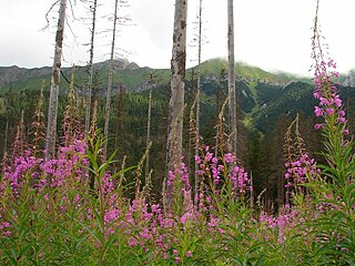
Andy Bailey Provincial Park is a provincial park in British Columbia, Canada, located 28 kilometres southeast of Fort Nelson, British Columbia. The park is 196 hectares in size and aims to protect black and white spruce forests, moose, beavers, foxes and songbirds.
Gold Bridge is an unincorporated community in the Bridge River Country of British Columbia, Canada. Although numbering only around 40 inhabitants, Gold Bridge is the service and supply centre for the upper basin of the Bridge River Valley, which includes recreation-residential areas at the Gun Lakes, Tyaughton Lake, Marshall Creek, and Bralorne; and the nearby ghost towns of Brexton and Pioneer Mine.
The New Jersey Coastal Heritage Trail Route extends along eastern and southern coast of New Jersey for nearly 300 miles. It travels along the Raritan Bay from Perth Amboy to Sandy Hook, along Jersey Shore at the Atlantic Ocean to Cape May, and along the Delaware Bay to the Delaware Memorial Bridge. The trail encompasses a variety of New Jersey state parks along with facilities under the jurisdiction of the National Park Service.
Deer Creek is a 52.9-mile-long (85.1 km) river in Maryland that flows through the scenic areas of Harford County and empties into the Susquehanna River, roughly halfway between the Interstate 95 bridge and Conowingo Dam. Its watershed area is 171 square miles (440 km2). Its watershed area in MD is 145 square miles (380 km2), with 3% impervious surface in 1994. It serves as a divider between the agricultural and urban/suburban areas of Harford County.
Don Castro Regional Recreation Area is a regional park located in Hayward, California. It is part of the East Bay Regional Parks system.
Pier 41 is a ferry terminal on Fisherman's Wharf in San Francisco. The former headquarters of Blue & Gold Fleet, their box offices are now located at Pier 39.
Point Molate Beach Park is a city-owned park in Richmond, California, accessible only via a narrow road from the Richmond-San Rafael Bridge toll plaza exit "Western Drive", and separate from the rest of the city. The park is adjacent to the present day ghost town of Winehaven.

Washington Township is one of thirteen townships in Owen County, Indiana, United States. As of the 2010 census, its population was 6,164 and it contained 2,755 housing units.
Leverich Park is a 33-acre (130,000 m2) park located in Vancouver, Washington. It is located along Burnt Bridge Creek in a natural area of Vancouver adjacent to Interstate 5. The park features a large picnic shelter, picnic tables, plenty of hiking trails and a twelve-hole Disc golf course.

Duxbury Reef State Marine Conservation Area (SMCA) is a marine protected area located about 1 mile (2 km) west of Bolinas in Marin County on California’s north central coast. This marine protected area covers 0.66 square miles (1.7 km2). Duxbury Reef SMCA prohibits the take of all living marine resources, except the recreational take of finfish from shore only and the recreational take of abalone.

Montara State Marine Reserve (SMR) and Pillar Point State Marine Conservation Area (SMCA) are two adjoining marine protected areas that extend offshore from Montara to Pillar Point in San Mateo County on California’s north central coast. The combined area of these marine protected areas is 18.42 square miles (47.7 km2), with 11.76 square miles (30.5 km2) in the SMR and 6.66 in the SMCA. Montara SMR prohibits the take of all living marine resources. Pillar Point SMCA prohibits the take of all living marine resources, except the recreational and commercial take of pelagic finfish by trolling or seine, the commercial or recreational take of Dungeness crab by trap and the commercial or recreational take or market squid by hand-held dip net or round haul net.
Upright Channel Park is a former unit of the Washington State Park System consisting of 20 acres (8.1 ha) of island, beach, and tidelands on Upright Channel in the northwest corner of Lopez Island. The park was not listed as a Washington State Parks property as of March 2014. San Juan County assumed management of the property per a Memorandum of Understanding in May 2014.
Skywest Golf Course is an 18-hole championship golf course in Hayward, California. It is managed by the Hayward Area Recreation and Park District. It opened in 1965. The course length is 6500 yards. The course has a pro shop and offers instruction.

Memorial Park, in Hayward, California, is a public park managed by the Hayward Area Recreation and Park District. The park contains an indoor swim center, the Hayward Plunge, which opened in 1936. The park is the access point to the Greenbelt Trails, which follow Ward Creek Canyon adjacent to California State University, East Bay. The park has a small bandstand with musical events offered on major holidays. It borders on Mount Saint Joseph Cemetery.