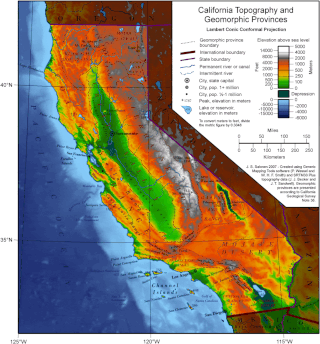
California is a U.S. state on the western coast of North America. Covering an area of 163,696 sq mi (423,970 km2), California is among the most geographically diverse states. The Sierra Nevada, the fertile farmlands of the Central Valley, and the arid Mojave Desert of the south are some of the major geographic features of this U.S. state. It is home to some of the world's most exceptional trees: the tallest, most massive, and oldest. It is also home to both the highest and lowest points in the 48 contiguous states. The state is generally divided into Northern and Southern California, although the boundary between the two is not well defined. San Francisco is decidedly a Northern California city and Los Angeles likewise a Southern California one, but areas in between do not often share their confidence in geographic identity. The US Geological Survey defines the geographic center of the state at a point near North Fork, California.
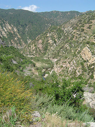
The Santa Monica Mountains is a coastal mountain range in Southern California, next to the Pacific Ocean. It is part of the Transverse Ranges. The Santa Monica Mountains National Recreation Area encompasses this mountain range. Because of its proximity to densely populated regions, it is one of the most visited natural areas in California.

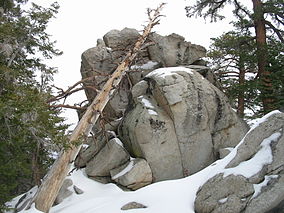
San Jacinto Peak is a 10,834 ft (3,302 m) peak in the San Jacinto Mountains, in Riverside County, California. Lying within Mount San Jacinto State Park it is the highest both in the range and the county, and serves as the southern border of the San Gorgonio Pass. Naturalist John Muir wrote of San Jacinto Peak, "The view from San Jacinto is the most sublime spectacle to be found anywhere on this earth!"

The San Jacinto Mountains are a mountain range in Riverside County, located east of Los Angeles in southern California in the United States. The mountains are named for one of the first Black Friars, Saint Hyacinth, who is a popular patron in Latin America.

The Santa Rosa Mountains are a short mountain range in the Peninsular Ranges system, located east of the Los Angeles Basin and northeast of the San Diego metropolitan area of southern California, in the southwestern United States.
The California Department of Parks and Recreation, more commonly known as California State Parks, manages the California state parks system. The system administers 279 separate park units on 1.4 million acres (570,000 ha), with over 280 miles (450 km) of coastline; 625 miles (1,006 km) of lake and river frontage; nearly 15,000 campsites; and 3,000 miles (4,800 km) of hiking, biking, and equestrian trails. Headquartered in Sacramento, park administration is divided into 21 districts. The California State Parks system is the largest state park system in the United States.

The San Bernardino National Forest is a United States National Forest in Southern California encompassing 823,816 acres (3,333.87 km2) of which 677,982 acres (2,743.70 km2) are federal. The forest is made up of two main divisions, the eastern portion of the San Gabriel Mountains and the San Bernardino Mountains on the easternmost of the Transverse Ranges, and the San Jacinto and Santa Rosa Mountains on the northernmost of the Peninsular Ranges. Elevations range from 2,000 to 11,499 feet. The forest includes seven wilderness areas: San Gorgonio, Cucamonga, San Jacinto, South Fork, Santa Rosa, Cahuilla Mountain and Bighorn Mountain. Forest headquarters are located in the city of San Bernardino. There are district offices in Lytle Creek, Idyllwild, and Fawnskin.

Fremont Peak State Park is a California State Park located in Monterey County and San Benito County, California. The park encompasses the summit of 3,169-foot (966 m) Fremont Peak in the Gabilan Range.

The Santa Rosa and San Jacinto Mountains National Monument is a National Monument in southern California. It includes portions of the Santa Rosa and San Jacinto mountain ranges, the northernmost ones of the Peninsular Ranges system. The national monument covers portions of Riverside County, west of the Coachella Valley, approximately 100 miles (160 km) southeast of downtown Los Angeles.
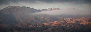
The Gabilan Range or Gabilán Range are a mountain range in the inner California Coast Ranges System, located in Monterey County and San Benito County of central California. Pinnacles National Park is located in the southern section of the range.

The San Jacinto River is a 42-mile-long (68 km) river in Riverside County, California. The river's headwaters are in Santa Rosa and San Jacinto Mountains National Monument. The lower portion of the 765-square-mile (1,980 km2) watershed is urban and agricultural land. As a partially endorheic watershed that is contiguous with other Great Basin watersheds, the western side of the San Jacinto Basin is a portion of the Great Basin Divide.
Hot Springs Mountain is a peak located in the Peninsular Ranges in California. The mountain rises to an elevation of 6,533 feet (1,991 m) and is the highest point in San Diego County. Some snow falls on the mountain peak during winter. It is located in a remote region of the county, 4 miles from the community of Warner Springs, 12 miles from Borrego Springs, and 50 miles from San Diego. The mountain and its immediate surroundings belong to the Los Coyotes Band of Cahuilla and Cupeno Indians. The summit and fire tower can be hiked via the Sukat Road route from the campground. Hikers and campers must pay an entry fee to access the area.

Santa Susana Pass State Historic Park is a California State Park of 670.68 acres (2.7141 km2) located in the city of Los Angeles, in Los Angeles County on the boundary between Ventura and Los Angeles counties, between the communities of Chatsworth and Simi Valley. Geologically, the park is located where the Simi Hills meet the Santa Susana Mountains. Here in the western part of the Transverse Ranges, the land is dominated by high, narrow ridges and deep canyons covered with an abundant variety of plant life. The park offers panoramic views of the rugged natural landscape as a striking contrast to the developed communities nearby. The park is also rich in archaeological, historical, and cultural significance.
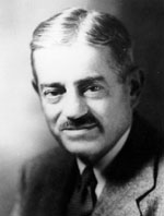
Newton Bishop Drury was the fourth director of the American National Park Service and the executive director of the Save the Redwoods League.

The following outline is provided as an overview of and topical guide to the U.S. state of California.

The Santa Rosa Wilderness is a 72,259-acre (292.42 km2) wilderness area in Southern California, in the Santa Rosa Mountains of Riverside and San Diego counties, California. It is in the Colorado Desert section of the Sonoran Desert, above the Coachella Valley and Lower Colorado River Valley regions in a Peninsular Range, between La Quinta to the north and Anza Borrego Desert State Park to the south. The United States Congress established the wilderness in 1984 with the passage of the California Wilderness Act, managed by both the US Forest Service and the Bureau of Land Management. In 2009, the Omnibus Public Land Management Act was signed into law which added more than 2,000 acres (8.1 km2). Most of the Santa Rosa Wilderness is within the Santa Rosa and San Jacinto Mountains National Monument.

Toro Peak, in Southern California, is the highest mountain in the Santa Rosa Mountain Range. It is located 15 mi (24 km) south of Palm Springs, 12 mi (19 km) west of the Salton Sea, and 31 mi (50 km) east of Temecula, in the County of Riverside, California.
Temescal Mountains, also known as the Sierra Temescal, are one of the northernmost mountain ranges of the Peninsular Ranges in western Riverside County, in Southern California in the United States. They extend for approximately 25 mi (40 km) southeast of the Santa Ana River east of the Elsinore Fault Zone to the Temecula Basin and form the western edge of the Perris Block.
