Natural Bridges State Marine Reserve

Last updated
Natural Bridges State Marine Reserve

Tide pools in Santa Cruz from Spray-splash zone to low tide zone.jpg

The intertidal zone at Natural Bridges is home to mussels, sea stars, sea anemones and limpets, seen here being studied by children.
Relief map of California.png
Red pog.svg
Usa edcp relief location map.png
Red pog.svg
Nearest city Santa Cruz, California
Coordinates 36°57′22″N122°08′08″W / 36.9562384°N 122.1354725°W / 36.9562384; -122.1354725 Coordinates: 36°57′22″N122°08′08″W / 36.9562384°N 122.1354725°W / 36.9562384; -122.1354725
Established 2007
Governing body California Department of Fish and Game
Tide pool at Natural Bridges Tidepools in Santa Cruz at low tide.jpg
Tide pool at Natural Bridges

Natural Bridges State Marine Reserve (SMR) is a marine protected area located at the northern edge of Santa Cruz, California, approximately 75 miles (121 km) south of San Francisco. The SMR covers 0.58 square miles (1.5 km2). [1] The SMR protects all marine life within its boundaries. Fishing or other removal of any living marine resource is prohibited. [2]

Marine protected area Protected areas of seas, oceans, estuaries or large lakes

Marine protected areas (MPA) are protected areas of seas, oceans, estuaries or large lakes. These marine areas can come in many forms ranging from wildlife refuges to research facilities. MPAs restrict human activity for a conservation purpose, typically to protect natural or cultural resources. Such marine resources are protected by local, state, territorial, native, regional, national, or international authorities and differ substantially among and between nations. This variation includes different limitations on development, fishing practices, fishing seasons and catch limits, moorings and bans on removing or disrupting marine life. In some situations, MPAs also provide revenue for countries, potentially equal to the income that they would have if they were to grant companies permissions to fish.

Santa Cruz, California City in California, United States

Santa Cruz is the county seat and largest city of Santa Cruz County, California. As of 2013 the U.S. Census Bureau estimated Santa Cruz's population at 62,864.

San Francisco Consolidated city-county in California, US

San Francisco, officially the City and County of San Francisco, is a city in, and the cultural, commercial, and financial center of, Northern California. San Francisco is the 13th-most populous city in the United States, and the fourth-most populous in California, with 883,305 residents as of 2018. It covers an area of about 46.89 square miles (121.4 km2), mostly at the north end of the San Francisco Peninsula in the San Francisco Bay Area, making it the second-most densely populated large US city, and the fifth-most densely populated U.S. county, behind only four of the five New York City boroughs. San Francisco is also part of the fifth-most populous primary statistical area in the United States, the San Jose–San Francisco–Oakland, CA Combined Statistical Area.

Contents

History

The California Department of Fish and Game established the Natural Bridges State Marine Reserve in September 2007. It was one of 29 marine protected areas adopted during the first phase of the Marine Life Protection Act Initiative (MLPAI), a collaborative public process to create a statewide network of marine protected areas along the California coastline.

The Marine Life Protection Act (MLPA) was passed in 1999 and is part of the California Fish and Game Code. The MLPA requires California to reevaluate all existing marine protected areas (MPAs) and potentially design new MPAs that together function as a statewide network. The MLPA has clear guidance associated with the development of this MPA network. MPAs are developed on a regional basis with MLPA and MPA-specific goals in mind and are evaluated over time to assess their effectiveness in meeting these goals. The overall goals of the Marine Life Protection Act are to maintain the diversity of marine ecosystems, conserve its populations, better educate people on human-marine life interactions, protect habitats, and effectively enforce MPAs. The establishment of this policy is an important step in expanding science-based management and decision making regarding policies.

Geography and natural features

Natural Bridges SMR is adjacent to Natural Bridges State Beach and Wilder Ranch State Park.

Natural Bridges State Beach

Natural Bridges State Beach is a 65-acre (26 ha) California state park in Santa Cruz, California in the United States. The park features a natural bridge across a section of the beach. It is also well known as a hotspot to see monarch butterfly migrations. The Monarch Butterfly Natural Preserve is home to up to 150,000 monarch butterflies from October through early February.

Wilder Ranch State Park

Wilder Ranch State Park is a California State Park on the Pacific Ocean coast north of Santa Cruz, California. The park was formerly a dairy ranch, and many of the ranch buildings have been restored for use as a museum. There are no campgrounds; a day-use parking lot provides access to the museum. Dogs are prohibited on the trails, but many trails allow bikes and/or horses. The long trails and ocean views make the area a favorite of hikers, equestrians and mountain bikers. Public beaches continue to the north in Coast Dairies State Park.

The marine protected area is bounded by the mean high tide line and a distance of 200 feet (61 m) seaward of mean lower low water between the following two points: [3]

Habitat and wildlife

Dramatic wave-cut platforms, exposed rocky cliffs, salt marsh, and sandy and rocky shores provide habitat for a wide range of species that inhabit Natural Bridges. These habitats include sandy beach, rocky intertidal, and surfgrass. [4]

Salt marsh A coastal ecosystem in the upper coastal intertidal zone between land and open saltwater or brackish water that is regularly flooded by the tides

A salt marsh or saltmarsh, also known as a coastal salt marsh or a tidal marsh, is a coastal ecosystem in the upper coastal intertidal zone between land and open saltwater or brackish water that is regularly flooded by the tides. It is dominated by dense stands of salt-tolerant plants such as herbs, grasses, or low shrubs. These plants are terrestrial in origin and are essential to the stability of the salt marsh in trapping and binding sediments. Salt marshes play a large role in the aquatic food web and the delivery of nutrients to coastal waters. They also support terrestrial animals and provide coastal protection.

Recreation and nearby attractions

Adjacent to the SMR is Natural Bridges State Beach which features tidepools and the Monarch Butterfly Natural Preserve. The Monarch Grove is home to migrating monarch butterflies from mid-October through the end of February. Docentled butterfly, tidepool, and nature trail tours are available.

Monarch butterfly milkweed butterfly in the family Nymphalidae

The monarch butterfly or simply monarch is a milkweed butterfly in the family Nymphalidae. Other common names depending on region include milkweed, common tiger, wanderer, and black veined brown. It may be the most familiar North American butterfly, and is considered an iconic pollinator species. Its wings feature an easily recognizable black, orange, and white pattern, with a wingspan of 8.9–10.2 cm(​3 12–4 in) The viceroy butterfly is similar in color and pattern, but is markedly smaller and has an extra black stripe across each hindwing.

Also adjacent is Wilder Ranch State Park, which has 34 miles (55 km) of hiking, biking, and equestrian trails. Historic farm buildings have been restored and the park conducts tours and living history demonstrations.

The University of California at Santa Cruz's Long Marine Laboratory and its public aquarium, the Seymour Marine Discovery Center, are also adjacent. Long Marine Laboratory is an oceanside research and educational facility. Limited tours are available.

California's government encourages recreational and educational uses of the ocean and the marine protected areas. [5] Activities such as kayaking, diving, snorkeling, and swimming are allowed unless otherwise restricted.

For a virtual tour of the underwater park click here

Monitoring

As specified by the Marine Life Protection Act, researchers monitor selected marine protected areas along California’s central coast to track their effectiveness and learn more about ocean health. Similar studies in marine protected areas located by the Santa Barbara Channel Islands have detected gradual improvements in fish size and quantity. [6]

Related Research Articles

Asilomar State Marine Reserve

Asilomar State Marine Reserve (SMR) is one of four small marine protected areas (MPAs) located near the cities of Monterey and Pacific Grove, at the southern end of Monterey Bay on California’s central coast. The four MPAs together encompass 2.96 square miles (7.7 km2). The SMR protects all marine life within its boundaries. Fishing and take of all living marine resources is prohibited.

Año Nuevo State Marine Conservation Area

Año Nuevo State Marine Conservation Area (SMCA) is one of two adjoining marine protected areas off the coast of San Mateo and Santa Cruz Counties, on California’s central coast.The area is approximately 55 miles south of San Francisco. The SMCA is 11.07 square miles. Except for limited taking of giant kelp, all living marine resources are protected.

Carmel Bay State Marine Conservation Area

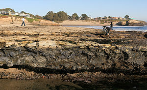
Carmel Bay State Marine Conservation Area (SMCA) is a marine protected area in Carmel Bay. Carmel Bay is adjacent to the city of Carmel-by-the-Sea and is near Monterey, on California’s central coast. The marine protected area covers 2.12 square miles. Recreational fishing of finfish and limited commercial taking of kelp is permitted within the SMCA.

Moro Cojo Slough State Marine Reserve

Moro Cojo Estuary State Marine Reserve (SMR) is a marine protected area established to protect the wildlife and habitats in Moro Cojo Slough. Moro Cojo Slough is located inland from Monterey Bay on the central coast of California, directly south of the more widely known Elkhorn Slough. The area covers 0.46 square miles (1.2 km2). The SMR protects all marine life within its boundaries. Fishing and take of all living marine resources is prohibited.

Gerstle Cove State Marine Reserve marine reserve in California

Gerstle Cove State Marine Reserve (SMR) is a marine protected area that lies onshore from Salt Point State Park, within the Salt Point State Marine Conservation Area, in Sonoma County on California’s north central coast. The marine protected area covers 0.1 square miles. Gerstle Cove SMR prohibits the take of all living resources.

Del Mar Landing State Marine Reserve marine reserve in California

Del Mar Landing State Marine Reserve (SMR) is a marine protected area that lies onshore, about two miles south of the town of Gualala and three and a half miles north of Sea Ranch in Sonoma County on California’s north central coast. The marine protected area covers 0.22 square miles (0.57 km2). Del Mar Landing SMR prohibits the take of all living marine resources.

Stewarts Point State Marine Reserve & Stewarts Point State Marine Conservation Area

Stewarts Point State Marine Reserve (SMR) and Stewarts Point State Marine Conservation Area (SMCA) are two adjoining marine protected areas that extend offshore from about a mile south of Black Point to Fisk Mill Cove, in Sonoma County on California’s north central coast. The marine protected areas cover 25.22 square miles. Stewarts Point SMR prohibits the take of all living marine resources. Stewarts Point SMCA prohibits the take of all living marine resources, except recreational shore based take of marine aquatic plants, marine invertebrates, finfish by hook and line, surf smelt by beach net, and species authorized by Title 14 Section 28.80 by hand-held dip net.

Salt Point State Marine Conservation Area marine protected area in California

Salt Point State Marine Conservation Area (SMCA) is a marine protected area that lies onshore from Fisk Mill Cove and south along Salt Point State Park in Sonoma County on California’s north central coast. The marine protected area covers 3.12 square miles. Salt Point SMCA prohibits the take of all living marine resources, except the recreational take of abalone and finfish.

Montara State Marine Reserve & Pillar Point State Marine Conservation Area

Montara State Marine Reserve (SMR) and Pillar Point State Marine Conservation Area (SMCA) are two adjoining marine protected areas that extend offshore from Montara to Pillar Point in San Mateo County on California’s north central coast. The combined area of these marine protected areas is 18.42 square miles (47.7 km2), with 11.76 square miles (30.5 km2) in the SMR and 6.66 in the SMCA. Montara SMR prohibits the take of all living marine resources. Pillar Point SMCA prohibits the take of all living marine resources, except the recreational and commercial take of pelagic finfish by trolling or seine, the commercial or recreational take of Dungeness crab by trap and the commercial or recreational take or market squid by hand-held dip net or round haul net.

Big Creek State Marine Reserve and Marine Conservation Area

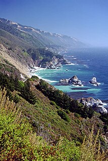
Big Creek State Marine Reserve (SMR) and Big Creek State Marine Conservation Area (SMCA) are two adjoining marine protected areas that lie offshore of Big Sur on California’s central coast. The combined area of these marine protected areas is 22.45 square miles (58.1 km2). The SMR protects all marine life within its boundaries. Fishing and take of all living marine resources is prohibited. Within the SMCA fishing and take of all living marine resources is prohibited except the commercial and recreational take of salmon, albacore, and the commercial take of spot prawn.

Cambria State Marine Conservation Area

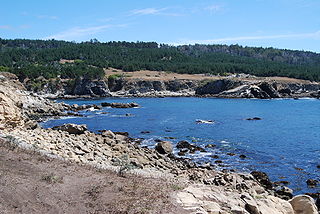
Cambria State Marine Conservation Area (SMCA) is a marine protected area located off the coast of the city of Cambria, California on California’s central coast in San Luis Obispo County, California. The marine protected area covers 6.26 square miles (16.2 km2). Within the SMCA recreational fishing and take is allowed while commercial fishing and take of all living marine resources is prohibited.

Carmel Pinnacles State Marine Reserve

Carmel Pinnacles State Marine Reserve (SMR) is a marine protected area in Carmel Bay including a unique underwater pinnacle formation with adjacent kelp forest, submarine canyon head, and surfgrass. Carmel Bay is adjacent to the city of Carmel-by-the-Sea and is near Monterey, on California’s central coast.

Edward F. Ricketts State Marine Conservation Area

Edward F. Ricketts State Marine Conservation Area is one of four small marine protected areas located near the cities of Monterey and Pacific Grove, at the southern end of Monterey Bay on California’s central coast. The four areas together encompass 2.96 square miles (7.7 km2). Within SMCAs fishing and take of all living marine resources is prohibited except the recreational take of finfish by hook-and-line and the commercial take of giant and bull kelp under certain conditions.

Lovers Point State Marine Reserve

Lovers Point State Marine Reserve (SMR) is one of four small marine protected areas located near the cities of Monterey and Pacific Grove, at the southern end of Monterey Bay on California’s central coast. The four MPAs together encompass 2.96 square miles (7.7 km2). The SMR protects all marine life within its boundaries. Fishing and take of all living marine resources is prohibited.

Morro Bay State Marine Recreational Management Area and Morro Bay State Marine Reserve

Morro Bay State Marine Recreational Management Area (SMRMA) and Morro Bay State Marine Reserve (SMR) are two marine protected areas that provide protection for Morro Bay Estuary on California’s central coast. The two marine protected areas together encompass 3.31 square miles (8.6 km2). Within the SMRMA fishing and take of all living marine resources is prohibited except that north of latitude 35° 19.70’ N the recreational take of finfish and aquaculture of oysters, pursuant to a valid State water bottom lease and permit, is permitted. And recreational hunting of waterfowl is allowed unless otherwise restricted by hunting regulations. The SMR protects all marine life within its boundaries. Fishing and take of all living marine resources is prohibited.

Pacific Grove Marine Gardens State Marine Conservation Area

Pacific Grove Marine Gardens State Marine Conservation Area is one of four small marine protected areas located near the cities of Monterey and Pacific Grove, at the southern end of Monterey Bay on California’s central coast. The four MPAs together encompass 2.96 square miles (7.7 km2). Within the SMCA fishing and take of all living marine resources is prohibited except the recreational take of finfish and the commercial take of giant and bull kelp by hand under certain conditions. According to the Frommer's guide, the Marine Gardens area is "renowned for ocean views, flowers, and tide-pool seaweed beds."

Piedras Blancas State Marine Reserve and Marine Conservation Area

Piedras Blancas State Marine Reserve (SMR) and Piedras Blancas State Marine Conservation Area (SMCA) are two adjoining marine protected areas that lie offshore of San Luis Obispo County on California’s central coast. The combined area of these marine protected areas is 19.68 square miles (51.0 km2). The SMR protects all marine life within its boundaries. Fishing and take of all living marine resources is prohibited. Within the SMCA fishing and take of all living marine resources is prohibited except the commercial and recreational take of salmon and albacore.

Point Sur State Marine Reserve and Marine Conservation Area protected area

Point Sur State Marine Reserve (SMR) and Point Sur State Marine Conservation Area (SMCA) are two adjoining marine protected areas that lie offshore of Point Sur, part of the Big Sur area on California’s central coast. The combined area of these marine protected areas is 19.68 square miles (51.0 km2). The SMR protects all marine life within its boundaries. Fishing and take of all living marine resources is prohibited. Within the SMCA fishing and take of all living marine resources is prohibited except the commercial and recreational take of salmon and albacore.

Vandenberg State Marine Reserve

Vandenberg State Marine Reserve (SMR) is a marine protected area located offshore of Vandenberg Air Force Base, near the city of Lompoc on California’s central coast. The marine protected area covers 32.84 square miles (85.1 km2). Vandenberg SMR protects all marine life within its boundaries. Fishing and take of all living marine resources is prohibited.

References

  1. California Department of Fish and Game. "California Marine Life Protection Act Initiative Summary of Central Coast MPAs as Adopted by the California Fish and Game Commission". Retrieved on December 22, 2008.
  2. California Department of Fish and Game. "Online Guide to California's Central Coast Marine Protected Areas". Retrieved on December 18, 2008.
  3. California Department of Fish and Game. "Central Coast Marine Protected Areas". Retrieved December 18, 2008.
  4. Department of Fish and Game. "Appendix O. Regional MPA Management Plans". Master Plan for Marine Protected Areas (approved February 2008). Retrieved December 18, 2008.
  5. Department of Fish and Game. "California Fish and Game Code section 2853 (b)(3) Archived 2013-03-26 at the Wayback Machine .". Marine Life Protection Act. Retrieved December 18, 2008.
  6. Castell, Jenn, et al. "How do patterns of abundance and size structure differ between fished and unfished waters in the Channel Islands? Results from SCUBA surveys". Partnership for Interdisciplinary Studies of Coastal Oceans (PISCO) at University of California, Santa Barbara and University of California, Santa Cruz; Channel Islands National Park. Retrieved December 18, 2008.