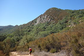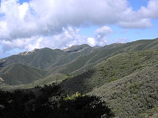
Chaparral is a shrubland plant community found primarily in California, in southern Oregon and in the northern portion of the Baja California Peninsula in Mexico. It is shaped by a Mediterranean climate and infrequent, high-intensity crown fires.

Chino Hills State Park is a state park of California, in the United States. It is located in the Chino Hills, foothills of the Santa Ana Mountains. It is a critical link in the Chino–Puente Hills wildlife corridor, and a major botanical habitat reserve for resident and migrating wildlife.

The Tehachapi Mountains are a mountain range in the Transverse Ranges system of California in the Western United States. The range extends for approximately 40 miles (64 km) in southern Kern County and northwestern Los Angeles County and form part of the boundary between the San Joaquin Valley and the Mojave Desert.
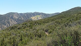
The Santa Ana Mountains are a short peninsular mountain range along the coast of Southern California in the United States. They extend for approximately 61 miles (98 km) southeast of the Los Angeles Basin largely along the border between Orange and Riverside counties.

The foothills of the San Gabriel Valley are the foothills and hills in the San Gabriel Valley of eastern Los Angeles County, California. They include the foothills of the San Gabriel Mountains, and independent low mountain ranges of hills, in the east Greater Los Angeles region. The landforms are part of the Transverse Ranges System of Southern California and Baja California.
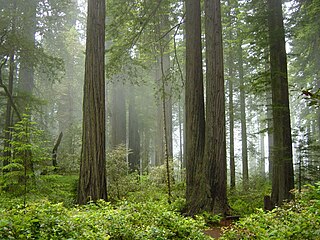
The Northern California coastal forests are a temperate coniferous forests ecoregion of coastal Northern California and southwestern Oregon.

Juniperus californica, the California juniper, is a species of juniper native to southwestern North America.

The Golden Gate Biosphere Network is a voluntary coalition of federal, state, and local government agencies, nonprofit organizations, universities, and private partners within the Golden Gate Biosphere region. The Network works towards protecting the biosphere region's biodiversity and conserving its natural resources to maintain the quality of life for people within the region. The Network has been part of the UNESCO Man and Biosphere Programme since 1988 and is part of the US Biosphere Network and EuroMAB. It is recognized by UNESCO due to the significant biodiversity of the region, as well as the Network's efforts to demonstrate and promote a balanced relationship between humans and the biosphere.
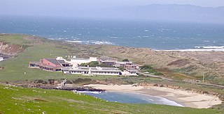
The University of California Natural Reserve System (UCNRS) is a system of protected areas throughout California. The reserves support UC's mission of teaching, research, and public service. Unlike national and state parks, they are not available for recreational uses, because they were specifically created to enable UC scientists to conduct research free from such distractions.

Trichostema lanceolatum, with the common names vinegarweed and camphor weed, is an annual flowering herb of the mint family native to western North America.

California oak woodland is a plant community found throughout the California chaparral and woodlands ecoregion of California in the United States and northwestern Baja California in Mexico. Oak woodland is widespread at lower elevations in coastal California; in interior valleys of the Coast Ranges, Transverse Ranges and Peninsular Ranges; and in a ring around the California Central Valley grasslands. The dominant trees are oaks, interspersed with other broadleaf and coniferous trees, with an understory of grasses, herbs, geophytes, and California native plants.
The 3,848 acres (6.013 sq mi) Landels-Hill Big Creek Reserve located in the southern region of Big Sur, California is owned by the University of California Natural Reserve System. It is located off State Route 1 in 50 miles (80 km) south of Monterey and adjacent to the Big Creek State Marine Reserve and Big Creek State Marine Conservation Area. It is open only for approved research or educational purposes.

Ephedra californica is a species of Ephedra, known by the common names California jointfir, California ephedra, desert tea, Mormon tea, and cañatillo.
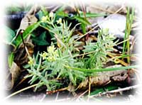
Galium californicum is a species of flowering plant in the coffee family known by the common name California bedstraw.
Quail Ridge Reserve is a 2,000-acre (810 ha) nature reserve in northern California. It is located in the vicinity of Lake Berryessa and the Blue Ridge Berryessa Natural Area, in Napa County, California.
The Donald and Sylvia McLaughlin Natural Reserve is a 7,050-acre (28.5 km2) University of California Natural Reserve System reserve in the Blue Ridge Berryessa Natural Area, in Napa and Lake counties of California. The site is owned by the Homestake Mining Company, and is the site of the now-closed McLaughlin Mine.

The California coastal sage and chaparral is a Mediterranean forests, woodlands, and scrub ecoregion located in southwestern California and northwestern Baja California (Mexico). It is part of the larger California chaparral and woodlands ecoregion.

The Palos Verdes Peninsula Land Conservancy (PVPLC) is a non-profit organization that is based on the Palos Verdes Peninsula in southwestern Los Angeles County, California.
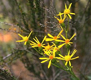
Packera layneae, known by the common name Layne's ragwort and Layne's butterweed, is a rare species of flowering plant in the aster family.
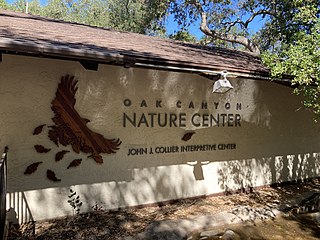
Oak Canyon Nature Center is a nature preserve located in Anaheim, Southern California. Owned by the city, the park spans an area of 58-acres, comprising three adjoining canyons of the Santa Ana foothills. It has an elevation range from 525 to 825 feet ., and contains three major vegetation zones: coastal sage scrub, oak woodland and riparian. Open on weekends, the John J. Collier Interpretive Center features a museum with live animal and regional natural history exhibits.
