Related Research Articles

The Angeles National Forest (ANF) of the U.S. Forest Service is located in the San Gabriel Mountains and Sierra Pelona Mountains, primarily within Los Angeles County in southern California. The ANF manages a majority of the San Gabriel Mountains National Monument.

Palomar Mountain is a mountain ridge in the Peninsular Ranges in northern San Diego County. It is famous as the location of the Palomar Observatory and Hale Telescope, and known for the Palomar Mountain State Park.

The Cleveland National Forest encompasses 460,000 acres/720 sq mi (1,900 km2) of inland montane regions—approx. 60 miles from the Pacific Ocean—within the counties of San Diego, Riverside, and Orange, California. The landscape varies somewhat, with mostly chaparral canyons, arroyos and high desert, but dotted with meadows and oak and conifer forests. Near water sources, riparian environments and perennial aquatic plants attract native and migratory wildlife, such as at San Diego’s man-made Lake Cuyamaca. A generally warm and dry, inland-Mediterranean climate prevails over the forest, with the cooler months producing morning frost and snowfall. It is the southernmost U.S. National Forest of California. The area is administered by the U.S. Forest Service, a government agency within the United States Department of Agriculture, and is locally overseen by the Descanso, Palomar and Trabuco Ranger Districts.

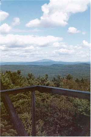
A fire lookout tower, fire tower, or lookout tower is a tower that provides housing and protection for a person known as a "fire lookout", whose duty it is to search for wildfires in the wilderness. It is a small building, usually on the summit of a mountain or other high vantage point to maximize viewing distance and range, known as view shed. From this vantage point the fire lookout can see smoke that may develop, determine the location by using a device known as an Osborne Fire Finder, and call for wildfire suppression crews. Lookouts also report weather changes and plot the location of lightning strikes during storms. The location of the strike is monitored for a period of days afterwards, in case of ignition.
Mount Grace State Forest is a publicly owned forest with recreational features located in the town of Warwick. The state forest centers around Mount Grace, which at 1,621 feet (494 m) is the third highest point in Massachusetts east of the Connecticut River after Mount Wachusett and Mount Watatic. It is bordered by portions of Warwick State Forest to the east and west and is managed by the Massachusetts Department of Conservation and Recreation.

Kearsarge North is a mountain located about 4 miles (6 km) northeast of North Conway, Carroll County, New Hampshire, United States. The U.S. Board on Geographic Names accepted the name "Pequawket Mountain" in 1915 but it was renamed Kearsarge North in 1957. The Pequawket are a subdivision of the Abenaki people who formerly lived in the area. It is sometimes referred to as Mount Kearsarge, a name officially assigned to a mountain in Merrimack County.

Jackson Demonstration State Forest is a public forest in Mendocino County, California managed by the California Department of Forestry and Fire Protection. It is the largest demonstration forest operated by the State of California. The forest land is located along California State Highway 20 between Willits and the coastal city of Fort Bragg. It is named after Jacob Green Jackson, founder of Caspar Lumber Company, which formerly owned the land. The forest holds sacred value as an ancestral home and ceremonial site for the Coyote Valley Band of Pomo Indians.
Calaveras Big Tree National Forest, in the Sierra Nevada, was established in California on May 11, 1954 with 390 acres (1.6 km2) to protect a grove of Giant Sequoias, although it had been authorized since February 18, 1909.
The Aermotor Windmill Company, or Aermotor Company, is an American manufacturer of wind-powered water pumps. The widespread use of their distinctive wind pumps on ranches throughout the arid plains and deserts of the United States has made their design a quintessential image of the American West.
Architects of the National Park Service are the architects and landscape architects who were employed by the National Park Service (NPS) starting in 1918 to design buildings, structures, roads, trails and other features in the United States National Parks. Many of their works are listed on the National Register of Historic Places, and a number have also been designated as National Historic Landmarks.
Rocky Mount is an unincorporated community in western Miller County, Missouri United States. The site is on Missouri Route Y approximately four miles southwest of Eldon. The Rocky Mount church is located at this location, however the post office was moved into neighboring Morgan County about two miles to the southwest in 1919. The Rocky Mount Lookout Tower and Rocky Mount Towersite State Wildlife Area lie approximately two miles to the east.
Gomer Hill is a 2,106-foot-tall (642 m) mountain in the Tug Hill region of New York. It is located west-northwest of Turin in Lewis County. In 1940, a 67-foot-6-inch-tall (20.57 m) steel fire lookout tower was built on the mountain. The tower ceased fire lookout operations at the end of the 1988 season, and officially closed the next year. The tower site is open to the public, but the tower is closed and used as an antenna support structure.
Mount Irvine is a mountain in the Southern Tier of New York. It is located in Carrollton, northwest of Limestone in Cattaraugus County. In 1928, a 60-foot-tall (18 m) steel fire lookout tower was built on the mountain. Three years later, the tower was moved to Science Hill.
Mount Colfax is a 1,266-foot-tall (386 m) mountain in the Capital District of New York. It is located north of Cambridge in Washington County. The mountain is the site of an 80-foot-tall (24 m) former fire lookout tower, which is closed to the public.
Science Hill is a mountain in the Southern Tier of New York. It is located west-southwest of Limestone in Cattaraugus County within Allegany State Park, near the Bradford, Pennsylvania entrance to the park. In 1932, a 60-foot-tall (18 m) steel fire lookout tower was built on the mountain. In 1978, it was taken down and reassembled at the Ellicottville BOCES school.

Mount Nimham is a 1,273-foot-tall (388 m) mountain in Hudson Highlands of New York. It is located northwest of Carmel in Putnam County. Nimham Mountain is named after Chief Daniel Nimham of the Wappinger tribe. In 1940, an 82-foot-6-inch-tall (25.15 m) steel fire lookout tower was built on the mountain. The tower ceased fire lookout operations at the end of the 1988 fire lookout season and was officially closed the next year. The tower appears on the National Historic Lookout Register and is still open to the public.
Mount Electra is a 2,260-foot-tall (690 m) mountain in the Adirondack Mountains of New York. It is located north-northeast of Little Rapids in the Town of Webb in Herkimer County. Deer Mountain is located north-northwest of Mount Electra. The mountain was previously known as Rock Lake Mountain. Around 1920, a 60-foot-tall (18 m) steel fire lookout tower was built on the mountain. The tower was dismantled in 1989 and left at the mountain top.
Mount Tuscarora is a mountain in the Southern Tier of New York. It is located within Allegany State Park in Coldspring, Cattaraugus County. In 1928, a 60-foot-tall (18 m) steel fire lookout tower was built on the mountain. The tower remains on the mountain but needs to be restored. The peak is the tallest in the Allegany State Park among those that have a trail to the summit, at 2,144 ft above sea level.
The Summit Fire Tower is a 60-foot-tall (18 m) LS40 Aermotor steel fire lookout tower in Cattaraugus County in the state of New York. The tower is located south of Salamanca on what is known as South Mountain.