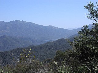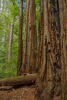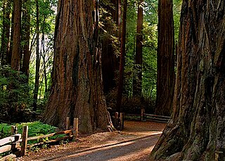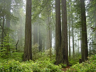
The California chaparral and woodlands is a terrestrial ecoregion of southwestern Oregon, northern, central, and southern California and northwestern Baja California (Mexico), located on the west coast of North America. It is an ecoregion of the Mediterranean forests, woodlands, and scrub biome, and part of the Nearctic realm.

Big Basin Redwoods State Park is a state park in the U.S. state of California, located in Santa Cruz County, about 36 km (22 mi) northwest of Santa Cruz. The park contains almost all of the Waddell Creek watershed, which was formed by the seismic uplift of its rim, and the erosion of its center by the many streams in its bowl-shaped depression.

The ecology of California can be understood by dividing the state into a number of ecoregions, which contain distinct ecological communities of plants and animals in a contiguous region. The ecoregions of California can be grouped into four major groups: desert ecoregions, Mediterranean ecoregions, forested mountains, and coastal forests.

The Santa Lucia Mountains or Santa Lucia Range is a rugged mountain range in coastal central California, running from Carmel southeast for 140 miles (230 km) to the Cuyama River in San Luis Obispo County. The range is never more than 11 miles (18 km) from the coast. The range forms the steepest coastal slope in the contiguous United States. Cone Peak at 5,158 feet (1,572 m) tall and three miles (5 km) from the coast, is the highest peak in proximity to the ocean in the lower 48 United States. The range was a barrier to exploring the coast of central California for early Spanish explorers.

Henry Cowell Redwoods State Park is a state park of California, USA, preserving mainly forest and riparian areas in the watershed of the San Lorenzo River, including a grove of old-growth coast redwood. It is located in Santa Cruz County, primarily in the area between the cities of Santa Cruz and Scotts Valley, near the community of Felton and the University of California at Santa Cruz. The park includes a non-contiguous extension in the Fall Creek area north of Felton. The 4,623-acre (1,871 ha) park was established in 1954.

The Northern California coastal forests are a temperate coniferous forests ecoregion of coastal Northern California.

The Diablo Range is a mountain range in the California Coast Ranges subdivision of the Pacific Coast Ranges in northern California, United States. It is stretches from the eastern San Francisco Bay area at its northern end to the Salinas Valley area at its southern end.

The Golden Gate Biosphere is a biosphere reserve in Northern California. It was created by UNESCO in 1988 and encompasses 13 protected areas in the San Francisco Bay Area. It extends through the central California coastal region from the Bodega Marine Reserve in the north to Jasper Ridge in the south and includes the Farallon Islands, Angel Island, and Alcatraz within the San Francisco Bay. The biosphere reserve is situated on both sides of the San Andreas Fault. Each side has a completely different type of bedrock, and the western side of the rift is moving northward. It encompasses a diverse range of marine, coastal, and upland habitats of the California chaparral and woodlands and Northern California coastal forests ecoregions, including mixed evergreen forests, Coast Redwood forests, Douglas-fir forests, Bishop pine forests, oak forests, woodlands and savannas, northern coastal scrub, chaparral, coastal dune, coastal strand, tidepools, kelp forests, coastal grasslands, and marshes. The associated fauna is also rich with cougars, Tule elk, California sea lions, elephant seals, and many shorebirds.

California mixed evergreen forest is an plant community found in the mountain ranges of California and southwestern Oregon.

The Coast Ranges of California span 400 miles (644 km) from Del Norte or Humboldt County, California, south to Santa Barbara County. The other three coastal California mountain ranges are the Transverse Ranges, Peninsular Ranges and the Klamath Mountains.

The California Floristic Province (CFP) is a floristic province with a Mediterranean-type climate located on the Pacific Coast of North America with a distinctive flora similar to other regions with a winter rainfall and summer drought climate like the Mediterranean Basin. This biodiversity hotspot is known for being the home of the Sierran giant sequoia tree and its close relative the coast redwood. In 1996, the Province was designated as a biodiversity hotspot allowing it to join ranks among 33 other areas in the world with many endemic species. To be named a biodiversity hotspot, an area has to contain species and plant life that cannot be found anywhere else in the world. The California Floristic Province is home to over 3,000 species of vascular plants, 60% of which are endemic to the province.

The Big Sur River is a 15.7-mile-long (25.3 km) river on the Central Coast of California. The river drains a portion of the Big Sur area, a thinly settled region of the Central California coast where the Santa Lucia Mountains rise abruptly from the Pacific Ocean. The upper river and watershed lies within the Ventana Wilderness and encompasses the headwaters downstream to the area known as the Gorge. The lower river flows roughly northwest through Pfeiffer Big Sur State Park, the Big Sur village, several private camp grounds and Andrew Molera State Park where it flows through a lagoon and sandbar into the Pacific Ocean at the Monterey Bay National Marine Sanctuary. Major Tributaries of the river include, in order: Redwood Creek, Lion Creek, Logwood Creek, Terrace Creek, Ventana Creek, Post Creek, Pfeiffer-Redwood Creek, Juan Higuera Creek, and Pheneger Creek.

California oak woodland is a plant community found throughout the California chaparral and woodlands ecoregion of California in the United States and northwestern Baja California in Mexico. Oak woodland is widespread at lower elevations in coastal California; in interior valleys of the Coast Ranges, Transverse Ranges and Peninsular Ranges; and in a ring around the California Central Valley grasslands. The dominant trees are oaks, interspersed with other broadleaf and coniferous trees, with an understory of grasses, herbs, geophytes, and California native plants.

Carbonera Creek is a 10.2-mile-long (16.4 km) watercourse in Santa Cruz County, California, that eventually flows to the San Lorenzo River.

Swanton Pacific Ranch is a 3,200-acre (13 km2) ranch in Santa Cruz County, California, outside the town of Davenport. The ranch is owned and operated by California Polytechnic State University for educational and research in sustainable agriculture. The ranch encompasses rangeland, livestock, and forestry operations for the College of Agriculture, Food and Environmental Sciences and comprises a significant part of the community of Swanton.

The California coastal sage and chaparral is a Mediterranean forests, woodlands, and scrub ecoregion located in southwestern California and northwestern Baja California (Mexico). It is part of the larger California chaparral and woodlands ecoregion.

The California montane chaparral and woodlands is an ecoregion defined by the World Wildlife Fund, spanning 7,900 square miles (20,000 km2) of mountains in the Transverse Ranges, Peninsular Ranges, and Coast Ranges of southern and central California. The ecoregion is part of the larger California chaparral and woodlands ecoregion, and belongs to the Mediterranean forests, woodlands, and scrub biome.

The Angelo Coast Range Reserve is located in the Northern Outer California Coast Ranges, in Mendocino County, Northern California. The 7,660-acre reserve includes a section of the Eel River.

The California Coast Ranges Biosphere Reserve was a UNESCO Biosphere reserve located along the California Coast Ranges of northern California and the San Francisco Bay area until June 2017. This biosphere reserve includes a highly diverse complex of evergreen sclerophyllous woodland, coastal, estuary and marine ecosystems.


