Philip L. Boyd Deep Canyon Desert Research Center

Last updated
Philip L. Boyd Deep Canyon Desert Research Center
Relief map of California.png
Red pog.svg
Usa edcp relief location map.png
Red pog.svg
Nearest city Palm Desert, California
Coordinates 33°38′N116°24′W / 33.633°N 116.400°W / 33.633; -116.400 [1]
Area2,469 hectares [ha] (24.69 km2) [2] [lower-alpha 1]
Created1958 [4]
Operated by University of California, Riverside
Website deepcanyon.ucnrs.org

The Philip L. Boyd Deep Canyon Desert Research Center is one of the original seven of the total 39 sites in the University of California Natural Reserve System. [5] It contains lands originally donated to the University by regent Philip L. Boyd in 1958. [6] The Research Center is contained within UNESCO's Mojave and Colorado Deserts Biosphere Reserve. [7]

Contents

Background

Deep Canyon, immediately east of the Palms to Pines Scenic Byway, is located inside the Santa Rosa and San Jacinto Mountains National Monument at the western edge of the Colorado Desert. The canyon cuts into the north face of the Santa Rosa Mountains creating cliffs 394 metres (1,293 ft) high. [8] [9] The canyon, created by an intermittent stream carrying moisture from the mountains, extends 13 kilometres (8.1 mi) dropping 1,500 metres (4,900 ft) in elevation down to 300 metres (980 ft) where an alluvial fan pours into the Coachella Valley. The temporary flows of Deep Canyon Creek seldom reach the alluvial fan and never meet Salton Sea. [10] Because the canyon lies in a rain shadow the climate is very arid and summertime temperatures reach 36 °C (97 °F). [11] The upper Sonoran, lower Sonoran, and transitional life zones are represented across this expanse. [10] The flora includes creosote bushes, palo verde trees, and ocotillo. [12] In places where water collects California fan palms and bighorn sheep can be found. [13]

The first scientific expedition to the site was carried out in 1908 by Harry Swarth and Joseph Grinnell on behalf of University of California, Berkeley's Museum of Vertebrate Zoology. [14] Philip L. Boyd, a Regent of the University of California, leased the land for the Living Desert Zoo and Gardens and invited faculty of the newly opened University of California, Riverside to use the property for research. When the need for a non-public range became evident, Boyd donated the initial 1,701 acres (6.88 km2) of land in Deep Canyon in 1958 as well as the funding to spur the University to acquire other contiguous properties. Construction began on the first hard facilities on site in 1961 and commemoration of the site with a bronze plaque took place on March 7, 1970 naming the center after Boyd. [14] The first director of the research center was Irwin P. Ting. [15] As of 2015 the director of the research center is Dr. Chris Tracy. [16]

The cactus Opuntia acanthocarpa has been studied at Agave Hill. [17] In 2010 a study of 35 species of Mutillid wasps revealed four new species, two of which (Odontophotopsis hammetti and Sphaeropthalma mankelli) are only known to exist at the center. [18] The center was the study ground for a 2013 National Science Foundation grant to develop a new method for identifying species of nematodes. [19] A series of five books (Mammals of Deep Canyon in 1968, Ants of Deep Canyon in 1973, Deep Canyon, a Desert Wilderness for Science in 1976, Birds of Deep Canyon in 1979, and Birds of Southern California's Deep Canyon in 1983) discuss the biodiversity of the area. [20]

Because of the remoteness of Deep Canyon, it hosts one of the 300 worldwide optical fiber infrasound sensors (OFIS) used to implement the Comprehensive Nuclear-Test-Ban Treaty. [21]

Notes

  1. The University of California has agreements with federal agencies for the use of tens of thousands of acres adjacent to the Research Center. Studies at Deep Canyon often cover transects across the adjacent properties. [3]

Related Research Articles

Palm Desert, California American city in California, United States

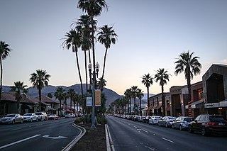
Palm Desert is a city in Riverside County, California, United States, in the Coachella Valley, approximately 14 miles (23 km) east of Palm Springs, 121 miles (195 km) northeast of San Diego and 122 miles (196 km) east of Los Angeles. The population was 48,445 at the 2010 census. The city has been one of the state's fastest growing since 1980, when its population was 11,801.

Mojave Desert Desert in the southwestern United States

The Mojave Desert is a xeric desert in the rain shadow of the Sierra Nevada mountains in the Southwestern United States. It is named for the indigenous Mojave people. It is located primarily in southeastern California and southwestern Nevada, with small portions extending into Arizona and Utah.

Sonoran Desert Desert in northwestern Mexico and the southwestern United States

The Sonoran Desert is a North American desert and ecoregion that covers large parts of the southwestern United States, as well as the northwestern Mexican states of Sonora, Baja California, and Baja California Sur. It is the hottest desert in both Mexico and the United States. It has an area of 260,000 square kilometers (100,000 sq mi).

James Reserve

The James San Jacinto Mountains Reserve, a unit of the University of California Natural Reserve System, is a 29-acre (120,000 m2) ecological reserve and biological field station located at an altitude of 5,200 feet (1,600 m) in a wilderness area of the San Jacinto Mountains near Lake Fulmor in Riverside County, California, United States.

<i>Washingtonia filifera</i> Species of palm tree

Washingtonia filifera, the desert fan palm, California fan palm, or California palm, is a flowering plant in the palm family Arecaceae, native to the far southwestern United States and Baja California, Mexico. Growing to 15–20 m (49–66 ft) tall by 3–6 m (10–20 ft) broad, it is an evergreen monocot with a tree-like growth habit. It has a sturdy, columnar trunk and waxy, fan-shaped (palmate) leaves.

Living Desert Zoo and Gardens Botanical garden and zoo in Riverside County, California

The Living Desert Zoo and Gardens, formerly the Living Desert Museum, is a non-profit zoo and desert botanical garden located in Palm Desert, Riverside County, California, United States. The Living Desert is home to over 500 animals representing over 150 species and welcomes over 500,000 visitors annually. Situated in the Sonoran Desert of the Coachella Valley and Santa Rosa Mountains foothills near Palm Springs, California, The Living Desert is set on 1,200 acres, with 80 developed as zoo and gardens.

University of California Natural Reserve System Network of nature reserves in California

The University of California Natural Reserve System (UCNRS) is a system of protected areas throughout California.

Santa Rosa and San Jacinto Mountains National Monument Protected area in California

The Santa Rosa and San Jacinto Mountains National Monument is a National Monument in southern California. It includes portions of the Santa Rosa and San Jacinto mountain ranges, the northernmost ones of the Peninsular Ranges system. The national monument covers portions of Riverside County, west of the Coachella Valley, approximately 100 miles (160 km) southeast of downtown Los Angeles.

<i>Opuntia engelmannii</i> Species of cactus

Opuntia engelmannii is a prickly pear common across the south-central and Southwestern United States and northern Mexico. It goes by a variety of common names, including desert prickly pear, discus prickly pear, Engelmann's prickly pear in the US, and nopal, abrojo, joconostle, and vela de coyote in Mexico.

Palm Springs, California Resort city in Riverside County, southern California, United States

Palm Springs is a desert resort city in Riverside County, California, United States, within the Colorado Desert's Coachella Valley. The city covers approximately 94 square miles (240 km2), making it the largest city in Riverside County by land area. With multiple plots in checkerboard pattern, more than 10% of the city is part of the Agua Caliente Band of Cahuilla Indians reservation land and is the administrative capital of the most populated reservation in California.

Box Springs, California Unincorporated community in California, United States

The Box Spring is a spring in Riverside County, California, around which grew the town of Box Springs. It is in the Moreno Valley, five miles (8.0 km) east-southeast of downtown Riverside on Interstate 215/State Route 60. Box Springs is named on the 7.5 quadrangle map, Riverside East (1967).

Santa Rosa Wilderness Protected wilderness area in California, United States

The Santa Rosa Wilderness is a 72,259-acre (292.42 km2) wilderness area in Southern California, in the Santa Rosa Mountains of Riverside and San Diego counties, California. It is in the Colorado Desert section of the Sonoran Desert, above the Coachella Valley and Lower Colorado River Valley regions in a Peninsular Range, between La Quinta to the north and Anza Borrego Desert State Park to the south. The United States Congress established the wilderness in 1984 with the passage of the California Wilderness Act, managed by both the US Forest Service and the Bureau of Land Management. In 2009, the Omnibus Public Land Management Act was signed into law which added more than 2,000 acres (8.1 km2). Most of the Santa Rosa Wilderness is within the Santa Rosa and San Jacinto Mountains National Monument.

Carl Eytel German-American painter (1862–1925)

Carl Eytel was a German American artist who built his reputation for paintings and drawings of desert subjects in the American Southwest. Immigrating to the United States in 1885, he settled in Palm Springs, California in 1903. With an extensive knowledge of the Sonoran Desert, Eytel traveled with author George Wharton James as he wrote the successful Wonders of the Colorado Desert, and contributed over 300 drawings to the 1908 work. While he enjoyed success as an artist, he lived as an ascetic and would die in poverty. Eytel's most important work, Desert Near Palm Springs, hangs in the History Room of the California State Library.

George Carlos Wheeler (1897–1991) was an entomologist who specialized in the study of ants.

Philip Linnaes Boyd was the first mayor of Palm Springs, California, a regent of the University of California and the namesake of the Deep Canyon Desert Research Center.

The Burns Piñon Ridge Reserve is a 303-acre nature reserve that is part of the University of California Natural Reserve System. It is located near Yucca Valley, California in San Bernardino County, California. Administered by UC Irvine, the reserve is owned by the University of California and managed for teaching and research.

Kenneth S. Norris Rancho Marino Reserve

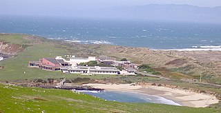
Kenneth S. Norris Rancho Marino Reserve is part of the University of California Natural Reserve System. The reserve is located along the coast of San Luis Obispo County at the south end of the town of Cambria, California. It is named for Kenneth S. Norris, a University of California professor, renowned naturalist, and founder of the UC Natural Reserve System. It is operated by the university under a use agreement, as it is privately owned and funded. There is no public access.

Philip Boyd or Phillip Boyd could refer to:

References

Citations
  1. Nobel, Park S. (2003). Environmental Biology of Agaves and Cacti. Cambridge University Press. p. 1. ISBN   9780521543347.
  2. "Philip L. Boyd Deep Canyon Desert Research Center". University of California Natural Reserve System.
  3. Fiedler, Rumsey & Wong 2013, p. 162.
  4. Fiedler, Rumsey & Wong 2013, pp. 161, 163.
  5. Wagenvoord, Helen (Summer 2002). "Hidden Reserves of California". California Wild .
  6. "Santa Rosa and San Jacinto Mountains National Monument – Points of Interest". Bureau of Land Management . Archived from the original on 2015-06-18.
  7. "Boyd Deep Canyon Desert Research Center". University of California .
  8. Weathers 1983, pp. 1–2.
  9. Frommer & Sublette 1971, p. 423.
  10. 1 2 Frommer & Sublette 1971, p. 414.
  11. Weathers 1983, pp. 10–11.
  12. Fiedler, Rumsey & Wong 2013, p. 161.
  13. Riilbal, Rodolfo (1963). "Deep Canyon Desert Research Area and the Philip L. Boyd Desert Research Center". American Zoologist . 3 (3): 353–354. doi: 10.1093/icb/3.3.353 .
  14. 1 2 Muth, Al (Fall–Winter 2013). "A Brief History of Philip L. Boyd Deep Canyon Desert Research Center". El Paisano (217).
  15. "Desert ecology to be study for 20 years". Redlands Daily Facts . January 31, 1973. p. 20 via Newspapers.com.
  16. "UCR Natural Reserves". University of California, Riverside . September 16, 2009.
  17. Nobel, Park S.; Bobich, Edward G. (2002). "Plant frequency, stem and root characteristics, and CO2 uptake for Opuntia acanthocarpa: elevational correlates in the northwestern Sonoran Desert". Oecologia . 130 (2): 165–172. Bibcode:2002Oecol.130..165N. doi:10.1007/s004420100793. PMID   28547138. S2CID   20246974.
  18. Pitts, James P.; Wilson, Joseph S.; Williams, Kevin A.; Boehme, Nicole F. (2010). "Nocturnal velvet ant males (Hymenoptera: Mutillidae) of Deep Canyon, California including four new species and a fifth new species from Owens Lake Valley, California" (PDF). Zootaxa . 2553: 2. ISSN   1175-5334.
  19. Garvey, Kathy Keatley (March 27, 2013). "NSF Grant to Steve Nadler for Study of Nematodes". University of California, Davis .
  20. Weathers 1983, p. vii.
  21. Fiedler, Rumsey & Wong 2013, p. 163.
Bibliography

Further reading