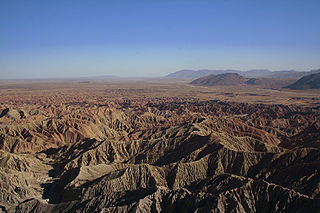
The Mojave and Colorado Deserts Biosphere Reserve is a biosphere reserve designated by UNESCO in 1984 to promote the ecological conservation of a cluster of areas in the Mojave and Colorado deserts of California. A principal feature is Death Valley. The four management units encompassed by the reserve upon its creation were:
The United Nations Educational, Scientific and Cultural Organization is a specialized agency of the United Nations (UN) based in Paris. Its declared purpose is to contribute to peace and security by promoting international collaboration through educational, scientific, and cultural reforms in order to increase universal respect for justice, the rule of law, and human rights along with fundamental freedom proclaimed in the United Nations Charter. It is the successor of the League of Nations' International Committee on Intellectual Cooperation.
The Mojave Desert is an arid rain-shadow desert and the driest desert in North America. It is in the southwestern United States, primarily within southeastern California and southern Nevada, and it occupies 47,877 sq mi (124,000 km2). Very small areas also extend into Utah and Arizona. Its boundaries are generally noted by the presence of Joshua trees, which are native only to the Mojave Desert and are considered an indicator species, and it is believed to support an additional 1,750 to 2,000 species of plants. The central part of the desert is sparsely populated, while its peripheries support large communities such as Las Vegas, Barstow, Lancaster, Palmdale, Victorville, and St. George.
California's Colorado Desert is a part of the larger Sonoran Desert. It encompasses approximately 7 million acres (28,000 km2), including the heavily irrigated Coachella and Imperial valleys. It is home to many unique flora and fauna.
Death Valley National Park is an American national park that straddles the California—Nevada border, east of the Sierra Nevada. The park boundaries include Death Valley, the northern section of Panamint Valley, the southern section of Eureka Valley, and most of Saline Valley. The park occupies an interface zone between the arid Great Basin and Mojave deserts, protecting the northwest corner of the Mojave Desert and its diverse environment of salt-flats, sand dunes, badlands, valleys, canyons, and mountains. Death Valley is the largest national park in the lower 48 states, and the hottest, driest and lowest of all the national parks in the United States. The second-lowest point in the Western Hemisphere is in Badwater Basin, which is 282 feet (86 m) below sea level. Approximately 91% of the park is a designated wilderness area. The park is home to many species of plants and animals that have adapted to this harsh desert environment. Some examples include creosote bush, bighorn sheep, coyote, and the Death Valley pupfish, a survivor from much wetter times. UNESCO included Death Valley as the principal feature of its Mojave and Colorado Deserts Biosphere Reserve in 1984.
Joshua Tree National Park is an American national park in southeastern California, east of Los Angeles, near San Bernardino and Palm Springs. The park is named for the Joshua trees native to the Mojave Desert. Originally declared a national monument in 1936, Joshua Tree was redesignated as a national park in 1994 when the U.S. Congress passed the California Desert Protection Act. Encompassing a total of 790,636 acres —an area slightly larger than the state of Rhode Island—the park includes 429,690 acres of designated wilderness. Straddling the border between San Bernardino County and Riverside County, the park includes parts of two deserts, each an ecosystem whose characteristics are determined primarily by elevation: the higher Mojave Desert and the lower Colorado Desert. The Little San Bernardino Mountains traverse the southwest edge of the park.
The Santa Rosa Mountains are a short mountain range in the Peninsular Ranges system, located east of the Los Angeles Basin and northeast of the San Diego metropolitan area of southern California, in the southwestern United States.
The current boundaries of the Reserve are unclear, because Death Valley National Monument was subsequently expanded and reorganized into Death Valley National Park, and the Santa Rosa Mountains Wildlife Management Area into the Santa Rosa and San Jacinto Mountains National Monument. There has been little published about the Reserve since its creation, and it appears to have been essentially overlooked. However interest in this Reserve seems to be increasing in 2008 with the increase in proposals for human use activity within the Anza-Borrego Desert State Park (see SDG&E Sunrise Powerlink proposal).
The Santa Rosa and San Jacinto Mountains National Monument is a National Monument in southern California. It includes portions of the Santa Rosa and San Jacinto mountain ranges, the northernmost ones of the Peninsular Ranges system. The national monument covers portions of Riverside County, west of the Coachella Valley, approximately 100 miles (160 km) southeast of downtown Los Angeles.
Coordinates: 33°35′N116°20′W / 33.583°N 116.333°W
A geographic coordinate system is a coordinate system that enables every location on Earth to be specified by a set of numbers, letters or symbols. The coordinates are often chosen such that one of the numbers represents a vertical position and two or three of the numbers represent a horizontal position; alternatively, a geographic position may be expressed in a combined three-dimensional Cartesian vector. A common choice of coordinates is latitude, longitude and elevation. To specify a location on a plane requires a map projection.
This article related to a protected area in California is a stub. You can help Wikipedia by expanding it. |
This Riverside County, California-related article is a stub. You can help Wikipedia by expanding it. |
This San Bernardino County, California–related article is a stub. You can help Wikipedia by expanding it. |
The Sonoran Desert is a North American desert which covers large parts of the Southwestern United States in Arizona and California and of Northwestern Mexico in Sonora, Baja California, and Baja California Sur. It is the hottest desert in Mexico. It has an area of 260,000 square kilometers (100,000 sq mi). The western portion of the United States–Mexico border passes through the Sonoran Desert.
Anza-Borrego Desert State Park (ABDSP) is a California state park located within the Colorado Desert of southern California, United States. The park takes its name from 18th century Spanish explorer Juan Bautista de Anza and borrego, the Spanish word for sheep. With 600,000 acres (240,000 ha) that includes one-fifth of San Diego County, it is the largest state park in California.
The Low Desert is a common name for any desert in California that is under 2,000 feet (609.6m) in altitude. These areas include, but are not exclusive to, the Colorado Desert and Yuha Desert, in the Southern California portion of the Sonoran Desert. These areas are distinguished in biogeography from the adjacent northern High Desert or Mojave Desert by latitude, elevation, animal life, climate, and native plant communities.
The James San Jacinto Mountains Reserve, a unit of the University of California Natural Reserve System, is a 29-acre (120,000 m2) ecological reserve and biological field station located at an altitude of 5,200 feet (1,600 m) in a wilderness area of the San Jacinto Mountains near Lake Fulmor in Riverside County, California, United States.
The Morongo Basin is an endorheic basin and valley region located in eastern San Bernardino County, in Southern California.
Ferocactus cylindraceus is a species of barrel cactus which is known by several common names, including California barrel cactus, Desert barrel cactus, and miner's compass. It was first described by George Engelmann in 1853.
Bursera microphylla is a North American species of tree in the frankincense family in the soapwood order. Bursera microphylla, known by the common name elephant tree in English or 'torote' in Spanish, is a tree in genus Bursera. It grows into a distinctive sculptural form, with a thickened, water-storing or caudiciform trunk. It is found in the southwestern United States and northwestern Mexico.
The Deserts of California have unique ecosystems and habitats, a sociocultural and historical "Old West" collection of legends, districts, and communities, and they also form a popular tourism region of dramatic natural features and recreational development. All of the deserts are located in eastern Southern California, in the Western United States.
The Sawtooth Mountains Wilderness is a federal wilderness area of 32,136 acres (130.0 km2) located in the Sawtooth Mountains in eastern San Diego County, California. It is located in the Colorado Desert, 35 miles (56 km) south of Borrego Springs, near Anza Borrego Desert State Park.
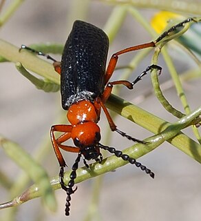
Lytta magister is a species of blister beetle found in southwestern North America.
The Santa Rosa Wilderness is a 72,259-acre (292.42 km2) wilderness area in Southern California, in the Santa Rosa Mountains of Riverside and San Diego counties, California. It is in the Colorado Desert section of the Sonoran Desert, above the Coachella Valley and Lower Colorado River Valley regions in a Peninsular Range, between La Quinta to the north and Anza Borrego Desert State Park to the south. The United States Congress established the wilderness in 1984 with the passage of the California Wilderness Act, managed by the both US Forest Service and the Bureau of Land Management. In 2009, the Omnibus Public Land Management Act was signed into law which added more than 2,000 acres (8.1 km2). Most of the Santa Rosa Wilderness is within the Santa Rosa and San Jacinto Mountains National Monument.
San Felipe Creek is a stream in Imperial and San Diego Counties of California. It arises in the Volcan Mountains of San Diego County 33°11′57″N 116°37′35″W, and runs eastward, gathering the waters of most of the eastern slope of the mountains and desert of the county before it empties into the Salton Sea. It is probably the last remaining perennial natural desert stream in the Colorado Desert region. In 1974, the San Felipe Creek Area was designated as a National Natural Landmark by the National Park Service.
Flora of the Colorado Desert, located in Southern California. The Colorado Desert is a sub-region in the Sonoran Desert ecoregion of southwestern North America. It is also known as the Low Desert, in contrast to the higher elevation Mojave Desert or High Desert, to its north.
The Philip L. Boyd Deep Canyon Desert Research Center is one of the original seven of the total 39 sites in the University of California Natural Reserve System. It contains lands originally donated to the University by regent Philip L. Boyd in 1958. The Research Center is contained within UNESCO's Mojave and Colorado Deserts Biosphere Reserve.
Lost Palms Oasis Trail is a 7.2 mile day-hike trail located in the southernmost part of Joshua Tree National Park. The trail is generally completed in a loop. Known for the beautiful palm trees from which the trail gets its name, this hike is also known for its great bouldering, pools of water, and the ever-elusive "Victory Palms". Deemed by the National Park Service as a "Day-Use-Only" area, this trail is also home to bighorn sheep who use the pools as their main source of water.
Sand to Snow National Monument is a U.S. National Monument located in San Bernardino County and into northern Riverside County, Southern California.