
The East Bay Regional Park District (EBRPD) is a special district operating in Alameda County and Contra Costa County, California, within the East Bay area of the San Francisco Bay Area. It maintains and operates a system of regional parks which is the largest urban regional park district in the United States. The administrative office is located in Oakland.

Point Pinole Regional Shoreline is a regional park on the shores of the San Pablo Bay, California, in the United States. It is approximately 2,315 acres (9.37 km2) in area, and is operated by the East Bay Regional Park District. It includes the Dotson Family Marsh and the Point Pinole Lagoon and hosts the North Richmond Shoreline Festival.

Coyote Hills Regional Park is a regional park encompassing nearly 978 acres of land and administered by the East Bay Regional Park District. The park, which was dedicated to public use in 1967, is located in Fremont, California, US, on the southeast shore of the San Francisco Bay. The Coyote Hills themselves are a small range of hills at the edge of the bay; though not reaching any great height, they afford tremendous views of the bay, three of the trans-bay bridges, the cities of San Francisco and Oakland, the Peninsula Range of the Santa Cruz Mountains and Mount Tamalpais. In addition to the hills themselves, the park encloses a substantial area of wetlands.
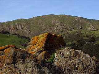
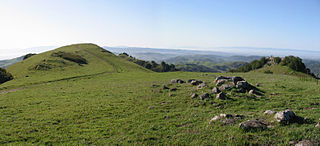
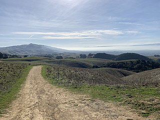
Mission Peak is a mountain peak located east of Fremont, California. It is the northern summit on a ridge that includes Mount Allison and Monument Peak. Mission Peak has symbolic importance, and is depicted on the logo of the City of Fremont. It is located in Mission Peak Regional Preserve, a regional park operated by the East Bay Regional Park District.
McLaughlin Eastshore State Park is a state park and wildlife refuge along the San Francisco Bay shoreline of the East Bay between the cities of Richmond, Albany, Berkeley, Emeryville, and Oakland. It encompasses remnant natural wetlands, restored wetlands, as well as landfill west of the Eastshore Freeway. Its shoreline is 8.5 miles (13.7 km) long, and its total area is 1,854 acres (750 ha), which includes both tidelands and uplands. Originally named just Eastshore State Park, it was renamed in October 2012 to honor the late Save the Bay founder Sylvia McLaughlin, who, along with the late Dwight Steele of Citizens for Eastshore Park, drove the establishment of the park. Prior to 2013, it was jointly managed by the California State Parks and East Bay Regional Park District (EBRPD). The state agency and EBRPD executed a 30-year agreement for EBRPD to manage the park.

Point Isabel Regional Shoreline in Richmond, California, is operated by East Bay Regional Park District, and is a multi-use park for joggers, windsurfers, kayakers, photographers, picnickers, and people walking dogs. It has access for pedestrians and via public transit, private vehicles, and bikes. It also features a concession offering food for people and grooming for pets. A longtime community organization and nonprofit, Point Isabel Dog Owners and Friends (PIDO), is active in the maintenance and improvement of the park.

Dr. Aurelia Reinhardt Redwood Regional Park is a part of the East Bay Regional Parks District (EBRPD) in the San Francisco Bay Area. It is located in the hills east of Oakland, California. The park contains the largest remaining natural stand of coast redwood found in the East Bay. The park is part of a historical belt of coast redwood extending south to Leona Canyon Regional Open Space Preserve and east to Moraga.

Neptune Beach was an amusement park on the shore of San Francisco Bay in the city of Alameda, California, in operations from 1917 until 1939. The park was served by the Southern Pacific Transportation Company and ferries from San Francisco. It was nicknamed, the "Coney Island of the West".

Cull Canyon Regional Recreation Area (CCRRA) is a regional park located in Castro Valley, Alameda County, California. It is part of the East Bay Regional Park District (EBRPD) system.
Del Valle Regional Park is a part of the East Bay Regional Park District (EBRPD) in an unincorporated region of Alameda County, California, 10 miles (16 km) south of the city of Livermore. The park covers 4,316 acres.
Las Trampas Regional Wilderness is a 5,342-acre (21.62 km2) regional park located in Alameda and Contra Costa counties in Northern California. The nearest city is Danville, California. Las Trampas is Spanish for the traps, or the snares. The park belongs to the East Bay Regional Park District (EBRPD).
Morgan Territory Regional Preserve is a regional park in Contra Costa County, California. Located east of Clayton and north of Livermore, California, bordering on Mt. Diablo State Park, it is part of the East Bay Regional Park District (EBRPD). The preserve was founded in 1975 with fewer than 1,000 acres (400 ha), but EBRPD has gradually acquired more property, and, since 2015, the preserve encompasses 5,230 acres (2,120 ha). The main access roads run from Livermore and Clayton.

Ohlone Wilderness is a 9,737 acres (39.40 km2) regional park in the United States that is part of the East Bay Regional Parks (EBRPD) system. It is located in southern Alameda County, near the cities of Fremont, California and Sunol, California. It is located between Mission Peak and Sunol Regional Wilderness.

Quarry Lakes Regional Recreation Area is a regional park located in Fremont, California that is part of the East Bay Regional Parks system. Before being converted into a park, the site was used as a gravel quarry. When water purchased by the public for groundwater recharge of the Niles Cone flooded the gravel pits, the gravel harvesters began to daily pump the seeping water down Alameda Creek into San Francisco Bay. The Alameda County Water District acquired the quarry after the pumping was declared to be an illegal waste in 1976.
Roberts Regional Recreation Area (RRRA) is an area adjacent to Redwood Regional Park located in Alameda County next to Oakland, CA and is part of the East Bay Regional Parks (EBRPD). It is across Skyline Drive from the City of Oakland's Joaquin Miller Park. Kaiser Aluminum and Chemical Corp. adopted Roberts Park in 1979, under the newly-developed Adopt-a-Park program, which promised continued funding. This was the first park in EBRPD to be so adopted.
Sobrante Ridge Regional Preserve (SRRP) is a regional park in Richmond, Contra Costa County, California and is part of the East Bay Regional Parks (EBRPD) system. The park preserves one of the few habitats of the Alameda manzanita, which is deemed extremely rare, according to EBRPD.
Citizens for East Shore Parks (CESP) is a United States environmental organization that focuses on the acquisition and preservation of parkland in the San Francisco Bay Area. CESP works to protect open space along the East Bay shoreline for natural habitat and recreational purposes through a combination of advocacy, education, and outreach. Since its founding in 1985, CESP has worked to secure approximately 1,800 acres (730 ha) of public land, primarily through the creation of the 8.5-mile (13.7 km) long Eastshore State Park in 2002.

Oyster Bay Regional Shoreline is a park in San Leandro, California, part of the East Bay Regional Park District (EBRPD). It is located along the eastern shore of San Francisco Bay directly to the south of Oakland International Airport. The property was originally used as a landfill for 37 years, until it was filled to capacity in 1977, when it was capped with a clay cover. EBRPD bought the property in 1980, intending to use it as a park.
Vargas Plateau Regional Park sits on a plateau in the Fremont Hills of Alameda County, California that overlooks the San Francisco Bay, Niles Canyon, and the cities of Fremont, Union City, and Newark. The elevation of the park is about 1,000 feet (300 m), making it an important link with nearby ridge-top parks such as Garin Regional Park, Pleasanton Ridge Regional Park, Mission Peak Regional Preserve, and Sunol Regional Wilderness.

Five Canyons Open Space (FCOS) is located in Castro Valley, in Alameda County, California. Five Canyons is a multi-agency collaboration between East Bay Regional Parks District (EBRPD), Alameda County Public Works, Hayward Area Recreation and Parks District (HARD), and several homeowners associations. EBRPD is the lead agency for this open space. FCOS opened in 1998, consists of 300 acres (1.2 km2) and 5 miles (8.0 km) of trails and has almost no amenities. The main visitors are hikers, bicyclists, equestrians and dog walkers. Restrooms and drinking water are available at HARD's nearby Five Canyons Park.


