Related Research Articles

Point Pinole Regional Shoreline is a regional park on the shores of the San Pablo Bay, California, in the United States. It is approximately 2,315 acres (9.37 km2) in area, and is operated by the East Bay Regional Park District. It includes the Dotson Family Marsh and the Point Pinole Lagoon and hosts the North Richmond Shoreline Festival.

Claremont Canyon Regional Preserve is a small regional park mainly located in the city of Oakland, California, and administered by the East Bay Regional Park District. The park is named for the canyon in which it is situated, Claremont Canyon, out of which Claremont Creek flows on its way to its confluence with Temescal Creek. Originally, the canyon was named Harwood's Canyon, and then later as Telegraph Canyon. The name was changed to Claremont by a developer of the nearby Claremont district.
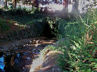
Strawberry Creek is the principal watercourse running through the city of Berkeley, California. Two forks rise in the Berkeley Hills of the California Coast Ranges, and form a confluence at the campus of the University of California, Berkeley. The creek then flows westward across the city to discharge into San Francisco Bay.

Codornices Creek, 2.0 miles (3.2 km) long, is one of the principal creeks which runs out of the Berkeley Hills in the East Bay area of the San Francisco Bay Area in California. In its upper stretch, it passes entirely within the city limits of Berkeley, and marks the city limit with the adjacent city of Albany in its lower section. Before European settlement, Codornices probably had no direct, permanent connection to San Francisco Bay. Like many other small creeks, it filtered through what early maps show as grassland to a large, northward-running salt marsh and slough that also carried waters from Marin Creek and Schoolhouse Creek. A channel was cut through in the 19th century, and Codornices flows directly to San Francisco Bay by way of a narrow remnant slough adjacent to Golden Gate Fields racetrack.

Schoolhouse Creek is a creek which flows through the city of Berkeley, California in the San Francisco Bay Area.
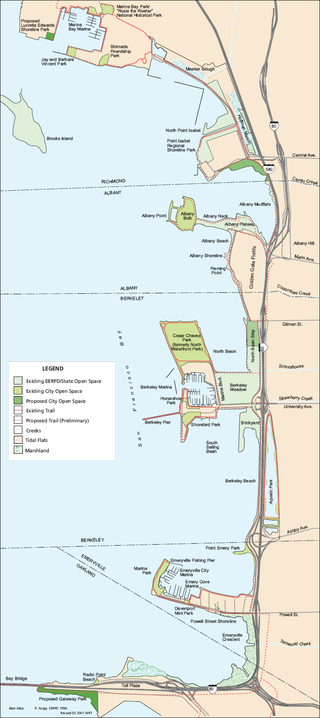
McLaughlin Eastshore State Park is a state park and wildlife refuge along the San Francisco Bay shoreline of the East Bay between the cities of Richmond, Albany, Berkeley, Emeryville, and Oakland. It encompasses remnant natural wetlands, restored wetlands, as well as landfill west of the Eastshore Freeway. Its shoreline is 8.5 miles (13.7 km) long, and its total area is 1,854 acres (750 ha), which includes both tidelands and uplands. Originally named just Eastshore State Park, it was renamed in October 2012 to honor the late Save the Bay founder Sylvia McLaughlin, who, along with the late Dwight Steele of Citizens for Eastshore Park, drove the establishment of the park. Prior to 2013, it was jointly managed by the California State Parks and East Bay Regional Park District (EBRPD). The state agency and EBRPD executed a 30-year agreement for EBRPD to manage the park.
Point Isabel is a promontory on the eastern shore of San Francisco Bay in the Richmond Annex neighborhood of Richmond, United States.
Campus Bay is an 87-acre (350,000 m2) property in the city of Richmond, California located off Interstate 580 (California), and situated between the San Francisco Bay, the Richmond Annex, and Point Isabel neighborhoods. The area receives its name from its proximity to the UC Berkeley Richmond Field Station.
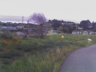
Baxter Creek or Stege Creek, is a three-branch creek in Richmond and El Cerrito, California, United States, forming the Baxter Creek watershed. The creek has three sources and flows from the Berkeley Hills to Stege Marsh and the San Francisco Bay. The Baxter Creek watershed at-large has 10 sources.
Cordelia Slough is a 10.8-mile-long (17.4 km) tidal watercourse which discharges to the Suisun Slough, which in turn empties into Grizzly Bay in Solano County, California. The Suisun Slough, fed by the Green Valley Creek and Red Top Creek, provides a productive habitat for a diversity of aquatic flora and fauna. In particular steelhead migrate up Cordelia Slough to spawn in its two tributaries.
Fluvius Innominatus or Central Creek is a stream in Richmond and El Cerrito, California, in western Contra Costa County. There is one main source and a secondary unnamed tributary. The creek drains into Hoffman Marsh and then flows into the bay through Point Isabel Regional Shoreline's Hoffman Channel. However, before the area was developed and as early as 1899 the creek had as many as 11 sources which stretched far higher into the Berkeley Hills.

Castro Cove is a "portion of the San Pablo Bay" in Richmond, California located between Point San Pablo and the confluence of Wildcat Creek into Castro Creek.
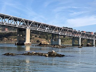
The Castro Rocks are several rocks in Richmond, California protruding from the waters in San Francisco Bay between Castro Point and Red Rock Island. The rocks lie almost directly under the Richmond-San Rafael Bridge (I-580).

Hoffman Marsh is a wetlands on San Francisco Bay in Richmond, California. The marsh has been protected within Eastshore State Park, and adjacent to Point Isabel Regional Shoreline. The marsh is an important nesting ground for wildfowl and stopping ground on the Pacific Flyway, as it is one of only a handful of undestroyed wetlands in the Bay Area. It borders Point Isabel Regional Shoreline and Interstate 80.
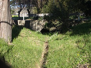
Marin Creek is a creek tributary of Codornices Creek in northwestern Alameda County, California. The lower stretch of Marin Creek is also known as Village Creek.

Stege, founded in 1876, was an unincorporated community in western Contra Costa County, California, United States. The town has now been annexed and absorbed by the cities of Richmond and El Cerrito, California. It was located on the Southern Pacific Railroad 1.5 miles (2.4 km) south-southeast of downtown Richmond, at an elevation of 23 feet. The site is now located in the area known as the Richmond Annex, at coordinates: 37°55′00″N122°19′38″W.
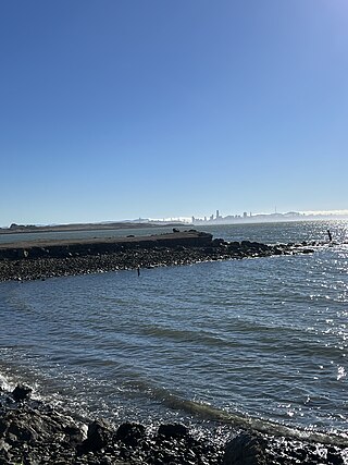
Fleming Point is a rocky promontory in the U.S. state of California. The rocky promontory is part of a band of rock, that geologists call the Novato Terrane. Which has been formed through titanic clashes of plates that have pulled the rock upwards. This area is the only original existing shoreline in the East Bay Region today. It is situated in Albany, on the eastern shore of San Francisco Bay. Albany Bulb is an extension of the point, having been formed in the 1960s from construction debris.
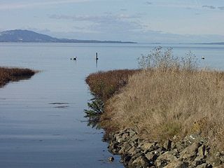
The Dotson Family Marsh, formerly Breuner Marsh, is a 238-acre regional park on San Pablo Bay in the East San Francisco Bay Area city of Richmond, California, In 2009 the East Bay Regional Parks District acquired the Breuner Marsh site, adding it to Point Pinole Regional Shoreline. A habitat restoration plan for 60 acres of wetlands and 90 acres of California coastal prairie was subsequently approved.
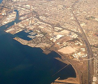
The Richmond Field Station (RFS) is a satellite campus of the University of California, Berkeley located in Richmond, California. The name was changed to the Richmond Bay Campus (RBC) in 2012 and then Berkeley Global Campus at Richmond Bay (BGC) in October 2014, reflecting plans to expand the site to address global issues, first as a second campus for Lawrence Berkeley National Laboratory (LBNL), then as an expansion of the main campus in Berkeley itself. In 2016, the expansion plans were suspended and the name reverted to Richmond Field Station.
References
- ↑ Eastshore State Park map, access date 02-12-2009
- 1 2 Western Stege Marsh Restoration Project Monitoring Plan, University of California, Berkeley, Richmond Field Station, Richmond, California, August, 2004, access date 12-02-2009
- 1 2 UC Ordered to Help in Cleanup of Polluted Stege Marsh in Richmond, by Jason Malinsky, The Daily Californian , 02-05-2002, access date 12-02-2009
